We are hiking a short section of trail that I missed last year. This will 100% complete my journey of the Appalachian Trail. I tried to hike this once last October just after summiting Katahdin and again early this April before my 1 year anniversary of my start date, but the weather got in my way both times. Third time is a charm!
Up at 6:40. Quick breakfast at hotel then off to the trailhead. On trail at 8:00.
Reached the Connecticut border and water refill at 11:90 and 5.8 miles in.
Moving into ConnecticutWaterfall near the MA/CT border
Reached the state line at 12:46 and 6.73 in.
CT-MA state line
Bear mountain CT summit at 12:10. Looking back at Race Mountain.
Bear mountain CT summit looking back at Race Mountain
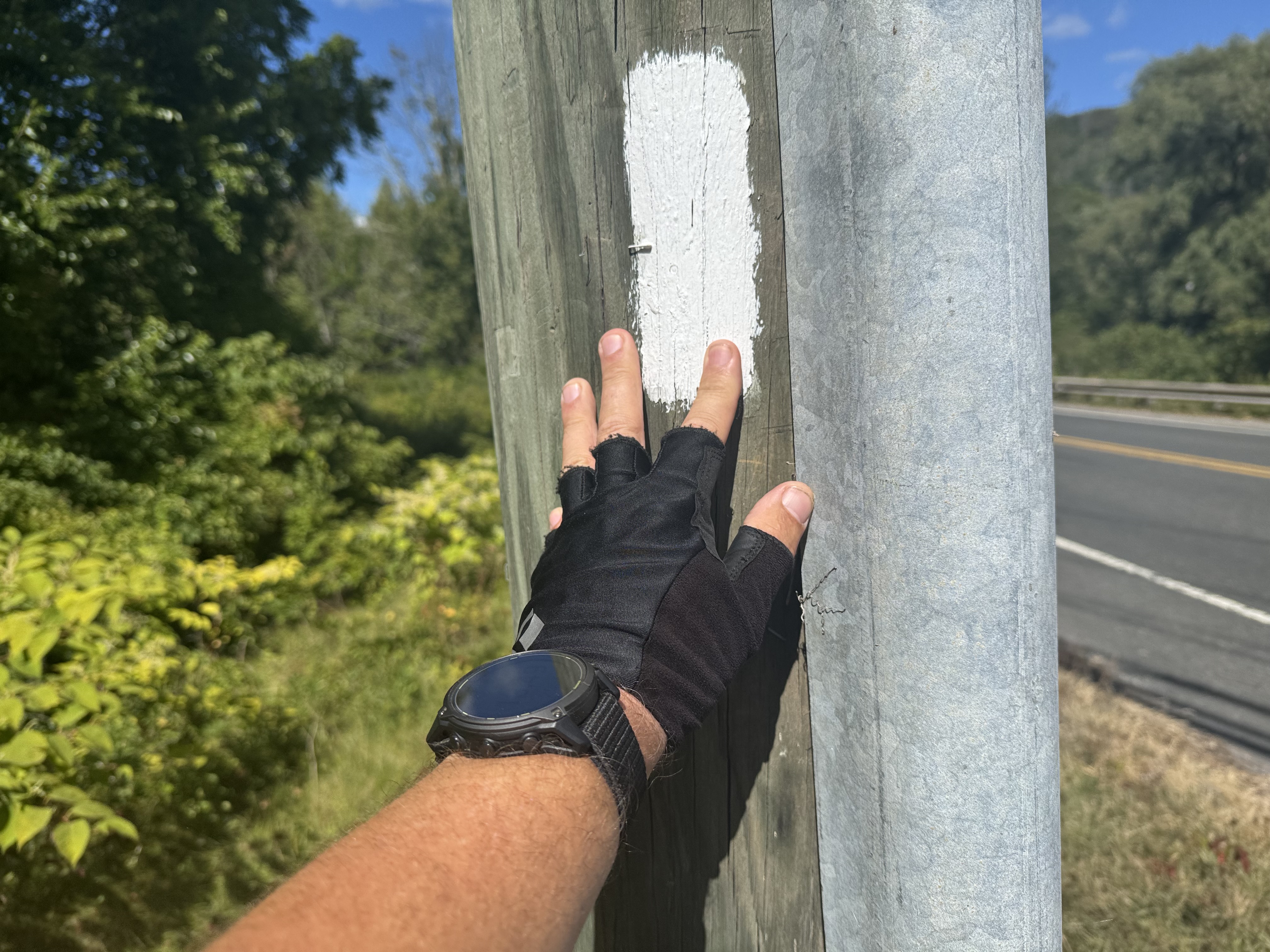
Finished at 2:50. This is a bit emotional as this is my final white blaze to 100% complete the Appalachian Trail.
My final Appalachian Trail Blaze
Got to White Hart Inn at 3:00. Jon Luning picked us up and drove us back to our car. We will be having dinner with Jon and Pam this evening in Pawling, NY.
Got up Sunday morning and drove back to Ed’s house in PA. Picked up my truck and drove back to Poolesville, MD.
Lost 7 lbs per the scale but I know I put on a lot of leg muscle. Overall, not bad weight loss.
And that’s it for this trip. Stay tuned for 3 more hikes before December this year.
Up at 6:45. Had coffee and read until 9:30. It rained hard this morning. Glad to not be on trail. The owner, Gail, came by and we paid our bill and headed to Dunkin for food before getting on I-95 to start our 7+ hour drive to Great Barrington, MA.
On the road at 10:30. We have 6:40 to Great Barrington. Weather is starting to clear and should be sunny by the time we reach southern Maine.
Arrived at the Holliday Inn on the edge of Great Barrington at 6:15. Got unpacked and ran down the street for great Mexican.
We are slackpacking tomorrow so we unpacked our gear and threw what we are not carrying in the car. All in I’m probably carrying about 13 lbs.
Friday, August 29, 2025. Up at 6:25. Overcast, cool, breezy, showers around noon.
Wishbone left camp (mile 2183.4) at 6:00am. He needs to be at the Baxter Park kiosk to meet the ranger at 7:00 to try to get one of the 12 hiker camp spots in the Birches Campground. Weather permitting he will try to summit tomorrow, Saturday. Weather does not look good for him.
We road walked a mile to the entrance to Baxter spark. Arrived a bit before 8:00am at the park entrance kiosk and talked with the ranger Donald Duck. He has the morning duty most days and is quite famous on the AT up this way. Wishbone is going to start with us and then meet us at the end and shuttle to Millinocket with us. It’s too risky to summit this afternoon with thunderstorms forecast after 1:00 on Katahdin.
Passed a minor waterfall at mile 4 and 9:30. Beautiful easy trail.
Waterfall in Baxter Park
Minor water crossing. Ed got both feet wet up to the calves but no harm.
Ed just before he falls into the stream
Stopped for second breakfast at 9:50 and 4.7 miles by the first waterfall on Nesowadnehunk Stream. Trail has been mellow with a slight incline and good footing.
waterfall on Nesowadnehunk Stream
At 10:45 and 6.34 miles we reached Big Niagara Falls on Nesowadnehunk Stream. Impressive even in a drought! See Ed on the right side for scale.
Getting close. Trail continues to be very pleasant.
Getting close to Katahdin
There are a ton of day hiking trails up here. Well marked fortunately.
hiking Trails in Baxter State Park
Arrived at Katahdin Stream Campground at the base of Mount Katahdin at 12:20. There are a pair of thru-hikers here who went up and down in 6 hours this morning. That’s insanely fast!
Ed and Chuck at Katahdin Stream CampgroundHunt Trail to summit KatahdinKatahdin Plaque
Wishbone arrived about 10 minutes after we did. Ranger Donald Duck was up here covering for the normal day rangers who had to do a night rescue on the mountain last night. We talked for about half an hour. Great guy!
Lloyd shuttled us back to Millinocket along with Wishbone at 1:40. Just as the rain started. Yay. Wishbone headed back to Monson for the night and will drive his car back up here tomorrow and try to summit on Sunday.
Hung out at 100 Mile Wilderness Inn until 5:30. Got a well needed shower after 7 days on trail. Called Pitcrew, caught up on news and blogs. Went for a drink at the Blue Ox then had dinner at the restaurant across the street. Back to the Inn and in bed about 8:45.
Day 18 Map – Abol Bridge to Katahdin Stream Campground
Thursday, August 28, 2025. Up at 6:40. Cold, breezy, not a cloud in the sky.
We have 11.4 miles to Abol Pines campground for our last night on the AT. Should be an easy and early day. Arrive about 1:15.
On trail (mile 2172.3) at 8:10.
Walked the edge of the lake for first 3.8 miles then started ascending to Rainbow Ledges. Stopped at Rainbow Ledges for a break at 10:30 and 5.1 miles. Ran into Wishbone again. He was leaving as we got here. Texted the shuttle service for tomorrow to let them know that we were on schedule.
Rainbow Ledges
Momma K showed herself in all her glory this morning.
Mama K from Rainbow LedgesMama K from Rainbow LedgesChuck and Mama K from Rainbow Ledges
Stopped at noon and 7.63 miles to refill water near Hurd Lean-to. The hike since Rainbow Ledges has been VERY rooty making for difficult footing. Only 3.5 miles to go.
Exited the Hundred Mile Wilderness. I love this sign!
End of the HMW
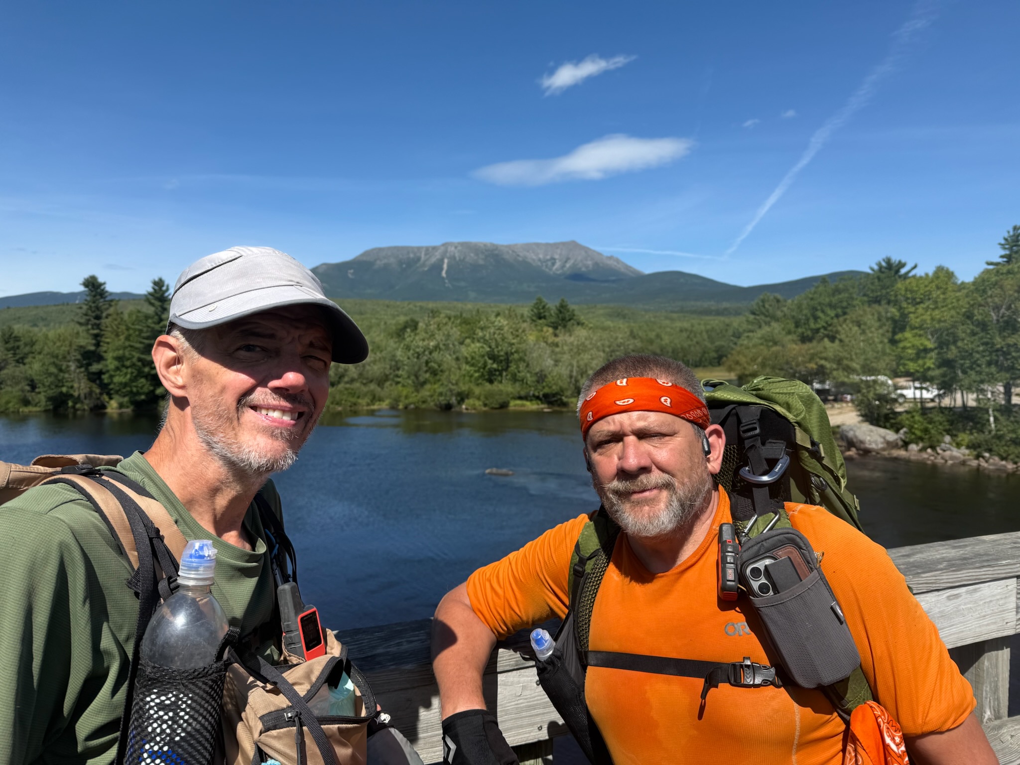
Got to the famous Abol Bridge (mile 2183.5) at 1:50. Huge milestone. Met Wishbone on the bridge. Amazing views of Katahdin from the bridge.
Ed and Whishbone on Abol BridgeMama K from Abol BridgeKatahdin from Abol BridgeWishbone, Ed, and Chuck with Katahdin taken from Abol BridgeChuck with Mama K from Abol Bridge
We went to the Abol Bridge camp store for beer, snacks, and to rent a small primitive cabin for the three of us for the night. It will be good to have a mattress that does not deflate on me 5 times a night tonight. Plus no need to mess with tents.
Abol Bridge storeOur cabin at Abol Bridge campground
We dumped our stuff in the cabin and then celebrated our hikes and reaching Katahdin. I bought a six pack of Schlitz. I have not seen that beer in over 25 years.
It’s Schlitz timeHappy hour with Ed and Wishbone at Abol Bridge campground
We hung out and talked until 5:15 when we walked back to the store to grab cold sandwiches for dinner and more beer. We were all in bed by 6:45 as it’s getting cold and windy and there is no electricity.
Really great end to the hundred mile wilderness. Abol Bridge is a huge milestone for NOBO hikers. All that’s left is a 10 mile hike to either The Birches camp or Katahdin Stream camp (KSC) inside Baxter Park, followed by an ascent and descent of Mount Katahdin. I did that last year and Ed wants to hold off on the ascent until he has section hiked the entire AT.
I got up at 1:00am and walked down to the lake to look at the stars. No clouds and very clear. Zero ambient light. The Milky Way was a bright band running diagonal over the lake. Stars from the horizon up to the Milky Way and back down behind me. Awesome view.
Wednesday, August 27, 2025. Up at 6:30. Cool, partly cloud, breezy. Nice hiking weather.
On trail (mile 2157.7)at 8:00. We have 14.5 miles to go.
Nice trail paralleling the lake this morning including some beach walks.
Ed hiking the beach at Nahmakanta Lake
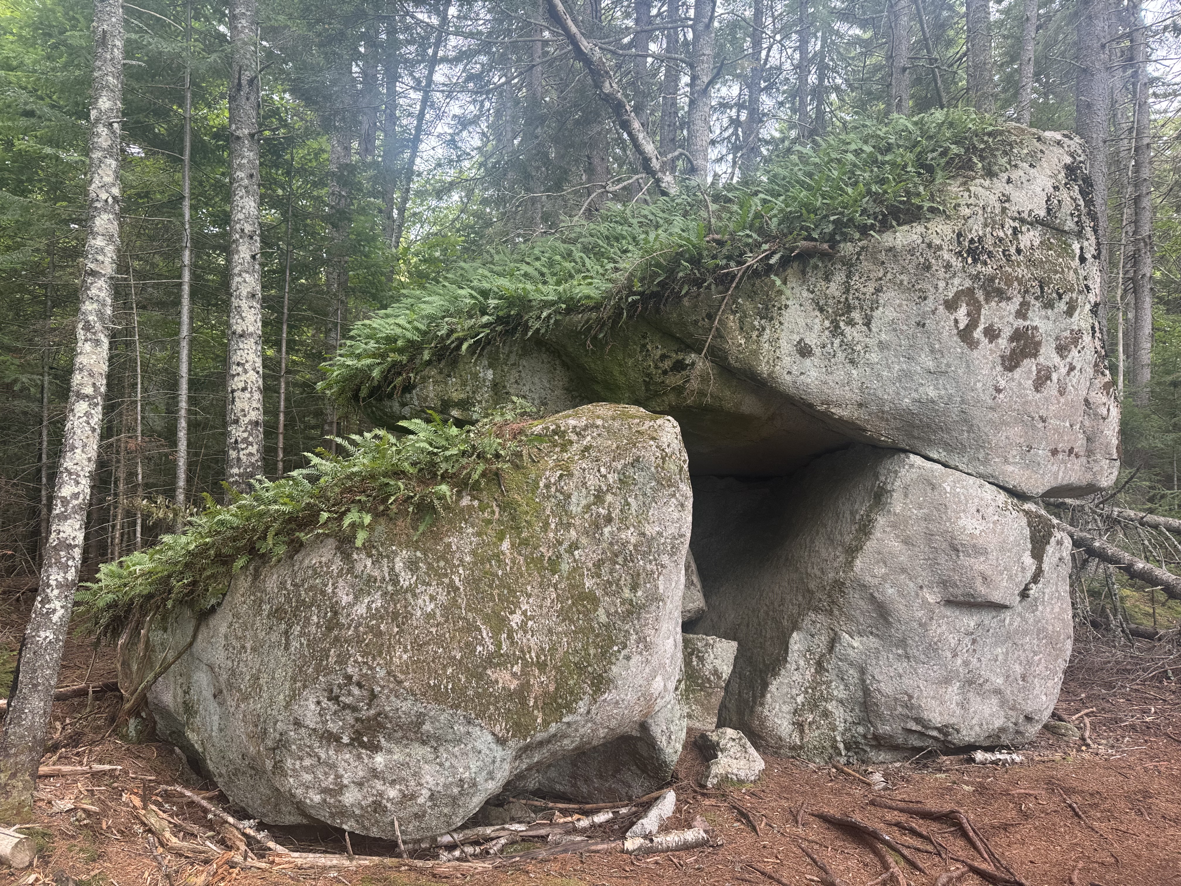
That turned into a good hard climb to our last decent mountain before Katahdin. Including some interesting rock formations. Tough rooty trail again.
Ed in Mother Nature’s rock house in HMWTough rooty trail in HMW
Stopped on summit of Nesuntabunt Mountain for second breakfast at 10:25 and 4.5 miles in.
Summit of Nesuntabunt Mountain
Good view of Momma K topped in clouds. Hopefully we will see her in sunshine later today.
Found something interesting at Wadleigh Pond Road.
Crutches at Wadleigh Pond Road
Stopped to fill up on water at noon. Mother Nature’s boat ramp.
Mother Nature’s boat ramp
Stopped at Rainbow Stream Cascades waterfall at 1:15 and 8.75 miles for a snack. Falls are flowing, but not nearly what they normally would due to drought.
Stopped at Rainbow Stream Cascades waterfall
Passed by Rainbow Springs Lean-To at 2:15. This was our backup in case of rain.
Rainbow Springs Lean-To
Stopped at Rainbow Lake Dam at 3:10. Thought about camping here but decided to push on. Awesome view of Katahdin from the tent spots.
Rainbow Lake Dam signKatahdin from Rainbow Lake Dam
At 4:00 we made at camp at Rainbow Spring Campsite (mile 2172.3). Good tent sites with picnic table, sheltered from the wind, and an amazing piped spring! Older gentleman from Tennessee named Wishbone we met on day 2 is here finishing his Hundred Mile Wilderness section hike and his summit of Katahdin. Had been sectioning with his brother, but the brother went home last Wednesday from Monson.
camp at Rainbow Spring Campsite
We all had dinner together at 5:45. By 6:30 everybody was cold and tired, so we adjourned to our tents. Took care of chores including blog edits by 7:00.
Going down to upper 40s and breezy tonight. Sleep pad is deflating within an hour. I picked a spot with a good bed of leaves for padding and insulation. Put two sit pads under the sleep pad at my torso to help with the cold that the ground sucks out of your body.
Good day overall. Just 1.5 days left on Maine on trail. Momma K is getting closer and closer.
Day 16 Map – Nahmakanta Lake Camp to Rainbow Spring Campsite
Tuesday, August 26, 2025. Up at 6:40. Warm, breezy, sunny. We are in no rush as we only have 11 flat miles.
If there was any doubt that I have a leak in my sleep pad, last night took care of that. I had to put more air in it 4 times. I may try to find the leak and patch it this afternoon.
I’m also running low on batteries. Not sure why one of my power banks only lasted 2 nights. Should have been 3+. I may have left WiFi on yesterday 🙁
We took an hour to dry our tents and clothes on the beach this morning. Breeze and sun are great. Fully disassembled the inner from the outer tent to get things as dry as possible. Inner is dry and foot print is dry. Outer is close enough. Can dry the outer more at camp this afternoon before pitching the entire tent.
On trail (mile 2146.7) at 9:00. Hope to be at camp by 2:00.
We got our first on-trail view of Katahdin. Spectacular. And emotional. More on that later.
First view of KatahdinEd and Chuck with Katahdin in background
Slippery wooden walkways all morning from the rain. Very slippery.
Slippery wooden walkways in HMW
We had 3 mellow water crossings. Most years you have to ford these. But with the drought this year we could rock hop.
Ed at water crossing in HMW
Nice walk in the woods for a few miles.
Nice soft trail in HMW
Stopped at 12:15 and 7.33 miles for lunch and water refill. Yes those are stairs bolted into the river side.
Stairs bolted to the river bank on trail in HMWLunch and water resupply in HMW
Hard last 3.7 miles. Lots of slippery nasty roots and rocks. Ed took a nasty fall at one point, but all is good.
Startled this little guy as he was eating lunch. Sorry dude.
Squirrel having lunch in HMW
We got to Nahmakanta Lake (mile 2157.7) at 2:20. There is a 4 person group already taking one big tent area. We found a great tent area very close to the lakeshore and about 100 feet from a picnic table. Setup camp and got a lot of gear out to air out.
Camp at Nahmakanta Lake in HMW
It’s VERY windy as you can tell from the whitecaps on the lake. The wind is a steady 15-20 mph and is 60 degrees at 4:00pm. Hopefully the wind chills out later.
Nahmakanta Lake
Refilled my sleep pad at 5:42. It was mostly flat by 7:00. Gonna use mine and Ed’s sit pads and spare clothes to try to make a pallet under the sleep pad to help with the cold and the tree root that is in the middle of my back!
Wind is finally dying down as Ed and I make dinner at 7:30. How about that sunset!
Sunset on Nahmakanta Lake
In bed to read at 8:40. Wind is mellowed and lows tonight are about 50. The pallet I made under the half deflated air mattress is helping. Fingers crossed on that front.
Good easy day today. I really wanted to swim in the lake but the wind and lack of sun messed that up. Got another lake to try that with tomorrow. Seeing Katahdin again brings up all kinds of mixed emotions. I’m exited to see it, but it dredges up some regrets from last year’s thru-hike. This could be my last time up here. Who knows.
That post-hike depression thing can linger for a long time. I try to look at life through the front windshield and never the rear view mirror, but every now and then ….
Monday, August 25, 2025. Up at 6:40. Overcast, potential rain, cool. It drizzled last night. Much less rain than I expected. Storms on and off today per forecast.
Out of camp (mile 2127.1) at 8:00 Either 15.4 or 19.6 to go today.
Stopped at 8:40 for water.
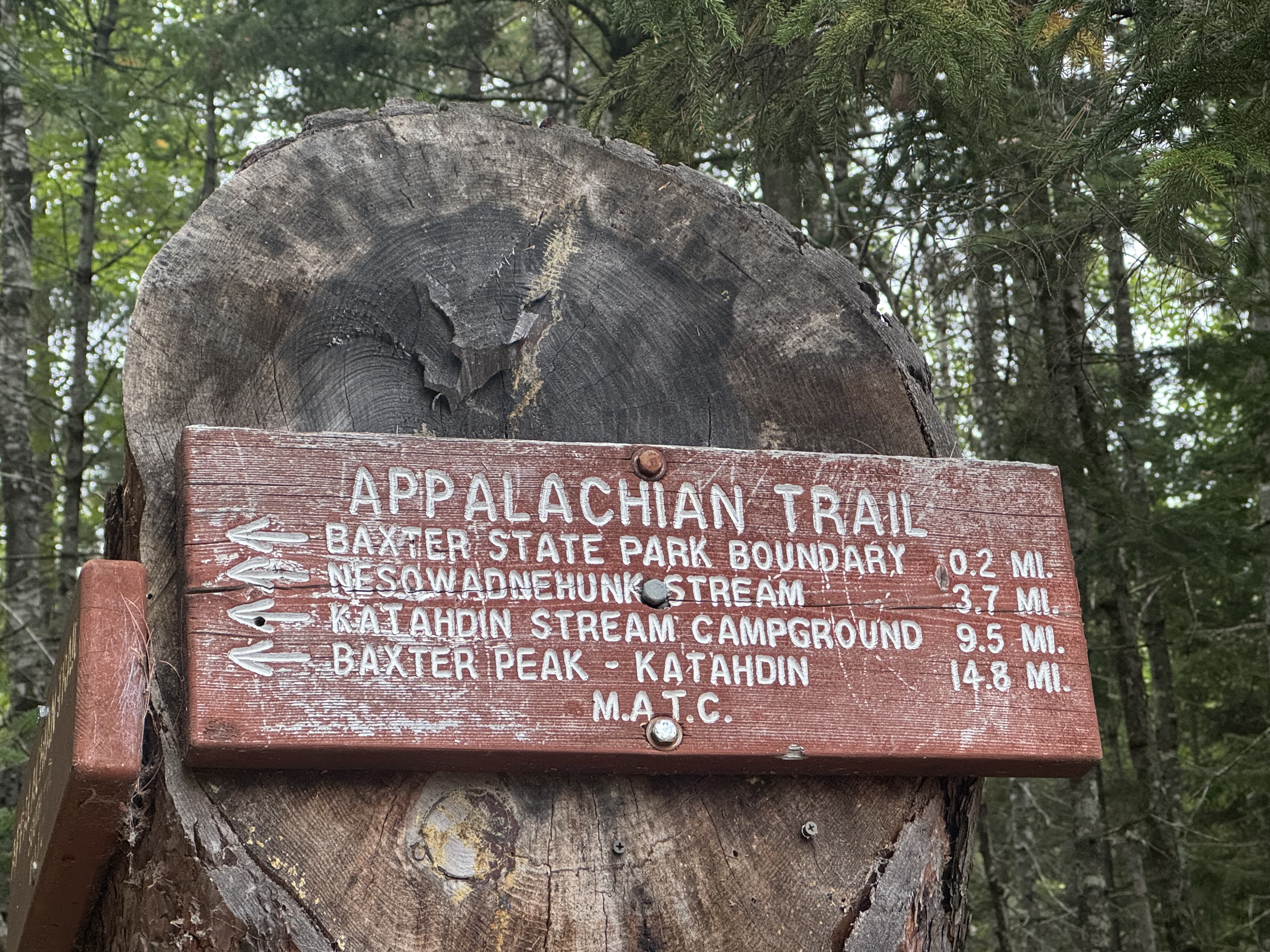
Appalachian Trail signage
Stopped at Mountain View Pond at 10:39 and 5.3 miles to fill water and have a snack. Small pond. Medium uphill last 1.2 miles. We have .7 down a saddle then .8 up to Little Boardman Mountain. Been misting heavily. Not quite rain yet. Hopefully that holds off till the afternoon. Back on trail at 10:50.
Summited Little Boardman Mountain at 11:40 and 6.84 miles. Surprisingly steep, but all easy after this!
Summit of Little Boardman Mountain
Texted with Pitcrew, sort of. One bad bar cell service on the summit. Starting to rain so headed down.
Making good time now that we are in better terrain. Stopped at a great stream at 1:40 and 10.9 miles to get water and have lunch. Humid but the sun is trying g to come out. Maybe we missed the real rain? Back on trail at 2:00.
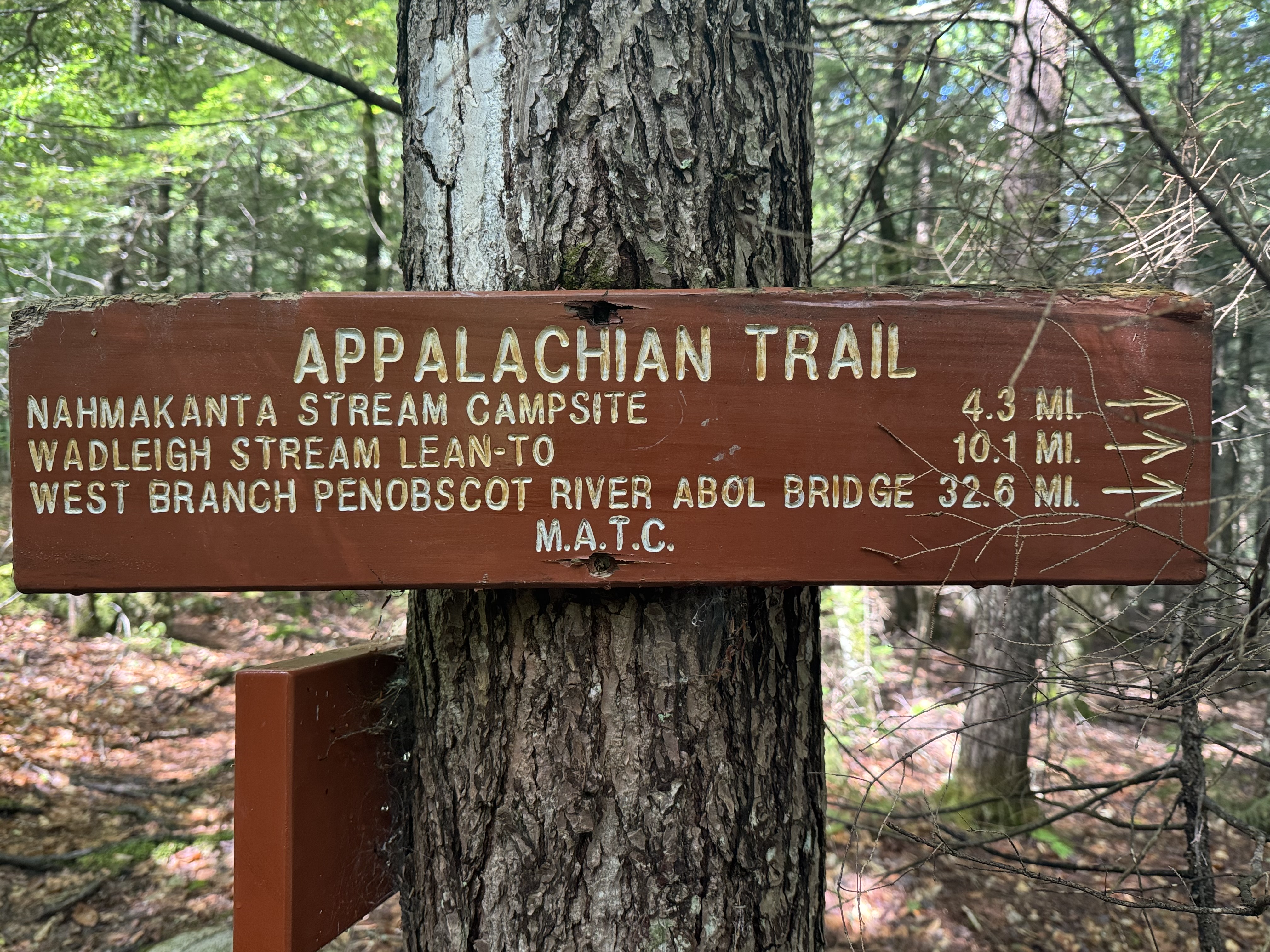
Took a break at Jo-Marry road at 3:33. This is one of the two major private logging roads through the HMW. Also where you can get a supply drop but we don’t need one. This road handles major logging traffic including 18 wheelers hauling big loads of logs.
Jo-Marry road
Beaver definitely at work here.
Beaver has been here
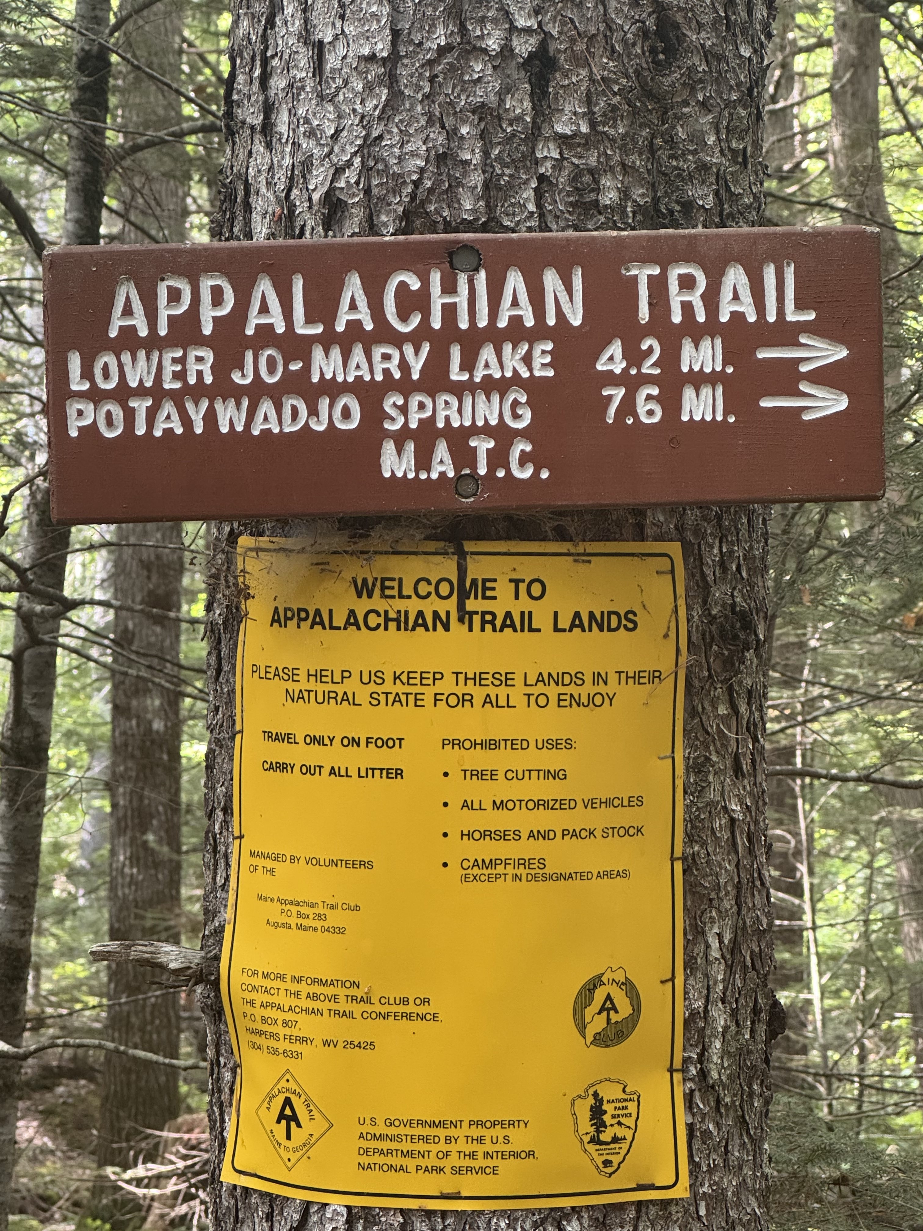
Got to Antlers Camp (mile 2146.7) at 5:20 and 19.6 miles. Good long hard day. There are 7 other hikers here. Lots of room so we are all spread out. Beautiful campsite on Jo-Marry lake. Very big lake in a chain of lakes. If the sun were out I would go for a swim. Water is warm.
Ed bathing at Jo-Marry Lake at Antlers Camp
Got camp all setup and dried clothes a bit before the rain got here at 6:45. We were both all set up and in our tents about 5 minutes before the rain started. Surprisingly have decent cell service. Looks like rain will continue until around 8:30. We will be cooking dinner in our tent vestibules tonight.
Camp site at Antlers CampRainy evening soaking in vestibule at Antlers Camp
Asleep at 9:30. Long day today but not too difficult other than carrying 30 pounds for 19 miles 🙂 My feet are feeling it.
Our long day today gives us a short flat 11 miles tomorrow. Should be mostly sunny which will let us dry our gear after all this rain this evening! We will get to camp around 2:00 at latest. It’s supposed to be an awesome camp right on the lake. Looking forward to that!
Day 14 Map – Logan Brook Lean-To to Antlers Campsite
Sunday, August 24, 2025. Up at 6:30. Warm and sunny and breezy. Heading for low 80s.
Packed up, had breakfast, and got shuttled back to Monson at 8:10. Arrived at 100 Mile Wilderness Adventures camp in Monson at 9:40.
Jordan picked us up at and we headed for Gulf Haggis via the Katahdin Ironworks Road at 9:55. Taking the long way in from Moosehead Lake due to the road being closed on the Millinocket side for bridge repairs.
Arrived at the trailhead in the Hundred Mile Wilderness (mile 2114.4) at 11:00. Immediately got on trail.
We made 5.6 miles by 1:30. Fairly cruisy with a few medium uphills. Took a break for a snack and to refill water before we start the hard climb. Next 5.8 miles to the summit of White Cap are 4 steep up and down mountains. Probably slow us down to a bit over 1 mile per hour. I hope to be at camp by 7:00pm.
Appalachian Trail sign near Gulf Haggas
We have been leapfrogging with Turtle since mile 1. He started in NY and is going to Katahdin, then flipping back to NY to complete his thru. He lost his water cap somehow while we were taking a break. I had a spare. The trail provides.
Nice waterfall.
Nice waterfall near Gulf Haggas
Back on trail at 2:00. We have 4 summits this afternoon. Reached Gulf Haggis Mountain at 2:35. That was a nasty hard climb.
Summit of Gulf Haggis Mountain
Crossed over West Peak about 3:30. Nasty climb number 2.
Summited Hay Mountain at 4:30. Nasty climb number 3.
Summit of Hay Mountain
Now we need to climb up to White Cap Mountain at over 3600 feet. That’s what we need to go over.
View of White Cap Mountain at over 3600 feet
Dragged our butts up to the top of White Cap about 5:40. Tough ascent and the wind is at least 30 miles per hour above tree line with gusts that push me around a lot. Amazing views up here even with the cloud cover. Looking north into the HMW we can’t see any sign of civilization.
Somehow there is decent cell service up here. Took a picture and sent it to Pitcrew. She sent me a picture back.
View from top of White Cap Mountain
We descended about a mile to Logan Brook Lean-To (mile 2127.1) by 6:20. The shelter as full and the tent sites were all taken. We got water and hiked about .25 miles to a decent stealth camp spot. Very rocky but it works. Finished setting up camp about 7:40. Made dinner in the dark and in bed to read by 8:30.
It’s very windy with a high chance of rain tonight. Ed and I both put extra guylines to hold the tents in the wind. Fingers crossed.
Not a bad day. Hard but not terrible. We are basically done with big climbs for the next 5 days. Yay! There is a 100% chance of rain tomorrow. Will see how wet we get. Probably soaked. Just hoping to put up our tents between storms tomorrow night. We have 15.3 miles to an OK spot, but we want to push for 19.4 to a good camp area. We will see how we feel by mid afternoon tomorrow.
Saturday, August 23, 2025. Up at 7:40. Mid 70s, sunny and breezy.
Did our route plan for the rest of the trip. Headed to breakfast at a highly recommended local truck stop then onto Millinocket. Should be there about 1:00.
We decided to cut out the first 2 days in the HMW. They are big mountains and we would have to do the nastiest in the rain. I hiked both those sections last year, so no problem here. This also lets us do an average of 14-15 mile days which also means we don’t need to do a resupply in the HMW. Should finish at Baxter Park on Friday afternoon.
We got to the Hundred Mile Wilderness Inn in Millinocket in the mid-afternoon. This is a nice little house that has been turned into a hostel. I stayed here last year and really liked it. Good location, clean, and great owners.
We met with the owners to plan our shuttle into the HMW at the Katahdin Ironworks (KI) Road tomorrow. And we hit a major snag. The eastern entrance to the KI road is closed. The lumber company that owns the road is replacing several culverts. They were supposed to be finished a week ago, but work continues. Our only option is to come into the HMW from the WEST end of the KI road over by Moosehead Lake and Greenville, Maine. And the only way to do that is to drive in a great big semi-circle from Millinocket south to Monson and then northwest to Greenville and then east on the KI road many. Miles into the HMW to meet the AT. Ugh. Fortunately the owner here can shuttle us to Monson in the morning and Jordan from the Hundred Mile Wilderness Adventures in Monson can drive us the rest of the way to the AT.
We walked to the Scootic Resturant for dinner then back to the hostel. I read for a while and decided that I need to find a different blog site. I plan to build my own site using WordPress and blog there. Downloaded several WordPress tutorial books and started reading.
Friday, August 22, 2025. Up at 6:15. Cool and sunny.
We have 18.6 miles to go. Estimating 5:00.
I got careless in my tent and tore a quarter sized hole in the netting. It’s the outer netting with a pocket attached, so I must have shoved something with a sharp edge into that pocket. Fixable with a patch kit but annoying.
I also had to put air in my sleep pad at 4:00am. I’m worried I have a slow leak. I need to figure that out before heading into the hundred mile wilderness.
On trail (mile 2061.8) at 7:15.
Stopped at 8:10 on the top of Moxie Bald Mountain. I need to call my doctor and get a rescue inhaler prescription sent to Millinocket. Fortunately that was successful! We made a hotel reservation in Bangor for tonight. It’s a 1 hour drive from Monson this evening. We get a real bed, bar, and restaurant. No rush as tomorrow will be a zero instead on a Nero day are hiking 18.6 miles today. Really looking forward to this evening as and a couple of bourbons.
Back on trail at 8:30. Stopped at Bald Mountain Pond for water and second breakfast. Easy descent from Moxie Bald Mountain.
Back on trail at 10:10. Should be a gentle downhill all day to Monson.
Stopped at 11:40 and mile 7.75 for a break and a snack. The last several miles were VERY Rocky!
Rocky trail near Moxie Bald Mountain
And then we got a brief break with this lovely path.
Lovely Appalachian Trail near Moxie Bald Mountain
Last few hours have been tough. Rocks, roots, and a lot of small steep ups and downs we had not expected. Last year I had to ford two streams. One was calf deep and one ankle deep. It’s so dry this year we walked across on stones.
Ran across Mary-Beth, Toni, cruise director, and Antlers on our hike today. Said good luck and goodbye to all of them.
Stopped at Horseshoe Canyon for a break and a snack at 2:20. Need to refill on water but not here. It is a canyon with the river waaaay at the bottom. We have 5.3 miles to go.
Getting close to Monson, Maine
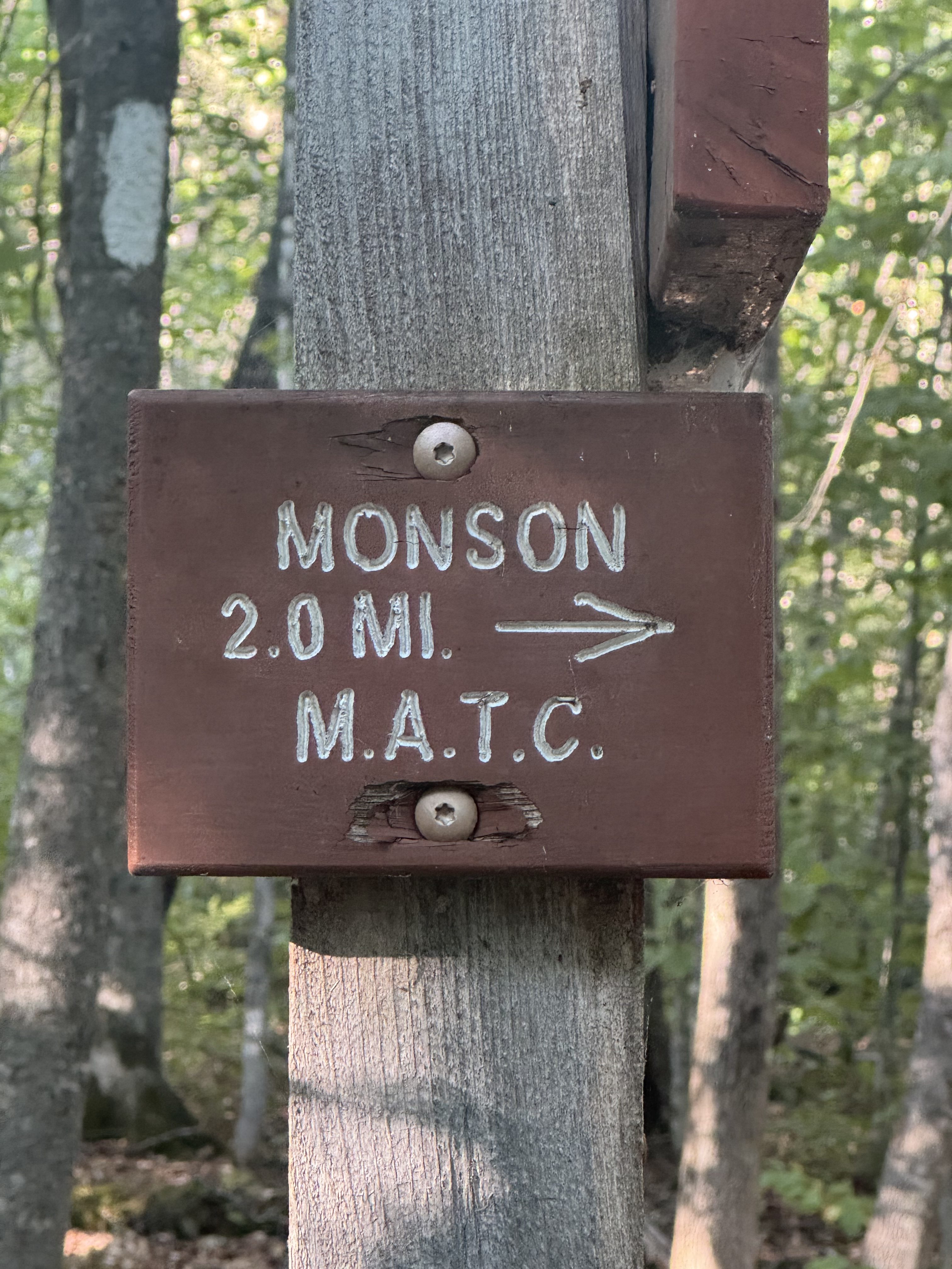
Reached the 100 Mile Wilderness Adventures in Monson (mile 2080) at 5:40. Awesome end to the first half of the trip.
Drove to Bangor for a hotel and meal. We have a day to kill tomorrow so no rush on things. Had a decent dinner at Texas Road house to celebrate the success of thfirst half of our trip.
Today was one of those slog it out days. No views, nothing special. You just have to get from point A to point B. Hike on, keep your head down, and suck it up.
Day 11 Map – Bald Mountain Brook Lean-To to Monson