Tag: 2024

  • Day 7 – Low Gap Shelter to Unicoi Gap

    Day 7 – Low Gap Shelter to Unicoi Gap

    Today’s Miles: 9.7

    Trip Miles: 60.07

    Up at 7:00. Partly sunny, with a high near 66. Northwest wind 5 to 15 mph.

    Didn’t rain after all last night. Pop-Tarts and tea for breakfast.

    Packed up and headed out at 8:30. Mike stopped for water at .25 miles. Humid today!

    Rained for about 15 minutes at 10:00. Umbrella works but need to reconfigure it now that I’m wearing my pack differently. Umbrella is too low and leans forward.

    Blue Mountain shelter

    Made Blue Mountain shelter at 12:15 and 7.58 miles. Last mile up was very tough. Steep, big rocks, slick from rain this morning. 

    We took a break for about an hour and I had a snack. I called Dana and chatted for a while. Walked .1 miles downhill to refill water. Here is how to use a leaf and a rock to hack a stream. Look close!

    The leaf trick

    Left shelter at 1:30 and made it to Unicoi at 2:35. Grabbed a coke at Trail Magic in Unicoi Gap. Bill from Green Dragon Hostel picked us up right away.

    Got to Green Dragon Hostel and chatted with a lot of familiar faces, showered, unpacked. Shuttled to Hiawassee outfitter and grocery store at 4:00. Got one dehydrated meal and some snacks. Probably too much food. 

    Did some basic planning and looks like Franklin next Friday or Saturday. Will need to resupply Wednesday or Thursday. Assumes my resupply box is at Around The Bend hostel on Monday, April 22.

    Shuttled over to Hiawassee Brewery at 5:15 for group dinner. 

    Hiawassee Brewery

    Back to Green Dragon at 8:00. Uploaded day 5 and 6 blogs. Got electronics charging and crawled into bunk at 9:15. Worked on day 7 blog and some route planning for the next week. 

    Lost 4 pounds this week…down to 215 pounds.

    Day 7 Map – Low Gap Shelter to Unicoi Gap

    Technical Notes:

    • Pop-Tarts x2 400
    • Tea 0 
    • Snickers 250
    • Trail mix 270
    • Electrolyte x 2  50
    • Coke 130
    • Cider x 2  520
    • Bacon x 1.5 200
    • Double cheeseburger 800
    • Fries 400
    • Water 4 liters
    • Miles 10.57
    • Time 6:00
    • Elevation gain 1950
    • Calories consumed 3300
    • Calories burned 4500
  • Day 6 – Neel Gap to Low Gap Shelter

    Day 6 – Neel Gap to Low Gap Shelter

    Today’s Miles: 11.7

    Trip Miles: 51.0

     “I woke last night to the sound of thunder. How far off I sat and wondered.” – Bob Seger

    Showers and thunderstorms likely before 9 a.m., then a chance of showers and thunderstorms. Partly sunny, with a high near 75. West wind 10 to 15 mph. Chance of precipitation is 60%. New rainfall amounts between a tenth and quarter of an inch possible.

    Follow me in near real-time here: https://share.garmin.com/CharlesStump

    Woke to alarm clock at 7:00. Woke up to thunder, lightning, and heavy rain in the middle of the night. Slept really well. Made tea and nuked a frozen burrito for breakfast. 

    Mike and I decided to wait till around 9:00 to leave as the worst weather should be good enough by then. Packed up all my gear, did morning chores, filled water with electrolytes this time, got rain gear in easy-to-reach locations (not wearing that stuff unless very necessary due to heat), and headed out. Stopped at the office to drop off the cabin key and then did the FINAL uphill walk to Mountain Crossings to get on the trail. 

    Feeling good about today. Mentally upbeat and bodily sound. Can’t wait to see how my newly fitted pack does. Hoping for big changes thanks to the Wizard! The sun just started peaking out and the radar shows the worst weather web by us. We have a nasty first 2 miles up a mountain, then 9.7 miles up 200-300 foot ups-and-downs….not bad overall. Should be to camp by 3:30.

    Mountain Crossings is the only place the AT goes through a structure.

    The trail runs through Mountain Crossings

    Hiked up a decent mountain and then onto ridges with sun on one side and dense clouds on the other. Walked into the clouds, but it just does not show well as a photo. Hiked 3.3 miles and took a break for a second breakfast (I.e. morning snack).

    Stopped 5.2 miles in for water. No more easy water for the next 7.2 miles. Ugh 🙁 Got to Cow Rock Mountain after 6 miles so far for the day at 1:00. 

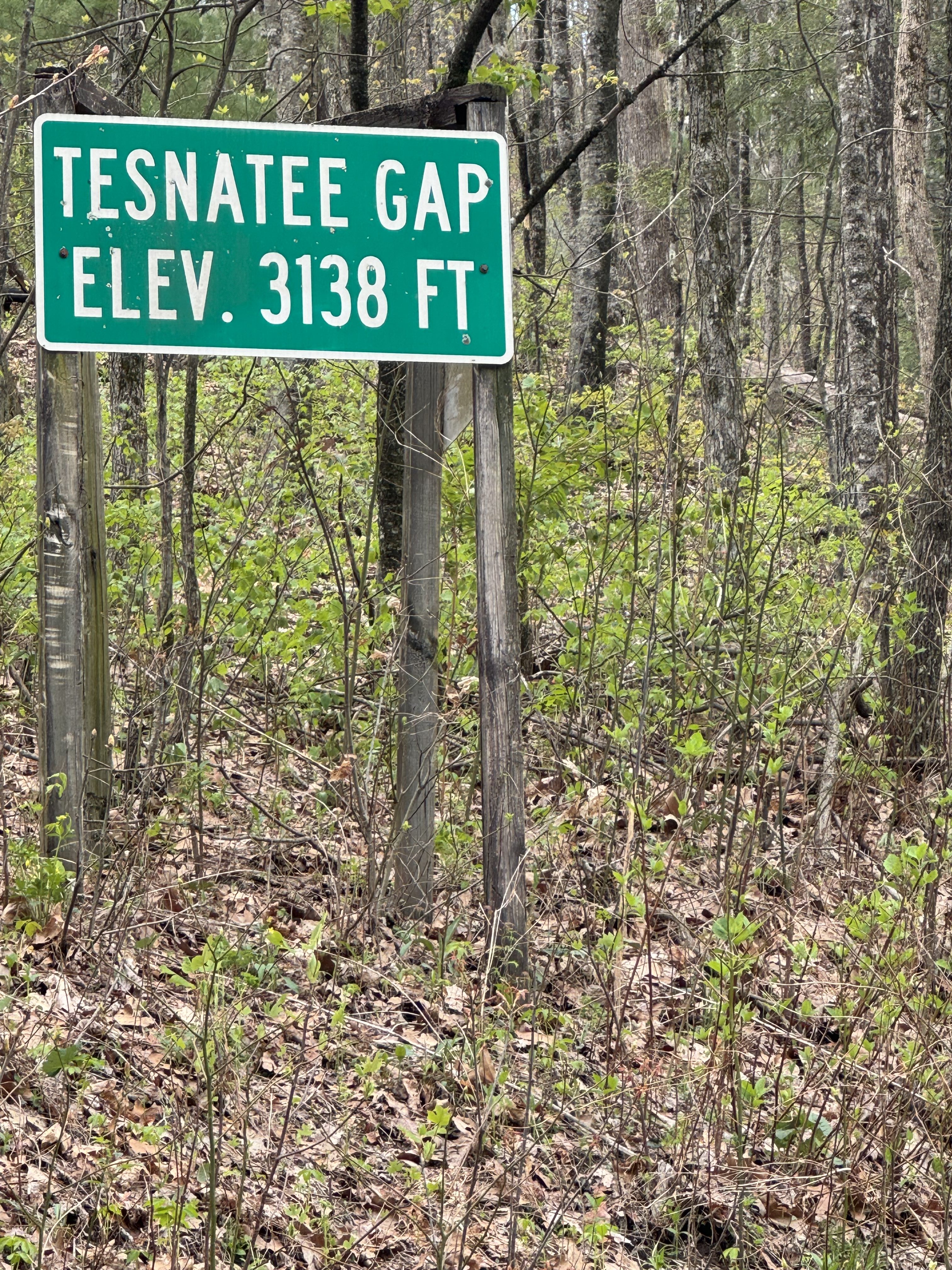
    Reached Tesnatee Gap at 1:30. Had a snack and a water break. Started up the hill at 2:00.

     Ran into a couple from New Orleans again and chatted. Dropped our packs and walked. 1 mile to water to refill. Easy walk this time. Very humid today from the storm this morning.

    At 4:40 and 12.23 miles in, we rested near the top of Sheep Top Rock. Had a snack and a rest. 

    Filtering water at Low Gap shelter

    Made it to the camp area at 5:25, 13.65 miles. Low Gap shelter. Group of about 10 youngsters (20s and late teens) near the trailhead with most of the good spots. We explored closer to the shelter further  downhill and found a decent spot with a downed log for a seat. Just room for the two of us. One old codger was near us as well. The shelter has a bad rep about the Norovirus. 2 people evacuated from here this week. The stream is about 50 yards away, and the privy is close. It has bear cables close too. Overall, not a terrible spot.

    Camp at Low Gap shelter

    Did a Friday happy hour call with some friends for an hour this evening. Just enough cell coverage if I walked uphill from camp about 100 yards.

    Made dinner at 7:35…coconut chicken curry for dinner. Really good!!!!

    Making dinner on trail at Low Gap shelter

    In bed at 9:00. Read for a while. Could not sleep. Critter tried to chew into my tent. Read some more. Worked on day 5 blog. Read some more. Finally tried to sleep again around 1:00.

    Harder day than expected. Hot and a few mountains were more challenging than expected.

    Day 6 Map – Neel Gap to Low Gap Shelter

    Technical Notes:

    • iPhone 38%
    • Watch 26%
    • iPad 100%
    • Headphones 83%
    • Garmin 68%
    • Burrito 700 
    • Tea 0
    • Tea 0
    • Snickers 250
    • Trail mix 270
    • Trail mix 270
    • Electrolytes x 3   75
    • Next generation back country Chicken curry 550
    • Fatty jalapeño beef stick 310
    • Tea 0
    • Water 5 liters
    • Miles 13.65
    • Time 8:05
    • Elevation gain 3068
    • Calories consumed 2460
    • Calories burned 6500
  • Day 5 – Zero Day at Neel Gap

    Day 5 – Zero Day at Neel Gap

    Today’s Miles: 0

    Trip Miles: 39.3

    “Be careful what you wish for, you might just get it.”

    Today’s weather is amazing. Mid 70s, low humidity, clear, breezy. Great day to chill, catch up on blogs, and get ready for the next section of the trail. My body needs some rest.

    Follow me in near real-time here: https://share.garmin.com/CharlesStump

    Up at 7:30. Great sleep in a real bed. Zero day. Mike and I said goodbye to Eric about 8:30. He has people to meet in a few days further north. I should cross paths with him again around Franklin if not before.

    Eating like a college student again…hot pocket in the cabin microwave for breakfast along with a Body Armor to wash it down. 

    I sorted my remaining food so I could plan out my resupply. I only need to pick up two dinners, three breakfasts, and electrolytes. The lesson learned on food is that I’m really not eating lunch. Just breakfast, second breakfast, two mid-day snacks, and dinner. I need to replan accordingly. 

    We walked to Blood Mountain Cabins store to pay for the cabin. Apparently, we missed seeing a bear walk right down the gravel road by the store this morning. There were very minimal supplies at the store. I may pick up coffee for tomorrow morning, but all else will be shopped at Mountain Crossings.

    I walked up to Mountain Crossings to do laundry. It takes  about 90 minutes. They do it for $8 per load. I am thinking about shuttling into town for early dinner around 4:00 ish. I picked up my resupply as well as some junk food for later tonight. 

    I took the supplies back to the cabin, then walked back to the office/store, bought a cup of coffee, and finalized the text and pics for my blogs while sitting in a rocking chair on the store’s porch using their Wi-Fi. It took a couple of hours. Mike found us a shuttle into town at 4:30.

    Hiked back up the hill to Mountain Crossings to pick up our laundry and deposit it back at the cabin. Since I was washing all my worn clothes, all I had to wear most of the day was a pair of black thermal underwear, a blaze orange thermal long-sleeve, and light gray shorts, and my baby blue Speedgoat shoes. Dana is making me share….

    Fashion Statement at Blood Mountain Cabins

    Changed into semi-normal clean clothes and hiked back uphill to Mountain Crossings to catch our shuttle into town. 20-minute drive and some good conversation with our driver. 

    Mike and I shuttled into Blairsville, GA, for dinner at Blairsville Restaurant Grits & Greens. Good southern food. Country fried steak and green beans. And tater tots. Walked around town square then popped into Blairsville Brewing for a nice porter. Got a shuttle home about 7:00.

    Downtown Blairsville

    Wrestled with getting four days of blogs uploaded till 9:30. Ugh! Had technical issues with the photos being over the allowed image  size for the site. Pain in the ass to fix one by one and could not fix them all. Finally got things uploaded and notices sent to Facebook. Modified my camera settings since I won’t have this problem again. 

    Got back to the cabin around 9:30. Mike was wooed I had been eaten by a bear as I was gone so long. Prepped gear for tomorrow so we can move out early. 

    Called Dana at 10:30. Long talk about lots of things and not just my hike. Miss her and the dogs. Could not sleep so read till almost midnight.

    Retrospective

    This shit is hard! Harder than I expected. The mountains are big and numerous. We skipped spring and jumped right into summer…at least for now. I’m two full days behind where I expected to be and taking my first zero on day 5 instead of day 14. Will lose at least one more day before Fontana. Seriously doubt I’ll be able to hook up with Eric Hanson in June due to our schedules not aligning.

    I should not have made any firm reservations or decisions (one hostel reservation in Hiawassee, GA, and a 2-night hotel reservation in Fontana, NC). I need to stay more flexible and only plan ahead 2-3 days in general. Stop thinking in terms of schedules.

    I’m eating surprisingly well. I had trouble eating on the trail last year. Glad I got over that!

    I’m  lucky that I have clicked with Eric and especially Mike. We keep each other moving and we reign each other in….like me pushing for an early zero day. Good to have company at camp and on the trail. Not sure how long this partnership will last as Mike needs to finish a month before I plan to finish. He starts a new job on September 2. I’m hoping we can keep pace with each other at least until after the Smoky Mountains. But at some point, he will need to really push big miles day after day to meet his schedule. I don’t think I’m up for that. Will see what happens as time progresses. 

    Mentally, day 1 was hard. My mind wandered a lot about emotional topics. By day 2 and later, I was mainly focused on the physical challenges.  Left, right, left, right, climb, descend, repeat. How much water do I have and how far to the next water? Can the sun please go behind the clouds and where is a breeze when you need it?

    I have been lucky to not have any cold, rainy days yet. That helps the mental game immensely. Worried a bit about what days alone on the trail will be like later on.

    Will revisit all this next time I take a zero. Either in Franklin or Fontana.

    Technical Notes

    • Ham n cheese hot pocket 270
    • Tea 0
    • Body armor lyte 20
    • Twix 250
    • Body armor lyte 20
    • KitKat 250
    • Pretzel bites 200
    • Country fried steak 700
    • Tater tots 550
    • Green beans: 60
    • Porter: 220
    • Body Armor Lyte: 20
    • Pringles: 100
    • Pringles 100
    • Miles: 4.54
    • Time: 0
    • Elevation gain: 500
    • Calories consumed: 3000
    • Calories burned: 2500
  • Day 4 – Lance Creek to Neel Gap

    Day 4 – Lance Creek to Neel Gap

    Today’s Miles: 7.4

    Trip Miles: 39.3

    A slight chance of showers and thunderstorms between 3 p.m. and 4 p.m., then a chance of showers and thunderstorms. Mostly cloudy, with a high near 68. Southwest wind around 15 mph, with gusts as high as 30 mph. Chance of precipitation is 40%. 

    Up at 6:50. OK sleep. Drizzled a bit in the middle of the night but had a dry morning. Packed up and ate a small bag of Fritos for breakfast. All I had left, plus I needed the salt badly. Headed out at 7:40 to tackle Blood Mountain.

    Side note…I had not planned on this heat so early. I did not bring any electrolytes this early in the trip. Mistake! I need to get a lot more salt in myself. I have been cramping a bit since last night.

    Hiking with Mike and Eric again today. They both planned on bigger days today, but between the approach trail, Sassafras Mountain, and now Blood Mountain, they both are going to stop for the night at Neel Gap and share my cabin. Mike is leaning towards also taking a zero tomorrow.

    Hiked 2.5 miles to Jarred Gap by 8:50.  Had a Snickers bar. Challenging but not too bad. The bad part starts now as we ascend Blood Mountain.

    We hiked 4.5 miles to Wood’s Hole shelter at 10:00. The stupid shelter is .4 miles off the trail, but it has a privy, and all of us needed to use it! Had a second breakfast before ascending Blood Mountain. Two packs of trail mix, mostly for the salt. Topped off water and headed onward and upward at 10:45.

    Water at Wood’s Hole

    Passed several people on our way up the mountain. Some we recognized and some were new faces. Randi and Debbie shuttled to Neel Gap this morning and slackpacked the mountain in the opposite direction. We passed them headed down as we were coming up. We summited at 11:55. It was hard but not as hard as Sassafras. The storm for tonight is moving in. Between altitude and weather front, temperatures have dropped over 10 degrees and winds are picking up. Not complaining! We hung out for about 20 minutes. The views are amazing. My camera does not do it justice. The weather is moving in and the 2.2-mile descent is STEEP…plus there is frozen pizza waiting for us at the bottom!

    Chuck at Blood Mountain Shelter
    View from Blood Mountain

    So glad we started early today. The descent is harder than the ascent in many ways. Steep, long, slick rock formations, big rock steps. We lost the trail at one point and had to climb back up. We added about a quarter of a mile of nasty to our day.

    Descending Blood Mountain

    Finished descending Blood Mountain and reached Mountain Crossings Outfitters at 2:10. We got a soda and Mike bought us two frozen pepperoni pizzas. Mountain Crossings cooks them for you! We explored the outfitter while waiting for pizza. This place is the best outfitter I have ever seen. The selection of gear, food, and equipment is outstanding. We will resupply tomorrow.

    Arriving at Mountain Crossings Outfitters

    After inhaling two pizzas, all three of us took advantage of the resident expert to do a pack fitting. I knew my pack was not fitted perfectly, but I can’t describe how much of an improvement he made to my pack with a few simple strap adjustments. My pack now feels like an extension of my body. It is the same for the other guys. We are now calling him the pack wizard!

    Pizza at Mountain Crossings Outfitters

    Eric and Mike also had the wizard fit them with new shoe insoles that made big improvements for them. I’m sticking with my custom orthotics.

    We shopped for dinner, breakfast, and snacks. We loaded the food into our packs and hiked down the road about 8 minutes to Blood Mountain cabins. Rain started just after 3:00….exactly when the forecast predicted. We got wet but not soaked on the way to cabins. 

    Turns out I rented the cabin the absolute furthest away…downhill then uphill then uphill 🙁 Stopped at the office and picked up the key they left on their door for me as they are closed today.

    We got into the cabin about 4:00. Exploded our gear everywhere, relaxed, and nuked our dinners. My appetite caught up with me. I ate a lot tonight. Two big frozen burritos, chips, and soda on top of the pizza we just ate an hour ago! Showered and put on clean clothes. Feels great.

    We are all figuring out our plans for the next trail stretch. Mike and I are going to hike together for at least 3-5 more days. We move at the same pace and are compatible. Reserved bunks at the Green Dragon Hostel for 3 nights from now. Plans set up to Hiawassee, GA. Eric is young and moves fast. He has to haul ass for a couple of days to meet up with friends. We will likely catch up to him when he does a double zero in Franklin, NC.

    I researched backpacking and calories and came to the conclusion that the Apple Watch sucks at estimating calories for this level of exercise. Looking at several resources including the Mayo Clinic, at my body weight and pack weight doing strenuous hiking, anywhere from 5000 to 8000 calories per day is a generally accepted range. I’ll be using this chart going forward:

    Calories Burned Chart

    Cleaned up gear, back flushed the water filter, got laundry ready for tomorrow, charged battery banks, and went to bed about 9:30. Called Dana and talked for about 30 minutes. Thought about reading a book, but just decided to sleep instead. 

    Day 4 Map – Lance Creek to Neel Gap

    Technical Notes:

    • iPhone 40%
    • Watch 20%
    • iPad 80%
    • Headphones 50%
    • Fritos 320
    • Snickers 250
    • Trail mix 270
    • Trail mix 270
    • Root beer 270
    • Pizza 800
    • Body armor 120
    • Burrito 740
    • Body armor 120
    • Burrito 740
    • Chips 150
    • Fritos 160
    • All in 4160
    • Water 4 liters
    • Miles 9.79
    • Time 6:40
    • Elevation gain 2302
    • Calories consumed 4160
    • Calories burned 5000
  • Day 3 – Gooch Mountain Shelter to Lance Creek Restoration Area

    Day 3 – Gooch Mountain Shelter to Lance Creek Restoration Area

    Today’s Miles: 8.2

    Trip Miles: 31.90

    High 78, low 56, sunny, breezy, dry

    Up at 7:20. Probably got 5 hours of sleep. Had a waffle and Justin’s nut butter for breakfast. Out of camp at 8:55. Hiked with a nice guy from NC named Michael. He is 50 and recently laid off. Starts a new job first week in September. Moving at my pace.

    Body is sore; any blister is bugging me.

    Made Woody Gap at noon for my first trail magic! Nice older couple who thru-hiked several years ago. Got a hotdog and a soda. We are not in a hurry today, so we hung out and chatted with people until 2:00. Ran into a father and two teenage sons who are thru-hiking. Saw them yesterday too. Dad is a super fit ex-Army Ranger. I swear this guy is carrying 45 plus pounds of gear like it was nothing. Splitting the load to lighten things up for his sons. Nice family. Had full bars of cell, so I called Dana and booked a cabin at Neel Gap for two nights. Decided to take a zero day early as my body will need it.

    Trail Magic at Woody Gap

    Could not find a hostel for tonight (last minute), but did push my reservation for Around the Bend Hostel from April 19 to 20! That still won’t work. Will need to shuttle there or push it yet another day to the 21st. 

    Took time to charge up my electronics. Chatted with Randi and Debbie before we headed out at 2:00. They are going to a hostel tonight, but we should run into them tomorrow. Was hard to get moving again. The Vortex was sucking us in! 

    Purple shirt dude from day 1, whose real name is Eric, joined us leaving Woody Gap. We plodded north several miles and reached a small stream .1 miles before our destination for today. We all chilled our feet in the stream. Super cold water, but wonderful. I took the opportunity to rinse out my shirt after 3 days. I had so much salt crusted on my shirt that Eric thought it was covered in sun tan lotion. We hung out at the stream for half an hour, then moved on to camp.

    Soaking sore feet near Lance Creek

    Got to Lance Creek Restoration area at 5:30. The 4 tent pads were full, so we walked about 300 yards down an old logging road and set up camp on the road. Good, quiet, shady spot as the road was flat and a stream was about 30 feet away. Set up camp, got water, and did my first PCT bear hang since there is no bear box/cables nor privy here. Nailed the bear hang on the first attempt!

    My original plan had been to hike all the way over Blood Mountain and reach Neel Gap today. That would have been another 8 miles, and Blood Mountain is nasty. Realized early today that plan was just insane. That meant I was out of dinner food. Not a crisis as I had two leftover lunches with me and plenty of snack foods, but Mike had a spare Mountain House spaghetti meal, and I borrowed that from him. 

    Had dinner about 6:00, hung out and talked till 8:00. In bed early as we want to get over Blood Mountain before it gets too hot tomorrow.

    Side note…almost everybody around me is struggling a bit with the sun. Wear in long sleeves and/or sun hoodies. Hot! Thankfully, Dana and I just got a good base tan in Jamaica. I’m bronzing up nicely and not worried about sun burn.

    Day 3 Map – Gooch Mountain Shelter to Lance Creek Restoration Area

    Technical Notes

    Battery 1 ran out, switched to battery 2.

    • iPhone 50%
    • Watch 23%
    • iPad 80%
    • Headphones 60%
    • Stinger waffle 150
    • Justin’s nut butter 200
    • Trail mix 270
    • Hotdog 151
    • Bread 79
    • Soda 160
    • Mountain House spaghetti 460
    • Fritos 320
    • Water 6 liters
    • Miles 9.92
    • Time 8:00
    • Elevation gain 2000
    • Calories consumed 1690
    • Calories burned 6000
  • Day 2 – Stover Creek Shelter to Gooch Mountain Shelter 

    Day 2 – Stover Creek Shelter to Gooch Mountain Shelter 

    Today’s Miles: 12.9

    Trip Miles: 23.7

    Mostly sunny and breezy, high 77, low 53, dry.

    Up at 7:00. Probably got 5 hours of sleep. Put on hiking clothes and a long-sleeve camp shirt. Walked over to the shelter and made tea. Had a Stinger Waffle with Justin’s Almond Butter for breakfast. Wrote yesterday’s blog and started on today’s. That killed an hour. People were gradually getting moving and heading out. 

    A guy came into camp at 8:00 who has been running the trail south from the NC line since 8:30 yesterday morning. He just set the Fastest Known Time (FKT) record for the Georgia section of the trail. He was exhausted!

    Took my meds, brushed teeth, used the privy, washed up with soap and water, put on a short-sleeve hiking shirt, got everything packed up, and headed out to Gooch Mountain shelter about 9:10. Should be about 12 miles today. Sent my Garmin daily check-in message.

    Slow getting out of camp today. Should have blogged last night. That cost me 45 minutes. Still, I was happy with all my camp chores today. Chatted with Debbie before leaving. Should see her and Randi at camp tonight.

    Damn Apple Watch is already down to 88%! Need to find cell service so I can upload the blog from yesterday and chat with Dana.

    Decided to listen to a book today. Going to redo the Honor Harrington series start to finish. Should last me into Virginia.

    Stopped for water .2 miles from camp. Topped off and moved on up the trail. Very warm day.

    Caught up to the Texans from last night. They are going to try to make Gooch Mountain but will decide in 5 miles at Hawk Mountain Shelter. They were struggling a lot with the elevation and their heavy gear. I found out a few days later that they bailed out Hawk Mountain after 1.5 days. 

    Stopped at Long Creek Falls about 2.78 miles in so far today. Still no cell reception. Falls are beautiful and the grotto they are in is probably 15 degrees cooler than on the trail. Took off pants legs and had a Snickers bar and chilled for 20 minutes.
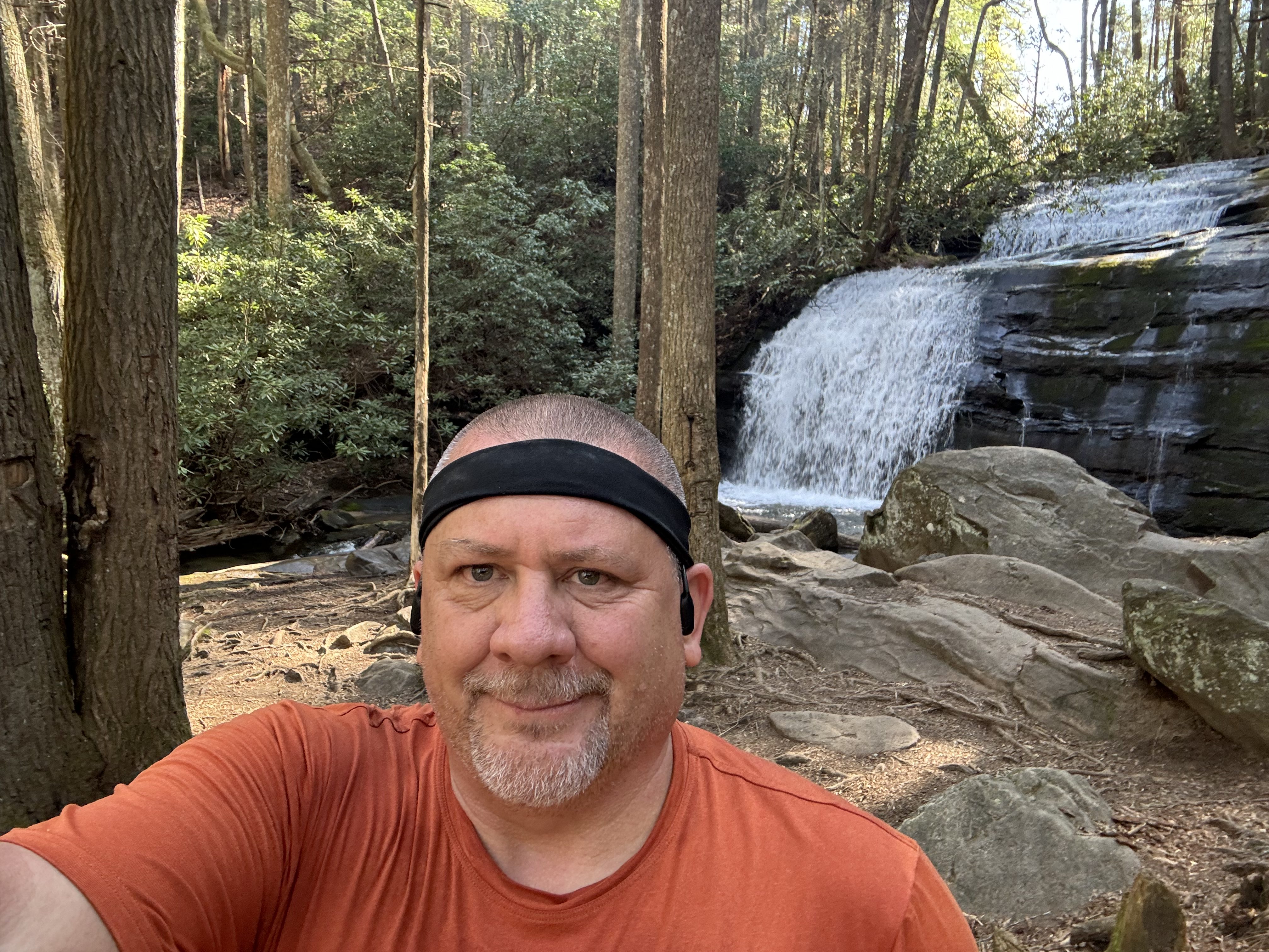
    Long Creek Falls
    Chuck at Long Creek Falls

    Met Jim from TN. Seems about my age, maybe a bit younger. He’s thru-hiking too. Moving a little faster than me. 

    Stopped at Hawk Mountain Shelter at 12:30 to try to fix a blister. Same little toe again. Punctured it and wrapped it. Gonna try my toe sock liners instead of my heavier toe socks. Had lunch with Debbie and Randi. Pepperoni and cheese. Had some cell and checked in with Dana. 

    The Army Rangers are training near here today. Got buzzed by a Blackhawk helicopter that landed and took off near Hawk Mtn several times. Heard sporadic automatic gunfire on and off. No big deal. It’s all blanks and was aware we could run into this.

    Stopped for water about .3 miles after leaving Hawk Mountain Shelter. It’s 80 degrees, sunny, and hot. About 7 miles to camp. Gonna be a tough afternoon.

    Wow… tough day and my nastiest mountain is right in front of me. Sassafras Mountain. I have not radically underestimated the physical challenges and hard mountains, but it is harder than I thought. GA is the second mountainous state on the trail. 

    Day 2 – Sassafras Mountain

    Stopped for a break at 3:30 before my last nasty climb of the day. Sassafras Mountain is 1.1 miles up and about 655 feet. Took till 4:40. Nasty!! This weather is unseasonably warm, but it was all cold and rain last week so I should not complain.

    Got to Justus Creek at 6:00. Exhausted. Met Randi and Debbie. They are staying here instead of pushing on. Watered up and rested. Thought about staying here, but all tent sites are full. Slogging 1.4 miles uphill to Gooch Mountain Shelter for the night. Ugh!

    It was more like 2 miles uphill, but I made it at 7:09. Stopped and got 3 liters of dirty water about .3 miles before camp. 

    Tent setup by 7:28. Checked weather. No rain, so not using rain fly tonight. Finished camp setup by 7:50. Made mountain house white bean chili with chicken for dinner a bit after 8:00. Chatted with two people who also ate late. Filtered water, put smelly things in bear box, and got settled into tent at 9:00. 

    Camping at Gooch Mountain Shelter
    Day 2 Map – Stover Creek Shelter to Gooch Mountain Shelter

    Hard day physically. Still having fun though!

    Technical Notes

    • iPhone 45%
    • Watch 23%
    • iPad 90%
    • Headphones 80%
    • Stinger waffle 150
    • Justin’s nut butter 220
    • Tea 0
    • Snickers 250
    • Pepperoni 560
    • Cheese 100
    • Mountain House White Bean Chili 575
    • Dehydrated chicken 170
    • Water 5 liters
    • Miles 12.9
    • Time 9:47
    • Elevation gain 2745
    • Calories consumed 2025
    • Calories burned 7000
  • Day 1 – Approach Trail to Stover Creek Shelter

    Day 1 – Approach Trail to Stover Creek Shelter

    Today’s Miles: 10.8

    Trip Miles: 10.8

    Sunday, April 14, 2024. Mostly sunny and breezy, high 73, low 53, dry.

    Up at 7:30. Pitcrew and I had a nice buffet breakfast at the lodge. Enjoyed my last good meal for about a week. Got packed up and reassessed the plan for today. Checked out and Pitcrew drove me down to the top of the waterfall parking lot. We said our goodbyes and I headed north on the AT approach trail at 10:10.

    Goodbye and headed North on the AT

    Perfect weather today. The 8 mile approach trail is basically uphill the entire way. Didn’t listen to any music or books this morning. Very introspective today thinking about what got me to this point and what the next 2200 miles will bring.  Maxed out at about 2 miles per hour.

    Only saw two other NOBOS, but lots of people headed south. All weekend hikers headed back to Amicalola to wrap up their weekend.

    Stopped at mile 6 to refill my .7 liter water bottle from a small spring. I filter anything that doesn’t come out of a water faucet. Met Randi, a retired female teacher from Florida out for a 3 week hike. She’s moving a bit faster than me so I let her take the lead.

    Water on the Approach Trail

    Summitted Springer mountain at 2:50. It was a 7.95 mile day in 4:45.

    Last 1.5 miles was a bitch. Took me almost an hour. Stopped 3 times in last .15 miles. About 4 miles to go to camp. Resting here for a bit.

    There were 5 people here when I arrived. One had recently passed me. Guessing others did not do approach trail. I am certain 2 of them were at the lodge when I left this morning. 

    There were 5 people here when I arrived. One young guy in a purple hooded sun shirt recently passed me. Rested at Springer for about 30 minutes, had some trail mix and a lot of water. Took some pictures, signed the log book, touched the first white blaze on the AT, put on my pack and headed to camp. About 2.8 miles to go to camp. 

    Start of the AT on Springer Mountain
    Start of the AT on Springer Mountain
    Chuck on Springer Mountain, Day 1

    Passed one older gentleman named Tony who is also on his first day. He started at Springer. Stopped to refill my water at a nice creek about .1 miles from camp. Took an extra liter with me in my dirty water bag for later this evening.

    Got to Stover creek shelter at AT mile 2.8 at 4:30. Found a good spot and set up my tent. That’s when I discovered my glasses were missing! Searched camp site then walked .1 miles back to the creek where I had filled up on water…and there they were!

    Stover creek shelter

    Zero cell service. This is why I love my Garmin satellite device. Checked in with Pitcrew via Garmin. Could not have touched base with just a cell phone. I hate those people who say that you don’t need a satellite device on the AT since you almost always have cell service. I learned last summer that was bullshit. But plenty of people online still preach this crap. End of rant. 

    Sat down at the shelter and chatted with a group of 3 retired gentleman from Texas on a week long hike. Also saw Randi and Mark who I met at Springer. Mark also did the approach trail today. Overall there were about 14 of us in camp by the end of the evening. There were 5 in the shelter and the rest tented. 

    After resting, I got the remainder of my camp set up for the night..inflated sleeping pad and pillow, got out my quilt, generally unpacked gear, started charging electronics. Since I was dry, I did not change into camp clothes. My apple watch died a bit before reaching camp. Need to tweak the settings on power usage. Garmin at 94%, iPhone at 70%, iPad mini at 100%, headphones at 95%.

    AT day 1 camp

    There were 14 people in camp. About 5 in the shelter and the rest tenting. Made dinner at 7:00. Leftover garlic bologna I did not eat for lunch, curry noodles with dehydrated chicken, and tea. Most of us cooked while hanging out at the shelter picnic table or around the big fire pit by the shelter. Got all my smellables (food, hygiene items, trash, cook gear) packed up and stowed them in the bear box for the night.

    Bear Box at Stover Creek

    Hung out by fire pit and made introductions and generally relaxed and chatted. Amusing that I was the youngest of the 6 of us who hung out and talked till 8:30. Lots of talk about grandkids 🙂

    Headed to my tent and settled in. Updated some blog entries for today and checked in with Pitcrew. She was about an hour from home. Being able to text via Garmin satellite device when there is zero cell coverage is awesome. Main reason why I invested in it. Took something to help me sleep and tried to go to sleep about 9:30. 

    Overall a good day. Nice to meet a few folks. Great weather. I actually ate well which is something I struggle with the first few days on trail. My body feels good…not much worse than one of my training hikes back home.

    Day 1 Map – Amicalola to Stover Creek

    Technical Notes

    • Breakfast 1000 calories 
    • Trail mix 270 calories 
    • Bologna 560 calories 
    • Curry noodle 450 calories 
    • Chicken  170 calories 
    • Tea 0 calories 
    • Water 4.1 liters
    • Miles 10.8
    • Time 6:44
    • Elevation gain 2900 feet
    • Calories consumed 2450
    • Calories burned 5500
  • Day 0 – Headed to Amicalola Falls

    Day 0 – Headed to Amicalola Falls

    Saturday, April 13, 2024.

    Pitcrew and I drove from Maryland to Gatlinburg, TN yesterday. We have been to Gatlinburg many times before and enjoy it. Drove through lots of rain storms and high wind. Rain stopped a little bit before we arrived. 

    Said goodbye to the dogs (Sky and Pen) for six months yesterday morning. I find it interesting how emotional that was. Ever since Andrea died almost three years ago, my emotions have been so much more intense than ever before in my life. Mainly emotions around separation, loneliness, sadness, etc. I thought that would calm down over time, but not yet.

    On that note, I am experiencing a seesaw of emotions between excitement and apprehension about the start of my thru-hike. I read that this is common.

    Today we drove to Newfound Gap in GSMNP and then to Franklin, NC and Hiawassee, GA. Both are trail towns and I took advantage of the short drive to get the lay of the land in each town where I will be stopping in a few days. We made it to Amicalola Falls state park visitor center at 3:45.

    Weather note…it is crystal clear and 72 degrees today. Same forecast for Amicalola Falls and Springer Mountain today! The forecast on the mountains looks like low 70s and mostly sunny with nights in the low 50s through for the next 6 days. I could not ask for better weather to start. I have been very nervous about the weather in April, hence why I chose a mid-April start date. Nailed it!

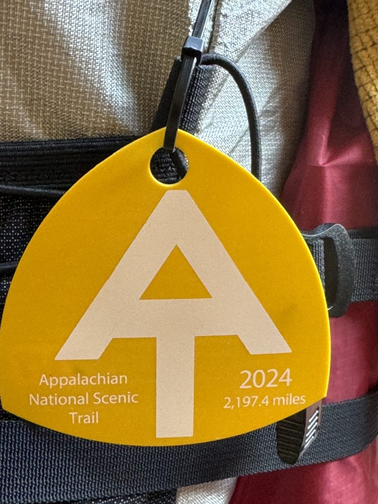
    Got checked in, received my hiker tag, and did the orientation briefing. I am number 2318. Glad we got here by 4:00 as the AT registration closes at 4:00, not 5:00 when the visitor center closes! Got some great advice from the folks working registration. Weighed my pack with 1.75 liters of water and 2.5 days of food at 29 pounds even! Just what I expected.

    2024 AT Hang Tag, Hiker Number 2318

    Drove up to the lodge, checked in, and checked the place out. The lodge is very nice and the views are amazing. Walked down to the top of the falls to check the view and to locate where I will start my hike up the approach trail to Springer Mountain in the morning.

    Chuck and Pitcrew at Amicalola Falls

    Got my backpack finalized for tomorrow, made my first daily blog entry, and relaxed with Dana and the amazing views. Will have dinner at the lodge dining room later.

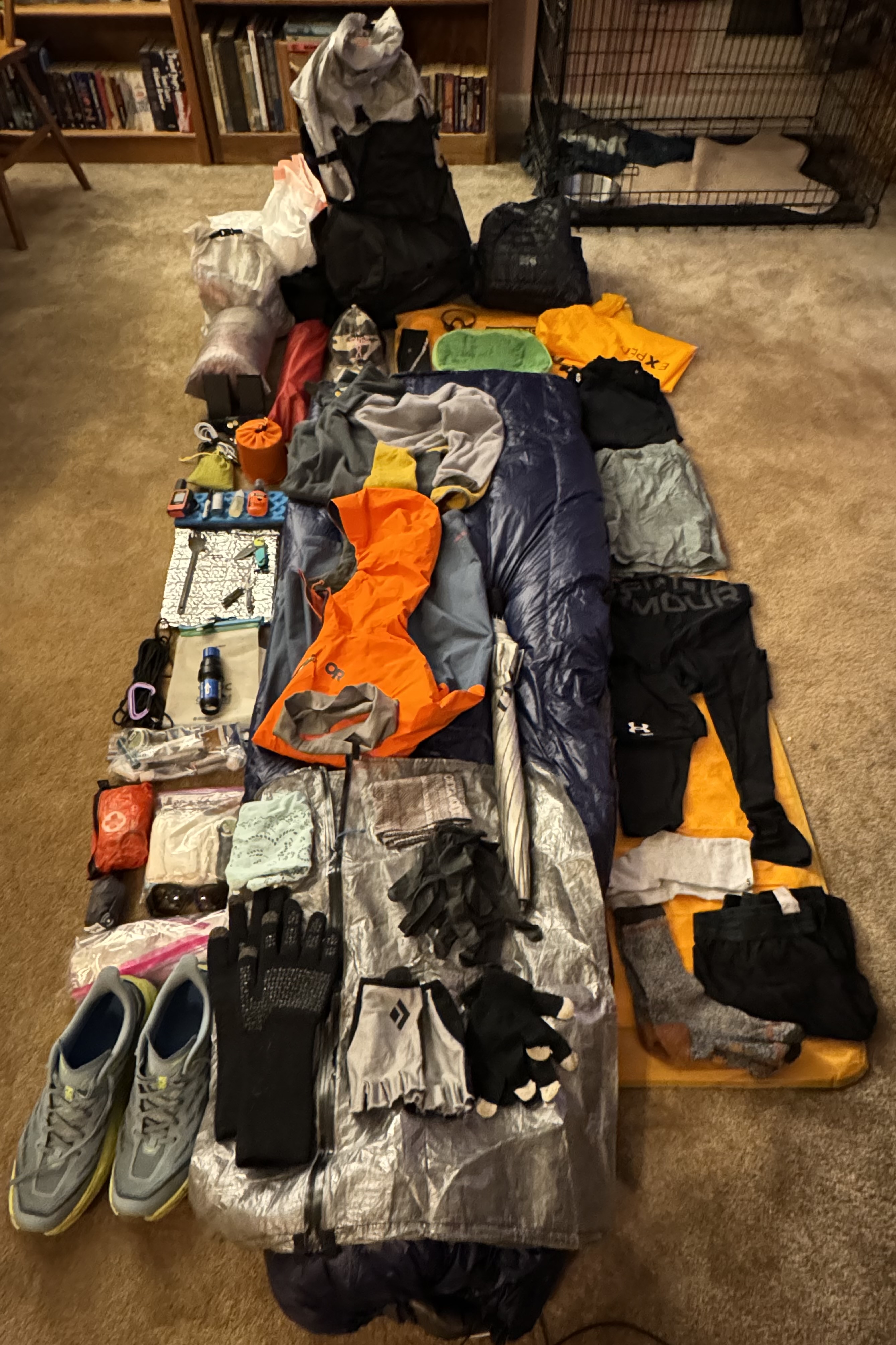
    Backpack ready to go at Amicalola Falls

    Gear note…starting out with brand new pair of Hoka Speedgoats on my feet. Guessing they will last about 350 to 400 miles per pair.

  • Gear List for 2024 AT Thru-Hike

    Gear List for 2024 AT Thru-Hike

    I started my thru-hike on April 14, 2024 with my cold weather gear. I planned to ship the cold weather gear home when I got to Damascus, Virginia. I decided to start my hike without any cap shoes in order to save weight. Overall, my base weight was 21 lbs and my total weight with 4 days of food was 31 lbs.

    Half-way through the Smokies, I stopped in Gatlinburg, TN on May 9, 2024 and shipped a few items home. Overall I got rid of 2lbs 11 ounces of gear. I did pickup a pair of cheap flip-flops at Walgreens.

    • Sent home: puffy, mittens, sun glasses, stuff sack from my quilt, straps for attaching quilt to sleep pad, some food, and some hygiene items. I only used the puffy twice and don’t see any need for it. I am good with my fleece.

    I swapped out my cold weather gear in Johnson City, TN on June 2, 2024. I also started carrying a pair of trail sandals for my camp shoes. Overall, I only dropped about 12 ounces of weight from my gear due to adding the camp shoes and my fan.

    • Sent home: long sleeve shirt, short sleeve shirt, seal skinz rain gloves, thermometer, balaclava, buff, 10 degree quilt, flip flops, old hiking pants that were too big, old bandana
    • Added/replaced: 40 degree quilt (22 ounces), hiking sandals (10.8 ounces), new short sleeve shirt, new hiking pants that fit, new bandana, new trash compactor bag, USB fan (1.76 ounces)

    I exchanged some more gear in Front Royal, VA on July 9, 2024. Lowered my base weight by about 16 ounces.

    • Sent home: rain jacket, ball cap, Apple Watch and charger, convertible pants/shorts, spare hiking socks
    • Added: lightweight shorts (4.8 ounces), camp towel (7 ounces)

    By the time I reached Duncannon, PA on July 21, 2024 I was done with my original pack. My back was killing me. I went to the local REI and picked up a beefy Osprey Atmos AG 65 pack. This added 2.8 lbs to my base weight, but it was worth it! Probably carrying a total of 32-33 lbs at this point.

    I added back some gear in Great Barrington, MA on August 15, 2024. Added about 18 ounces to my base weight.

    • Added/replaced: heavy rain jacket, hiking pants, spare socks

    Somewhere in New England I added a pair of rain pants (5 ounces).

    I swapped back in my cold weather gear in Killington, VT on August 28, 2024. I added about 18 ounces to my base weight.

    • Sent home: 40 degree quilt, hiking sandals, short sleeve shirt, USB fan
    • Added/replaced: 10 degree quilt, water shoes (14 ounces), gloves, mittens, balaclava, buff, long sleeve shirt

    Gear List – Equipment Name, Description, Quantity, Weight in Ounces, Notes

    Pack

    Pack LinerKirkland 18gal Compactor Bag12.2
    PackULA Ultra Circuit 68L + pouches135

    Sleep System

    Sleep PadNemo Tensor Insulated inflatable, regular/wide118.66
    Winter QuiltEE Revelation Down 10 degree quilt regular wide130.4
    Quilt repair patchesEE patches10.48
    Pump sack / storageExped Schnozzel Medium pump/dry bag12.1
    Nemo Sack and Patch KitComes with Nemo10.6
    PillowSea to Summit Aeros Premium12.57
    Dry BagZpacks Large dry compression bag for quilt10.8

    Shelter

    TentMSR Hubba Hubba 2150
    FootprintMSR universal 85 x 5117
    Tent Repair KitSplint, tenacious tape x 4, tenacious mesh x 210.74
    Tent StorageZpacks Medium Dry Bag10.71
    Rope frameframe for fly-first setup 10.75

    Kitchen

    StoveMSR pocket rocket 212.57
    PotTOAKS LIGHT TITANIUM 650ML POT W. Handles12.8
    SporkSea to Summit Alpha Light Spork – Long10.42
    CozyLarge cozy. Avoid simmer time on stove.10.95
    Fuelisobutane-propane 100 gram (empty)13.5
    LighterMini Bick10.39
    Wash ClothLight Load hand towel10.56
    Bear HangMtn Laurel Design Rope, rock bag, lock carabiner11.9
    Gallon BagsZiplock Freezer Bag70.31
    Food Storage BagMtn Laurel Design 12×24 DFC Bag11.1

    Hydration

    Primary Water FiltrationSawyer Squeeze12.79
    Backup Water Purification50 Aquatabs10.25
    Dirty Water ContainerCNOC Vecto 3L13.2
    Sawyer Couplingattach Sawyer Squeeze to Smart Water bottle10.18
    Spare water bottle capSpare sports cap for Smart Water bottle10.18
    Water BottleSmart Water 1L with Sport Cap21.38
    Spare O-ringSpare sawyer o-ring10.04

    Clothing

    Long Sleeve ShirtCamp Shirt Cold Weather – Under Armour Heatgear15.75
    ShortsCamp Shorts – Nike Challenger 7’’ Running Short14.8
    SocksCamp Socks – Wrightsock midweight12.93
    Toe SocksInjini sock liners – second set of hiking socks11.31
    UnderwearSpare set of dry underwear – helps with chaffing 12.89
    Long UnderwearUnder Armour Heat Gear – year round15.19
    Light Weight Mid LayerSky goat half zip fleece – large110.02
    Insect NetSea to Summit Mosquito Head Net11
    Clothing Stuff SackZpacks Slim Dry Bag 4L – replaced with schnozzel10.6

    Rain Gear

    UmbrellaZpacks Lotus UL Umbrella16.7
    Umbrella clipGear clip + small carabiner – left chest strap10.81
    CarabinerTop of pack to hold umbrella10.85
    HatBall cap, Mesh with hard bill13.5
    Rain KiltZpacks rain kilt. Doubles as tarp, ground cloth, other11.8
    Rain Jacket, HeavyOutdoor Research Foray II Gore-Tex w. pit zips112.5
    Rain Gloves8 mil Nitrile gloves from Amazon20.6

    Hygiene

    Wash ClothLight load Towel10.49
    Tooth PasteTravel size10.92
    Tooth BrushOral-B10.35
    Dental FlossGlide pro-health 54yd10.63
    SoapDr. Bronners in .5oz bottle10.95
    Insect RepellentBen’s 100% DEET – hip belt pouch11.25
    Chap StickBlistex10.35
    Anti ChaffingSquirrel Nut Butter – small container20.7
    Diaper Rash CreamA&D Zinc Oxide + Dimethicone11.83
    Hygiene BagHalf gallon Ziplock10.35
    Nail ClippersGeneric10.46
    TinactinAnti-fungal10.75

    Toiletry

    TrowelDutchwear Duce Scoop10.75
    Toilet PaperIn quart ziplock bag11
    Waste BagGallon Ziplock 10.3
    Wet WipesCottonelle12.5

    First Aide

    TweezersMetal10.25
    Mole Skin4.5’’ X 3.5’’10.18
    Self adhesive bandage1’’ X 5yds10.32
    Q-tips10 generic10.07
    Anti-diarrheal6 tablets10.14
    Motrin1000 Mg packets100.07
    Triple antibiotic ointmentGeneric packet 50.04
    Band-Aid3’’ X 1.5’’60.03
    Band-Aid2’’ X 4’’40.07
    Sterile Gauze Small2’’ X 2’’20.06
    Sewing NeedleLarge…use with floss or similar for repairs10.01
    Oral MedsPrescription – as needed (x 3)10.35
    First Aid Dry BagRed Space Bear Bags DFC small dry bag10.28
    Antibiotics100mg doxy x 610.11
    Safety PinsGeneric20.01

    Electronics

    Power BankNITECORE NB1000025.29
    Wall ChargerAnker 25W USB-C11.34
    PhoneiPhone 15 w. Case – left chest strap pouch18.11
    Head PhonesShokz OpenRun Pro bone conduction11
    GPS DeviceGarmin in-reach mini 2 + carabiner14
    HeadlampTactikka Core rechargeable12.68
    Charging Cable 14-in-1 USB-C, Lightning, Micro USB, USB-A11.31
    Charging Cable 2USB-C – USB-C10.67
    Apple Watch ChargerUSB-C and Lightning10.67
    Headphone charging adapterUSB-C to proprietary magnetic10.12
    Waterproof BagZiplock 1/2 gallon10.32

    Misc

    Duct TapeSmall roll10.56
    Multi ToolLeatherman Squirt12
    Paracord/clothes line15’11.45
    Carabiner, largeBlack Diamond Mini Wire 20x7kN load bearing20.85
    Carabiner, smallZpacks mini carabiner20.1
    Reading GlassesThinoptics + small case10.15
    LighterBic Mini – spare10.39
    PenMini sharpie 10.21

    Luxury

    Sit PadZpacks sit pad10.81
    ipadIpad mini111

    Worn/Carried

    Pants/ShortsREI Sahara Convertible113
    Long Sleeve Shirtoutdoor Research long sleeve15
    Sweat BandGeneric10.6
    SocksInjinji Trail Midweight Crew Socks13.2
    UnderwearLong bike-short style13.42
    BandanaGeneric10.85
    BuffBuff UV and Insectshield11.2
    WalletZpacks Wallet Zip Pouch – CC, ID, cash, insurance card 11
    Reading GlassesPrimary glasses, carried in left chest strap pouch11.16
    Sun GlassesOmbraz Teton, carried in left chest strap pouch12
    ShoesHoka Speedgoat 5120.6
    Trekking PolesBlack Diamond Pursuit120
    Camera MountAccessory Basics mount – right trekking pole13.95
    KnifeThe James Redstone, in pocket11.98
    Pill caseMetal pill case in pocket12.5
    GlovesFingerless hiking gloves11.2

    Consumables

    Water1 liter and .75 liter in smart water bottles1.752.2 lbs3.85 lbs total
    Fuelisobutane-propane14
    Food24oz per day4246 lbs total

    Cold Weather

    Gloves, lightweight Cloth lightweight 21.2
    Mittens, midweightConvertible mittens 12.4Swap out for summer gear
    Ear CoverGeneric  10.8Swap out for summer gear
    Balaclava Generic  11.48Swap out for summer gear
    PuffyMountain Hardware Ghost Whisperer 218.8Swap out for summer gear
    Long Sleeve Thermal BaseZengjo 18.1Swap out for summer gear
    Rain GlovesSealskinz Skeyton13.63Swap out for summer gear
    Dry bagZpacks small dry bag10.39


    Added/Modified Gear Throughout Hike

    PackOsprey Atmos 65 AG + pouches – 4.75lb177Swapped out ULA for this pack at Duncannon
    Summer QuiltEE Revelation Down 40 degree quilt regular wide022Swapped in for Summer and out in Fall
    Long Sleeve ShirtCamp Shirt Cold Weather – Under Armour Heatgear15.75
    Short Sleeve ShirtCamp Shirt warm weather – REI Active Pursuits T-Shirt15.25
    Camp / Water ShoesMerrell Men’s Hydro Moc014Only carried these from Killington, VT
    Camp shoes Xeros Z-Trail EV Sandals110.8Carried from Johnson City, TN to Killington, VT
    FanHot Weather – USB fan for hot humid nights11.76Carried from Johnson City, TN to New England
    TowelPackTowl17Carried from Front Royal, VA till end
    Rain PantsGeneric Nylon from Amazon15Carried in New England
  • How Does Thru-Hiking Work?

    How Does Thru-Hiking Work?

    “Amateurs study strategy, professionals study logistics.” – Omar Bradley

    I get a lot of questions about how this entire thru-hiking thing works and what have I done to prepare for it. 

    As for how I have physically prepared, I have been trying to hike two to four times a week, moderate to difficult terrain, 10+ miles each hike and carrying my full pack for the last twelve months. I have taken a week off here and there, but have stuck with this schedule fairly religiously. Overall, I feel like I am in pretty good shape to start this thru-hike.

    I also did three two-night backpacking trips on the AT and a week-long trip on the AT in the summer and fall of 2023. Due to the time of year that I was hiking in the mid-Atlantic (Front Royal VA to Duncannon PA) I was very much alone on the trail and in camp most nights. This let me get comfortable with my gear, the physical aspects of backpacking and camping, and most importantly the mental aspects. It is that mental aspect of a solo thru-hike that worries me the more than anything else.

    Some statistics about hiking the trail.

    Before I get into how this whole “how does this thru-hiking thing work”, a little bit of statistics.

    Approximately three million people visit the Trail every year. Approximately 4,000 people attempt a thru-hike of the entire AT each year. Historically about 25% of those who attempt to thru-hike the AT are successful. In fact, the completion rate appears to be dropping. Since 2016, only about one in five have finished the whole trail. Of those hikers that do drop-out for any number of reasons, 60% of them drop-out before they reach Damascus, Virginia (NOBO mile 471). There is anecdotal evidence that a significant amount of the drop-outs occur within the first 100 miles or roughly 10 days.

    Here is a great little article on why 75% of AT thru-hikers won’t make it.

    The largest age group of thru-hikers by far are under 30, but there is a significant amount of people in their late 50s and early 60s.

    Here is a nice easy read on a lot of interesting AT thru-hiker statistics for 2023.

    Gear Overview

    Everything that I need for 5-6 months on the trail, not counting  consumables, will be carried on my back. That means I need to be very careful in choosing what to take with me, what not to take with me, and how to plan and manage my gear and consumables (food, water, fuel, meds, toiletries, etc.). I have a complete gear listing on a later blog page, but I am including some major highlights here based on questions that I am frequently asked.

    Shelter – MSR Hubba Hubba 2 two person free-standing tent that weighs 2.8 pounds. Very roomy and very dry. Been using this for the past year.

    Sleep System – Nemo Tensor Insulated inflatable sleep pad at 19 ounces, Enlightened Equipment Revelation down quilts at 30 ounces for winter and 22 ounces for summer, Sea to Summit Aeros inflatable pillow at 2.6 ounces. I sleep on my side and generally prefer a quilt to a traditional heavy sleeping bag. I have one for clod weather and a different one for warm weather. Will swap as needed. Been using this setup for the past year.

    Backpack – ULA Circuit Ultra 68 liter pack with waist belt pouches and chest strap pouches at 2 pounds 3 ounces. This is an internal frame pack with a fairly sturdy waist belt. I carry a .75 liter water bottle on my right chest strap and my iphone and sunglasses on my left chest strap. Snacks in one hip pouch and frequently used items like bug spray and bandanna in other hip pouch. Just switched to this heavier backpack in January.

    Kitchen – 650ml titanium pot with lid, a long handled spoon, MSR Pocket Rocket stove, isobutane fuel canister, misc items all at a pound.

    Clothes – one long sleeved shirt, one short sleeve shirt, one pair of long thermal underwear, one pair of shorts for sleeping, one pair of convertible pants (turn into shorts), three pairs of socks (one just for sleeping), one spare pair of underwear, light-weight fleece pull over.

    Rain gear – umbrella, rain kilt, heavy rain jacket, two pairs of  8 mil Nitrile gloves.

    Electronics – iphone, Garmin InReach Mini satellite/GPS communicator, two 10,000ma power banks, headlamp, iPad mini. Originally I had just planned on taking a Kindle at 7 ounces, but Dana had a spare iPad mini at 11 ounces which will make blogging much easier and I can read books on it. Decent trade off for the extra 4 ounces. The two power banks can recharge my iphone from 0% to 100% a little over two times each. I go through about 50% of iphone battery daily while on trail due to audio books or music.

    Note on clothes and hygiene….basically I have one set of clothes to hike in and one set to sleep in. I hope to be able to get a shower and do laundry about once a week or so.

    Why is weight so important on the trail?

    I cannot stress enough how important managing weight is on a long hike. By weight I am refereeing to how much weight you are carrying, not how much you weight. There is a direct correlation between people who carry less weight on the trail and successfully completing a thru-hike. People who carry less weight have a much higher success rate than people who carry more weight. 

    “Base weight” is the weight of all of your gear minus consumables like food, water, and fuel. You’re generally considered an ultralight backpacker if your base weight is under 10 pounds and a lightweight backpacker if your base weight is under 20 pounds. Most traditional backpackers will have a base weight under 30 pounds.

    “Total Weight” is your base weight (all your gear including your cell phone) plus the weight of all your food , water, and fuel (i.e. your consumables). 

    Water is heavy. One liter weight 2.2 pounds. Food is also heavy. The general rule of thumb is 2 pounds of food per day. That said, there are plenty of ways to make food lighter without sacrificing calories. Think calorie dense food with zero or minimal water content that you can rehydrate at meal time. I personally find that I can get by on 1.5 pounds (24 ounces) per day with careful planning.

    I spent a LOT of time researching, planning, testing, failing, re-planning, re-testing and continually paying attention to the weight that I am carrying. At 55 years old with lots of hard miles on my lower body and back, weight is everything. Also, ounces quickly add up into pounds. For example, I literally cut my tooth brush in half to save 1.5 ounces. 

    In my opinion, anything over 20 pounds base weight or 30 pounds total weight is asking for trouble. 

    My starting base weight for this AT thru-hike is 19.8 pounds which includes 1.5 pounds of cold weather gear that I will ditch after the first 30-40 days. 

    I carry a 1 liter water bottle and a .75 liter water bottle for 3.85 pounds of water. I prefer to only carry 2.5 days of food at any one time or about 4 pounds. There are plenty of times where I need to carry 3 days of food at about 5-5.5 pounds and a few (3 I think) where I will have to carry 4 days of food at 6.5-7.5 pounds (not looking forward to those). And lastly, I carry one small fuel canister for my stove which weighs 7.5 ounces when full. 

    That makes my total weight for a 2.5 day section of trail roughly 28.5 pounds or 27 pounds once I ditch my cold weather gear. That assumes that all my gear is dry and I am not dragging around couple of pounds of water logged tent and clothes!

    I am not in love with my base weight, but I can live with it. I was down to about 16 pounds last fall, which I thought was great. But that was using some ultralight gear that my older body just was not happy with (not enough  support and some other physical problems). Fortunately I hiked A LOT with that gear and learned that sometimes physical comfort/necessity outweighs weight 🙂

    One caveat on that body weight topic. All weight has an impact on your feet and legs, including the body weight you are carrying. I worked hard to drop 20 pounds of body weight before my AT thru-hike because it is hard to drag that extra weight up and down steep mountains for days on end.

    Where to spend the night on the trail?

    There are shelters along most parts of the trail spaced roughly 7 to 12 miles apart. Shelters are three-sided structures that provide basic protection from the elements. One side is left open to the elements and you set up your sleeping kit on a wood floor. They range from small and basic with room for 4 people to sleep to large and fancy with porches, picnic tables, fire pits, swings and room for up to 16 people. There are locations to set up your tent at/around the shelters ranging from a few tent sites to 40+ tent sites. Many shelters (most?) have a privy (crude semi-outdoor toilet facilities) as well as some mechanism to keep your food away from bears and other animals (bear boxes, bear poles, bear cables). 

    In addition to shelters, there are sometimes official camp sites that have specific locations for setting up a tent. These may have a privy and food storage mechanisms. There are lots of unofficial camping locations with room for anywhere from 2 to 8 tents but no other facilities. Camping at one of the unofficial camping spots is known as “stealth camping” or “dispersed camping”.

    There are a lot of hostels along the trail, particularly in the south and again in New England. Hostels range from first-come-first serve bunk rooms that can sleep anywhere from 4 to 20 people, to rentable rooms with 1 or 2 beds, to small rentable cabins with a heating source. They range from very basic to almost luxurious. Hostels generally have some kind of common/social room for the hikers to congregate and socialize as well as a self-service kitchen for preparing your meals. A night at a hostel can range from $25 up to $100 depending your sleeping preference. Most hostels offer showers, laundry, loaner clothes, snacks, and basic food resupply (ramen, Knorr rice dishes, jerky, tuna packets, snack food, etc) for an additional fee. 

    Lastly, there are the traditional motels/hotels available in towns directly on the trail or within a short hitchhike or shuttle ride to town. Think Motel 6 or even non-chain mom-and-pop roadside motels. Those run anywhere from $75 to $125 a night. 

    The FarOut app is the most common tool used by hikers to navigate the trail and to find details on shelters, camp sites, hostels, towns/hotels, drinking water, food resupply, and much more. This is a mobile app for your phone or other computer device and includes comments from hikers (online version of word of mouth). This app is your most accurate and current source of info on the trail.

    In general, my plan is to find a hostel or motel every third or fourth night and sleep in my tent all other times. I will avoid sleeping in shelters, particularly in GA, NC, and TN due to the Norovirus problems on trail in those states.

    Where to go to the bathroom on the trail?

    Most shelters have a basic privy. These are intended for pooping and NOT for peeing. Go find a tree or a bush to hide behind to pee. Bring your own toilet paper.

    The problem with privies, particularly in highly traveled areas and all of the trails in GA and NC in the spring, is that they can fill up, they can smell, people can be inconsiderate slobs, and they can be the perfect place to pick up Norovirus. More on that last item later. 

    Other than privies, what options does that leave? Dig a 6-8 inch deep hole well away from the trail or water sources, and do your business there. Then cover it back up with dirt.  Welcome to the great outdoors and Leave No Trace principles!

    Side note – anything you pack in you need to pack out. Except for some rare exceptions at large parking lots on trail or state parks, there are NO TRASH CANS. 

    Where to get water on the trail?

    In most areas there are plenty of water sources on the trail. The most common are streams, springs, creeks, rainfall runoff, stagnant pool of water under a bridge. When getting water from these sources you should filter or chemically treat the water. Sometimes if the water is nasty enough (think fecal contamination form livestock), you might want to both filter and treat the water.

    The trick with natural water supplies like this is that they can be very seasonal and unpredictable. You need to research water availability constantly and plan ahead. Word of mouth about water sources is the best way to know about water availability on trail. Hiker notes/comments about good or bad water sources in the FarOut app.

    If the trail runs through a state park there will typically be well water of some sort. 

    Roadside gas stations, convience stores, and restaurants are also common locations to get water. Just refill your water bottle from the sink in their bathroom.

    A few important notes about water:

    • Water is the heavy. One liter is 2.2 pounds. 
    • Water availability varies by season. There are lots of good water sources in spring and early summer. But those same sources can be bone dry in the summer and fall.
    • The goal is to strike a balance between 1) how much water to carry versus 2) availability of water on trail versus 3) how hot it is and how much you need to drink. 

    Where to get food/supplies on the trail?

    There are two basic ways to resupply yourself on the trail. One way is to package up your supplies ahead of time at home into resupply boxes and mail them to yourself on the trail. The other is to buy what you can where you can at things like gas stations, convenience stores, Dollar Generals, hostel, outfitters, etc. 

    I prefer to resupply on trail, but there are some locations where it is just easier to ship things to myself than to get a shuttle and go into town and find a store and then get right back on trail. Therefore, I am doing a mixture of both methods. I put together resupply boxes that I will ship via USPS to various hostels as well as a US Post Office or two. These mainly contain food items other things that I will have trouble finding on a particular part of the trail. Also they contain my meds as I don’t want to carry 170 days worth of meds with me.

    My goal is to carry the least amount of food as possible to minimize weight. I also don’t like getting off trail and dealing with hitching or shuttling miles into town to resupply. There are sections of trail where I know I can resupply from a hostel or some store that is less than a mile off trail almost every day or every other day. This is my perfect world. 

    However there are some hostels and towns that don’t have good resupply options and some sections where there are no resupply options. In those cases I will use resupply boxes. For example, when I hike through the Great Smoky Mountain National Park I do not want to carry all the food that I need for 7-8 days! The other resupply option is to get off trail on day 4, get a shuttle and drive 30 minutes into Gatlinburg TN, buy supplies, get a shuttle back to the trail. I want to push all the way through the Smoky Mountains and not get off trail. To solve that, I shipped a resupply box to a shuttle driver who will deliver it to me at Newfound Gap on day 4. 

    I am very fortunate that I have a great support network at home. I made up resupply boxes for the first half of the trail and Dana will tweak their contents as needed and ship them to me at pre-arranged locations as I progress up the trail.