April 26, 2026. Rainy, windy with gusts to 35 mph, 34 going up to 38, feels like 24 degrees.
Up at 6:30. It’s cold, wet, very windy, and miserable. It won’t warm up much if any today. We have 12 miles to town with the first 9 uphill. I figure this will take at least 7 hours.
Last night was miserable. Rain on and off, freezing temperatures, and crazy wind. The wind buffeting the tent made it almost impossible to sleep. The rock trick worked to keep the tent up until about 5:00 a.m. when my tent collapsed again. Crawled out and got things fixed and slept for another hour. If you call that sleep.
Brad and I got moving at 7:30.
I don’t have much to say about today other than YUCK. It was very cold, extremely windy, overcast with rain on and off until about 1:00. Long steady uphill ending at 5900 feet. We have gained over 3000 feet in elevation in 3 days. Hence the cold and chance of snow tonight.
Boom!
Brad and I arrived at the Pine House Cafe in Mount Laguna at 2:15. Brian, Hell Yeah, Titus were here. We had an early dinner together before Brian and Hell Yeah headed out to do 8 more miles. Crazy youngsters. Awesome to have real food.
Lodge at Mount Laguna
Checked into the mediocre Tiny House Block hostel at 3:30. Titus is also staying here. I’ve been in worse, but not for $50. They are the only game in town. Got settled in, dried tent as best I could, walked 1/2 mile to get resupply before they close at 5:00, showered, started laundry, and started relaxing.
Hostel at Mount LagunaHostel at Mount Laguna
Got blogs updated and posted. Packed food bag. Generally got ready for hiking tomorrow. Once my electronics finish recharging I plan on a good night’s sleep out of the elements. The wind is still howling outside our room and it is 35 degrees with a real feel of 24 at 6:45 p.m.
My cold weather gloves tore in two places today. Not sure how that happened. I will replace them later this week in the next big town. The heel started to tear off my NEW hiking shoes. These things are 5 days old and only 2.25 days in the trail. I’ll be sending a nasty-gram and a photo to the manufacturer. Duct tape to the rescue until I can find a replacement layer in the week. Frustrating!
Overall, the trip has been good so far. I’m a little disappointed in how slow I’m hiking and that I can’t do more than 15 miles yet. But that is to be expected. I planned for the bad weather, but I was hoping to not have it for longer. Oh well.
One potential issue, however. Full disclosure time. That hike in the rain today on top of the heat the past 2 days has left me with a bad chafing issue. I should have gotten ahead of it more than I did. There is a chance that I will not be able to hike tomorrow. Will see in the morning. Fingers crossed.
April 25, 2026. Sunny and mid-40s going up to mid-50s.
Up at 6:00. Slept really well. Surprisingly so for the first night on the trail.
On the trail at 7:00. We had a tough climb out of Hauser Creek first thing. I struggled and had to make frequent stops. Still feeling that 11lb water carry in my hips.
What trail looks like
We reached Lake Maurena campground at 9:25. Brad beat me here by 15 minutes. I wasn’t as slow as I thought!
There was a big trail magic event at the campground! We stayed for an hour. I had coffee and bagels and chatted with folks. Everyone from camp last night plus many others were here.
Trail magic at Lake Maurena
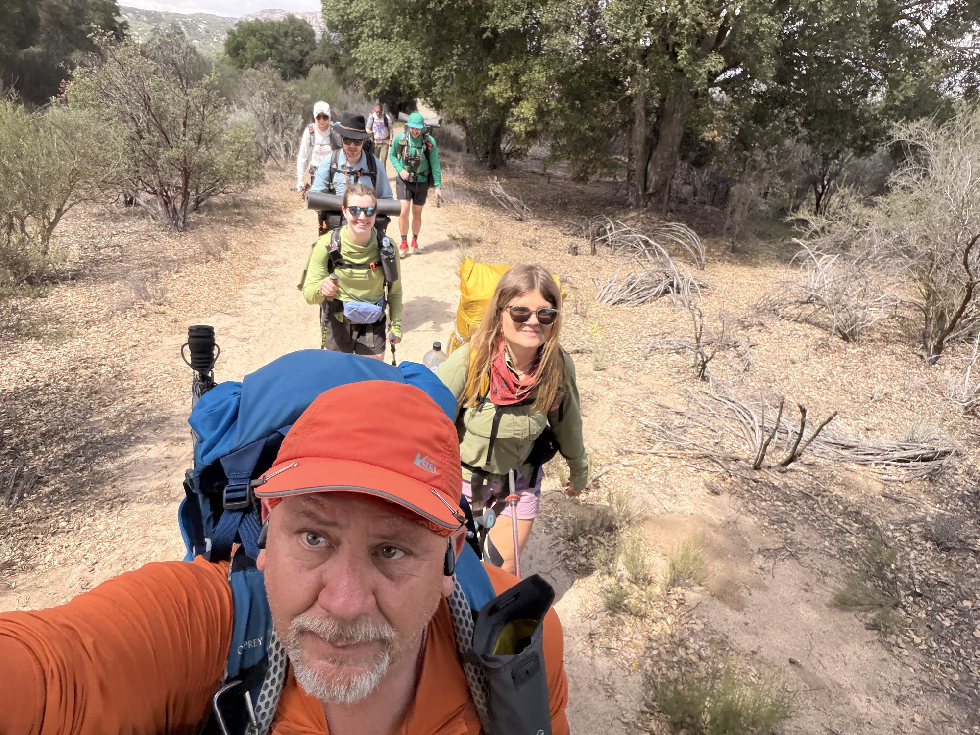
Hiked out of Lake Maurena with a crew of six. We all met at CLEEF on Thursday evening.
Hiking with 6 from CLEEF
Stopped at 12:00 and 8.7 miles for a break. Found a nice shade tree. First shade in 3.5 miles. We are making good time as a group. Next stop is a campground in 2.3 miles for water and a decision as to how far to go today.
Brad and I took a break at 1:00 in the shade. We let the younger folks plow ahead. We are not in a hurry and they are on a mission.
We reached Boulder Oaks Campground at 1:15 and 11.1 miles. Lots of hikers here including the folks we were hiking with earlier. Toilets and water too.
Blooming Cactus on Trail
I reached our planned campsite at 13.8 miles at 3:15. Brad missed it and kept going. Took a break and pressed on trail to follow. Ugh.
Met up with Brad 1 mile down the trail. I was struggling badly at this point. We pressed onward hoping to find a pair of tenting spots not on the map. I found two spots while Brad took a side trail DOWN into Kitchen Creek for water. No way I could handle the climb back out of there. I’ll survive with the 2 liters I have with me tonight. Set up camp at 4:40.
The forecast for the night is bad. Rain, very cold, high winds. Worried about keeping my tent from collapsing in this high wind and sandy soil.
Got camp set up slowly. Almost fell asleep getting my air mattress and other gear settled into the tent. Dozed for 90 minutes and then forced myself to eat dinner. Rain and wind started around 6:00.
Wind pulled out 2 tent stakes and the tent collapsed at 6:30. Big winds have not even arrived yet. Trying the little rock, big rock trick instead of using tent stakes. Hopefully, that will hold through the night.
Ugh. I am almost broken. 15.6 miles today. The plan was 12, but we ran into issues and had to go further. 31.7 miles in 2 days. That was not the plan. I need to slow up. Water is proving very problematic and dictating where we need to stop. I’m okay, just need to slow up before I injure myself.
Friday, April 24, 2026. Mostly sunny and 36 going up to 67.
Up at 5:30. A bit chilly this morning, but the sun isn’t fully up yet. Slept fairly well last night. Coyotes woke me up at least once.
Had a nice breakfast provided by the staff, packed up, got my PCT hang tag, and headed to the Mexican border. The staff at CLEEF are really amazing. And it’s all volunteer.
Mile sign at CLEEF
It was an easy half-mile walk south to the border. I walked there with Aubrey, who is a fellow AT thru-hiker. That wall is much larger in person than it looks on TV.
Border WallBorder Wall
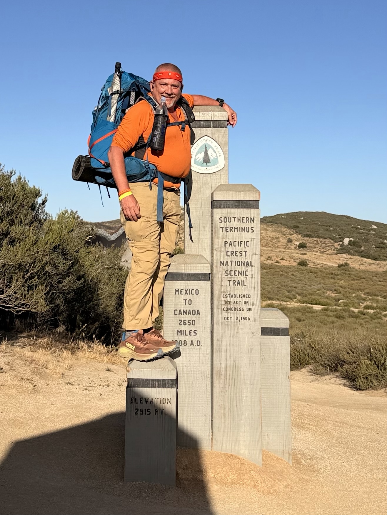
Brad was already at the PCT Southern Terminus Monument when we arrived. Me, Brad, and Aubrey took each other’s pictures on the monument.
Orange Man at PCT Southern MarkerOrange Man at PCT Southern Marker
We then walked to the actual border wall and touched Mexico before heading north to Canada. This is the official start of our 2,655-mile adventure!
Touching Mexico
Brad and I left together at 7:35. We took each other’s picture at the famous 3-mile marker.
Orange Man at the Famous PCT 3-Mile Sign
We planned to go 16 miles to camp. Both of us would have preferred a 13-mile day, but water will be dictating a lot of our plans. I started the day with 4 liters of water, which means a 32.5-lb pack. Ugh.
We stopped for water and a snack at 9:30 and 4.4 miles. Natalie was already there taking a break. We both refilled 1 liter of water and moved on after a 15-minute break. The next water is in 10 miles. As we were leaving, Aubrey, Brian, Hell Yeah, Britta, Nile, and John arrived, followed by Pebbles.
We started a long ascent into the desert. There were no clouds in the sky, and the sun was hot. I was not covering my face or arms with my sun hoodie. More on that later.
We stopped for a break and a snack in the only shade we had seen all day at 11:10 and 7.75 miles. We have been climbing since we hit water at mile 4.4 and have 1.6 more miles of climbing. Then it’s flat and downhill to camp.
Day 1 View
The temperature was only about 70, but the constant sun and long, steady climb made it quite warm. We stopped for a break at 1:30 and 11.5 miles in the shade. We started the day at 3 miles per hour but slowed to about 2 miles per hour. I was really feeling those 32 lbs on my hips.
We took another break at mile 13 in the shade. My feet and hips were really feeling the weight plus the first day blues.
We reached the water cache at 3:00 and 14.6 miles. This cache is maintained by the staff at CLEEF. This day would be brutal without the cache.
Day 1 Mile 14 Water Cache
The sun finally started to get to me. My arms were okay, but I think I burned my lips and my face a bit. Not terrible, but still. I started hiking with the hood of the sun hoodie up from here on.
Hot and Sun Burned on Day 1
There is no water at camp, and we have 5 miles uphill in the morning before we reach water. I carried 5 liters or 11 lbs of water the next 1.2 miles to camp. That made for a 37 lb pack on day 1. Let me tell you how much that sucked!
The last mile was steep downhill with slippery, loose sand and a huge weight on my back and hips. Just a bit sketchy.
We got to Hauser Creek at 3:50 and set up camp. We beat all but 2 hikers here and basically got the best camp spots in the shade of a grove of trees. Awesome!
As expected, I needed that 5 liters of water. Between rehydrating and making dinner I went through almost 3 liters leaving me with 2 liters for the first 5 miles tomorrow.
My hips were SCREAMING by the time I dropped my pack. I had to rest for a bit before setting up camp. That is very unusual for me. Walking was very challenging at this point.
Brad and I set up camp by 4:30. Really nice camp spot! Just after we set up, Aubrey, Niall, Natalie, and Jacob arrived. Natalie took a spot in our area, and the rest camped another 50 yards onward. Another much longer, Wyoming pitched her tent with us. She is celebrating her 50th birth year by hiking 5000 miles, including the PCT.
Brad and I made dinner about 6:30. I was pleasantly surprised to have a good appetite. I usually don’t the first week on the trail.
Hips were still pretty bad. I decided that sitting was not helping, so I walked around camp for the next hour, which helped a lot.
Britta, from Germany, arrived around 7:00 and made camp with us. She was not feeling well and had all the signs of altitude sickness. We were worried about her, but she started feeling better and managed to eat eventually.
Brian and Hell Yeah showed up at some point and took the lady 2 spots in our camp area. Brian is a ski instructor from Salt Lake City, and Hell Yeah is an Aussie miner.
Day 1 Camp
We all hung out and chatted until 8:30. It turns out Hell Yeah is carrying a 50-lb pack. He is a big young guy, but still, that’s insane. We had a lot of fun poking fun at his gear, including the largest cooking pot I have ever seen on the trail. All in good fun.
Crawled into my tent at 8:30 and worked on blogs until 9:15. Read for a bit and tried to get to sleep at 10:00.
Overall, it was a good first day. I’m not sure if Brad and I will hike together long-term, but we should be good for at least the next week. The mileage was difficult due to the heavy water carry. I should not have to do that again for at least 2 weeks! I plan to send my camp shoes home in a couple of days. I’ll probably just stick with my trail shoes for now and think about camp shoes much later on. That will save me about 12 ounces and some bulk in my pack.
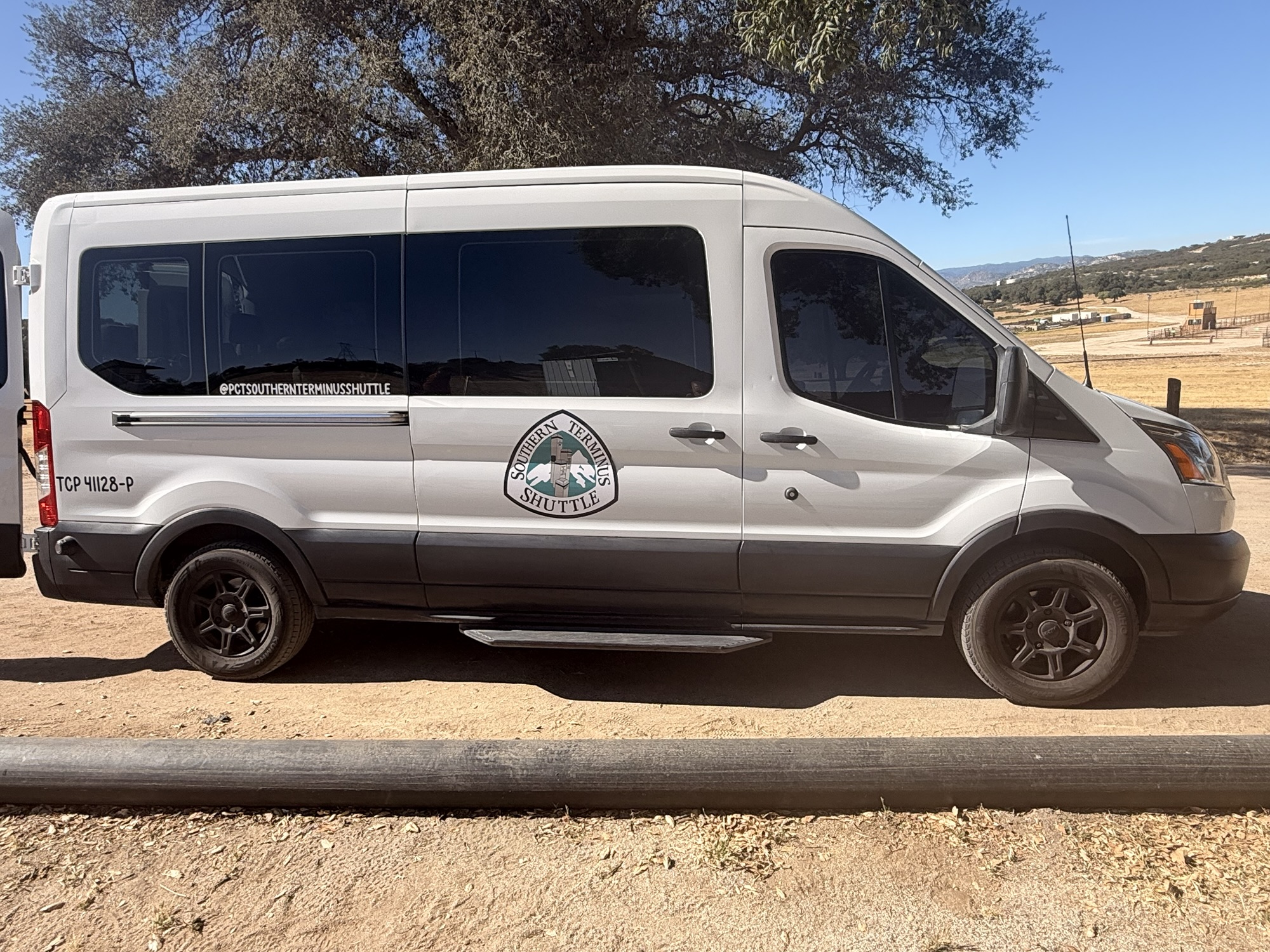
Good nights’ sleep at the Best Western. And a very nice breakfast buffet. I chilled in the room until I checked out at noon. Put on my pack and walked about 1.4 miles to a UPS store to ship my duffle bag and travel clothes home. Got to the Old Town Transfer Station about 12:45 to wait for my 2:00 shuttle to Camp Lockett Event & Equestrian and Facility (CLEEF) campground.
Southern Terminus Shuttle
There were two other hikers there waiting. Both from Canada. Brad from British Columbia and roughly my age. Titus from Montreal. We chatted until the shuttle arrived. Four other hikers joined us and we left right at 2:00. We stopped at REI and I bought my fuel canister. From there we drove about 45 minutes to the general store near camp and picked up sandwiches for dinner. Checked into camp about 3:30 and pitched my tent.
Tents at CLEEF
The group of 7 from that shuttle hung out and socialized most of the evening. Hoping to build a trail family out of this group, but time will tell.
Shuttle crew at CLEEF
The camp volunteers gave a 60-minute lecture on things like safety, water, hitchhiking, etc. Good info. Of the 25 of us here, only 5 have prior long-distance hiking experience.
CLEEF pavilion
Everyone signed the 2026 hiker banner.
My name on CLEEF banner2026 CLEEF Banner
Hiker midnight is 9:00 and everyone is in their tents and lights out by 9:15. I worked on today’s blog and read until midnight.
Pit Crew drove me to Dulles Airport to catch a morning flight to San Diego via Denver. Said goodbye to our dog, Pendleton. That’s always hard since he has no idea what I’m saying and probably will think I’m never coming back.
Pendleton
Hugged Pit Crew goodbye at the airport. We won’t see each other until I get to Lake Tahoe around July 10…over 2.5 months away if all goes well. Saying goodbye is hard, but not as hard as leaving her standing at the trailhead on the AT waving goodbye and knowing all I have to do is turn around and walk back to her. We just got back from a very nice vacation in the Florida Keys, so we both have those recent memories to hang onto. That trip was my partial repayment for leaving her alone to manage everything for almost half a year.
Pit Crew and Orange Man pre-hike
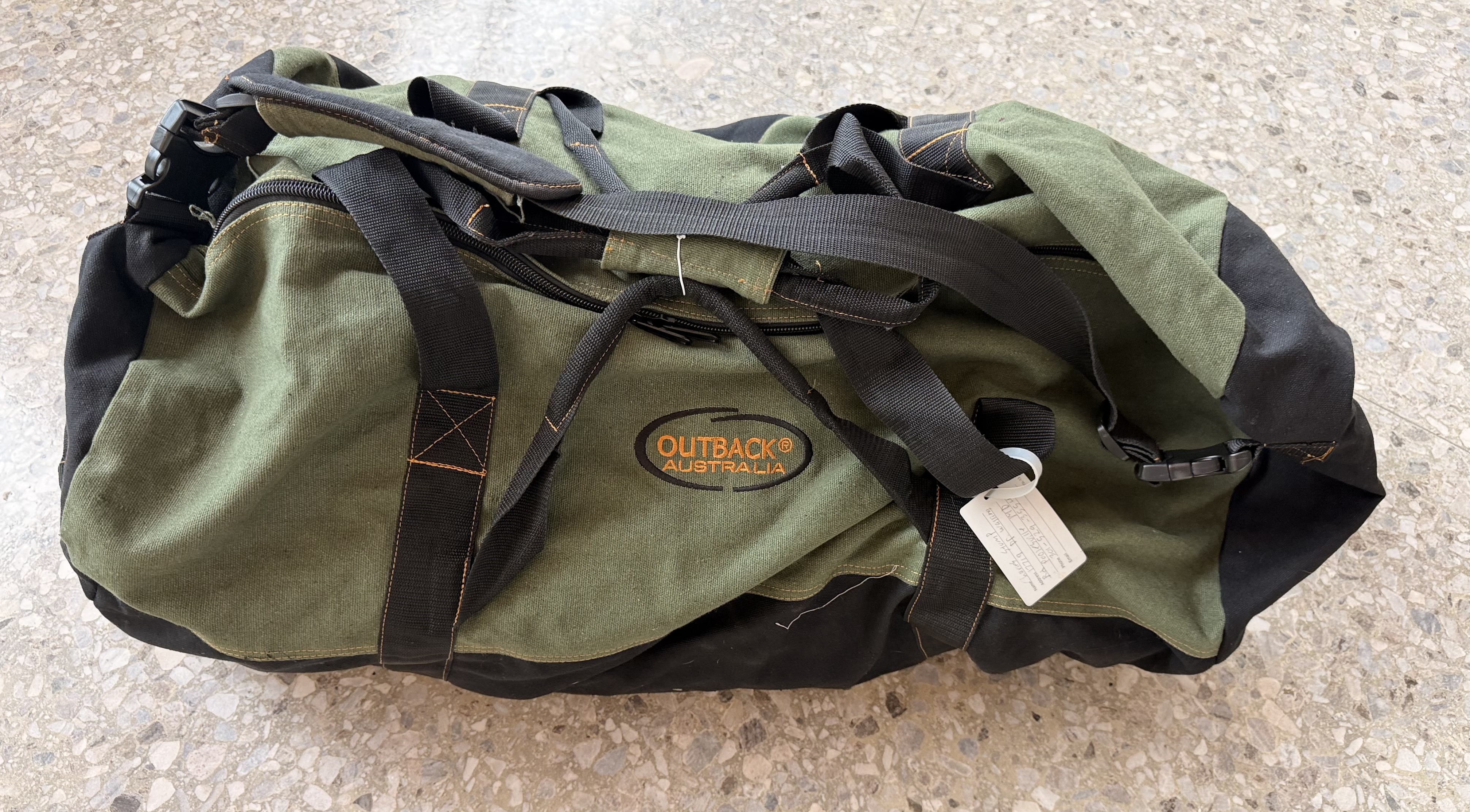
Checked my duffel bag containing my backpack and got through airport security in just a few minutes. Pulled out fuel can, lighters, water filter, meds, electronics, and my fleece. All but fuel can are in my small carry-on. Very quiet at the airport this morning. I’ll ship that duffel and carry-on home from San Diego tomorrow.
Duffel bag containing backpack for PCTQuiet morning at Dulles Airport
Had an uneventful stay in Old Town San Diego. Repacked my backpack and finalized plans for tomorrow. I have to ship my duffel bag home, get a shuttle from San Diego to the Camp Lockett Event & Equestrian and Facility (CLEEF) campground, pick up a fuel canister, and get my head ready for almost 6 months of hiking.
This article originally appeared on The Trek, which you can read HERE.
The Permitting Process
Unlike the Appalachian Trail and many other trails on the East Coast, the PCT requires a permit to hike the trail. Those permits are not easy to get for a desired start date. The PCT Association uses a random lottery system to assign permits. You can only apply for one permit once per hiking season.
The way the process works is that you randomly get assigned a time to log into the permit portal on Permit Release Day (November 13, 2025 for the 2026 hiking season). There are 35 permits available per day from March 1 through May 31. The permits for a given date are assigned on a first-come, first-served basis. That means the earlier in the day you get assigned a time slot to log in, the better your chance of getting a good start day. Later in the day (typically by 1:30-2:00), all the permits are taken for all the dates. Hence why not everybody who wants a permit gets one. It is a lottery!
I was happy with my draw in the lottery. I received a 12:20 application time, which put me a little before the halfway point, which should mean that there are a few dates in April still available. When I got into the portal, at 12:20:40, all the permits through April 23 were taken and there were only 7 permits left for April 24. I grabbed an April 24 permit quickly!
PCT Overview
The first 700 miles of the PCT are in the Southern California desert. That section is typically very dry, and water can be an issue. There are parts of that section where I will have to carry 5 liters of water (11 pounds) and be careful with that supply of water. Much of the time, there is little to no shade, and it can be very windy. Daytime highs should be anywhere between 65 and 90 with lows between 32 and 45. There are quite a few small towns, hostels, or volunteer-provided waysides in this section. The average number of days to hike that section is 48 days.
The second major section of the PCT is roughly 400 miles through the High Sierras. This includes very remote areas, long 5-6 day food carries, traversing alpine snow fields, snow-covered mountain passes, lots of water crossings from snow melt, elevations up to 14,500 feet, and some amazing scenery. I will cross through Sequoia, Kings Canyon, and Yosemite National Parks and traverse the John Muir Wilderness and the Ansel Adams Wilderness, eventually finishing in the high desert just before South Lake Tahoe. The average duration for the High Sierras is 38 days.
The third major section is 600 miles in Northern California ending at the Oregon border. Water should not be as problematic as in the desert, but with this being a drought year, it may get a little problematic. There are quite a few small towns along the way for resupply, and I only anticipate one 5-day food carry in this section. There are lots of long steep ascents/descents in this section, particularly into and out of towns where roads cross the trail at the bottom of a valley. The weather will be hot and, hopefully, dry. This is where wildfires become not just a possibility but a fact of life. The average duration for the Nor Cal section is 30 days.
The fourth major section is approximately 450 miles across the state of Oregon. This section is “flatter” than Nor Cal, but with lots of mosquito activity in the summer. This section includes Crater Lake, the Three Sisters Wilderness, and Mount Hood. This is also an area that has frequent wildfires during the summer and fall. The average duration for the Oregon section is 23 days.
The fifth major section is approximately 600 miles across Washington state in the North Cascade mountain range, ending at the Canadian border. Much of this section is remote and rugged, with constant ascents and descents. Given how late in April I am starting, completing Washington and reaching the Canadian border before the high mountain passes are closed for the season due to snow may be a challenge. The average duration for the Washington section is 27 days. That includes the two-day hike BACK from the Canadian border to reach civilization and leave the PCT.
Resupply on the PCT
My plan for resupply on the PCT is a bit different than my original plan for the AT. I only plan to mail myself supplies when 1) I need to change gear (just before and just after the High Sierras), 2) to restock up on prescription, 3) there is no other good choice for getting food. I am keeping resupply boxes to a minimum with only 11 planned, and I hope to skip a few of those. The rest of the time, I will resupply from confidence stores, outfitters, or equivalent when I can get to town. Note that getting to town will involve a LOT more hitchhiking on the PCT than I did on the AT.
Pit Crew will mail my resupply boxes a few weeks before I need them. That way, she can add things that I can’t plan out ahead of time, like new shoes, a new pair of hiking pants after I lose a ton of weight, etc.
PCT Resupply Box
Gear for the PCT
My gear, including clothes, mainly consists of items that I used on the AT in 2024 and numerous section hikes since then. The exceptions to that are a new backpack, a new fleece, micro-spikes, ice axe, bear can, and an Ursack. Other than these exceptions, I am just going to refer to my detailed PCT gear page on my personal website instead of regurgitating all the gear info here.
PCT Gear
The new backpack is the lighter version of the Osprey Atmos AG 65 pack that I used for the second half of the AT. This new version has the EXACT same beefy suspension system, but ditches a bunch of internal compartments, zippers, and other bells and whistles in order to shed about 1.5 lbs of weight. Also, I have removed the lid/brain from that pack for weight savings. Even with that weight savings, it is a heavy pack at 3.53 lbs, but I know that it does not cause me back issues. I will take that trade-off.
For the desert section of the PCT, there are no requirements on how you store your food. However, there are strict regulations in the Sierras and the first part of Northern California that require a bear-resistant hard-sided container called a Bear Can. My Bear Can weighs 2.5 lbs empty and takes up a lot of space. I am not looking forward to carrying that thing for almost 500 miles, but the fines are nasty, and I could get my permit revoked if I am caught without it. Once I get north of the Desolation Wilderness in Northern California, the hard-sided container rules go away, but there are still requirements in various areas for bear-resistant food storage. When I send the bear can home, I will switch to an Ursack. The Ursack is a lighter weight (13 ounces) soft-sided food storage container that meets the new food storage regulations in Northern California, Washington, and Oregon.
Bear Can and Ice Axe
For Mount Baden-Powell and the High Sierras, I will be using Micro-Spikes. These are steel spikes that get attached to the bottom of my shoes to prevent slipping on ice and snow. For the Sierras, I will be carrying an Ice Axe. The purpose of the ice axe is to help arrest a fall and slide down an icy/snowy slope. I will send the spikes and axe home from Lake Tahoe.
Overall Schedule on the PCT
This will be a very interesting year to hike the PCT. There has been very little snow in the Sierras and Cascades this year. Lots of rain, but warm temperatures have kept the snow to a minimum except at higher altitudes. Some areas are reporting only 20-30% of the typical snowpack for the year. That is a double-edged sword. That SHOULD mean less snow at lower elevations to have to deal with. There will always be snow at higher elevations to deal with. The lower snowpack COULD also mean that the water crossings due to snowmelt in the High Sierras will not be as deep or swift this year. Only time will tell on that item. However, the lower snowpack also means less drinking water and a higher risk of wildfires in the summer and fall.
I am starting on April 24, 2026. I feel confident about making it through the desert and making it to the start of the Sierras at Kennedy Meadows South by June 9. There are two mountains that I need to cross in the desert section that usually have snow this time of year. The first is Mount San Jacinto. As of mid-April 2026, there is no snow on that peak, so I don’t have to worry about having my micro-spikes or ice axe for that. The second is Mount Baden-Powell. That mountain still has snow and difficult terrain, so I will need my micro-spikes but not my ice axe based on recent hiking reports from that area.
Once I reach the start of the High Sierras around June 9, things start to get tricky. It is not safe/advised to start into the High Sierras until the snow has sufficiently melted. This is USUALLY around June 15. This year, with the lack of significant snow, I should be able to start into the Sierras immediately. I will not know for certain until sometime in May when the early-season hikers send back information on trail conditions. That said, they received five feet of snow over the course of two snowstorms in early April in the Sierras.
I hope to complete the Sierras and reach South Lake Tahoe around July 7. Pit Crew will fly out and meet me in Tahoe for a well-deserved double-zero day off-trail.
Without getting into too much detail, my goal is to reach the Canadian border by September 30. That is a bit aggressive, but I am worried about early-season snow in the Northern Cascades, which could bring my adventure to an abrupt and early halt. Only time will tell if I can get to Canada before the first snow!
Happy Trails
That’s all for now. Before I get on trail in the very near future, I plan to do a post with Frequently Asked Questions. I will be posting trail-log summaries on The Trek and posting daily detailed trail logs on my Web Site. Until then, keep on keeping on!
This article originally appeared on The Trek, which you can read HERE.
I told myself and my girlfriend that I was never doing another long distance hike. Or so I thought after finishing my Appalachian Trail thru-hike in 2024. Little did I realize just how addictive long-distance hiking was and how much post-trail depression would impact me.
What is post-trail depression? In general, “a common, often intense, period of sadness, anxiety, and loss of purpose experienced by hikers after finishing a long-distance, life-changing journey.” I heard about post-trail depression prior to my AT thru-hike, but I never gave it much thought. Sure enough, I started to feel its impacts the day I summited Katahdin. Those feelings got more intense in the months after. I knew the only way to fix this was to get back on the trail. I summited Katahdin on October 6, and I think I decided to do another thru-hike by early December of the same year.
Why another thru-hike?
I am fortunate to have retired early, and my body is in fairly decent condition. The reason I retired early sucks (I miss you, Andrea), but life must go on. Read my bio for more. The fact that my body can handle long-distance hiking is a bit surprising given how much abuse my body received in my 20s, 30s, and early 40s. I have become a bit of an exercise addict in retirement. I realized that the best way to stay healthy, feel good, and have a long life is to stay highly active. What better way to stay active and exercise than to lug around a 27-pound backpack for hundreds or thousands of miles at a time? A body at rest tends to stay at rest, and a body in motion tends to stay in motion.
I have an amazing support system at home in the form of my girlfriend Dana, a.k.a. Pit Crew. Pit Crew is not retired and will be working full time for several more years. She understands why I hike and encourages me to do so. She not only encourages me, but she supports me on trail whenever possible. This includes taking care of the house and the dogs when I am away, sending me resupply as needed on trail, texting with me to keep my spirits up, and making visits to me on trail. Even if those visits are half a day away from home or, in the case of the PCT, over 3000 miles away. She is always there to support me. Hence her trail name Pit Crew.
I look at hiking as my retirement gig. Be it day hikes, 5-day section hikes, 2-4 week LASHes, or thru-hikes. Pit Crew calls it my post-retirement job. When I grab my day pack and head out for a 12-mile hike, she tells me “have a good day at work”.
All that said, Pit Crew and I have an understanding. I will alternate big thru-hikes (i.e. AT, PCT, CDT) every other year and do smaller thru-hikes (i.e. CT, AZT, Long Trail) and LASHes in the off years. The plan is to get the 4-6 month monster hikes done before she retires.
Planning for the AT vs. Planning for the PCT
There are a lot of differences between the AT and the PCT. Weather, terrain, altitude, water, remoteness, and more. More on how those impact planning and logistics in another post. What I found to be the most interesting difference about planning for my first thru-hike on the AT versus my second thru-hike on the PCT was the lack of urgency and the general “it will be what it will be” attitude that I had.
For the AT, I planned things out in excruciating detail. Where I planned to stop every night, exact mileage, 20+ resupply boxes, etc. There was also the constant feeling of anxiousness leading up to the start of the hike for many months.
For the PCT, things have been just a bit different. I have had to plan out my mileage in general mainly because I have to ship gear for the High Sierras to and from trail and, being an old fart, I have to ship meds to trail every 20-30 days. But I don’t feel the sense of urgency or anxiety that I did for the AT. Even though I have never hiked in the desert before nor traversed snow-covered mountain passes at 12,000 to 14,000 feet of elevation before. I am doing minimal resupply boxes on the PCT and I have found myself letting all my resupply box preparations linger until literally the last 1-2 weeks before leaving for California. I am not worried about if I will find a place to stay in town or how I will get to/from trail and towns. It will be what it will be.
I was discussing this with a hiking friend who has kids, and it is reminiscent of the first kid versus the third kid. For the first kid, you overplan everything, obsess about healthy meals, arrange playdates, and generally hover over the child. For the third child, you are feeding them Cheetos to keep them quiet, telling them to “get out of the house and find something to do”, and thinking “no blood, no foul” or “for gods sake, just walk it off”.
Happy Trails
That’s all for now. Before I get on trail in the very near future, I plan to do a post about PCT planning and logistics and one that deals with Frequently Asked Questions. I will be posting trail-log summaries on The Trek and posting daily detailed trail logs on my blog at https://retiredhiker.com/pacific-crest-trail/ . Until then, keep on keeping on!
I plan to start my PCT thru-hike on April 24, 2026, without my Sierra Mountains gear. Since it is a very low snow year, I do not need Micro-Spikes or an Ice Axe for Mount San Jacinto. I will ship my Micro-Spikes to Wrightwood, CA, as I expect to need them to summit Mount Baden-Powell. That adds 13 ounces to my gear. I will ship the Micro-Spikes home once I got to the next town, as I will not need them again until I reach the Sierras.
For the desert section of the PCT, there are no requirements on how you store your food. However, there are strict regulations in the Sierras and the first part of Northern California that require a bear resistant hard sided container called a Bear Can. My Bear can weighs 2.5 lbs empty and takes up a lot of space. I am not looking forward to carrying that thing for almost 500 miles, but the fines are nasty and I could get my permit revoked if I am caught without it. Once I get north of the Desolation Wilderness in Northern California, the hard-sided container rules go away, but there are still requirements in various areas for bear resistant food storage. When I send the bear can home I will switch to an Ursack. The Ursack is a lighter weight (13 ounces) soft sided food storage container that meets the new food storage regulations in Northern California, Washington, and Oregon.
I will ship my Sierra gear, including my Bear Can, Ice Axe, and Micro-Spikes, to Kennedy Meadows South. I will send the Ice Axe and Micro-Spikes home from Lake Tahoe. Unfortunately, the new regulations make me keep my Bear Can until I get through the Desolation Wilderness north of Lake Tahoe. I will ship the Bear Can home from Sierra City, CA, and exchange it for an Ursack.
My starting base weight is 19.45 lbs, and my total weight with 2.6 days of food and 2 liters of water is 27.77 lbs.
My starting base weight for the Sierras is 23.07 lbs.
My starting base weight for Northern California, less the Bear Can and with the Ursack, is 19.95 lbs.
A few gear and clothing notes:
My backpack is heavy by ultralight standards but quite reasonable by traditional standards. I can’t go any lighter due to needing a beefy suspension for my bad back. Trust me, I have tried.
My body is always hot. Both while hiking and in camp. I sweat like crazy, hence the multiple bandannas, and I can’t wear a knit cap or anything else on my head unless it is way below freezing and not sunny.
After a lot of thought, I once again decided NOT to start with a puffy jacket. Most people carry a puffy for cold evenings in camp. I also see videos of people wearing a puffy on trail even though that is a BAD idea since they do not breathe at all. I used my puffy one time on the AT and just don’t need it. I have a good lightweight fleece that I can pair with my ultralight rain jacket when additional warmth is needed or I need a wind blocker.
I prefer to wear long hiking pants unless it is well into the upper 80s and humid. The long pants also help with things like poison ivy, poodle dog-bush, mosquitoes, etc. Plus the hiking pants breathe, unlike rain pants. I wear convertible pants that allow me to remove the lower legs (mid-thigh) when I am too hot.
My electronics are a little heavy, but I use my phone all day for audiobooks or music. I take lots of pictures and do my blogging throughout the day. The two 10,000 mAh batteries can get me through 5 days if I am careful. I can stretch that to 6 days if I am extremely careful.
In hot humid weather, I carry an ultralight USB-powered fan. It does not weigh much and is a lifesaver for me. I just can’t sleep in hot humid weather in a tent with no breeze.
I always carry a decent-sized (3′ x 4′) lightweight towel. Some hostels and other locations on the trail have showers, but you need to provide a towel. It is great if I want to jump in a creek/river/lake to cool off. And did I mention I sweat like crazy in humid weather?
My rain gear is highly tuned to fit my needs and experience. I can use my umbrella for the vast majority of rain situations. Some people think they are useless or a waste, but I have many thousands of trail miles and my umbrella has only failed me in very high winds above the tree line. Plus it makes for great shape in the desert or above the tree line. For cold driving rain, I have a very light rain jacket and a pair of pop-up rain pants. The rain pants also come in handy when doing laundry.
A more detailed description of most of my gear including pictures can be found on my overall Gear page.
Gear List – Equipment Name, Description, Quantity, Weight in Ounces, Notes
Pack
PackLiner
Kirkland 18gal Compactor Bag
1
2.2
Pack
Osprey Atmos AG 65 LT minus brain
1
56.5
Trekking Pole Holders
Toggle bungee front and back
2
0.07
Water Bottle Holder
Mountain Mike Hiking bottle holder
1
0.5
Phone Holder
REI Rain Shield
1
.9
Sleep System
Sleep Pad
Big Agnes Zoom UL Insulated Wide 25×72
1
17.4
Spring Quilt
EE Revelation Down 20 degree regular wide
1
22.62
Quilt repair patches
Gear Aid tape x 4
1
0.14
Foam Pad
Gossamer Gear Thinlight Foam Pad – 1/8″
1
3.3
Pump sack / storage
Big Agnes pump sack
1
2.4
Pad Patch Kit
Comes with pad
1
0.14
Pillow
Sea to Summit Aeros Premium
1
3
Dry Bag
Sea to Summit ultra-sil dry bag for quilt
1
1.5
Shelter
Tent
Durston X-mid 1
1
25.7
Tent Footprint
Durston X-mid footprint (lighter than Tyvek)
1
3.6
Tent Tie Downs
Shock cords on 4 tent tie down points
4
0.25
Guylines
guylines + carabiners for alt/windy setup
3
0.6
Tent Repair Kit
various patches
1
0.14
Tent Stakes
4 large, 7 short groundhog stakes
1
4.37
Tent Stake Bag
zippered dynema clear bag
1
0.5
Kitchen
Stove
MSR pocket rocket 2
1
2.57
Pot
TOAKS LIGHT TITANIUM 650ML POT W. Handles
1
3.21
Spork
Sea to Summit Alpha Light Spork – Long
1
0.42
Cozy
Large cozy. Avoid simmer time on stove.
1
0.95
Fuel
isobutane-propane 100 gram (empty)
1
3.5
Lighter
Mini Bick
1
0.39
Wash Cloth
Light Load hand towel
1
0.49
Bear Hang
Mtn Laurel Design Rope, rock bag, lock carabiner
1
1.9
Quart Bags
Ziplock Freezer Bag
9
0.21
Food Storage Bag
Liteaf Dyneema 19L bag
1
1.1
Use Ursack + Opsack OR Bear Can OR Food Bag depending on regulations.
Ursack
Ursack Major XL
1
7.45
Use Ursack + Opsack OR Bear Can OR Food Bag depending on regulations.
Opsack
oder proof bag for food
1
1.6
Use Ursack + Opsack OR Bear Can OR Food Bag depending on regulations.
Bear Can
BearVault 500 + Bear Can Key
1
40.3
Use Ursack + Opsack OR Bear Can OR Food Bag depending on regulations.
Hydration
Primary Water Filtration
Sawyer Squeeze
1
2.4
Backup Water Purification
50 Aquatabs
1
0.25
Dirty Water Container
CNOC Vecto 3L
1
3.35
Sawyer Coupling
attach Sawyer Squeeze to Smart Water bottle
1
0.18
Spare water bottle cap
Spare sports cap for Smart Water bottle
1
0.18
Water Bottle
Smart Water 1L with Sport Cap
3
1.38
Spare O-ring
Spare sawyer o-ring
1
0.04
Clothing
Long Sleeve Shirt
Camp Shirt Cold Weather – Under Armour Heatgear
1
6.0
Shorts
Camp Shorts – Nike Challenger 7’’ Running Short – no liner
1
4.0
Waterproof Socks
Sealskinz Unisex / camp socks
1
3.3
Toe Socks
Injini sock liners – second set of hiking socks
1
1.31
Underwear
Spare set of dry underwear – helps with chaffing
1
3.0
Long Underwear
Under Armour Heat Gear – year round
1
5.19
Light Weight Mid Layer
Mountain Hardware AirMesh Hoody
1
6.8
Insect Net
Sea to Summit Mosquito Head Net
1
1
Buff
generic
1
1.4
Camp / Water Shoes
Merrill Men’sHydro Moc
1
14
Only carry these when there are water crossings. Otherwise carry 10oz Xero Z-Trail Sandals.
Clothing Stuff Sack
Zpacks Slim Dry Bag 4L – replaced with schnozzel
1
0.54
Rain Gear
Umbrella
Zpacks Lotus UL Umbrella
1
6.7
Carabiner
Top of pack to hold umbrella
1
0.85
Hat
REI Active Pursuit Cap
1
2
Rain Pants
Generic Nylon from Amazon – good for cold
1
7.7
Rain Jacket, Medium
Montbell Peak Shell Large
1
7
Gortex with pit zips
Rain Gloves
8 mil XL Nitrile gloves from Amazon
2
0.6
Hygiene
Wash Cloth
Light load Towel
1
0.5
Tooth Paste
travel size
1
0.85
ToothBrush
Oral-B cut in half
1
0.25
Dental Floss
Glide pro-health 54yd
1
0.63
Soap
Dr. Bronners in .33oz bottle
1
0.63
Chap Stick
Blistex
1
0.35
Diaper Rash Cream
A&D Prevent Gel
1
1.5
Hygiene Bag
zippered dynema clear bag
1
0.5
Nail Clippers
Generic
1
0.46
Tinactin
Anti-fungal
1
0.75
Toiletry
Trowel
Dutchwear Duce Scoop
1
0.75
Toilet Paper
In quart ziplock bag
2
1
Waste Bag
Gallon Ziplock
2
0.42
Wet Wipes
Cottonelle
0
2.5
Stopped carrying them. Dead weight.
Anti Chaffing
Body Glide
1
1.5
Never leave home without it!
Toiletry Bag
half gallon ziplock
1
.35
First Aide
Tweezers
Metal
1
0.25
Mole Skin
4.5’’ X 3.5’’
1
0.18
Self adhesive bandage
1’’ X 5yds
1
0.32
Q-tips
10 generic
1
0.07
Anti-diarrheal
6 tablets
1
0.14
Motrin
2oo Mg packets
10
0.02
Triple antibiotic ointment
Generic packet
5
0.04
Band-Aide
3’’ X 1.5’’
6
0.03
Band-Aide
2’’ X 4’’
4
0.07
Sterile Gauze Small
2’’ X 2’’
2
0.06
Sewing Needle
Large…use with floss or similar for repairs
1
0.01
Oral Meds
Prescription – as needed
1
0.8
Inhaler
Asthma Inhaler
2
1.09
First Aid Dry Bag
Red Space Bear Bags DFC small dry bag
1
0.28
Antibiotics
100mg doxy x 6
1
0.11
Safety Pins
Generic
4
0.01
Electronics
Power Bank
Nitecore NB10000 Gen 3
2
5.47
Wall Charger
Anker 523 dual port USB-C
1
2.86
Phone
iPhone 17
1
8.6
Head Phones
Shokz OpenRun Pro bone conduction
1
1
GPS Device
Garmin in-reach mini 2 + carabiner
1
4
Headlamp
Nitecore NU25
1
1.68
Charging Cable 1
USB-C to USB-C
1
0.21
Charging Cable 2
USB-C – USB-C short
1
0.11
Apple Watch Charger
USB-C and Lightning
1
0.67
Headphone charging adapter
USB-C to proprietary magnetic
1
0.11
Waterproof Bag
Quart ziplock
1
0.21
Misc
Insect Repellent
Ben’s 100% DEET – hip belt pouch
1
1.9
Duct Tape
Small roll
1
0.8
Multi Tool
Gerber Dime
1
2.3
Cordage 2mm
30’ w min carabiner
1
1.23
Carabiner, large
Black Diamond Mini Wire 20x7kN load bearing
1
0.85
Carabiner, small
metal mini carabiner – on clothes line
1
0.11
Reading Glasses
Thinoptics + small case
1
0.15
Lighter
Bic Mini – spare
1
0.39
Pen
Mini sharpie
1
0.21
Cloth
Swedish Dish Cloth
1
0.2
Mini bungees
multiple uses
2
0.05
Bug Bite
Hydrocortisone cream
0
1.13
Carry only when needed
Luxury
Sit Pad
REI sit pad
1
1.34
Towel
Light Load Towel 3’x4’
1
4.3
Fan
Hot Weather – USB fan for hot humid nights
1
2.2
Worn/Carried
Pants/Shorts
REI Sahara Convertible
1
13
Long Sleeve Shirt
Black Diamond AlpenGlow Sun Hoodie, quarter zip
1
9.9
Socks
Injinji Trail Midweight Crew Socks
1
3.2
Underwear
Long bike-short style
1
3.42
Bandana
Generic
2
0.85
Wallet
Zpacks Wallet Zip Pouch – CC, ID, cash, insurance card
Day 3 – Four Pines Hostel to Pickle Branch Shelter
Tuesday March 31, 2026. Up at 7:30. Sunny going up to mid-70s.
I slept very well. My heels are hurting this morning but the rest of me feels decent. Thought I would feel worse. Should be a good day!
The hostel crew made us a nice breakfast. I decided that my pack was way too heavy due to excess food. I sorted my food bag and left a lot of food at the hostel. I left 2.5 lbs of food! That leaves me 3.5 in food bag plus 10oz Fritos, 1 M&M, 2 trail mix in hip pockets for 3 full days. The hostel’s scale says my pack is down to 30lbs, which sounds correct.
We got packed up and walked the .5 miles back to the trail by 9:30. We are headed 2.7 miles up to Dragon’s Tooth. My recollection is that this is going to be a rough climb up steep rocky slabs. No water until about mile 9 today.
The ascent is about as I thought. Steep and rocky. We paused for a view back do to the hostel from last night at 10:05 and 1.44 miles.
Chuck and Ed on ascent ot Dragon’s ToothLooking down on Four Pines Hostel
We had to walk around a 6 foot black snake who was winning himself on the trail. He refused to get out of our way.
6 foot black snake on trail
There is a spot on the ascent that we had to butt slide down last time I was here. It isn’t quite vertical, but darn close.
Looking down a near vertical cimb on Drangon’s Tooth
The last .2 3 miles are steep nearly vertical faces. You have to switch back up the rock face and be careful of your footing. Would not want to do this in the rain or ice.
Ed standing on the side of the mountain near Dragon’s Tooth
We arrived at the summit of Dragon’s Tooth at 11:25 and 2.95 miles. It is getting very hot and humid out here. I think I am going to have a bit of sun burn when this day is over.
Top of the ascent to Dragon’s Tooth
The high school group from the past two days got here before us. They camped at the end of the pastures yesterday instead at the base of Dragon’s Tooth as planned. They are finishing their hike in a few miles at the parking lot on the south side base of the Tooth.
High school group at Dragon’s Tooth
We took a 25 minute break on the top of the mountain before pressing on to Pickle Branch in 4.3 miles for water.
Between the ascent up Dragon’s Tooth and the ups and downs over the next 5 miles, Ed was not doing too well. His legs just did not recover last night from our nearly 19 miles yesterday. Since we have to cross a gravel road near Pickle Branch, Ed decided to call the hike early. His brother Stuart will pick us up at the road around 3:00 this afternoon.
We met Stuart on trail about .5 miles before the road. He hiked towards us and brought us beer and soda. Thanks amigo! We hiked back to the car and Stuart drove me back to Blacksburg where I got my truck and drove back home to Maryland. I got home about 10:20 p.m. Nice evening for a drive. I also got to experience my first Buc-ee’s on the drive home up I-81.
My first Buc-ee’S
Overall this was a good hike for me. I got my new pack adjusted and felt very good the last 1.5 days on trail. No more back issues. I also realized that I just don’t eat much food on trail for the first few weeks. I had packed my food as if I had been on trail for several weeks, leading to a very heavy pack. That is probably the best lesson learned from this shakedown hike. I will plan much less food to start the PCT in a few weeks. I need to replace my hiking gloves. The right palm is tearing out. I also figured out a better way to arrange my gear in my pack. This new pack has two huge side pockets that are very deep. I found I can put my cooking pot and rain pants in one of the side pockets along with a 1 liter water bottle. That frees up some internal space. Nice!
The biggest lesson learned, sorry Ed, is that we are not ready to do big miles yet. I remember that I intentionally did smaller 11-12 mile days for the first two weeks on the AT in 2024. And I took breaks every 2 hours and stretched my feet. Both of us need to keep that in mind. Me for my upcoming PCT hike and Ed’s AT LASH from Springer to Fontanna.
Day 3 Map – Four Pines Hostel to Pickle Branch Shelter
Monday, March 30, 2026. Up at 7:00. Cloudy and 45 degrees. Showers in the next few hours going up to 70.
Slept decently for the first night on the trail. My back is very stiff but not nearly as bad as it could be.
Had breakfast, checked the weather, and got packed up fairly quickly this morning. We wanted to beat the rain that could start by 8:00. We started the 940-foot ascent to Tinker Cliffs at 8:00.
The ascent up to Tinker’s Cliff was longer and harder than I remembered. The last time I was hiking, I was going down towards Daleville and not up this thing. We arrived at Tinker Cliffs at 9:10. It was breezy and looked like rain was moving in across the valley to the west.
Chuck at Tinker Cliffs
It started to rain as we left Tinker Cliffs. Ed and I both used our umbrellas for most of the trek from Tinker to Campbell Shelter. The trail is not marked as well as it could be headed in this direction. We lost the trail several times. It was no big deal, but it was annoying. This rain makes all the leaves and rock climbs very slippery.
Ed and his umbrella
Finished the final steep climb to Campbell Shelter at 11:40 and had 6.1 miles. We got water, had lunch, put away our umbrellas, used the privy, and took a 30-minute break. There were several groups of people at the shelter getting water and avoiding the rain. They were all headed back the way we had come towards Daleville.
Campbell Shelter
We arrived at McAfee Knob at 1:15. That last .8 miles is very up. We have about 10 more miles to go today. This is going to be a long, hard day. Really feeling it in the hips and feet. Back is doing good though!
View at McAfee KnobChuck at McAfee Knob
The rain stopped a while ago, and the sun is trying to come out. Warming up very fast, and it is very humid. We go to Rt 311 at 2:45. This is the new pedestrian bridge and parking lot for McAfee Knob. Took a 15-minute break, swapped water bottles, and rested my feet. We have 6.3 more miles to go. Lovely 🙁
We crossed paths with the high school hiking group several times this afternoon. We took a break at 5:00 before crossing several miles of pastures. We have 2.7 more miles to go.
Rest before crossing the pastures
The last 3 miles were a death march. With a good-sized up and down in the last .7 miles. I struggled like I haven’t struggled in a very, very long time. My feet hurt like crazy. Hips are sore. Legs are dead. Absolutely exhausted!
We got to the road for the hostel and did a .5 mile road walk to the hostel. Last thing my feet needed was the feel of hard asphalt under foot.
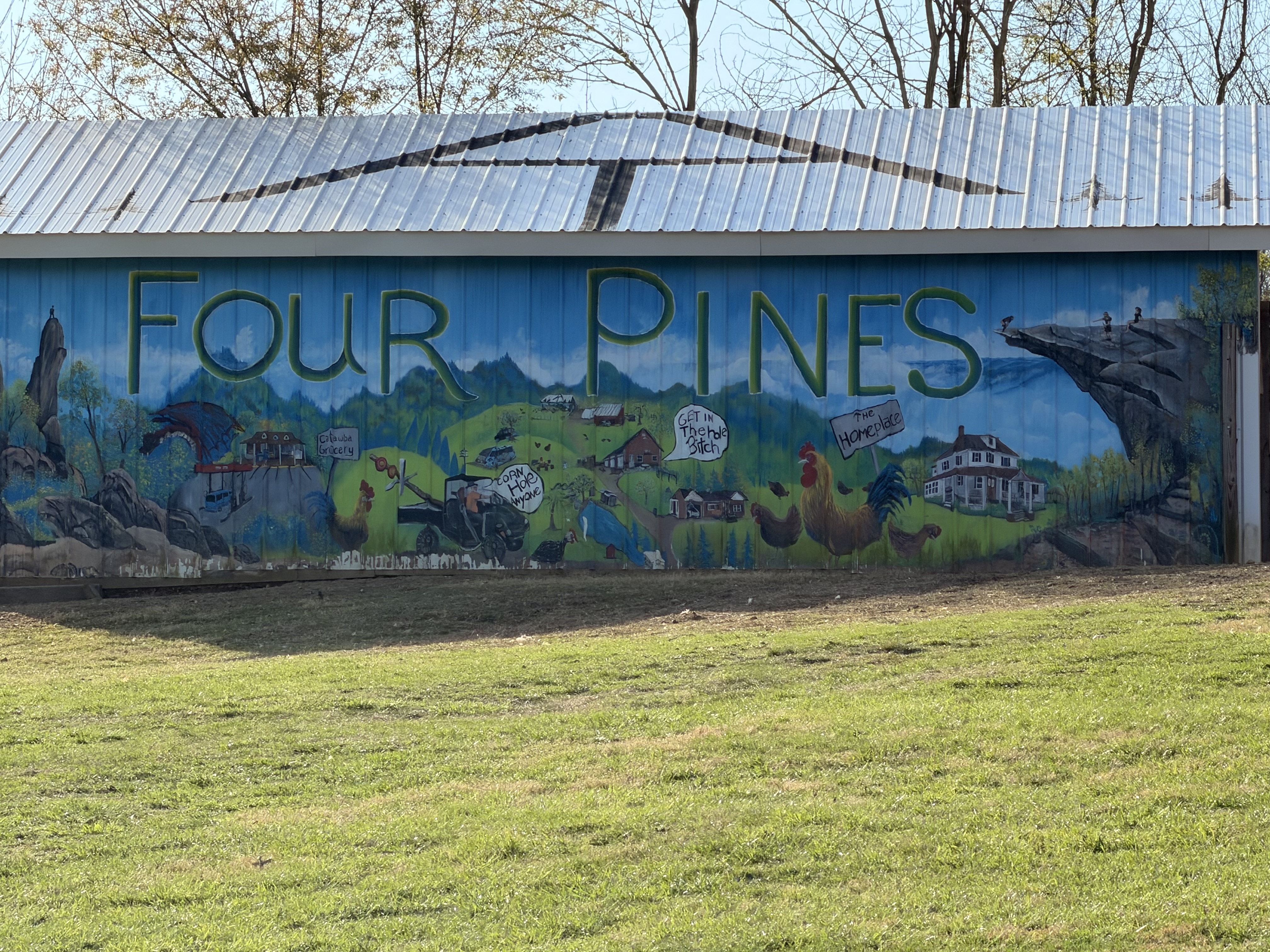
Four Pines Hostel
Got to Four Pines Hostel at 6:45. We are the only 2 guests tonight. There are two guys here who basically are doing work-for-stay this year. Both past thru hikers. We got a basic dinner with our stay. Tasty and filling. Hot shower was nice. Basic AT bunk room hostel. Nothing fancy but does the job. Plus they had a soda machine!
Four Pines Hostel
In bed at 9:00. Today was a very hard day. It ended up being over 18 miles mostly uphill with a stupidly heavy pack. We should not have tried this many miles this early in the season. I don’t know about Ed, but my legs and feet are very angry with me. Curious to see how I feel in the morning. We decided to sleep in a bit tomorrow.