Tag: Appalachian Trail

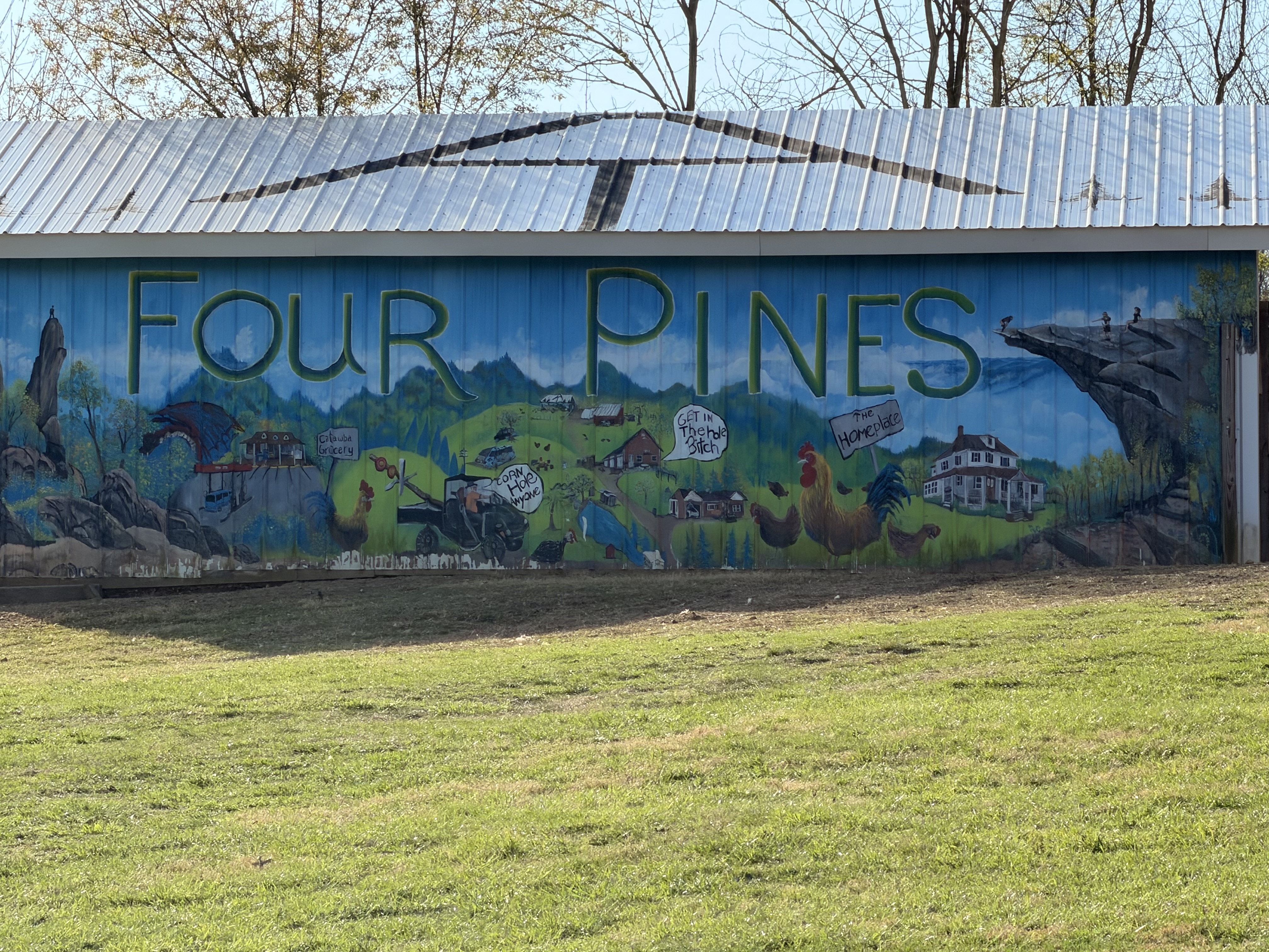
  • Day 3 – Four Pines Hostel to Campsite (mile 691 NOBO)

    Day 3 – Four Pines Hostel to Campsite (mile 691 NOBO)

    Today’s Miles: 8.73

    Trip Miles: 36.52

    Day 3 – Four Pines Hostel to Pickle Branch Shelter

    Tuesday March 31, 2026. Up at 7:30. Sunny going up to mid-70s.

    I slept very well. My heels are hurting this morning but the rest of me feels decent. Thought I would feel worse. Should be a good day!

    The hostel crew made us a nice breakfast. I decided that my pack was way too heavy due to excess food. I sorted my food bag and left a lot of food at the hostel. I left 2.5 lbs of food! That leaves me 3.5 in food bag plus 10oz Fritos, 1 M&M, 2 trail mix in hip pockets for 3 full days. The hostel’s scale says my pack is down to 30lbs, which sounds correct. 

    We got packed up and walked the .5 miles back to the trail by 9:30. We are headed 2.7 miles up to Dragon’s Tooth. My recollection is that this is going to be a rough climb up steep rocky slabs. No water until about mile 9 today. 

    The ascent is about as I thought. Steep and rocky. We paused for a view back do to the hostel from last night at 10:05 and 1.44 miles.

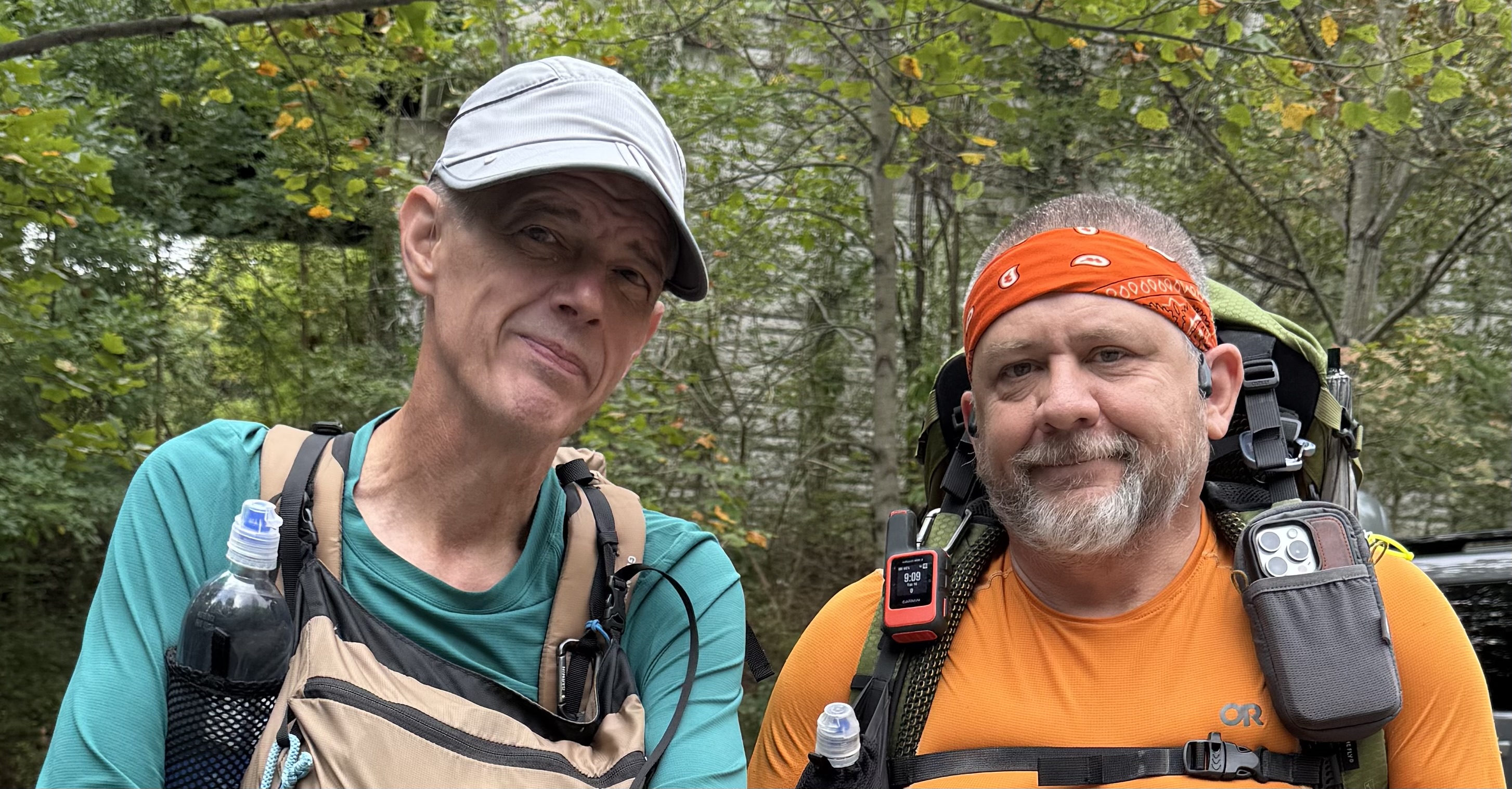
    Chuck and Ed on ascent ot Dragon’s Tooth
    Looking down on Four Pines Hostel

    We had to walk around a 6 foot black snake who was winning himself on the trail. He refused to get out of our way.

    6 foot black snake on trail

    There is a spot on the ascent that we had to butt slide down last time I was here. It isn’t quite vertical, but darn close.

    Looking down a near vertical cimb on Drangon’s Tooth

    The last .2 3 miles are steep nearly vertical faces. You have to switch back up the rock face and be careful of your footing. Would not want to do this in the rain or ice.

    Ed standing on the side of the mountain near Dragon’s Tooth

    We arrived at the summit of Dragon’s Tooth at 11:25 and 2.95 miles. It is getting very hot and humid out here. I think I am going to have a bit of sun burn when this day is over. 

    Top of the ascent to Dragon’s Tooth

    The high school  group from the past two days got here before us. They camped at the end of the pastures yesterday instead at the base of Dragon’s Tooth as planned. They are finishing their hike in a few miles at the parking lot on the south side base of the Tooth.

    High school group at Dragon’s Tooth

    We took a 25 minute break on the top of the mountain before pressing on to Pickle Branch in 4.3 miles for water.

    Between the ascent up Dragon’s Tooth and the ups and downs over the next 5 miles, Ed was not doing too well. His legs just did not recover last night from our nearly 19 miles yesterday. Since we have to cross a gravel road near Pickle Branch, Ed decided to call the hike early. His brother Stuart will pick us up at the road around 3:00 this afternoon. 

    We met Stuart on trail about .5 miles before the road. He hiked towards us and brought us beer and soda. Thanks amigo! We hiked back to the car and Stuart drove me back to Blacksburg where I got my truck and drove back home to Maryland. I got home about 10:20 p.m. Nice evening for a drive. I also got to experience my first Buc-ee’s on the drive home up I-81.

    My first Buc-ee’S

    Overall this was a good hike for me. I got my new pack adjusted and felt very good the last 1.5 days on trail. No more back issues. I also realized that I just don’t eat much food on trail for the first few weeks. I had packed my food as if I had been on trail for several weeks, leading to a very heavy pack. That is probably the best lesson learned from this shakedown hike. I will plan much less food to start the PCT in a few weeks. I need to replace my hiking gloves. The right palm is tearing out. I also figured out a better way to arrange my gear in my pack. This new pack has two huge side pockets that are very deep. I found I can put my cooking pot and rain pants in one of the side pockets along with a 1 liter water bottle. That frees up some internal space. Nice!

    The biggest lesson learned, sorry Ed, is that we are not ready to do big miles yet. I remember that I intentionally did smaller 11-12 mile days for the first two weeks on the AT in 2024. And I took breaks every 2 hours and stretched my feet. Both of us need to keep that in mind. Me for my upcoming PCT hike and Ed’s AT LASH from Springer to Fontanna.

    Day 3 Map – Four Pines Hostel to Pickle Branch Shelter

    Technical Notes:

    • 2 eggs 160
    • 6 sausage patties 400
    • Biscuit 212
    • Coffee
    • Fatty Beef Stick 300
    • Water liter 3
    • Miles 8.73
    • Time 5:55
    • Up 2126
    • Down 2490
    • Calories consumed 1100
    • Calories burned 2711
    • Phone battery used 35%
  • Day 2 – Lambert’s Meadow to Four Pines Hostel

    Day 2 – Lambert’s Meadow to Four Pines Hostel

    Today’s Miles: 18.19

    Trip Miles: 27.79

    Day 2 – Lambert’s Meadow to Four Pines Hostel

    Monday, March 30, 2026. Up at  7:00. Cloudy and 45 degrees. Showers in the next few hours going up to 70.

    Slept decently for the first night on the trail. My back is very stiff but not nearly as bad as it could be. 

    Had breakfast, checked the weather, and got packed up fairly quickly this morning. We wanted to beat the rain that could start by 8:00. We started the 940-foot ascent to Tinker Cliffs at 8:00.

    The ascent up to Tinker’s Cliff was longer and harder than I remembered. The last time I was hiking, I was going down towards Daleville and not up this thing. We arrived at Tinker Cliffs at 9:10. It was breezy and looked like rain was moving in across the valley to the west. 

    Chuck at Tinker Cliffs

    It started to rain as we left Tinker Cliffs. Ed and I both used our umbrellas for most of the trek from Tinker to Campbell Shelter. The trail is not marked as well as it could be headed in this direction. We lost the trail several times. It was no big deal, but it was annoying. This rain makes all the leaves and rock climbs very slippery.

    Ed and his umbrella

    Finished the final steep climb to Campbell Shelter at 11:40 and had 6.1 miles. We got water, had lunch, put away our umbrellas, used the privy, and took a 30-minute break. There were several groups of people at the shelter getting water and avoiding the rain. They were all headed back the way we had come towards Daleville.

    Campbell Shelter

    We arrived at McAfee Knob at 1:15. That last .8 miles is very up. We have about 10 more miles to go today. This is going to be a long, hard day. Really feeling it in the hips and feet. Back is doing good though!

    View at McAfee Knob
    Chuck at McAfee Knob

    The rain stopped a while ago, and the sun is trying to come out. Warming up very fast, and it is very humid. We go to Rt 311 at 2:45. This is the new pedestrian bridge and parking lot for McAfee Knob. Took a 15-minute break, swapped water bottles, and rested my feet. We have 6.3 more miles to go. Lovely 🙁

    We crossed paths with the high school hiking group several times this afternoon. We took a break at 5:00 before crossing several miles of pastures. We have 2.7 more miles to go.

    Rest before crossing the pastures

    The last 3 miles were a death march. With a good-sized up and down in the last .7 miles. I struggled like I haven’t struggled in a very, very long time. My feet hurt like crazy. Hips are sore. Legs are dead. Absolutely exhausted!

    We got to the road for the hostel and did a .5 mile road walk to the hostel. Last thing my feet needed was the feel of hard asphalt under foot. 

    Four Pines Hostel

    Got to Four Pines Hostel at 6:45. We are the only 2 guests tonight. There are two guys here who basically are doing work-for-stay this year. Both past thru hikers. We got a basic dinner with our stay. Tasty and filling. Hot shower was nice. Basic AT bunk room hostel. Nothing fancy but does the job. Plus they had a soda machine!

    Four Pines Hostel

    In bed at 9:00. Today was a very hard day. It ended up being over 18 miles mostly uphill with a stupidly heavy pack. We should not have tried this many miles this early in the season. I don’t know about Ed, but my legs and feet are very angry with me. Curious to see how I feel in the morning. We decided to sleep in a bit tomorrow. 

    Day 2 Map – Lambert’s Meadow to Four Pines Hostel

    Technical Notes:

    • Pop tarts 360
    • Fatty beef stick 300
    • Double Stuff Oreos x 4 300
    • Peanut M&M 250
    • Biscuit 212
    • Rice and beans 500
    • Kielbasa 125
    • Soda 160
    • Soda 160
    • Water liters 4
    • Miles 18.19
    • Time 10:45
    • Up 4091
    • Down 4242
    • Calories consumed 2400
    • Calories burned 4712
    • Phone battery used 55%
  • Day 1 – Daleville, VA to Lambert’s Meadow 

    Day 1 – Daleville, VA to Lambert’s Meadow 

    Today’s Miles: 9.6

    Trip Miles: 9.6

    Sunday, March 29, 2026. Up at 8:00. Sunny and 34 going up to mid-50s. Sunrise: 7:08 a.m. Sunset: 7:41 p.m.

    Had a big breakfast in Blacksburg, VA with Ed and our friend Jon. Dropped my truck off at our friend Don’s house for the week and drove to Ed’s brother Stuart’s house to drop off Ed’s car. Stuart drove us to the trailhead. Thanks a lot, Don and Stuart. We really appreciate the support.

    We got on the trail where the AT crosses US 220 near Daleville, VA at 12:30. We are headed SOBO. I hiked this section in 2024 on the thru-hike NOBO.

    I’m carrying my full load for the PCT including 5.5 days of food and 1.75 liters of water. Call it 33 lbs. I won’t have to carry more than 3 days of food on the PCT until mile 300 or further. This is a good test / prep. There won’t be water until we reach camp in 9.6 miles today. If it were summer, like last time I did this, I would carry a third liter today. 

    Power line warning

    The first 2 miles were our worst climb of the day. Hiked up to a massive set of high-tension lines. You can hear them humming and crackling.

    We made it to an overlook of the Roanoke Reservoir at 1:45. That steep climb is as bad as I remembered it, plus I don’t have trail legs yet. 

    Ed at Roanoke reservoir overlook
    Chuck at Roanoke reservoir overlook

    I’m also still getting used to this new pack. I need to fine-tune it a lot over the next few days. Passed about a dozen day hikers in this area.

    We took a break to swap water bottles at 3:49 and 5.77 miles in. We have 3.8 miles to go until we reach camp. The pack is doing okay after some adjustment.

    We reached an overlook and cliffs at 4:30 and 7.1 miles in. My hips and calves are not happy. I have not carried more than 28 pounds yet this year and on less steep terrain. 

    View from ledges looking over Daleville
    Chuck at ledges looking over Daleville

    We got to the ledges at 5:00 with 1.4 miles to go. Took a short break. My back is not happy. More on that later.

    We arrived at Lambert’s Meadow campsite at 5:45. There is 1 bar of cell service. Great water right by my tent spot.

    Lambert’s meadow camp site

    We both set up our tents. I set up about 5 feet from a babbling stream just past that picnic table. While we were setting up, a group of 6 high school kids stopped for water. They are camping 2 miles further ahead. I guess they are out for the week based on their loads.

    We filtered water and made dinner fairly quickly as it’s getting cold fast. We had to put on my fleece while making dinner. We both finished dinner and got in our tents by 7:15. It’s going to be COLD tonight. 

    Decent day overall. My hips hurt a fair amount, but that’s expected with this much weight. My calves were a slight issue, which did surprise me. The real bummer is my back…again. The last 2.5 miles were very annoying. I will try shortening the torso length on the pack (thank god it’s adjustable) so that I can crank down my load lifters to raise the weight off my shoulders. The net effect SHOULD be to get more weight off my back and instead transfer it to my hips. I also need to rearrange the gear in my pack and try to get my camp shoes inside my pack so that they are not pulling down and back on the rear of my pack. I will work on all that in the morning.

    Tomorrow we have 17 miles and 2 big climbs in the first half of the day. There are only 2 options for water, and both are in the first 9 miles. This time of year, that should be fine in terms of water. Given my pace, which is very slow at present, and my back issue today, I guess we will need about 9-10 hours tomorrow.

    Curious to see how bad my back feels in the morning. It could be annoying, could be very painful. It also depends on how well my back feels after sleeping on an air mattress on the ground:)

    Talked to Dana for a few minutes and played some games on my phone until 10:30 before trying to get to sleep.

    Technical Notes:

    • 2 eggs: 140
    • 4 pieces of bacon: 210
    • 4 sausage patties: 250
    • Coffee: 90
    • Peanut M&Ms: 250
    • Dehydrated chicken: 170
    • Curry noodles: 450
    • Water liters: 1.5
    • Miles: 9.6
    • Time: 5:25
    • Up: 2352
    • Down: 1642
    • Calories consumed: 1600
    • Calories burned: 2969
    • iPhone battery used: 30%
  • Pre-Hike – Daleville, VA to Big Stoney Creek Rd, VA

    Pre-Hike – Daleville, VA to Big Stoney Creek Rd, VA

    Ed and I are slowly section hiking the entire AT. Since my AT thru-hike in 2024, I have a goal to section hike the entire trail again over the next few years between big thru-hikes.

    In addition, this hike will serve as a shakedown hike for my upcoming PCT thru-hike starting on April 24, 2026. The goals of a shakedown hike include:

    • test all my gear and clothes
    • make sure I did not forget to pack anything
    • double check how much for per day I need
    • fine-tune my new backpack
    • generally get my mind ready for another thru-hike

    I have been training for the PCT for the past several months. Day hiking with 20+ lbs and/or working out in the gym 4-5 days a week. We have had some wild winter weather for Maryland including the harshest winter in a long time. That has been great training for the PCT including the heavy snow with a thick layer of ice. The weather for this upcoming shakedown hike will be a good test with nights in the upper 30s and days in the mid-80s. Plus a little rain.

    I have my exact pack load that I will be carrying on the PCT including a 5.3 day food supply. That is the longest food carry that I will have on the PCT, so this is a great test.

  • Day 10 – Gravel Springs Hut to Front Royal

    Day 10 – Gravel Springs Hut to Front Royal

    Thursday, October 16, 2025. Up at 7:25.   Windy, cold, 38 degrees, going up to 60 with sunny skies.

    Annoying…I have ash stuck all over my tent from the very smoky fire last night. 

    Chatted with Javelin and wished him happy trails. Packed up and got on the trail at 8:40. 

    Last Skyline Drive crossing NOBO

    Very cold wind this morning. Nasty gusts. Summited Mount Marshall at 10:00. Cold and windy.

    Shenandoah View Day 10

    Stopped at 11:45 and 7.13 miles on Compton Peak for an early lunch. I chatted with a group of youngsters and their chaperones about the AT for a bit. It’s still quite chilly and windy. Not sure about that 60-degree forecast. 

    At 12:55, we left the park. 

    Exiting Shenandoah NOBO
    Exiting Shenandoah NOBO

    Reached the 4H facility at 2:00. Just 1.8 miles to go. Unfortunately, uphill the next mile.

    We reached US 522 and the end of our hike at 2:40.

    Ed and Chuck finishing Shenandoah 2025

    We road walked a short distance to Mountain Home B&B to pick up Ed’s car and drive home this afternoon. 

    Very good trip overall. Even with the bad weather on Sunday and Monday. This will likely be my last overnight backpacking trip for the year. Between the colder weather, the lack of water, and the very short days, I think it is time to hang up the gear until the spring. Or maybe until February if I head to the South West for a few weeks.

    Day 10 Map

    Technical Notes:

    • Pop-Tarts 360
    • Fig bar 200
    • Fatty sausage 300
    • Trail mix 210
    • Water liters 1
    • Miles 14
    • Time 6:00
    • Up 2379
    • Down 3829
    • Calories consumed 1100
    • Calories burned 1923
  • Day 9 – Pass Mountain Hut to Gravel Springs Hut

    Day 9 – Pass Mountain Hut to Gravel Springs Hut

    Wednesday, October 15, 2025. Up at 8:00. Sunny and warm going up to the low 60s.

    Today is our last full day on the trail and in the park. We have 7.6 miles to Elkwallow Wayside. Looking forward to hot food for lunch. Only 13.6 miles total today with nice weather. Should be a good day.

    I had visitors while packing up this morning. Mom was hanging out about 8 feet from me while I was breaking down camp. She had no fear. The little one was only slightly more nervous.

    Help taking down my tent day 9
    Curious fawn at Pass Mountain

    On the trail at 9:00. Nothing much to see in the first part of today. Reached the burn  area from 2 years ago. It has recovered dramatically since I hiked this site last year. 

    Forest Fire burn area

    Reached Elkwallow Wayside at 12:00. Talked to Jolly who just flipped down to this area from NH. He has 4 more weeks on the trail headed south. Should get near the end of Virginia before he runs out of time. I pointed him to the best Chinese buffet on the AT in Waynesboro.

    ElkWallow Wayside

    We had a nice lunch and got back on the trail about 1:00. We have 6 miles to camp with the next 2 being a bit of a steep uphill. Should be making camp about 4:00.

    View of Front Royal in the distance. About 25 miles away.

    Looking North at Front Royal
    Shenandoah view Day 9

    We arrived at Gravel Springs Hut at 4:10. Got camp set up fairly quickly. Two other guys showed up separately. 

    Talked to Javelin who is SOBO on a thru-hike but will have to call it quits in about 4 weeks due to an injury. He started at Katahdin in June. He will finish his thru in April next year. 

    Adam is out for 2 days from Arlington. He built a fire with some help from all of us. 

    Ed at Gravel Springs Hut

    Hung out and chatted with the group until 7:15. Getting cold so headed into my tent to blog and read for a while.

    Day 9 Map

    Technical Notes:

    • Pop tarts 360
    • Cheese burger 600
    • Blueberry milkshake 250
    • Dr pepper 140
    • Onion rings 150
    • Crackers 190
    • Ramen 370
    • Spam 250
    • Chex mix 350
    • Water liters 1.5
    • Miles 14.46
    • Time 7:10
    • Up 2841
    • Down 3064
    • Calories consumed 2660
    • Calories burned 2287
  • Day 8 – Sky Land to Pass Mountain Hut

    Day 8 – Sky Land to Pass Mountain Hut

    Tuesday, October 14, 2025. Up at 7:30. Breezy, rainy, foggy, low 50s.

    The entire resort has no water this morning. Annoying for me and Ed, but this place is going to be nasty in about an hour or two once everyone else gets up and moving.

    The forecast is for clearing weather towards noon with no rain this evening. That means dry tents at camp assuming the forecast is correct. We hope to visit Stony Man, The Pinnacle, and Mary’s Rock if the weather is decent. We have 11.4 miles to camp not counting any side trips. We will wait until 9:00 or 10:00 to head out. 

    Water is trying to come back on at 8:45. We checked out at 9:00 and got breakfast at the restaurant before heading out. The restaurant opened at 9:00 once the water was fixed. Good timing. No coffee unfortunately. 

    Skyland Dining Room

    Ran into Jenna and Gus Creedon at breakfast. They are doing a few-day hikes and Jenna saw me as we were leaving the dining room. Chatted for a bit. Great to see them.

    On trail at 10:00. Still overcast, foggy, breezy, and wet. 

    Skipped Stony Man since we are still socked in by clouds. 

    Reached Little Stony Man Cliffs at 10:39 and 1.4 miles. Here there be dragons. 

    Little Stony Man Ledges
    Little Stony Man Ledges

    Ed’s not feeling well today. A bit of a struggle in crappy weather for him. 

    Reached Pinnacle picnic area at 11:50 and 4.4 miles. No change in weather up here on the mountain. Still cool, foggy, wet, and icky.

    Pinnacle Picnic Area Shenandoah
    Chuck at Pinnacle Picnic Area

    Arrived at The Pinnacle at 12:45. Still cloud-covered.

    Chuck at Pinnacle Rocks Shenandoah

    Arrived at Birds Nest number 3 at 1:10. Sun tried to peek out for a minute, but gave up.

    Bird’s Nest Shelter #3

    At 1:25 we descended below the clouds for the first time today. There is sun down in the valley.

    Clouds lifted in Shenandoah Day 8
    Clouds lifted in Shenandoah Day 8

    Reached Many’s Rock at 1:55. Decent break in the weather. We have 3.5 miles to go to reach camp. Very downhill from here.

    Mary’s Rock
    Mary’s Rock

    Stopped at Panorama parking area for water and bathrooms before heading uphill the last 1.7 miles to camp. Surprisingly large amount of people here and on trail for a Tuesday.

    Panorama Parking Area

    Arrived at Pass Mountain Hut at 3:40. One bar cell service.

    Pass Mountain Hut Shenandoah

    Set up camp, filtered water, and settled in for the evening.

    Camp site at Pass Mountain Hut

    Early dinner at 5:15. We have dinner guests. Getting chilly quick and sun is setting on the other side of the mountain from us. 

    Dinner guest at Pass Mountain Hut

    In bed at 7:30. Good day even with the fog and icky weather to start. I felt really good on trail today. No back issues.

    Day 8 Map

    Technical Notes:

    • Sausage, eggs, toast, potatoes 700
    • Apple juice 250
    • Fig bar 200
    • Trail mix 210
    • Payday bar 250
    • Peak refuel beef stroganoff 810
    • Chex mix 240
    • Water liters .75
    • Miles 11.98
    • Time 5:57
    • Up 2313
    • Down 3297
    • Calories consumed 2660
    • Calories burned 2055
  • Day 7 – Zero Day at Sky Land 

    Day 7 – Zero Day at Sky Land 

    Monday, October 13, 2025. Up at 7:00. Cloudy, foggy, rain stopping around 10:00am, warming to mid 50s.

    Rainy day at Skyland

    Rained all night, but should clear this morning. Fingers crossed. Will have some showers on and off at camp tonight, but the next 2 days look very nice.

    It’s almost 11:00am and the forecast and the actual weather don’t match at all. Still raining, foggy, windy, and not getting any better. Worse if anything. Ed and I had breakfast at the restaurant decided to take a Zero day. There are 3 side trips we want to do and we won’t be able to see anything in this fog today. Therefore we decided to take a Zero day. Bonus with that is we won’t have to deal with wet tents tomorrow morning!

    Rain, wind, fog all day. Things got worse up here all day. Apparently things are decent down in the valley. 

    We read and chilled all day. 

    Technical Notes:

    • Sausage, eggs, toast, potatoes 700
    • Brunswick stew and cheese burger
    • Pasta in cream sauce with shrimp
    • Water liters 0
    • Miles 0
    • Time 0
    • Up 0
    • Down 0
    • Calories consumed 
    • Calories burned 
  • Day 6 – Hawks Bill Stealth Camp to Sky Land

    Day 6 – Hawks Bill Stealth Camp to Sky Land

    Sunday, October 12, 2025. Up at 8:30. Windy and rainy and 50s. 

    Big storm last night. Rain and wind. We are decently sheltered from the worst of the wind coming in from the east by Hawks Bill cliffs. We can hear the wind roaring above us but it is not terrible where we are. However, we need to leave eventually and head north out of the shelter of the cliffs. 

    We decided to stay hunkered down a bit longer as radar shows a break in the rain about 10:00. It won’t get any warmer than it is now. We only have 4.4 miles to go and check-in isn’t until 4:00.

    The temps went up more than I expected. It’s roughly 55, windy, foggy, light rain. The worst of the storm blew through in the night and stayed further offshore. Not a terrible hike but everything is wet. Looking forward to a shower, dry clothes, and to drying all our gear out.

    Arrived at Skyland at 12:15. We will be taking a Nero day here and a late checkout tomorrow. Checked in but room will not be ready for an hour or two. Dumped our gear in the basement, put on a dry shirt, and got lunch at the restaurant.

    Hung out and chatted with a nice older couple who live in Stanley, VA. That is right down in the valley from where we are. Also chatted with a group of 3 hikers on fall break from Michigan. They drove out here to hike Shenandoah for a few days. Had a very nice conversation with them and shared my blog address.

    We got our room around 3:00. Ed and I both exploded all our gear in the room to dry things out. This is where a picture and a video are worth a thousand words.

    Pack Explosion in Shenandoah Once

    YouTube video of pack explosion in Shenandoah 

    Once we got things dry or drying, we headed back to the Tap Room for dinner and drinks. The restaurant and bar were packed! Had a nice dinner, grabbed some beverages to go from the lodge store, settled into our room for the evening. The fog/clouds are insane this evening. I can’t imagine driving out there this evening.

    Tomorrow is a little up in the air depending on the weather. It should clear up about mid-day. The tentative plan is to get late breakfast and hit the trail at 11:00.

    Day 6 Map

    Technical Notes:

    • Snickers 220
    • Zero sugar sausage 80
    • Payday 240
    • Lots of food on a Nero day…stopped counting 
    • Water liters .5
    • Miles 4.16
    • Time 1:48
    • Up 853
    • Down 781
    • Calories consumed – lots on a Nero
    • Calories burned 720
  • Day 5 – Bearfence Hut to Rock Springs Hut

    Day 5 – Bearfence Hut to Rock Springs Hut

    Saturday, October 11, 2025. Up at 7:45. Cold, cloudy, no wind. Sun should come out later this morning and get up to 60. Rain late this evening.

    We had a group arrive at the shelter way after dark at 8:00. Noisy. But I could not sleep so no big deal. They left before sunrise this morning.

    I forgot to open the vents on my tent last night and woke to a very wet inner then fly. Outside is dry but wet inside from condensation. Fully disassembled the inner and outer tent to keep the inner dry today. Hopefully the sun comes out and I dry the tent before the rains get here this evening.

    On trail at 8:50. We have a .7 icky uphill then we get to have fun on the Bearfence Rock Scramble.

    Bearfence rock scramble about 10:00. Lots of fun and lots of people. Mainly families. I always love this scramble and Ed really enjoyed it as well. 

    Chuck at Bearfence
    Ed on Bearfence rock scramble

    Had to make this little girl give us the trail at one point. Did not think she was going to budge.

    Doe in Shenandoah

    Stopped at Milam Gap parking area at noon to dry my tent on the grass. Only took 20 minutes in the full sun and light breeze.

    Reached Big Meadows wayside for supplies and a Coke at 1:15. Very crowded with the holiday crowd. Pushed on to Big Meadows lodge at 2:00 to charge electronics and get a hot meal at the Tap Room. Talked to Pitcrew for a while. Had to wait until 2:30 for the tap room to open. I got 2 days with of blogs uploaded. Will catch up on the rest tomorrow at Sky Land. I had a pizza and beer and Ed had wings and beer. And all was right with the world. 

    We got sandwiches to go and headed out 3.8 miles to our campsite at 4:00. Reached Rock Spring Hut at 5:40. As I was afraid, no room at the inn. Must have been close to 20 people in an area that can hold 12-15 max. 

    We moved on to our alternate stealth camp site in the woods about .3 miles further north. Reached the camp spot at 6:10. We are moving fast as sunset is in 35 minutes. Decent spot in some trees just off trail underneath Hawks Bill rocks. Several dead trees so we tried to be careful about picking our exact tent sites as we will get wind and rain tonight. There is a nor’easter coming up the coast. 

    Had our carry out sandwiches for dinner in our tents at 6:50. Getting chilly fast. 

    About 7:20 a group of 4 hikers all with nice new shiny gear walked by using their head lamps. They took a wrong turn just past us and got off the AT onto a side trail. At least the figured that out and turned around fairly quickly. They must be headed to Rock Spring Hut where there is zero space to camp. I will be curious to see if they push on to who knows where or turn around and come back here. Night hiking can be tricky and hiking without a good plan even more so.

    It was a nice short day with a fun rock scramble and a good hot meal. And a good alternate camp site. I love it when a plan comes together.

    Day 5 Map

    Technical Notes:

    • Pop Tarts 360
    • Fig bar 200
    • Skittles 120
    • Root beer 140
    • Large latte 200
    • Pepperoni pizza 600
    • Corona 148
    • Corona 148
    • Club sandwich 400
    • Potato chips 300
    • Skittles 120
    • Water liters 1
    • Miles 13.5
    • Time 9:00
    • Up 2713
    • Down 2208
    • Calories consumed 2740
    • Calories burned 2757