Tag: California Section B

  • Day 16 – Mile 193.6 to I-10 San Jacinto Hiker Haven

    Day 16 – Mile 193.6 to I-10 San Jacinto Hiker Haven

    Saturday May 9, 2026. Clear and 54 going up to 78.

    Up at 5:50. On trail at 6:30. Hikes .3 to water, filtered 3 liters, and started the 12 mile trek through the desert to the next water.

    Crossed 200 miles this morning.

    200 Mile Marker

    Reached water at 11:45 and 12.5 miles. Water faucet courtesy of local water department. Non-Potable. I nursed my last little bit of water to get here. 

    Faucet in the Desert

    I was beat when I got here. Found a bit of shade behind and under a boulder. That was a fast, hard, hot, shadeless trek through a very boring desert on a narrow path today.

    Orange Man After 12 Miles In The Desert Sun

    Now I just have 4 miles in 95 degrees and no shade across this. 

    Last 4 Miles to I-10
    Lady 4 Miles of Day 16

    Awesome self-service trail magic about 2 miles into this death march.

    Day 16 Trail Magic

    I haven’t done a trail hiking video in a while, and this is very different than the last one.

    YouTube video of Desert Death March.

    I was so happy to drag my butt under the I-10 underpass and take a break after that last 4 miles. Totally fried.

    I-10 Underpass
    I-10 Underpass

    Reached the San Jacinto Hiker Haven hostel at 2:05 and 16.79 miles. Thank God! What a tough last 5 miles. I’m fried. Lots of hikers here that I know. 

    San Jacinto Hiker Hostel

    Showered, washed laundry, ate, got pack ready for. Mother long hot day tomorrow. We hope to be on trail by 5:00 to beat the heat.

    Day 16 – Mile 193.6 to I-10 San Jacinto Hiker Haven

    Technical Notes:

    • Pop Tarts 340
    • Slim Jim 175
    • Cookies 500
    • Frozen pizza 1550
    • Propel x 1
    • Water liters: 8
    • Miles: 16.79
    • Time: 7:45
    • Up: 692
    • Down: 5787
    • Calories consumed: 2600
    • Calories burned: 2846
    • iPhone battery used: 70%
  • Day 15 – Mile 180.9 to Mile 193.6

    Day 15 – Mile 180.9 to Mile 193.6

    Friday May 8, 2026. Clear and 54 going up to 78.

    Up at 6:00. Brad left about 4:00 to watch the sunrise on the summit of San Jacinto. I hate night hiking and my body needs the rest. I’ll run into him at camp this evening or tomorrow at the hostel.

    There is water in about 1 mile. I have about .5 liters to get there. My filter is barely flowing due to that dirty water yesterday morning. Hopefully I can back flush it and get some better flow this morning.

    On trail at 7:00. And up we go to the summit.

    The PCT loops around San Jacinto and the summit trail forks off and goes up and over the summit.

    Snow on San Jacinto

    Stopped at a lovely spring 1 mile into my day to filter water.

    And now the hard 2.5 miles up begins.

    There is an aerial tram from way down in Palm Springs up to this point about 2 miles below the peak.

    Still some snow on the mountain. I’m seeing more as I ascend . This is at 9,970 feet.

    Almost to the top! It took me 2:45 to get up here. Slow but about what I expected.

    There is an emergency shelter .1 miles below the summit. It contains rescue gear and emergency equipment. 

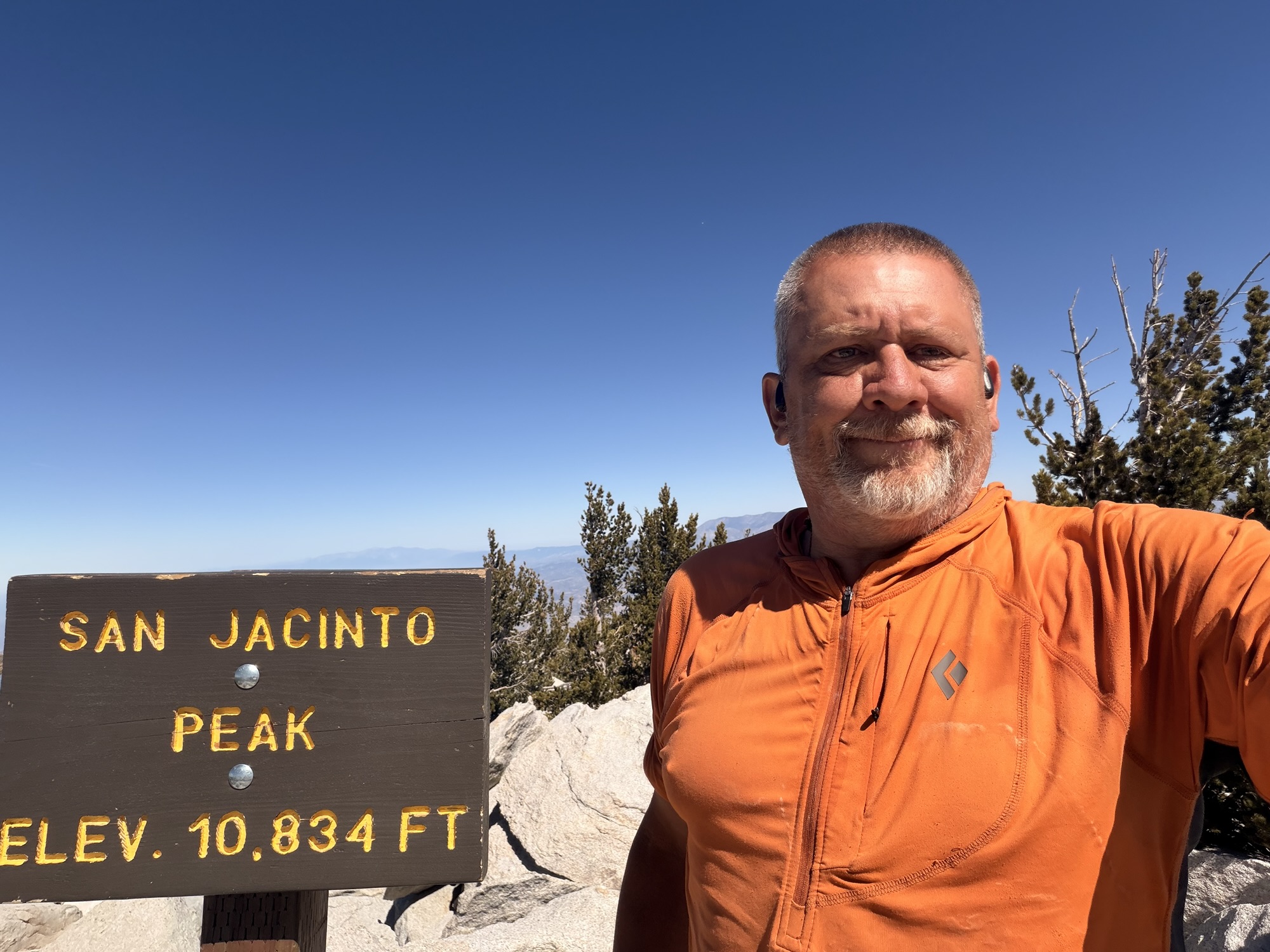
    Reached the summit at 9:45 and 3.75 miles. Awesome views at 10,834 feet. It’s too hazy to see the Pacific today unfortunately.

    YouTube video from the summit of Mount San Jacinto.

    Hung out for an hour and 15 minutes. Started my 5,800 foot descent for the afternoon at 11:00. 

    Just as I was leaving, Hell Yeah arrived with that stupid scooter he has been carrying since Idilwyld. I had to stay for the photo opportunity. 

    His goal has been to do scooter tricks in his Speedo on the summit of San Jacinto. Mission accomplished. Crazy kids! I won’t make my readers see the video of this.

    Stopped at noon at 6 miles to filter 2 liters of water. Amazing how much water there is on the west side of the mountains. Very different after two weeks of dry desert. 

    Rejoined the PCT at 12:30 and 6.85 miles. From here I am hiking on Fuller Ridge the rest of the day. I have quite a few camp spots to choose from. The hostel I’m headed to tomorrow is 23 miles away. 

    Awesome views all afternoon on the descent.

    Cool views back at reverse side of San Jacinto peak. I think as up there 3 hours ago. 

    Finally stopped for lunch and to rest my feet at 2:40 and 10.1 miles. I just cleared the last ascent for the day. All down from here. 

    I’ve been looking at this massive wind farm for two days. I get to hike through it in a few days. The picture does not do it justice.

    Made it to camp at 5:00 and 15.18. Water is .3 easy miles away, so I’ll fill up in the morning. I have 1.5 liters for tonight. Kellie and her husband joined me at the campsite. The next good spot is about 4 more miles and I don’t want to set up camp at 6:45. This spot leaves me 16 miles tomorrow. All downhill in the desert. No problem.

    Technical Notes:

    • Pop Tarts 340
    • Jerky 200
    • Propel x 2
    • Chiba Chow Mein 480
    • Tuna 90
    • Fritos 200
    • Fritos 560
    • Water liters: 6.3
    • Miles: 15.18
    • Time: 10:12
    • Up: 2726
    • Down: 5220
    • Calories consumed: 2070
    • Calories burned: 3868
    • iPhone battery used: 50%
  • Day 14 – Mile 166.6 to Mile 180.9

    Day 14 – Mile 166.6 to Mile 180.9

    Thursday May 7, 2026. Clear and 55 going up to 78.

    Up at 6:00. On trail at 7:00.

    Big 1700 foot climb in 2.6 miles to start the day.

    That was a nasty climb. Maybe the steepest so far. Killed 1 liter just on that climb. 

    Orange Man Entering San Jacinto Wilderness

    More good views of Palm Springs.

    Looking Down on Palm Springs

    Once we got to the Apache Spring Junction at 8:30, we had to do a steep .6 mile climb down a side trail to get water. The climb back up was brutal. I filtered 3 liters of water. The next water is in 8 miles. We rested and had a snack. Back on trail at 10:00.

    Margarita

    Margarita was with us for the water adventure.

    The hiking today was amazing. Damn difficult but amazing. The views were spectacular as we climbed over 5000 feet today.

    Brad On Trail Day 14
    Hell Yeah Catching Some Rays
    Orange Man With Palm Springs In Back
    Brad Taking A Break

    YouTube video of amazing views and from Day 14.

    Reached a tent-site at the top of today’s large climb at 2:10 and 11 miles. I’m beat. That was 4 hours of hard climbing. I’m at 8386 feet and started this day at 5996 feet. I still have 4.6 miles to go and one more very steep 2 mile climb to reach camp.

    Reached Tahquitz Creek and nice water at 2:45 and 12.25 miles. Brad, Hell Yeah, Chinchilla, were here. Rested, ate, and filled 2 liters of water to carry to camp in 3.5 more miles up the mountain.

    This was my view from my napping position staring up into the trees. Nice!

    Taking A Nap Looking Up

    The next 1.5 miles weren’t bad, but that last 1.2 miles almost killed me. I had to stop at least each .1 miles and rest a few minutes. It took me an hour to climb that last mile. Utterly beat!

    Reached camp at 6:00, 11.27 miles, and 5456 feet of elevation gain. We are camping at 8974 feet elevation. This was a huge brutal day!

    This was the most difficult day so far. 5500 feet of elevation gain is on hell of a day. But when you realize that all took place between 7000 feet and 8900 feet of elevation gain, well damn! I’m doing good with the elevation, but I could still use more acclimation. 

    Tomorrow we ascend to the summit of Mount San Jacinto at 10,679 feet. That is the beast that we have been climbing all day. Most years we would have been hiking on snow for the past 5 miles and all the way up and over the summit tomorrow. I can’t imagine how difficult this hike would be in snow and ice. I still have that experience to look forward to in the Sierras.

    Day 14 Map – Mile 166.6 to Mile 180.9

    Technical Notes:

    • Pop Tarts 340
    • Skittles 125
    • Jerky 200
    • Slim Jim 200
    • Propel x 2
    • Ramen 460
    • Tuna 90
    • Water liters: 5
    • Miles: 16.38
    • Time: 11.17
    • Up: 5456
    • Down: 2513
    • Calories consumed: 1620
    • Calories burned: 4556
    • iPhone battery used: 50%
  • Day 13 – Idyllwild to Mile 166.6

    Day 13 – Idyllwild to Mile 166.6

    Wednesday May 6, 2026. Sunny and 40 degrees going up to 62. 

    Up at  6:10. Ate breakfast, finished packing, and walked to the front of the hotel to wait for our ride to the trail at 7:30. 

    I am carrying 3 liters of water today. We have between 16 and 19 miles today depending on how we feel. The first water is at mile 11. It’s all uphill for the next 3 days. 

    Trail angel dropped us at the trail at 8:00. She is headed into Palm Springs for an appointment and her path goes right by the trail. Kellie, infinity, Emmett, Matthew (Apprentice) also got dropped off. Brad and I headed out just before them. 

    Nice first 6.7 miles. Pine trees mixed with desert scrub and massive rock formations. 

    Day 13 Trail
    Day 13 Trail

    Steady climb up all day. We stopped at a trail junction at 10:50 and 6.7 miles to rest and eat in some shade. Water is .25 miles downhill and our tentative camp site is about 7 miles further. 

    We hiked .3 miles down a very steep hill to get water from a cattle trough. The climb back up is the steepest thing we will hike all day. We filtered and purified water and headed out at noon. 

    Day 13 Water Trough

    The last 3 miles were a very steep climb plus a full load of water. Very difficult. My feet are not happy. We stopped at 1:25 and 10.10 miles. Took my shoes off and did some foot stretches. 

    We have a minimum of 4.7 miles to go. Brad will likely want to go further. I think I’ll be pretty much done by then. There is another option 1 mile further that we might be able to compromise on.

    Took a break at 3:05 and 13.13 miles. Feet hurting as normal. We have been looking down to the east at Palm Springs down on the desert floor for the past hour or so. We also got a good look at the Salton Sea back to the south east.

    Palm Springs

    Stopped at Fobes Ranch Trail at 4:45 and 15.85 miles for the day. Very big ascents and descents today. Tempted to go the next 2.6 miles to Apache Spring, but the vertical climb is nuts and there are no switchbacks. I’ll wait to tackle that in the morning.

    Infinity, Brian , Emmett, Kellie, Brad, and I all took a long break here. The others eventually headed to Indian Spring. They are almost out of water. 

    Margarita and  Chinchilla also camped here tonight.

    Had dinner at 6:30. Sun ducked behind the mountain early and it’s getting chilly fast. Tented on very sandy ground, so I hope the wind does not pull the tent stakes out and collapse the tent tonight!

    In bed at 7:30.

    I am REALLY not looking forward to the climb out of here tomorrow!

    Day 13 Map – Idyllwild to Mile 166.6

    Technical Notes:

    • Pop Tarts 340
    • Coffee 0
    • Slim Jim 175
    • Skittles 125
    • Slim Jim 175
    • Propel x 2
    • Ramen 460
    • Tuna 90
    • Water liters: 3
    • Miles: 15.85
    • Time: 8:53
    • Up: 3714
    • Down: 2628
    • Calories consumed: 1365
    • Calories burned: 3733
    • iPhone battery used: 50%
  • Day 12 – Zero Day in Idyllwild

    Day 12 – Zero Day in Idyllwild

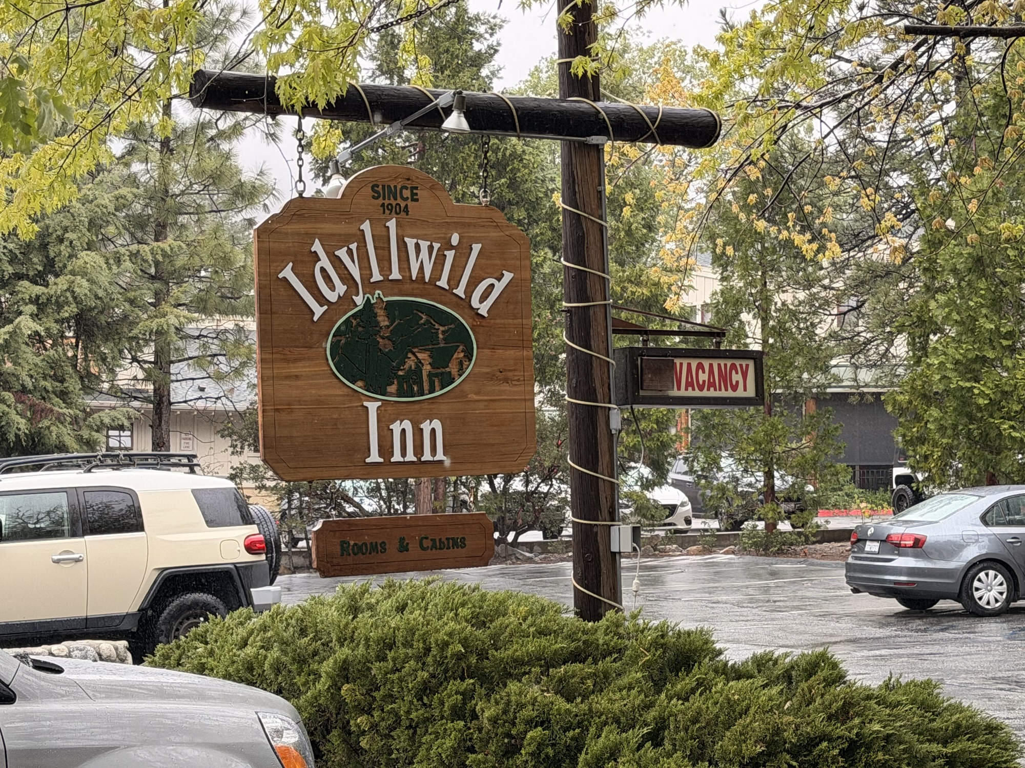
    Idyllwild Inn

    Me and the sheriff’s department had a nice breakfast at the Red Kettle.

    Bought new toe socks and shoe insoles at the outfitter. 

    Shipped heavy camp shoes, knee brace, camera mount, and a few other items home from the Post Office. 

    Resupplied at the local grocery store.

    Took care of town chores: back flushed water filter, washed water bottles, washed spork and food cozy, prepared food bag, cleaned out tent, prepped backpack for leaving town tomorrow.

    Brad scored us a ride to trail at 7:30 tomorrow morning with a trail angel.

    Uploaded 3 days worth of blogs. Still need to write today’s blog which will be more blog-like than trail journal. 

    Spent a few hours figuring out a reasonable plan for the next four days. Had to balance water, miles, elevation, camp sites, and arrive it White Water on Saturday. The next two days are going to be challenging. 

    Had a nice dinner at the Brew Pub then had a drink with Natalie, Jacob, PD, and Niaal at the pizza place. They are zeroing tomorrow. We should cross paths around Cabazon / White Water in 2 or 3 days. 

    I think that the next 4 days are going to be very hard. 

    Side note…I was bummed to learn that David Allan Coe died last week. One of the last country art is from the 1970s Outlaw Genre. I remember where I was on my AT thru-hike when Kristoffer Kristofferson died. Only Willie is left now.

  • Day 11 – Little Bear Hostel to PVC

    Day 11 – Little Bear Hostel to PVC

    Sunday, May 4, 2026. Cold, cloudy, damp, very windy. 

    Up at  5:30. On trail at 6:20.

    We have 8.8 miles to get to Paradise Valley Cafe (PVC) today. This is a famous landmark 0.8 miles off the PCT. It is a restaurant in the middle of nowhere at the intersection of the only 2 major roads in a large area. Super hiker-friendly and the best place to get a ride into Idyllwild. They also accept mail packages for hikers. 

    Rough uphill climb with high wind. Sweating and cold is not a good mix. We passed the 150-mile marker at 8:15.

    150 Mile Marker

    We reached PVC at 9:15 after an 0.8-mile road walk down Highway 74. There were about 15 hikers here. More arrived over the next 2 hours. 

    Road walk to PVC
    Breakfast at PVC

    We had an awesome breakfast at PVC. My breakfast burrito was the size of a football!

    I contacted Grumpy, a famous local trail angel, about a ride to town. It turned out he was just arriving at PVC for lunch! Perfect timing. Grumpy drove 4 of us to Idyllwild at 11:30. 

    Brad and I checked in at the Idyllwild Inn and our room was almost ready now instead of at 4:00. Our good luck continued. We dropped our packs and wandered around town for a bit until the hotel texted that the room was ready.

    Our hotel is in the heart of downtown within 2 blocks of everything. Some folks are staying almost 2 miles out of town. Glad I booked this place 3 weeks ago.

    Side note…there is very bad weather rolling in tonight. Rain, wind, and lows near freezing on the mountain with possible snow up there. Everyone is changing their plans and getting off trail. Even those who hiked on from PVC this morning changed their minds and sought shelter in town. We are at almost 6000 feet and will be climbing to 10000 feet over the next 2-3 days. Huge weather changes at those altitudes. 

    I unpacked, showered, got laundry going, and found good beer and pizza right across the street.

    Town celebratory beer

    Just chilled the rest of the day.  Planning on doing town chores tomorrow. My package from home arrived with my lightweight camp shoes. I will send my heavy camp shoes home tomorrow to save weight. 

    Took a nice nap, talked to my mom and to Pit Crew. Mom was worried since I had not posted blogs in 3 days. I explained about the lack of cell service. 

    I headed to dinner with Brad around 7:30. We connected with a large crowd including Hell Yeah, Brian, Margarita, TJ, Banquet, Chinchilla, and 5 others.

    Cool side note…Banquet is a young aerospace engineer who lives and works above Baltimore. She went to school at WVU where she got introduced to hiking. We had a good talk about hiking spots in WV and MD.

    After dinner, we walked to a pub that I found earlier today and listened to an awesome British duo on guitar and upright bass.

    Paul Hooper, you would love these guys! Amazing talent.

    Great band in Idyllwild

    I called it an early night and went back to the cabin about 9:00 and watched some videos before falling asleep. 

    Day 11 Map – Little Bear Hostel to PVC

    Technical Notes:

    • Fig bar 200
    • Breakfast Burrito 650
    • Personal pizza 800
    • Not counting anymore town calories 
    • Propel x 0
    • Water liters: .5
    • Miles: 8.34
    • Time: 3:13
    • Up: 1539
    • Down: 932
    • Calories consumed: lots 
    • Calories burned: 1359
    • iPhone battery used: 10%
  • Day 10 – Mike’s Place Plus Some to Little Bear Hostel

    Day 10 – Mike’s Place Plus Some to Little Bear Hostel

    Sunday, May 3, 2026. Sunny, clear, low 50s, going up to upper 60s.

    Up at 6:00. Packed and on trail at 7:00. Carrying 3 liters of water. 

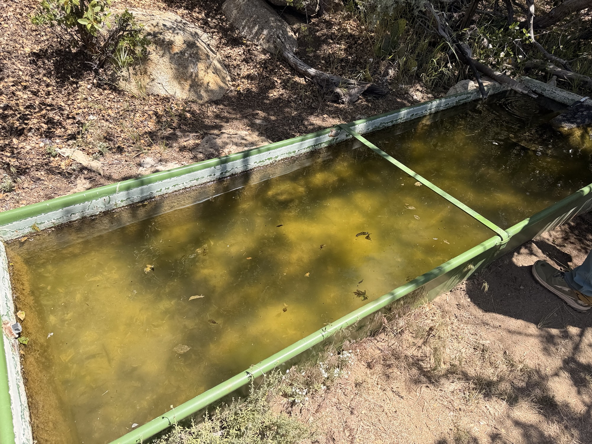
    Normal desert hiking day. We reached the infamous cistern at 10:10 and 8.1 miles. The water here is nasty, but I have had to use worse than this. Fortunately, I still have 1 liter and can skip the cistern as we are stopping at the DeBenedetti’s ranch in just a mile or so. 

    Day 10 Cistern

    There are 5 hikers here at the cistern: Natalie, Gandalf, Jacob, Niaal, and Emmett. All are headed to Little Bear Hostel 4.4 miles north.

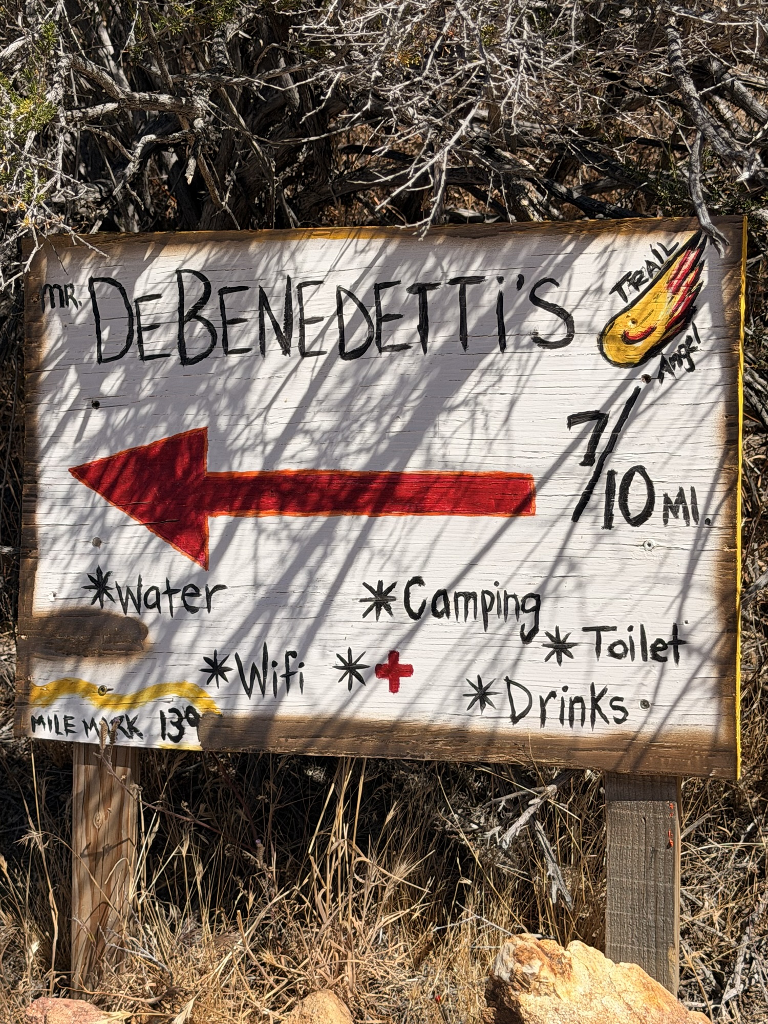
    We got to DeBenedetti’s ranch at 10:40. They are trail angels 15 minutes off trail. Lovely people. Water, soda, shade, snacks, power, toilet, nice seats, friendly dogs. Super nice people. We hung out and chatted for two hours! Orange Man, Brad, Titus, Kellie, Emmett.

    DeBenedetti Turnoff
    DeBenedetti Trail Angels
    DeBenedetti Trail Angels
    Singed trailer at DeBenedetti’s

    We all got a soda, cheese stick, and two oranges upon arrival. Kellie was cracking up at the image of Orange Man peeling an orange with an orange knife wearing an orange bracelet. Some people amuse easily.

    Orange Man Peeling an Orange with an Orange Knife wearing an Orange Bracelet

    TJ and Mash arrived as we were leaving.

    We had a hard slog the next 5 miles to get to Little Bear Hostel. Steep uphill and zero shade.

    Day 10 View

    I arrived at 3:50 and 16.45 miles for the day. My feet were killing me. Little Bear is a self-service hostel with hot dogs, beer, soda, snacks, and a toilet. 

    The temps dropped big time, and a storm rolled in. Brad, me, Gandalf, and 3 others slept in the garage. Kellie, Natalie, and Bobbie (aka Infinity) slept on the floor in the kitchen area.

    Garage camping at Little Bear Hostel

    We had a quick 50th birthday celebration for Brad when we got here. Natalie, Kellie, Gandalf, Emmett, Infinity, me, Brad, Jacob, and Niaal.

    Brad’s 50th Birthday Celebration
    Little Bear Hostel

    A quick note on Emmett. He has taken a vow of silence while on the trail. His goal is to become more present and mindful in life. He has not spoken in almost 2 weeks. He writes very eloquently. His new trail name is Presence.

    Overall, it was a good day. I’m very happy we stopped at DeBenedetti’s and stayed at Little Bear Hostel. We are all looking forward to a huge breakfast at Paradise Valley Cafe tomorrow followed by our first zero day in Idyllwild.

    Technical Notes:

    • Pop Tart 340
    • Chomps Beef stick 100
    • Cheese stick 160
    • Orange 70
    • Hot dog x2 500
    • Seltzer 300
    • Cupcake 130
    • Ramen 360
    • Spam 170
    • Propel x 0
    • Water liters: 2
    • Miles: 16.42
    • Time: 9:13
    • Up: 2218
    • Down: 2776
    • Calories consumed: 2330
    • Calories burned: 3301
    • iPhone battery used: 30%
  • Day 9 – Warner Springs to Mikes Place Plus Some

    Day 9 – Warner Springs to Mikes Place Plus Some

    May 2, 2026. No clouds, mid-40s going up to 83.

    Up at 5:45. On trail at 6:30. Carrying 3 liters of water.

    Today started with a long, hard climb. We kept ascending for 14.5 miles. The first 2 hours were not too bad, but it got hot by 8:30 and just kept on climbing. The views were pretty much the same all day. 

    Day 9 View

    One new thing today were the black flies. They were around all day, but swarmed whenever you stopped. Little suckers bite too!

    This is the largest pine cone that I have ever seen!

    Big Pine Cone

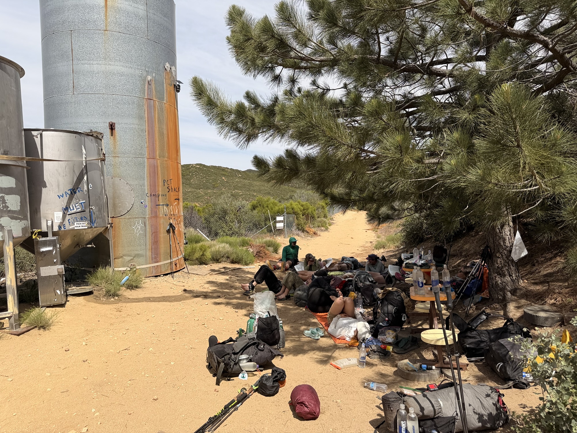
    Got to the road by Mikes Place at 1:30 and there was trail magic. Hosted by two PCT hikers from last year. Everybody is worn out from that last 14.5 miles uphill with no water and nasty heat. The trail magic is awesome, especially the shade!

    Trail Magic near Mikes Place

    Grabbed 4 liters of water from the tanks by Mikes Place. Lots of hikers taking naps in the shade by the tanks. 

    Mike’s place is a cabin where a guy named Mike lives and lets hikers camp on his property. When he is in residence, he provides snacks and a toilet. He was not there when I got water. Apparently, he showed up later in the evening, and the youngsters had a hell of a desert party with beer and cheap tequila.

    Hikers at Mike’s Place

    Brad and I headed out at 3:30. Limited tenting spots ahead, and we want to claim one before the crowd gets there.

    The next water is 12.6 or 13.5 miles away, depending on how clean you want your water. More on that with pictures tomorrow. Therefore, we carried 4 liters out of Mike’s place.

    We trudged 4.6 more miles mostly uphill and found some decent spots to camp. Kellie and another hiker joined us. Glad we left early as at least a dozen others passed by looking for a place to camp. 

    We had camp set up by 5:30. No cell service, no surprise.

    It is amazing how dusty it is out here. Sand is one thing, but the dust is almost as fine as talcum powder and gets into everything. 

    Overall, another damn hard day. That makes for back-to-back 20-mile days. My feet are not happy at all! I had to make dinner in my tent vestibule lying down to get my feet to stop screaming. 

    Day 9 in my tent
    Day 9 Map – Warner Springs to Mikes Place Plus Some

    Technical Notes:

    • Pop Tart 340
    • Slim Jim 140
    • Skittles 120
    • Croissant 350
    • Kpop ramen 580
    • Sweet Spicy tuna 80
    • Fritos 350
    • Propel x 1
    • Water liters: 5
    • Miles: 20.15
    • Time: 9:00
    • Up: 3883
    • Down: 2145
    • Calories consumed: 1960
    • Calories burned: 3694
    • iPhone battery used: 30%