Wednesday, June 17. Clear and mid-30s going up to 67.
Up at 5:50. I have to be at the Onion Valley trailhead by 11:00 to meet our shuttle to Independence and then at the bus stop by noon to go to Bishop. Steep 1.2 miles to summit Kearsarge Pass. Then 5.5 miles very downhill to Onion Valley. Brad and Margarita have to add about 4 miles to that including the nasty climb I did yesterday late afternoon. On trail at 6:45.
The ascent up to Kearsarge Pass was steep, but not bad.
Day 55 NOBO Into Kearsarge Pass
Summited Kearsarge Pass at 7:20 and 1.2 miles.
Day 55 Lake Near Kearsarge Pass
There is a cool lake just over the summit on the south side of the pass.
Day 55 Lake Near Kearsarge Pass
The 4.5-mile hike down is easy, but I’m not looking forward to hiking back up it in 2 days to get back on the PCT.
I took a break at 8:30, had a snack, and enjoyed a little cell service. Sent Pitcrew some pictures and sent Brad a status in the shuttle and bus.
Day 55 killing time into Onion Valley
I got my first view of civilization as I neared the bottom coming into Onion Valley campground and trailhead.
Day 55 First Civilization In 7 Days
Got to the parking lot at 9:30. Shuttle arrived at 10:45. Thankfully, we saw Brad and Margarita descending the last part of the mountain. Shuttled down another 5,000 feet into 90-degree desert heat in Independence.
Got the bus loaded with about 25 PCT Hikers at 12:25. A bit of a cluster f@&k.
Day 55 Bus Stop in Independence
Drive an hour to Bishop and got dropped off 1.5 hot miles away from my hotel.
Day 55 Bus Stop in Bishop
We walked to our hotels, after a stop for lunch at the bowling alley. I got to my hotel at 4:00 and had to wait for my room. I got checked in, unpacked, and talked to Pitcrew for an hour. Then I jumped on the Kile family Zoom call for an hour. Finally, I showered and went out for a big celebratory dinner at 7:00.
Tell me I don’t look like a homeless person!
Homeless Me
I have a ton of chores tomorrow, including planning the rest of the Sierras hike!
Sunday, June 14. Clear and mid-40s going up to mid-60s.
Did not feel great last night. Breathing issues. My asthma is back. Hence why I have been struggling so much. Damn it!
Up at 6:00. Everything is damp. We are in no rush today as we need to stage ourselves to summit Mount Whitney. On trail at 7:20.
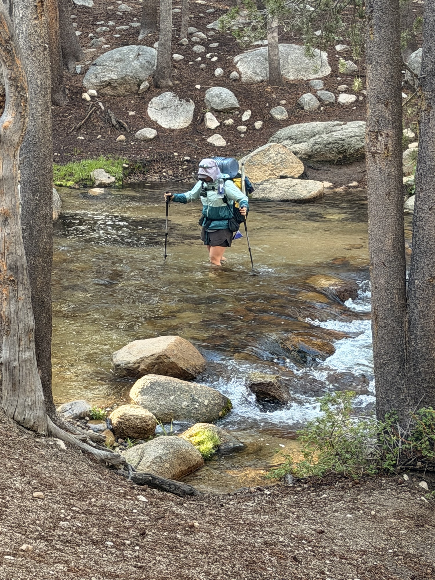
Time for the first water crossing. Most people crossed like this. Brad and I crossed on a log about 3 feet above the water just a bit downstream.
Day 52 First Water Crossing
Had a steep climb to start the day. It was 10,100 feet at the top of the climb and it took me 2 hours to go 2.84 miles. Ugh.
I’m really having breathing issues again today. Combination of altitude and asthma, I think. Not good.
Stopped to dry my tent and rearrange my pack at 10:00 and 3.6 miles. Nice spot.
Day 52 Sierras View
Made my second water crossing of the day here. Sandy bottom and no more than knee-deep. Crossed barefoot.
Day 52 Second Water Crossing
Saw this guy on the way to camp near Crabtree Meadows.
Day 52 Yellow-bellied Marmot
Made my third water crossing of the day. Narrow, knee-deep, very fast water. Wore my hiking shoes on this one due to the rock and rapid water.
Day 52 Third Water Crossing
Reached camp at 12:15 and 8 miles. I’m a mess. Back hurts, breathing issues are bad, and my stomach is bugging me a bit. That last maybe due to my tight hip belt.
Brad and Margarita were here. A ton of people are camping here in order to summit Whitney starting at 1:00 a.m. tonight. 25-mile round trip. They should be back by 11:00 a.m. I counted at least 70 tents here.
Day 52 Tent City
It thunderstormed with hail from 4:00 to 6:30 on and off. The temperature dropped a lot. We all hid in our tents trying to stay warm and dry.
Day 52 Hail
Now for the bad news. Our goal was to get to Mount Whitney around noon and then summit Sunday night / Monday morning (night hike). I have finally gotten it through my head that I have been struggling a lot lately due to a combination of altitude and my breathing issues….again.
There is no way I can safely climb up 4,000 feet to summit Whitney. I either need to turn around and go back to Cottonwood Pass or push on past Forester Pass and then exit via Kearsarge Pass. It’s 21 miles back to Cottonwood or 31 miles to exit via Kearsarge Pass.
I took some oral steroids and a second hit of the steroid inhaler and rested the rest of the afternoon. I will repeat that in the morning. I plan to try for Kearsarge Pass with Brad and Margarita instead of hiking backwards solo.
We have to cross our first of many high mountain passes tomorrow. These passes have snow above 11,000 feet approximately. You can safely cross the snow when it is mostly frozen, but when it heats up and gets slushy it becomes difficult to cross. You start to posthole, which means your foot and leg punch through the snow crust. There are tree tops, limbs, and other junk hiding under that snow. It’s painful, slow, and not recommended to cross snow like this.
Tomorrow Margarita and I will hike 8.6 miles to Tyndall Creek Campsite at 11,041 feet. Brad will join us later in the day after the rest from his Whitney Summit night hike. This stages us to start climbing Forester Pass (13,120 feet) early the following day. We have to go up 4.8 miles, and then down the other side about 4 miles as early as possible to get through the snow fields while they are solid. After that we have about another 6 miles to reach our staging campsite to exit at Kearsarge Pass the day after that.
The exit via Kearsarge Pass (11,791) is 7.5 miles ending at Onion Valley Campground. We will need to hitch out of there to the main road about 15 miles away. From the main road, we will hitch or shuttle or bus north 40 miles to the town of Bishop for a zero day.
Technical Notes:
Protein Shake (10oz): 330 cal, 19g carb, 13.5g fat, 36g protein
Saturday, June 13, 2026. Clear and mid-40s going up to low 70s.
Up at 5:30. Packed and ready to go at 6:40, but Brad hurt his back this morning somehow. Probably a pulled muscle. We are going to wait a while and see if it gets good enough to hike with. We can always bail out to Cottonwood Pass and get a hitch to Lone Pine, CA. That exit point is 4 miles away followed by a 4.5-mile hike to a campground.
We got on trail at 7:25. Brad is taking it slow today to try to help his back. We have a 10-mile climb that mellows out after the first 3 miles.
Hiked past the bailout point for Lone Pine.
Day 51 First Bailout Option
Filtered water at 5.18 miles from a fast-flowing stream from snow melt higher up the mountains. Very clean, cold water!
One of several high alpine meadows.
Day 51 High Sierra Meadow
This is the view into Cottonwood Pass. Note the snow. This route provides access to civilization in the form of a small road that leads to CA 395 about 15 miles away. Need to hitch from here if bailing.
Day 51 View of Cottonwood Pass
We stopped at Chicken Springs Lake (11,218 feet) at 12:15 and 9.44 miles. Frozen less than a month ago. Several people swam, but I wasn’t interested. The water was VERY cold.
Day 51 Chicken Spring LakeDay 51 Chicken Spring LakeDay 51 Chicken Spring Lake
Late afternoon thunderstorms and hail. Lasted a few hours.
Day 51 Storms Rolling InDay 51 Late Afternoon Rain
Reached camp at 5:45. Another long, hard day. It was a struggle. Most of my gear is damp from the rain. Will dry it all out tomorrow.
We only have an 8-mile hike tomorrow to get to Crabtree Meadows at the base of Mount Whitney. From there, it is a 15-mile slack pack up and back to summit Whitney. There is minimal snow up there this year, so hiking it during the day is a viable option as opposed to most years when you really need to complete the round trip before noon.
Day 51 Map – Mile 742.9 to Mile 761.7
Technical Notes:
Protein Shake (10oz): 330 cal, 19g carb, 13.5g fat, 36g protein
Friday, June 12, 2026. Clear and mid-40s going up to 78.
Up at 5:30. Packed up and on trail at 6:40.
Solid climb for the first 3.6 miles of the day. Reached the top at 8:10. We are at 10,526 feet. We are going another 18 miles today with one more 4.5-mile steep climb starting around our midway point for the day.
We need to get over this in the next 1.5 days.
Day 50 Sierras
My feet and pack feel good so far today. The pack is about 1.5 lbs lighter with the food I went through. Also trying to keep my water carry to 1-1.5 liters.
Lunch at 10:45 and 10.12 miles at Death Canyon Creek. Carrying 2 liters of water out of here for our 4.5-mile climb. Back on trail at 11:30.
That was a very steep, nasty 4.5-mile climb. I took a long break at the top.
Day 50 Sierras
Filtered water at 3:45 and 18 miles.
Reached camp at 5:30. Brad and Margarita were here. About 7 others showed up around 7:00.
The biting insects are starting to get annoying. They will get very bad in a few days, I think. The altitude, over 10,000 feet, and the steep climbs are making the days difficult. I think tomorrow will be better. Our goal is to position ourselves so we can climb Mount Whitney (14,505 feet) on Sunday.
Day 50 Map – Mile 721.9 to 742.9
Technical Notes:
Protein Shake (10oz): 330 cal, 19g carb, 13.5g fat, 36g protein
Up at 6:00. Not sure when we are leaving today. That’s up to Brad. He is having some foot issues and may want to take it easy today. I’m up for anything.
We are hiking this morning. Yay. I packed up while waiting for the breakfast line to go down. My pack weighs 40 lbs as expected. That’s 7 days of food and ONE liter of water plus bear can, ice axe, and micro spikes.
Back Flip (Brian) arrived at KMS while we were having breakfast. He took a few days off for a family vacation.
Day 49 Brian at KMS General Store
We left the general store and road walked to the trail at 8:40. The first several miles were mostly flat. We left civilization at the end of the last road in this mountainous area at 3.25 miles. There is a small National Forest Campground here and that’s it for civilization on the trail for over two weeks.
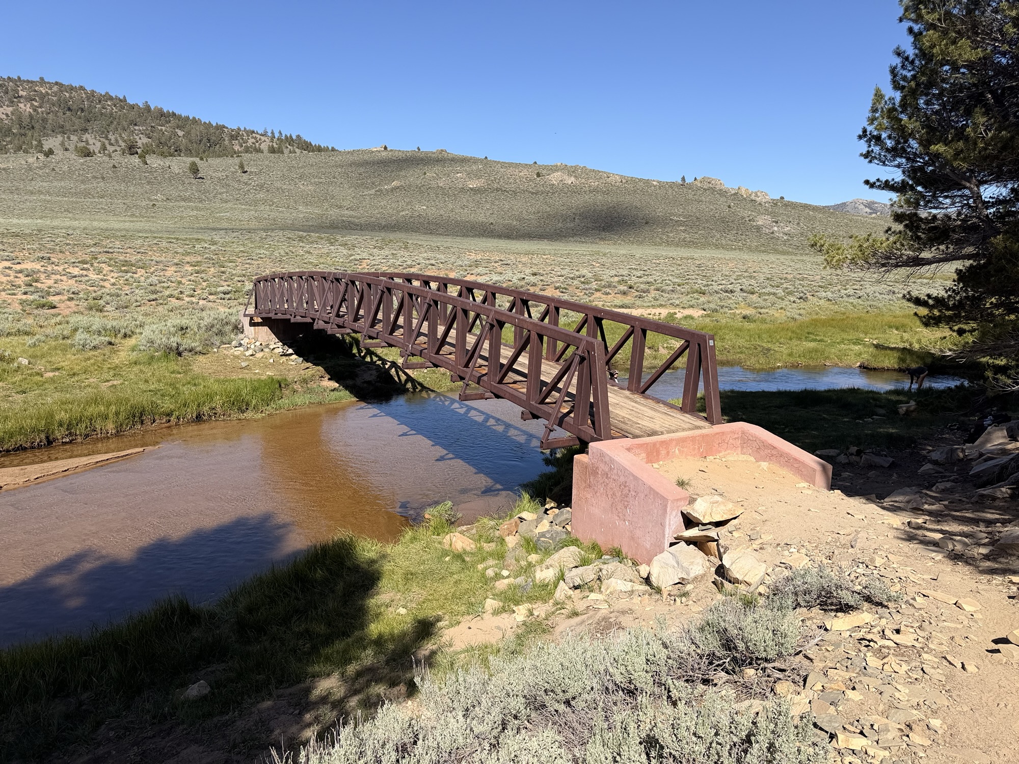
We followed the south fork of the Kern River the first part of the day. Lots of water options in the sierras. We crossed the south fork of the Kern River on a foot bridge at 10:40 and 5.2 miles. Took a 30-minute break. Now the steeper climb begins and goes on for 14 more miles.
Day 49 Footbridge over Kern RiverDay 49 Orange Man on Footbridge over Kern River
We stopped for lunch at 2:15 and 11.5 miles. Big climbs all morning with these 40-lb packs. Took a 60-minute lunch break at the beginning of Beck Meadow.
We reached the foot bridge over the South Fork Kern River at Monache Meadow at 4:30 and 15.30 miles. This bridge is a bit famous as it appears in a lot of PCT videos and people like to camp in the meadow just beyond. We ran into Margarita and four other hikers here.
Day 49 Footbridge over South Fork Kern RiverDay 49 Footbridge over South Fork Kern River
Hard last 2-mile ascent into camp. We are camping at 9145 feet. We reached camp at 6:50. Only two other people here so far. In bed at 8:00.
My feet felt good all day. Blisters seem to be gone and the new shoes took care of the other general foot pains. I can’t wait for this pack to slowly get lighter.
Two problems. Both zippers on my tent are having problems. I’m afraid one or both will completely break soon. Next time we get to camp early, I’ll attempt to make it better with my mini pliers, but I’m going to need a new tent at some point. Also, my CNOC water bag developed a second leak. This one is more problematic as it is right at the connector where the filter attaches. I should have replaced it in KMS. I need to nurse it along until we reach Bishop in 6 days.
Up at 7:15. If the scale here is accurate, and I think it is close, then I am down to 198 lbs. That’s about 22 lbs so far.
Gathered up my laundry and battery packs to be charged and wandered down to the main building. They open at 8:00 for breakfast. As expected, there is a huge line at the bathrooms and to get food. I plugged in my batteries to charge and worked on blogs while waiting for the food lines to go down. This place is famous for their hubcap-sized pancakes.
Grumpy Bear’s Massive Pancake
Like I said yesterday, it is very emotional getting to Kennedy Meadows South (KMS). We have been struggling through the desert for 47 days with KMS as this magical destination on the horizon. We have made friends and trauma-bonded through the desert. We have seen people leave the trail for various reasons and we have seen at least three helicopter rescues from the trail. It’s amazing that the vast majority of our roughly dozen-person bubble is still together after all this time.
Tomorrow we venture into the High Sierras. I’d say about half the hikers are doing a short 4-day section and exiting at Cottonwood Pass and hitching into Lone Pine, CA. The other half, us included, are attempting a 6-7 day section, exiting at Kearsarge Pass and hitching into Bishop, CA. This longer hike includes a one-day overnight side quest to summit Mount Whitney at 14,481 feet.
We will have to cross over several high mountain passes between now and Bishop. Snow should not be a big issue this year, but the numerous swift water crossings due to snow melt are still an issue. Some people are very nervous about those.
I’m nervous about the remoteness of these next few sections. Once you get into the first section, there are only two exits. One is Cottonwood Pass, which takes you over half a day to get down to a road to attempt a hitch. And the other is Kearsarge Pass, which takes more than a day to get from the trail to a road. I’m also a little nervous about Mount Whitney and that elevation. At least we get to leave our tents and heavy gear at the base camp while we summit and then descend back to camp in one day.
After this section, we have the second section, which is just as remote, maybe more so, and has a big mountain pass to conquer every day. The trick with these high passes is that you can’t safely hike after about 1:00 in the afternoon because the snow is too soft. You have to plan where to stop and start each day with a bit of forethought. Basically, the next three weeks are going to be very challenging.
I’m not looking forward to carrying the bear can nor 6+ days of food plus an ice axe plus micro spikes. At least I won’t have to carry more than 2 liters of water until I get to Northern California. And I have brand-new shoes!
I got my Bear can packed and my backpack packed. Not all 7 days of food fit in the Bear can. I’m not surprised. I also got rid of one smart water bottle which frees up a lot of room in one side pocket. I am totally rearranging how my pack is organized in order to get the can to fit vertically in the pack. I had to move my quilt to the outside of my pack on the bottom. I need to be very careful how/where I set my pack down going forward.
New Pack Setup for Sierras
I got my new trekking pole tips installed and washed my laundry. There are about 40 hikers here getting ready to go back to the trail today. Most people are doing a short hike out of here starting in the late afternoon.
Lots of packs at Grumpy Bear’s
I took the 2:00 shuttle back to the general store. We are camping there tonight, so we won’t need a shuttle in the morning. We can just walk .75 miles to the trail. This also lets me practice unpacking, setting up camp, and repacking using my new backpack setup. I’m sure I’ll need to tweak that setup.
Here is what an outdoor shower looks like.
Nice Outdoor Shower
And here is what my house currently looks like.
My house
The weather forecast looks awesome for the next week!
Day 48 weather forecast
I have not talked much about hiker boxes. These are boxes where hikers leave their extra, unneeded, unwanted, or other miscellaneous stuff. This ranges from food to socks to tents to clothing to electronics to almost anything. This is common on most long-distance trails. Even most hotels/motels that cater to hikers have hiker boxes. This is one of the few times in life that it is socially acceptable to rummage through other people’s cast-away stuff. Brad and I were grazing on candy and cookies left at KMS for dessert today. Somebody even left a brand-new beard trimmer with all the attachments in the original packaging in the hiker box at KMS. It’s a different world out here.
Hiker Boxes at KMS
In bed at 8:00. We plan to get breakfast here at 7:00 and hit the trail by 8:00 tomorrow morning. No cell service or WiFi for the next 7 days.
Tuesday, June 9, 2026. Partly cloudy and 54 going up to 78.
Up at 5:30. Had a small breakfast as I’m anticipating a huge lunch at Kennedy Meadows. We got on trail at 7:35.
Easy 9 miles off hike with lots of water today. Nice temperature and a light breeze.
Crossed the 700-mile mark short after leaving camp.
Day 47 Reached 700 Mile Mark
Finally saw a jackrabbit. He is also on the PCT.
Jackrabbit on Trail
I reached the General Store at KMS at 10:00. Everyone gets a huge welcome from the people on the deck as they walk in. Cheering, applause, and cow bells. It’s very cool!
Welcome to KMSMain Deck at KMS General Store
I got a Dr Pepper, a beer, and signed up to get my packages. They have so many packages for hikers that you have to sign up and it can take up to half an hour for them to retrieve your packages. Pit Crew sent me a fully loaded bear can, my ice axe, micro spikes, gloves, meds, and several other items.
I picked up my new shoes at Two Foot Adventures. This is the same outfitter where I bought my current shoes back around day 5. The new shoes are amazing. Like walking on clouds. Also picked up two pairs of toe sock liners. I want to switch back to lighter socks for the Sierras.
We had lunch, more beers, and eventually shuttled to Grumpy Bears Retreat about 3 miles away. Grumpy Bear’s is a bar/restaurant with tons of tenting, showers, laundry, etc. I pitched my tent in a good spot around 3:00 before the horde of other hikers arrived. Good decisions as it got really crowded later in the evening.
I bought a new water filter and a new fuel canister at Triple Crown Outfitters next door to Grumpy Bear’s around 4:00. That was it for chores today.
Today is a huge celebration. Making it to KMS and getting ready to tackle the High Sierras is a huge milestone and a very emotional roller coaster. Excited to have made it here, anticipating the Sierras, and nervous or scared about the Sierras.
As more of our bubble of people arrived, the beer kept on flowing.
The Extended Tramily at Grumpy Bear’sThe Extended Tramily at Grumpy Bear’sOrange Man at Grumpy Bear’sTJ, Bonk, Hell yeah arriving at Grumpy Near’s
I went to bed about 8:00, but I heard the party going on for quite a while.
Tomorrow I need to review my food, finalize the hiking plan for the next section, pack my Bear can, wash laundry, shower, and pick up any additional food items I need. This next stretch will be 6-7 days, which is my biggest food carry ever by a good margin. That pack is going to be heavy.
Day 47 Map – Maenter Creek Mile 694.7 to Kennedy Meadows South
Monday, June 8, 2026. Partly cloudy and 45 going up to 76.
Up at 5:30. It’s chilly and windy this morning. We both got moving slowly this morning. I am carrying 3 liters of water. We only have 8 miles downhill to water and a campground. Then a big 6 mile climb followed by a 6 mile descent to water and camp for the night. That will leave us just 8 miles to get into Kennedy Meadows early tomorrow. Looking forward to new shoes and a zero day for my feet.
Today was a hard day for reasons other than the trail. I can’t believe it has been five years today since Andrea died. That event is the main reason I’m out here doing this. Miss you sweetheart.
Reached camp at 4:45. About 15 of us here including Margarita. There is a nice stream about a foot deep right by camp. I soaked my sore feet as soon as I got here.
Set up my tent for the last time in the desert.
Last camping in the desert
Everyone is excited to be done with the desert and to get to Kennedy Meadows early tomorrow to Nero and then Zero.
Day 46 Map – Mile 674 to Maenter Creek Mile 694.7
Technical Notes:
Protein Shake (10oz): 330 cal, 19g carb, 13.5g fat, 36g protein
Sunday, June 7, 2026. Clear and 75° going up to 90°.
Up at 6:00. Packed up and attempted to wrap my blisters and sore pinky toes. Will see how well that works.
Trail angel Larry dropped us off at the trail at 7:45. Big climbs this morning with heavy packs. Three days of food and 3 liters of water. We don’t have water today until mile 13.
Day 45 Walker Pass
Took a break at 1.9 miles in. Big steep climb this morning. Still have almost 6 more miles of ascent to go this morning. I feel good, but Brad is struggling today. He woke up not feeling well. At least it’s breezy and 15 degrees cooler up here than back in town.
Day 45 On Trail
Took a snack break at 10:25 and 5 miles. Still 2.5 more miles of ascent to go. Reached the top of our climb and started the 4.5 miles descent to water. Very rocky trail. I can feel every rock through my soles. Need new shoes!
Day 45 Rocky Trail
Stopped for lunch in a small path of shade with boulders for seats at 12:20 and 8.3 miles.
We reached the 1/4 way mark at 1:50 and 674 miles!
Day 45 1/4 Way Mark
Stopped for a water and an hour break at 5:00 and 17 miles. We are going to go as far uphill from here as we can by 8:00 or until my feet give out, whichever comes first. Otherwise, we have a very nasty day tomorrow, so every additional mile today is a big help.
That last 2 miles was a nasty climb. Particularly carrying 5 liters of water. Fortunately, that 1-hour break really helped my feet. I made it to the tent site at 8:00. All the good spots were taken. I had to camp further up the summit on a very small, very oddly shaped spot. Sandy soil too. My tent pitch is so bad I had to laugh at it. Plus, I’m inclined on all axes. Should be an interesting night.
Made dinner at 8:45 in my tent. Getting windy and chilly. And there is a critter nearby in the tall weeds making noise. Probably something small.