Wednesday, August 20, 2025. Up at 6:30. Overcast and cool.
Just 3.7 miles downhill to the ferry then .4 miles to the road and a shuttle to the hostel. Yey.
On trail (mile 2043.1) at 7:45. Easy day following the stream that flows out of Pierce Pond. Lots of waterfalls all the way today. We stopped at a good viewpoint for a waterfall at 1 mile from camp.
Waterfall from Pierce Pond outflowWaterfall from Pierce Pond outflow
Arrived at the canoe ferry across the Kennebec River at 9:45. There were 3 people in front of us so we had to wait for 2 round trips before we crossed. Ferry holds 2 passengers.
Canoe ferry across the Kennebec River
Got a shuttle to the Sterling Inn (mile 2047.1) and checked in just before 10:30. I stayed here last year. Showered and did laundry. Got more chores to do this afternoon. Full house at the hostel including Toni, Antlers, Flash, Crash, and a lot of others.
The Sterling Inn, Caratunk Maine
Had lunch at hostel and did a bunch of chores. Finalized our hiking plan for the next 12 days. Made hostel and shuttle reservations in Milinocket. All we need to do yet is schedule our resupply drop into the Hundred Mile Wilderness (HMW) on day 5 of our HMW trek.
I also changed the display on my watch to show fewer fields but in a bigger font while hiking. Old age sucks!
We are all resupplied and packed for tomorrow. Got 14.7 miles with one medium sized mountain mid-day.
Went to dinner at the rafting adventure place a few miles up the road with Antlers and Perfect Day. Back to hostel and had a long call with Pitcrew.
About 8 of us hung out in the hiker lounge and chatted until 8:30. Very nice social evening.
Tuesday, August 19, 2025. Up at 6:45. Clear and cool.
Short day today. Just 10 flat miles. Would go further but the ferry closes at 1:00pm, so we are limited. Should be an easy day and guesstimating at camp by 2:30.
On trail (mile 2033.1) at 8:15.
Ran into Antlers at West Carry Pond. Fair number of vacation homes across the lake.
West Carry PondSign for The Great Carrying Place
Crossed several boardwalks over boggs today.
Boardwalks and Boggs in MaineEd on the boardwalk in Maine
Reached the beach of East Carry pond at 10:00.
Beach at East Carry pond
The trail hugs the pond for about half a mile.
Appalachian Trail on the shores of East Carry pond
Stopped for a snack at Scott Road at 10:50. Road is owned and maintained by The Scott Paper company which owns huge swaths of land in the area.
Tedious but easy hike the rest of the day.
Arrived at Pierce Pond (mile 2043.1) at 1:15. Made it in 5 hours flat. Great campsite right on the pond.
Pierce PondCamp on the shores of Pierce PondChuck’s tent at Pierce Pond
Late afternoon nap with the sound of rushing water from the river in the background, sun and breeze seeping into the tent, and the lake-view just 15 yards away. Wonderful!
Antlers is in the shelter, Flash and Crash are tenting up the hill, some weird angry lady tenting by the shelter, and a young NOBO in the shelter. Limo Bean arrived about 5:00. She had a long hard day. Another young pair of NOBOs is tenting someplace close by. There are only a few good tent spots by the pond and we got them early:)
We have a bunch of logistics to figure out tomorrow including our shuttle back to the start oh the hundred mile wilderness from Millinocket.
Had dinner by the shelter with Limo, Antlers, a different Lady Bug and two others.
Now that there is a damn good bear hang!
Good bear hang at Pierce Pond
In bed and reading at 7:00.
Day 8 Map – West Carry Pond Lean-To to Pierce Pond Lean-To
Monday, August 18, 2025. Up at 6:30. Sunny breezy and high of 65.
Packed up and on trail (mile 2020.5) at 8:10.
Here is a map view to put our location in context. We are the big blue dot.
Maine Map
First 3.7 miles are uphill but easier than the past several days. Once we pass Bigelow Ledges at mile 3.7 it will be mostly 9 miles downhill.
Stopped for second breakfast at 10:00. Still more views of sugarloaf. We have hiked in a half circle and are directly across from the Sugarloaf summit, which we hiked past 2 days ago.
Sugarloaf mountain and ski runs seen from the Bigelows
Flash stopped and asked if we had seen Crash. She took a phone call and he hiked on. A little worried that she had not caught up to him yet as he is slow. She decided to backtrack and try to find him. Odd.
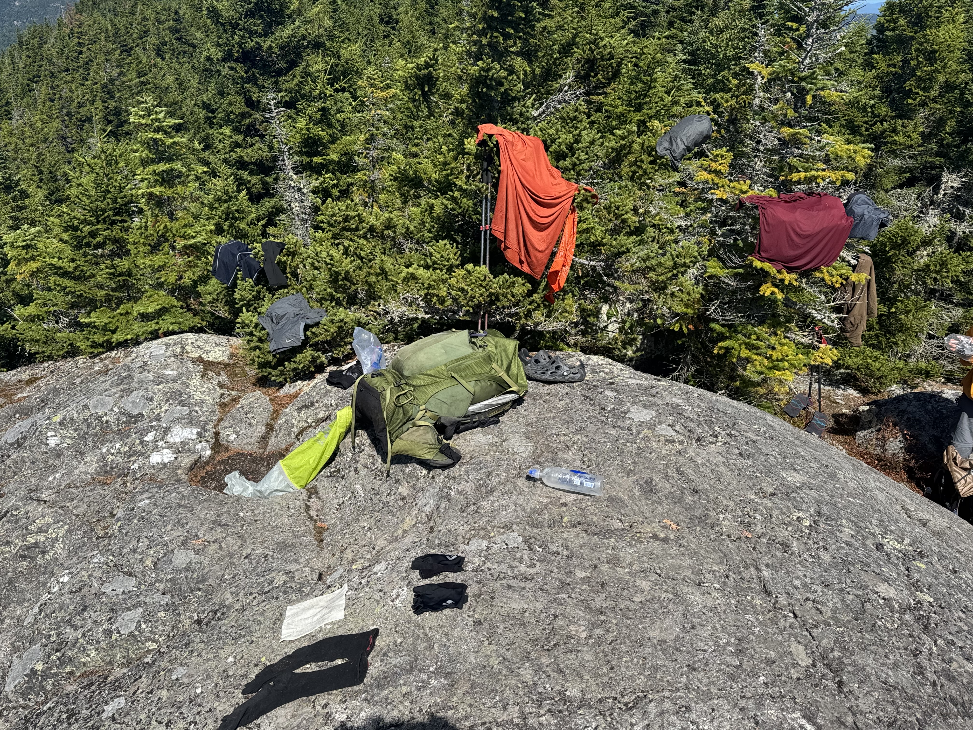
Reached the Bigelow Leges at 11:00. Highest point of the day. It’s cool but sunny and breezy, so we are trying to dry our clothes from yesterday. Just hiker trashing up Mother Nature.
Flash and Crash stopped to say all was well. He got off trail to use the potty and she must have hiked past him during his bathroom break. All’s well that ends well.
Clothes are mostly dry. Packed up and headed out at noon. We have 9 miles to camp. Guessing about 5:30.
Stopped at little Bigelow lean-to at 1:00 for water. Quick stop.
At 1:40 we crossed Flagstaff Road. Highly trafficked gravel road. This is where shuttles drop off a lot and there is a busy AT parking lot.
At 2:00 we passed Flagstaff lake. Very choppy. Big lake!
Flagstaff Lake, Maine
Got water near Long Falls Dam road at 3:15. My feet are not happy but we have 3.4 miles to go.
Made camp by West Carry Pond (mile 2033.1) at 5:15. There are 3 others here: Antlers, One Speed, and another guy. No cell service. Chatted with Antlers and One Speed while we had dinner. Antlers is an older guy sectioning to Caratunk and One Speed is thru hiking NOBO.
Camp at West Carry Pond, Maine
In bed at 8:00 and read for an hour or so. Cold night.
Day 7 Map – Safford Notch Campsite to West Carry Pond Lean-To
Sunday, August 17, 2025. Up at 6:00. Clear cool morning, rain on and off afternoon and evening.
Hopefully we will get to camp after the afternoon rain and before the evening rain so that we can pitch our tents in dry conditions. Fingers crossed.
Got shuttled to trail at ME Rt 27 (mile 2010.1) by the hostel at 7:50. On trail at 8:05. I am carrying 4 liters of water as there is only one good place to get water the entire hike today.
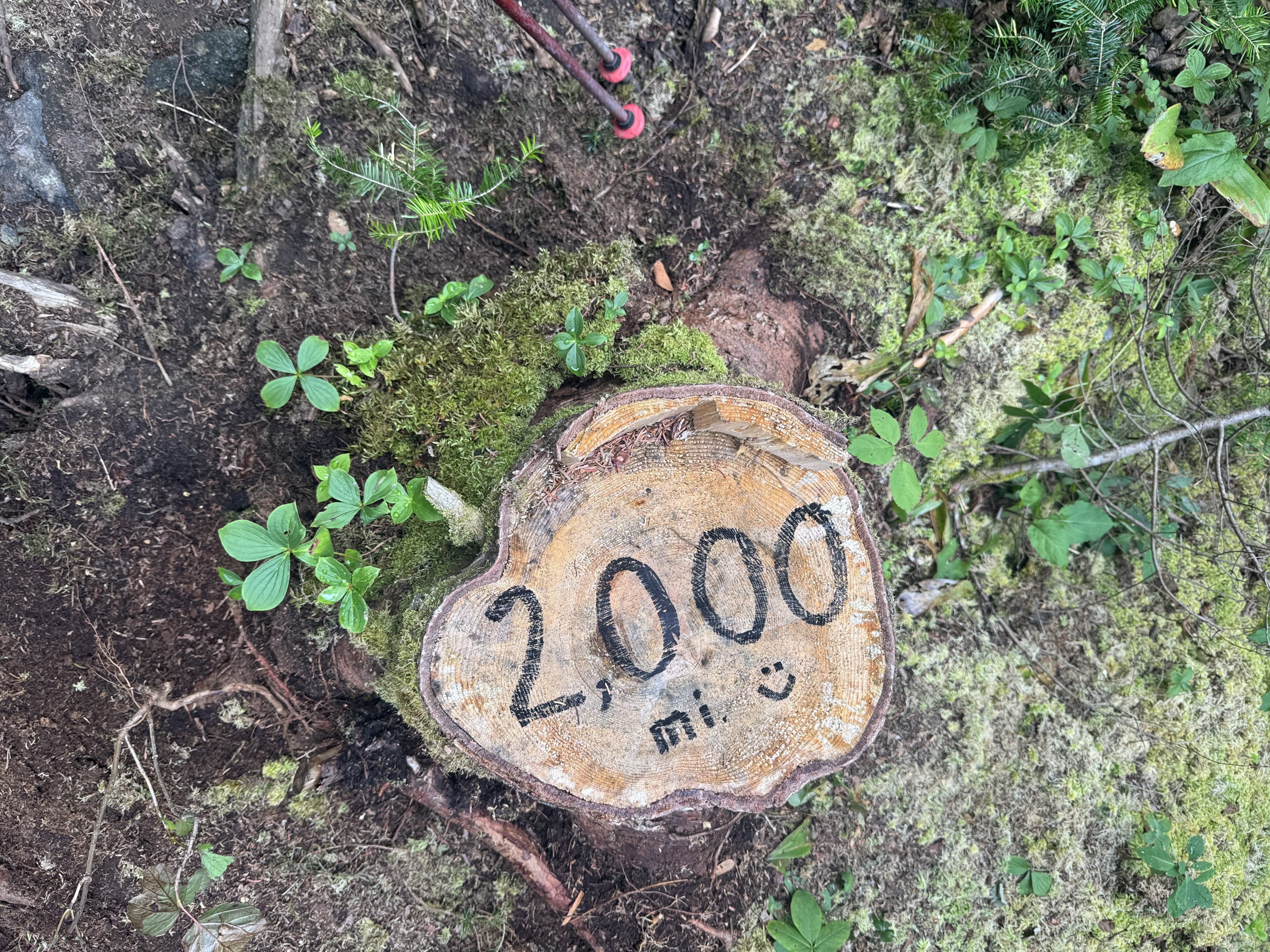
Trail sign to start the day at ME Rt 27Old 2000 mile marker
Easy flat first 2 miles followed by steep dirt uphill for 1.4 miles. The next 1.5 miles was one big rock scramble. Not as bad as Saddleback on day 1, but a good workout.
Stopped at a nice overlook at 11:00 to swap water and have lunch. We have .7 to the next lean-to where there is a pond where we can get water. Then a big steep climb 🙁
Stopped at an amazing overlook. That is the pond where we will get water shortly. Horns Pond. The 2 peaks in the background are South Horn and North Horn.
Looking down on Horns Pond with South Horn and North Horn peaks in the background.
Reached Horns pond at 12:10. Lovely alpine pond. We got 2 liters of extra water as there is none for the next 6 miles and we have also some tough climbing to do.
Horns Pond
The weather finally turned to clouds and rain and strong winds right as we ascended above tree line on Bigelow Mountain West. Summiting a 4100 foot rock pile in that weather is not fun.
Ed summiting Bigelow Mountain WestEd summiting Bigelow Mountain WestEd and Chuck at the summit of Bigelow Mountain West
The rain and wind picked up as we went down from Bigelow West, crossed the saddle between peaks and ascended Bigelow Avery at 4062 feet. Visibility was about 50 feet and the winds were way over 25 mph.
After that peak, we had a 2.3 mile steep rocky slippery descent almost 2000 feet to camp. Rain and wind for 3 hours. We were soaked and cold when we finally reached camp.
Got to Sanford Notch Campsite (mile 2020.5) about 5:00. Set up in drizzle by 5:30. Cold and windy and rain evening. At least we climbed down about 1500 feet unlike some of our friends from last night such as Lady Bug and Limo Bean. They are camping much higher up and it’s very cold and very windy up there. They are not happy based on their texts.
I’m dry and have a good tent pitch, so I’ll be good for the night. Surprisingly we have 2 bars of cell service.
Warming up and drying out at Safford Notch after bad weather day in the Bigelows
An older couple, Flash and Crash, arrived just after we setup. They are section hiking to Monson.
Made a hot dinner in the tent vestibule. Hot food is very welcome at this point. Tried Good to Go dehydrated meals for the first time. Vegan but darn tasty. Added jalapeño tuna to fix that vegan issue.
Cooking dinner in the tent vestibule in the Bigelows
All ready for bed and blog entries written by 8:00. Will read for a bit and hopefully fall asleep soon.
Saturday, August 16, 2025. Up at 6:00am. Beautiful morning!
Interesting morning. We almost had to cancel the rest of the trip. Ed lost his wallet. We ransacked the hostel and the car that we used to shuttle back from the restaurant. No luck. We had about 5 other people search the hostel too. The restaurant does not open until 4:00 this afternoon. If it is not at the restaurant we will cancel the trip and head home so Ed can deal with all the issues associated with canceling all his credit cards. It’s also a bad idea to hike with your head not 100% in the game.
I went with the “second set of eyes” concept and took a Quick Look into the trash compactor bag Ed keeps his gear in to stay dry. Guess what I found! Ed was certain he had not even opened that bag after we got back from the restaurant last night. He must have stashed his wallet in there just before going to bed.
By the time we got everything worked out, all the morning shuttles had left for a long distance drop off and we would not get on trail until at least 10:00am. Plus the stress of all the fun and games this morning, our heads are not in the right place. Given that we are taking a zero. There are a bunch of folks zeroing today including Toni, Lady Bug, Limo Bean, and Spiderman. Plus the staff here are wonderful. Really good sociable group of people. Classic AT social scene.
This gives me a chance up upload 5 days worth of blogs and take care of some chores. All’s well that ends well!
Video chatted with Pitcrew. This is the last reliable cell service for 4 days.
I made a hostel reservation for us in 4 days at the Sterling Inn. We got the last private room! I stayed there last year. It is a really nice place and it is under new ownership this year. Even more hiker friendly than in the past based on their updated website and feedback from Lady Bug. She was there 4 days ago.
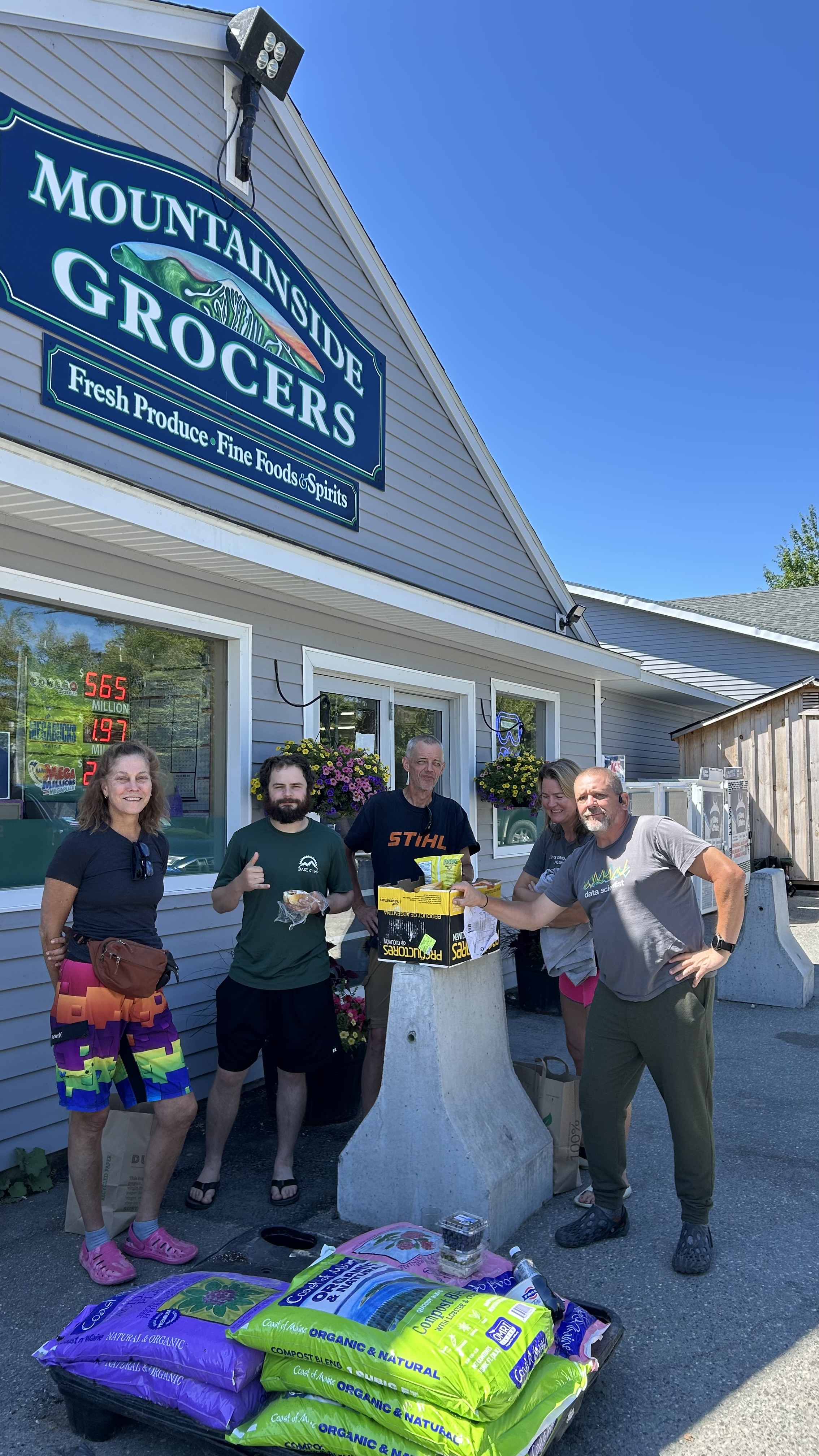
We all went to the local grocery store and got lunch and food to grill at the hostel tonight. While we were waiting for the shuttle we were swapping stories and Lady Bug realized that she and I met and hiked together last year! We were at the Hikers Welcome hostel together and slacked Moosilauke together on my day 145. Small world! That’s Lady Bug in the middle.
Limo Bean, Chuck, Lady Bug, Spider-Man, Ed getting groceries in Carrabassett Maine
Ed, Spiderman, Lady Bug, and I played The Oregon Trail over lunch and generally chatted.
Chuck, Spiderman, Ed, Ladybug playing The Oregon Trail on a zero day at the Hostel of Maine
Got 5 days worth of blog entries created. I hate managing all the photos on my iPhone. Tedious! I’ll add some of the pics Ed sent me once I get home and have a real computer to edit with.
Had a nice cookout with Ladybug and Ed at the hostel. Followed by some nice conversations with the owners.
Chuck, Ed, and Ladybug having dinner at The Hostel of Maine
Friday, August 15, 2025. Up at 6:30. Chilly and clear. Probably in the low 50s.
On trail (mile 2002.8) at 7:45. Carrying an extra 2 liters of water as there may be no water for the next 8 miles. The youngsters are more concerned about weight, but Ed and I being the wise old men want to stay hydrated!
Steep rocky climb, but not as hard as the last few days. Part of that is I’m starting to get my trail legs.
Ed and Mary-Beth ascending South Crocker Mountain in MaineEd ascending through a rock field on South Crocker Mountain in Maine
We met up with Mary-Beth from last night and hiked on and off today. We had some great conversations about hiking. She had lots of questions about long distance hiking.
Stopped at South Crocker summit overlook for a water break and lunch. Very glad I carried the extra 2 liters of water. Great view of Sugarloaf mountain ski runs.
Chuck and Mary-Beth on the summit of South Crocker Mountain in MaineSugarloaf ski runs seen from South Crocker Mountain summit in Maine
Summited North Crocker at 10:45 with Mary-Beth. Topped off my water bottles from the 2 liters I carried up here. We have 5 miles DOWN to meet our shuttle. About the same difficulty as South Crocker.
Summit of North Crocker Mountain with Mary-Beth and Ed in Maine
Arrived at Rt 27 (mile 2010.1) at 2:25. The town chief of police, who is also an avid hiker, was doing trail magic. Ed and I helped ourselves to a nice cold PBR! We chatted with the chief for about 20 minutes while we waited for our shuttle. Ed got a great description of the next 16 miles through the Bigelows and talked about Maine in general. Really nice guy.
PBR trail magic courtesy of the Stratton Maine police chief
Our shuttle driver from Hostel of Maine, Mike, took us to the hostel. Very nice upscale hostel. They are open year round and do a lot of ski businesses. Hence the upscale part.
Hostel of MaineHostel of Maine Great Room
Showered, got laundry done, and chilled out. Sat in the great room and talked to other folks for several hours.
Jumper is a 27 year old getting ready to head to Kings College in London to do her masters in theoretical physics. She is finishing up a 200 mile section hike SOBO from Katahdin.
Toni is a trial lawyer from North Carolina platinum blaze section hiking with some friends. She retired last year. She did her graduate work at the London School of Economics.
Ladybug is a mother of 2 section hiking Maine, but has to make an emergency trip home but will be back on the 27th to submit Katahdin.
Limo Bean is thru thinking NOBO.
It’s amazing the people you meet and sync with on the trail. Wide cross section of people. We all decided to go to the barbecue place just up the road for dinner. Excellent food and large quantities. I split a platter with Toni.
Dinner with the gang from the Hostel of Maine
Ed and I are slack packing 16 miles SOBO across the Bigelows tomorrow. Long dry day, but we are only carrying about 16 pounds including 4 liters of water (8.8 lbs), minimal food for the day, first aid, headlamp, and a few misc items. There are no exit points once we start until we get back to Rt 27 near the hostel. I’m guessing 10 hours. Any longer and we will be night hiking.
Got our packs setup for tomorrow, finished charging electronics, and chatted with other hikers until 10:00.
Very nice day with lots of great AT social interactions.
After much thought, we decided to NOT do the 16.8 miles tomorrow slackpack. We are worried that we can’t make that distance with 5200 feet elevation gain in the amount of daylight we will have. So we are back to our original plan and doing 10.5 miles tomorrow. We resupplied for the next 4 days here at the hostel. We will repack our bags in the morning and catch the 7:30am shuttle to the trail.
Thursday, August 14, 2025. Up at 6:45. Cold and breezy after the rain last night.
Packed up and headed out (mile 199.6) at 7:55.
Summited Spaulding mountain about 8:45. Tough climb but easier than the past few days. Ran into a few dozen blowdowns over the next 2 miles. Ranged from easy to difficult. Had to crawl under 2 of them.
Ed navigating the blowdowns on Spaulding Mountain
Some nice views up here. Nothing spectacular, but nice.
Ed and Chuck at viewpoint on Spaulding Mountain
We took a snack break at the side trail to Sugarloaf Ski Lodge at 10:10. If you need to bail out of this section, that is one of only two bailouts. It’s a .5 mile hike up to the top of the ski lift from here then 3 miles down the ski lift trails.
Water is challenging. We refilled water at 10:50. Barely a trickle using the leaf trick, but it works.
Getting water using a leaf
Began the nasty descent for today. This is in the to 4 hardest descents on the trail in my opinion. Photos don’t do it justice.
Map view of descent to Crocker CirqueEd descending to Crocker CirqueEd still descending to Crocker Cirque. Appalachian Trail Maine
Completed the very challenging descent off of Sugarloaf down to the South Branch of the Carrabassett River at 12:30. Five miles down and 1.2 more miles to go on this short day. There is good water at camp so we do t have to carry a couple of liters uphill like the other night. Yey!
Hung out, filled water, had lunch, and generally chilled for a while in the shade.
Crossing the South Branch of the Carrabassett River
Did the last 1.2 miles to Crocker Cirque Campsite (mile 2002.8) by 2:30. Nice place with privy, stream, tent pads, but terrible trees for making our bear hangs. Got setup and settled in for a long afternoon by 3:30. One or two bars ATT service depending on the wind.
Chuck’s tent at Crocker Cirque Campsite
It was a short day. We could have knocked out 4 or 6 more miles, but there are no more campsites for 8.5 miles and very questionable water. We are not on a hard schedule and our bodies are still getting used to these big verticals, so we are good with where we ended up. Tomorrow we get picked up at Rt 27 and get showers and beds and real food! And laundry…very important.
Had a long conversation with Mary-Beth. Solo NOBO section hiker. She was at Virginia Tech from 1986 to 1991 and partied at Theat Xi her freshman and sophomore year. Small world.
In bed at 7:30. Blogged and read for a few hours.
Day 3 – Spaulding Mountain Lean-To to Crocker Cirque Campsite
Wednesday, August 13, 2025. Up at 6:50. Clear and humid going up to upper 80s.
Slept well once I got to sleep. Muscle cramps in my legs kept me up a bit. We got out of camp (mile 1988.6) at 8:00.
We stopped at Oberon Stream for a break and water at 9:45 and 2.5 miles. This is the first good water we have seen in a day.
Oberon Stream
Ed is struggling a bit. Yesterday wiped us both out. Going to be a short day today. Just 8 miles with 5.2 left. We might expand that by making a side trip to Mount Abraham, the second highest alpine zone in Maine. That will be a game time decision around late afternoon.
Back on trail at 10:40 after a long break.
Stopped for water and food at 4.7 by a fast moving stream at noon. We have a nasty 1.2 mile climb up Lone Mountain, then some decisions to make on a potential side trip.
Day 2 water break and lunch.
Back on trail at 12:30. This ascent may only be 1.2 miles, but it’s a killer. 1000 feet in that 1.2 miles. We are still feeling yesterday’s massive climbs. We are stopping for a short break every .075 miles. Needless to say, we are moving SLOWLY.
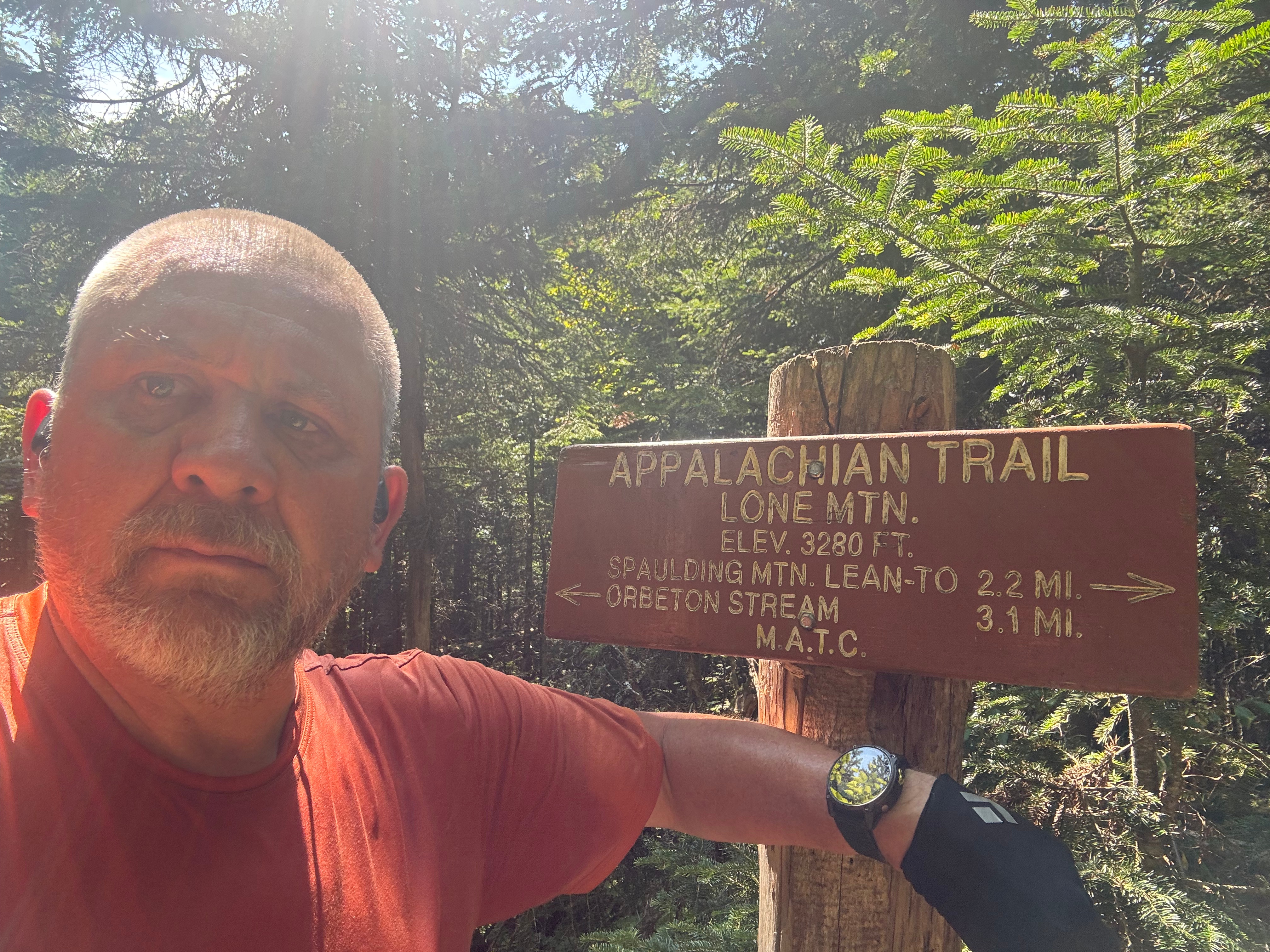
Summited Lone Mountain at 1:45. We have 2.2 miles to camp. That was a hard climb. Last one for today unless we make a side trip to Mt Abraham. I’m not interested but Ed wants to. We will see in about a mile. I don’t think I have enough water for multi-mile side trip.
Chuck at the summit of Lone MountainEd contemplating life on Lone Mountain
Surprisingly had 2 bars cell on Lone Mountain so I had a nice call with Pitcrew. Also gave Hostel of Maine a heads up.
Last 2 miles weren’t bad relatively. Arrived at Spaulding Mountain lean-to (mile 1996.6) at 3:30. There are a pair of retired brothers from west Tennessee here. They are slowly section hiking the entire AT. They are SOBO at present. Chatted with them quite a bit.
There are 2 bars of cell service surprisingly. Texted with Hostel of Maine and booked 2 bunks in bunk room. Since we are adding a day to this part of the hike, we arrive on a Friday and they are nearly full. Glad I reached out today!
Rained at 5:20. Gonna rain on and off this evening. Five other hikers showed up over the course of the evening. All tenters. Had some good conversations.
Overall about a dozen people here tonight. Far cry from the 1 or 2 that I would see last year. In bed at 7:30 and read for an hour.
Day 2 Map – Poplar Ridge Lean-To to Spaulding Mountain Lean-To
Tuesday, August 12, 2025. Up at 5:30. Clear and getting up to the low 90s and dry.
It was so hot on the top bunk that I gave up and slept on the cabin floor with the door partially open to allow cool air in. Got about 4 hours of sleep. Not great, not terrible.
100 Mile Wilderness Adventures, Monson Maine
It’s so warm already that I decided on light shorts. Not bothering with my convertible hiking pants for today. It is supposed to cool off in 2 days after a storm front moves through.
Packed up. Topped off on water. Left my travel pack in Ed’s car. Generally got ready for our next 8 days on the trail.
Barry picked us up at 6:30. We stopped in Monson for coffee and drove to the trailhead at Maine Rt 4 (mile 1977.9) near Rangeley, Maine.
Started on the trail at 8:30. Hiking through pine forests and ferns most of the day with a lot of uphill the first 2/3 of the day.
Appalachian Trail Sign Rangeley Maine
The trail is not too rocky, but it is steep! Ascended 1260 feet in the first 3.7 miles. We have 3000 more feet to go today and the nasty incline is still a ways off.
Ed climbing the trail NOBO near Rangeley Maine
Passed by Ethel Pond at 10:00. Stepped aside to let a group of 4 thru-hikers pass by NOBO.
Ethel Pond
Stopped at Eddy Pond to fill up on water before we ascend into the alpine area for the next 6 miles. Had a snack while enjoying the view. Crystal clear alpine pond nestled up against some low mountains. There are 4 canoes here with paddles and life vests. According to comments, they have been here for years and people can use them on the pond.
Eddy Pond with CanoesEddy Pond clear view
Back on the trail at 11:15. Time to start the big ascent to Saddleback Mountain.
That last pond looks a lot smaller from above tree line.
Looking down SOBO on Eddy Pond from the ascent up Saddleback Mountain
Summited Saddleback Mountain (4126 feet) at 1:15. That was a bitch of a climb. Lots harder than last year. Guess I had been hiking for 5 months before I got here last year so I had my trail legs.
Ed and Chuck nearing the summit of Saddleback MountainEd on the summit of Saddleback Mountain
Had a light lunch, talked to some day hikers and thru-hikers, then moved on at 2:00. We still have 7.8 miles to go to reach camp.
Reached the summit of The Horn (4017 feet) at 3:20. Hard steep climb after a challenging decent from Saddleback. Basically we just walked down and back up both sides of a big saddle.
Looking back SOBO at the trail between Saddleback Mountain and The Horn
Getting low on water and no good water source for 2.5 miles. We have a nasty decent, then one more steep ascent up Saddleback Junior then down to a stream. Not sure we are going to make it 6.3 more miles to our primary campsite. Probably stay at our alternate site in 3.4 miles.
Map view of Saddleback, The Horn, and Saddleback Junior.
That last 3.4 miles kicked our asses. Steep up and down with some treacherous and scary downhill parts. We gave up on the primary plan and settled for Poplar Ridge lean-to at mile 10.7.
We stopped 3.6 miles short of camp and hiked .2 miles to get sketchy water. Glad we did because we were almost out and the next water was not until 1 mile from camp and so sketchy. I have drank worse, but not in a long time.
Shallow nasty water before ascending Saddleback Junior
We summited Saddleback Junior at 6:15. We need water before camp and we will be pushing hard to make camp before dark! Not good.
Got bad water (muddy and stagnant) 1 mile from camp and carried an extra 2 liters to camp, ouch. Glad we did because spring at camp is dry.
Got to Poplar Ridge Lean-To (mile 1988.6) at 7:30. There are 4 tenters here already in bed. We took the shelter as there are no more camp sites. Made dinner in the dark at 8:20. Surprisingly I had a good appetite. All settled into my bed at 9:00. Gonna read for a while.
Overall a good day and a frustrating day. Good because that was a damn hard day and all the other thru-hikers agreed. We made it to our alternate site as planned. Not many idiots try a day like this as their first big day on the trail. I’m sore but don’t feel bad. Frustrated because I was so slow today. One mile per hour! Which got us to camp way too close to dark for my risk tolerance.
We are changing our plans for tomorrow and going for an 8 mile day.
Up at 6:00. Ed and I had coffee and ordered breakfast to go from Wawa. Said goodbye to Lisa and got on the road at 7:15.
Uneventful 11 hour drive. Went from this view of the New York skyline…
New York City Skyline
To this view of a camp in Monson, Maine…
Monson Maine Campground
Arrived at 100 Mile Wilderness Adventures in Monson at 6:30pm. Chatted with the owner and headed to the deli in town for takeout dinner before they closed at 7:30. Had a nice dinner while chatting with the hostel caretaker for a few hours.
We split a nice little 2 bunk cabin. Unfortunately Maine is having a heat wave. It was 93 here today. Insane for this time of year up here. Very dry as well. Poor ventilation in the cabin and can’t leave the door open due to mosquitoes.
Cabin at 100 Mile Wilderness Adventures, Monson Maine
Our ride picks us up at 6:30 tomorrow morning. Looking forward to 3 hard days starting tomorrow. In theory we will be back here in 8 days, but I won’t be surprised if it takes 10 days.