Tag: Virginia

  • Day 82 – Lewis Mountain campground to Rock Springs Hut

    Day 82 – Lewis Mountain campground to Rock Springs Hut

    Today’s Miles: 12.5

    Trip Miles: 938.8

    “Just about 200 years ago, they signed that declaration

    Tellin’ everybody in the whole wide world

    They’re gonna start a brand new nation

    From that day on, the Fourth of July has been a holiday

    To the rich man, poor man

    And everybody else but the cowboys in the RCA” – Chris Ledoux

    Up at 6:00. Out at 7:35. Glass, Polar, and Newt left about 7:15 and headed to pamper themselves at Skyland Resort today.

    Fun rock scramble this morning on Bearfence Mountain.

    Overkill rock scrambling on Bearfence Mountain
    Overkill at top of Bearfence Mountain
    Overkill descending off of Bearfence Mountain

    Stopped for a snack break at 10:30. And a random rabbit.

    Random rabbit in Shenandoah

    Mileage graffiti next to a parking lot. 925 miles down and 1269 miles to go. Well, close enough. Those numbers are a year or two old.

    Helpful Mileage graffiti

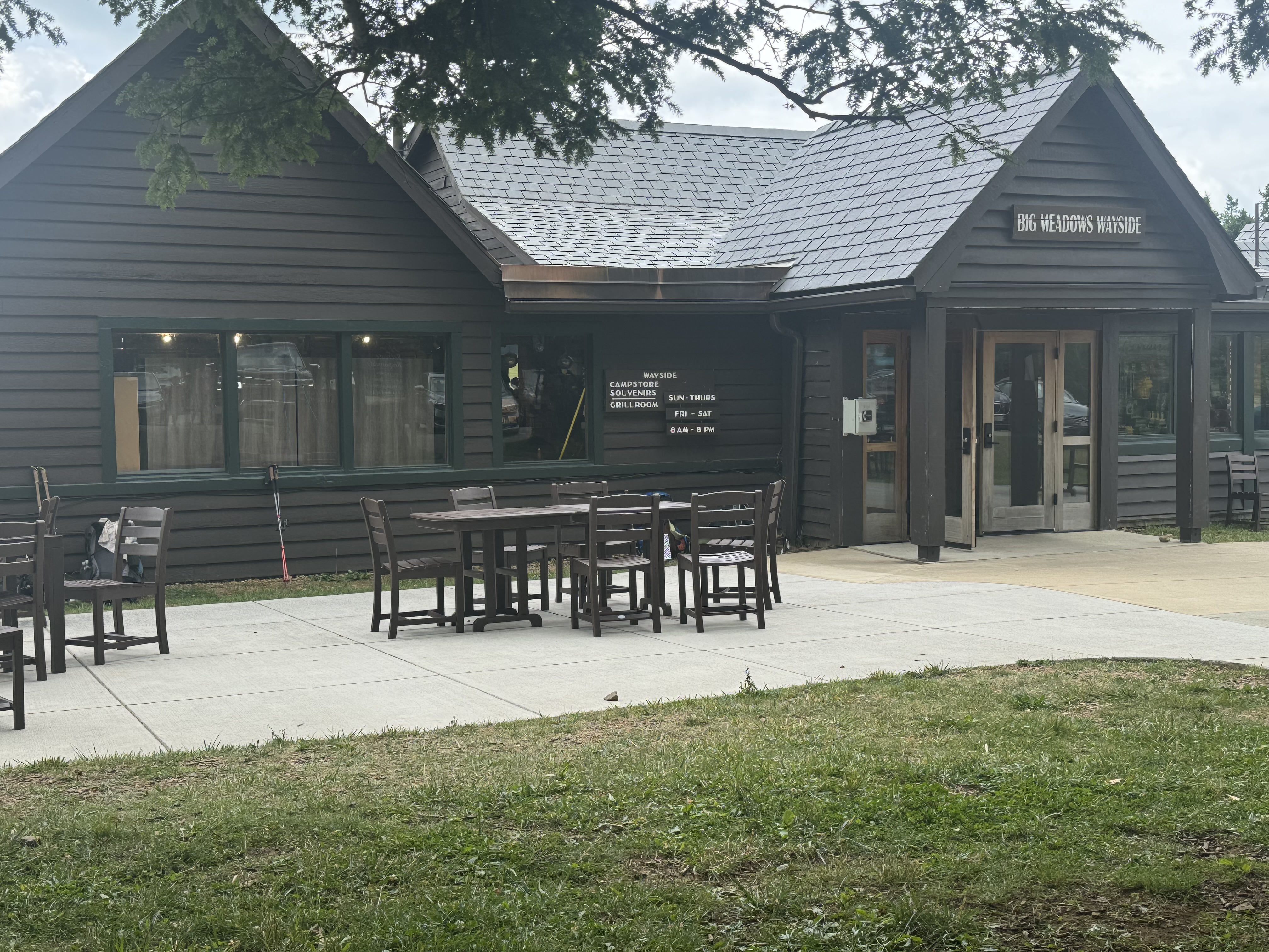
    Got to Big Meadow Wayside at 11:50. Time for food and blackberry milkshakes!

    Big Meadow Waysid

    Resupplied for the next 3 days. Not counting on quality resupply other than snacks at the next two waysides. The brothers showed up as we were finishing our lunch. They are headed to the same shelter as us for tonight.

    The rain got here at 2:00. We are just hanging out at the Wayside until the worst of the storm passes. Us and a ton of civilians. We have 5 miles to go to reach our shelter for the night. And it’s uphill the last mile again. 

    We left  in drizzling rain at 3:00. Stopped by Big Meadows Lodge just to check it out.

    Big Meadows Lodge

    Then hiked up to Blackrock Overlook for a great post-storm view of the Shenandoah Valley.

    Blackrock Overlook
    Chuck at Blackrock Overlook

    We have a relatively easy 3.9 miles to Rock Spring hut. Should be there about 4:45. Not sure if I will use the hut or pitch my tent. 

    Ran across Mom and two babies with no fear of people.

    Mom and two babies

    OMG is it hot! After the storm, the sun came out, and I can literally see the steam rising from the forest. 

    Got to Rock Spring hut at 5:50. One other person here, and the brothers are tenting here. One bar cell and good cold water. It’s ridiculously humid and has zero air movement. Everything we wore is soaked, and there is no chance of drying tonight. Welcome to July in the mid-Atlantic!

    Rock Spring hut

    Got settled in and made dinner at 7:00. It rained again, but it was slow and steady as opposed to the downpour this afternoon. I took an upper bunk in the shelter. It’s two-tiered and can sleep 8-10 comfortably.

    Day 82 Map – Lewis Mountain campground to Rock Springs Hut

    Technical Notes:

    • Pop-Tarts 370
    • Hershey bar 210
    • Sausage snacks 300
    • Skittles 100
    • Sausage snacks 140
    • Skittles 70
    • Blackberry milkshake 400
    • Cheeseburger 600
    • Root beer 260
    • Fritos 370
    • Blackberry milkshake 400
    • Backpackers pantry: Santa Fe rice and beans 590
    • Pringles 300
    • Water liters: 4
    • Miles: 12.6
    • Time: 8
    • Elevation gain: 2219
    • Calories consumed:  4200
    • Calories burned: 5700
  • Day 81 – Hightop Hut to Lewis Mountain campground 

    Day 81 – Hightop Hut to Lewis Mountain campground 

    Today’s Miles: 11.6

    Trip Miles: 926.3

    “You know what, Stuart? I like you.

    You’re not like the other people here, in the trailer park.” – The Dead Milkmen

    Mostly sunny, windy, 67 going up to low 80s.

    Up at 7:45. Ate, packed, and hit the trail at 9:20.  Nice lazy morning as we only have about 12.5 miles today. 

    Starting the day with a .7-mile steep climb to the top of Hightop Mountain. This will be the worst climb of the day.

    View from Hightop Mountain
    Black snake in Shenandoah

    Crossed US 33 and Skyline Drive at 10:45. Went to the entrance station to get water and have a second breakfast.

    Water at entrance station at US 33 and Skyline Drive

    Stopped at the South River picnic area at 12:40. 6.5 miles down, 5.2 more to Lewis Mountain campground. We watched 4 different women walk up to the pit toilet building, open the door, look in, shake their heads, and walk away. We used the same toilet and thought, this is pretty nice for a park toilet. Damn civilians.

    South River picnic area

    Stopped to get water at 2:30. We have 2 miles to the camp store. 

    Got to Lewis Mountain campground at 3:40. Got some trail magic from a fellow hiker and his family. We got a campsite for $30 and were all set up by 4:30. Picked up some small resupply at the camp store. Need a few things. Will do a big resupply tomorrow at Big Meadow Wayside.

    Lewis Mountain campground tent setup

    We had 3 other hikers ask to share our camp space tonight. Folks we have spent time at shelters with on and off for the past week or so: Glass, Polar, Newt. One tent and two cowboy campers.

    Newt, Glass, and Polar joined us in the camp site
    Newt, Glass, and Polar joined us in the camp site

    YouTube video of Lewis Mountain campground.

    Technical Notes:

    • Pop-Tarts 370
    • Mini donuts 450
    • Little Debbie oatmeal pies 240
    • Turkey sausage 120
    • Cheese crackers 250 
    • Trail mix 300
    • Sausage 150
    • Cupcakes 400
    • Root beer 220
    • Sandwich 360
    • Sandwich 360
    • Seltzer 600
    • Cupcakes 400
    • Pringles 400
    • Water liters 2.7
    • Miles 11.6
    • Time 6
    • Elevation gain 2768
    • Calories consumed  5300
    • Calories burned 5400
  • Day 80 – Blackrock Hut to Hightop Hut

    Day 80 – Blackrock Hut to Hightop Hut

    Today’s Miles: 21.3

    Trip Miles: 914.7

    “Cause I love the long shots, and the left-out lost causes

    And hangin’ out in the back of the pack with the dark horses

    I ride the wrong road just as fast as I can

    And God knows there’s no one else to blame

    Sometimes I think I get off on the pain” – Gary Allan

    Upper 50s going up to mid-80s, low humidity, mostly sunny, nice breezes. Perfect hiking weather. 

    Up at 6:15. On trail at 7:20. 21.4 miles today with a camp store and a wayside at the 1/3 mark. Super excited.

    Ran into a massive rock field at about 1.5 miles. Glad I did not have to walk that…yet. That starts in northern PA.

    Rock slide in Shenandoah

    Took advantage of a picnic area at 8:30  for a snack, ditch trash, and use the privy. Nice picnic area and clean bathroom …for a pit toilet it was clean. 

    First picnic area in Shanendoah

    We road walked on Skyline Drive for about 2 miles to avoid a big trail climb. Only saw 3 cars. That will change in 2 days as July 4 approaches. We expect BIG crowds in the park for the long July 4 weekend.

    A damn bee stung me through my sock. Ouch. What did I do to him to deserve that?

    Shortcut by the amphitheater at Loft Mountain. It’s a beautiful day. Almost to the camp store for a break and resupply.

    amphitheater at Loft Mountain

    Arrived at the Loft Mountain camp store at 10:30. Did a 1.5-day resupply. Trying to keep it light. Picked up a Hershey bar and a fresh cup of coffee. Overkill took the opportunity to borrow an outlet and charge some electronics. Texted with Vick and she is going to join us for lunch in Front Royal on Monday. Sweet!

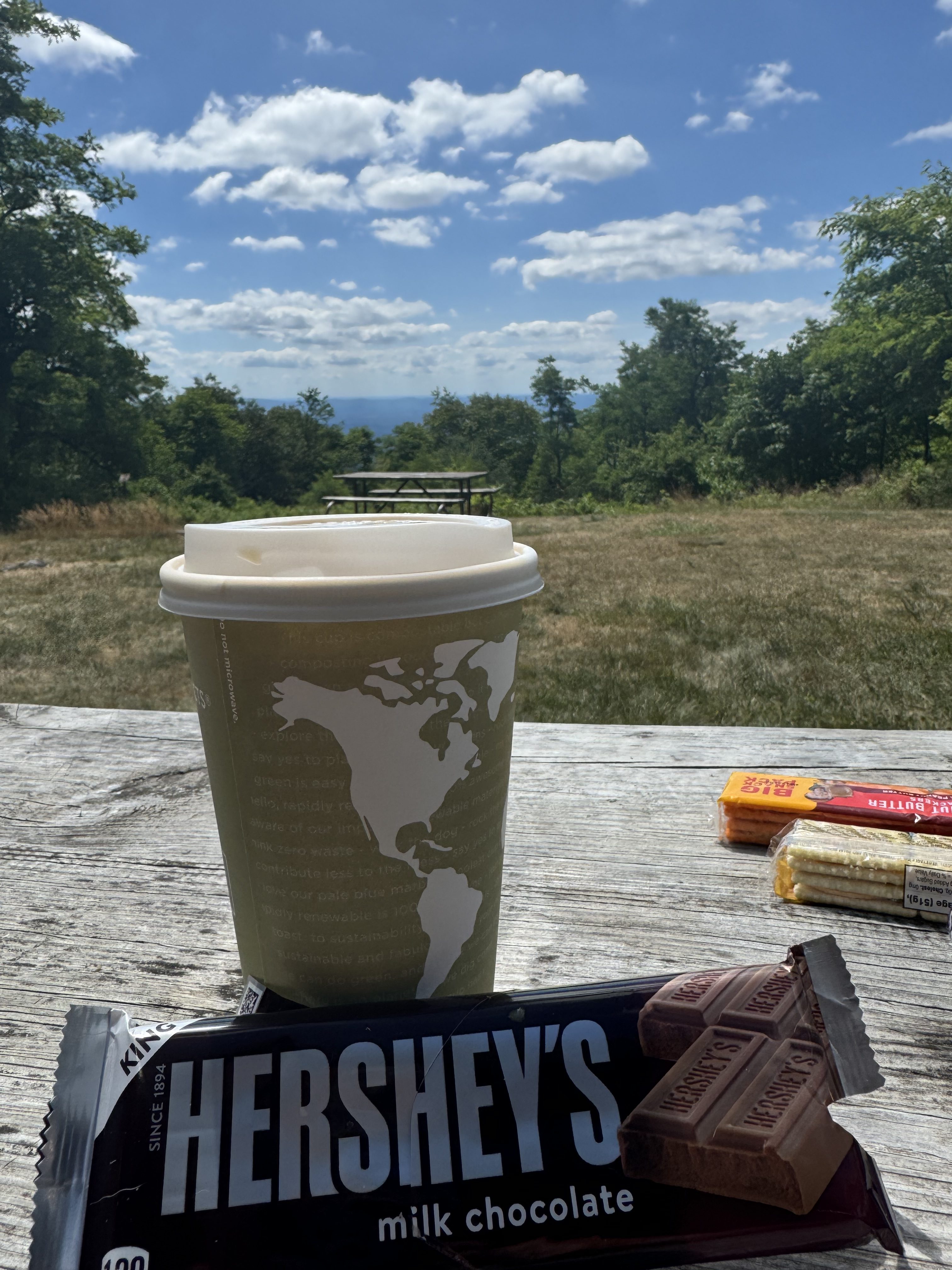
    Sat and drank my coffee and ate my Hershey bar with this view before heading to the grill at the Wayside. Nice!

    Coffee, Hershey Bar, nice view for breakfast

    Headed to the Wayside for brunch at 11:30. Easy walk downhill. Good food, not much resupply, hiker trash infestation.

    Loft Mountain Wayside

    This is lunch part 1.

    Loft Mountain Wayside lunch part 1

    And this is lunch part 2.

    Loft Mountain Wayside lunch part 2

    Saved the chips for snacks later in the day. Headed out at 12:50. We have about 13.5 more miles to go today. Hope to be to camp by 7:30.

    Stopped at an overlook on the BRP for a snack and a break at mile 11.8 for today. Nice view east to Grottoes. 

    Looking east towards Grottoes, VA

    Took a quick break at 3:30 at the summit of Weaver Mountain. We have 1.1 miles downhill to Simmons Gap Ranger Station where we can get potable water and take a good break. 

    We hit the 900-mile mark !

    900-mile mark

    At 4:10 we stopped for water and a break at Simmons Gap Ranger Station. It’s a beautiful afternoon.

    Simmons Gap Ranger Station

    Back on trail at 4:30. We have 6.4 miles to go to camp.

    Took a good break at 6:00. We have 3.4 more miles to go mostly up.

    Break and snack at 7:00. 1.8 more to go

    Last 1 mile was a real bitch of an uphill. Just what we needed to end the day.

    Got to Hightop Hut at 7:55. One bar cell service. Nobody else here so far.

    Camp setup and starting dinner at 8:30.  

    We ended up with the entire campsite to ourselves. Us and the RATS in the shelter. Yuck! Ate dinner and in bed in my tent at 9:45.

    Long day but good day. The stops at the camp store and the Wayside were great. Really broke the day up plus ….food! At one road crossing later in the day people stopped their truck and offered us water and snacks. Very nice. 

    In our last 6 hiking days we have 2 days in the 19 range and 4 over 20. We are feeling those miles. For the next 5 days we will be staying under 15 per day. Trying to actually enjoy the scenery and amenities in Shenandoah a bit and take it a little easier on the body.  We will reach Lewis Mountain campground in about 6 hours tomorrow…call it 2:00. More resupply and snacks there. Will be in our camp for the day by 3:00 or 4:00. Yey!

    We should start really seeing the crowds tomorrow. Tons of July 4th tourists.

    Day 80 Map – Blackrock Hut to Hightop Hut

    Technical Notes:

    • Pop-Tarts 370
    • Little Debbie oatmeal pie 240
    • Skittles 80
    • Turkey sausage 80
    • Skittles 40
    • Coffee 0
    • Hershey bar 360
    • Root beer 150
    • Italian sausage 500
    • Root beer 150
    • Hotdog 314
    • Skittles 100
    • Cheese crackers 250
    • Skittles 50
    • Turkey sausage 120
    • Skittles  110
    • Trail mix 270
    • Chips 150
    • Backpackers Pantry Santa Fe rice and beans 590
    • Chips 150
    • Fritos 500
    • Water liters 5
    • Miles 21.7
    • Time 12
    • Elevation gain 4824
    • Calories consumed  4750
    • Calories burned 7500
  • Day 79 – Rockfish Gap to Blackrock Hut

    Day 79 – Rockfish Gap to Blackrock Hut

    Today’s Miles: 20.9

    Trip Miles: 893.4

    “Almost heaven, West Virginia
    Blue Ridge Mountains
    Shenandoah River –
    Life is old there
    Older than the trees
    Younger than the mountains
    Growing like a breeze” – John Denver

    Sunny with a high of 78. 

    Up at 6:15, on the road at 7:35. Got to the trail and did some stretching. Researched back stretching. Will see if any of it helps. 

    OMG does my pack feel heavy after slackpacking several days. Carrying 2.7 liters of water does not help. 

    We are off at 7:52 on our next big leg of this adventure. The Shenandoahs beckon us.

    Welcome to Shenandoah National Park

    Stopped for a snack at 8:55 and 2.4 miles. Breezy and low 70s…actually chilly!

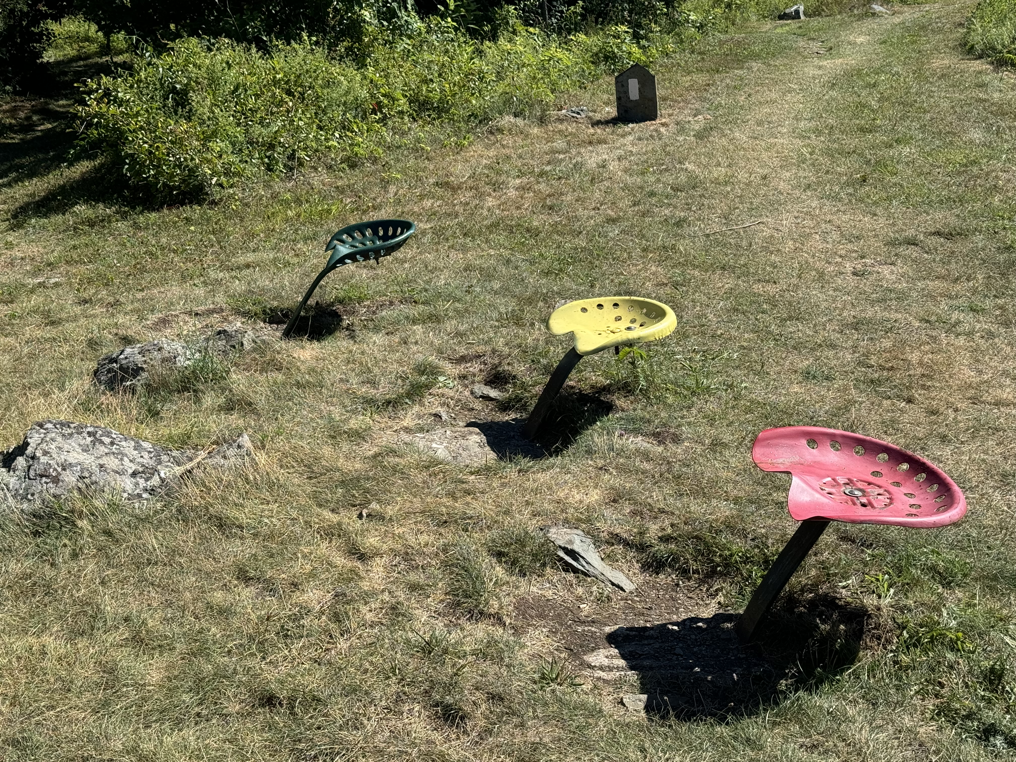
    Stopped for a quick break at 10:20 and 5 miles on Bear Den Mountain. We are at the big communications towers and weather radar installation and the famous tractor seats. Great place to sit.

    Communication towers on Bear Den Mountain
    Tractor seats on Bear Den Mountain

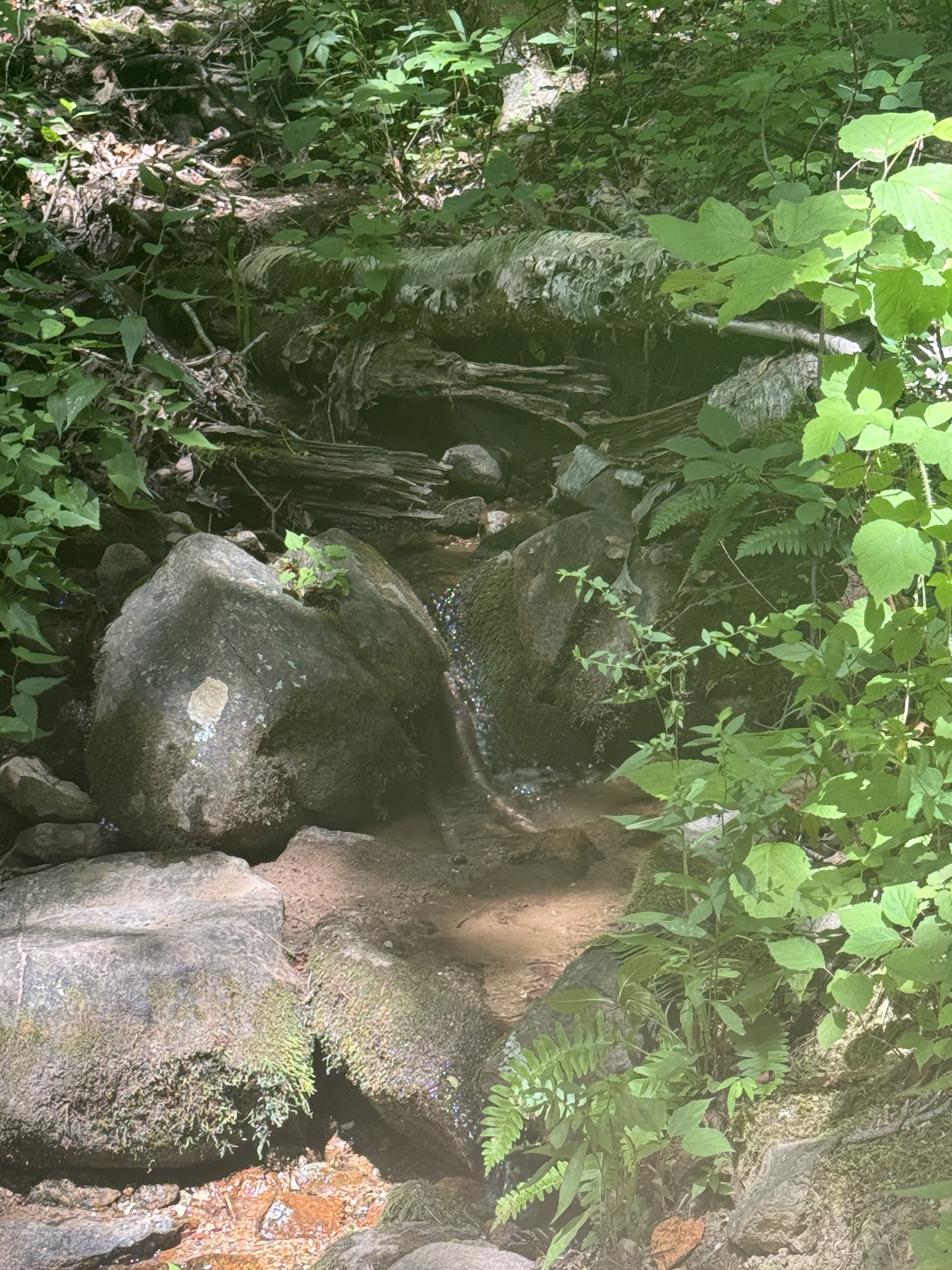
    Crossed over Little Calf Mountain and Calf Mountain around  11:45. Stopped for water at a spring .2 miles off trail at 12:05. Had lunch at the spring before getting back on trail at 12:45

    Piped spring neara Calf Mountain

    Took a break at 3:15.

    Took a break at 4:30.

    Had an interesting encounter with a doe. She has no fear of people.

    YouTube video of deer 

    Took a break for water at 5:45.

    Low bridge.

    Low bridge

    Got to Blackrock Hut at 7:30. There are a dozen of us here. No room in the hut. Set up tent and finalized camp by 8:00. One bar cell service and good water supply at camp. Made dinner and got settled into tent by 9:05. 

    Long day without much to see. At least the weather was nice. Another even longer 22-mile day tomorrow. But we have a wayside at mile 7 for resupply and a hot lunch!!! Will be eating at waysides and camp stores almost daily starting tomorrow. Hope to leave camp by 7:00 so we can get to shelter by 6:30  tomorrow evening. Easier days after tomorrow.

    Back hurt a bit later in the day, but not as bad as the last few days.

    Day 79 Map – Rockfish Gap to Blackrock Hut

    Technical Notes:

    • Mini donuts 190
    • Half a waffle 400
    • Little Debbie oatmeal pie 240
    • Payday mini 90
    • Skittles 120
    • Turkey sausage x4 160
    • Payday mini 90
    • Payday mini 90
    • Turkey sausage x4 160
    • Trail mix 200
    • Fig bars 200
    • Trail Mix 170
    • Fritos 500
    • Dehydrated Beef 165
    • Ramen 740
    • Water liters 4.7
    • Miles 20.9 + .4
    • Time 11:30
    • Elevation gain 4888
    • Calories consumed  4000
    • Calories burned 7500
  • Day 78 – Reid’s Gap to Rockfish Gap

    Day 78 – Reid’s Gap to Rockfish Gap

    Today’s Miles: 19.10

    Trip Miles: 872.5

    “I was just fifteen and out of control, lost to James Dean and rock and roll.

    I knew down deep in my country soul that I had to get away.

    Hollywood was a lady in red who danced in my dreams as I tossed in bed.

    I knew I?d wind up in jail or dead if I had to stay.

    I thought happiness was Lubbock, Texas, in my rearview mirror” – Mac Davis

    Mid-80s, rainy.

    Up at 6:15. Ate breakfast and got ready to drive to the trailhead. Left at 7:05 and got to the trail at 7:35. It’s still raining on and off. Will run into occasional rain all day, but it’s warm!

    Lol. Interesting trail magic as we crossed the BRP. Smoke ‘ em if you got ‘em. 

    Interestin trail magic

    Stopped at 9:05 and mile 3.6 at an overlook for a snack and a view. Back on the trail at 9:20.

    Day 78 view

    Got a great view of Wintergreen ski resort at mile 6.8. 

    Wintergreen ski resort

    Summited Humpback Mountain at 11:40. We have 11.2 miles predominantly downhill for the rest of the day.

    Got my first tick. He was just crawling on me.

    Got to the Paul C. Wolfe shelter at 3:00. Great water from the creek. We have 4.8 miles to go. Should be to Rockfish Gap about 5:30.

    Paul C. Wolfe shelter

    Saw a yearling bear just after the shelter. We scared it and it took off running. Young and gangly.

    Ran into a huge patch of wine berries. We ate our fill. Yum!

    huge patch of wine berries

    We got to Rockfish Gap at 5:30. We got a hot dog and a coke at a roadside stand while waiting for the shuttle. It was very hot this afternoon. Heat index at 100. 

    Overkill at Rockfish Gap
    Rockfish Gap

    Back to the hostel, arranged a shuttle to go back to the trail at 7:30 tomorrow, showered, did laundry, packed up my backpack. All ready to rock and roll in the morning. 

    Used a beard trimmer at the hostel just to clean things up a bit. 

    I’m trying not to carry much food into the Shennies as there are waysides and camp stores almost daily after the first day. I am carrying a bit too much, but better than some people I could mention 🙂

    I am excited to get into the Shennies. This is one of the big 3 parks on the AT. To a lot of us, it also marks the end of the boring, nasty central Virginia trek. The last 7-9 days have been boring, steep, hot, and pointless. They were just miles you had to do to get from southern Virginia to Shenandoah. And some of those were damn hard miles. We pushed big mileage days to get them done. They were like work every day. I’m happy to put central Virginia in the rearview mirror and say goodbye to Waynesboro.

    We have a kind of leisurely schedule for the Shennies. First day we need to do 21 miles because of water issues, but after that we re taking our time. We have an 11.5, 13, and 15-mile day planned. Shennies start what I consider to be the flat part of Virginia. From here on up to northern Pennsylvania, things are relatively easy. Emphasis on the word RELATIVELY. Even the Virginia rollercoaster is easy compared to what we have done. More on that later.

    If my back would stop hurting every day, we would be cursing even on the hard days. I just can’t figure out how to get my back to behave. I will start taking ibuprofen and trying to stretch more, but this has been going on for about 3 weeks and seems to be getting worse. Even when slackpacking with a 10-pound pack.

    Side note…the brothers we have been hanging out with for the last week are on a different schedule starting tomorrow. They may catch up to us at some point in the future, but we said goodbye to them this evening just in case.

    The Brothers and Overkill
    Day 78 Map – Reid’s Gap to Rockfish Gap

    Technical Notes:

    • Mini donuts 600
    • Trail mix 270
    • Little Debbie oatmeal pie 240
    • Trail mix 270
    • Sausages 260
    • Sausages 260
    • Hotdog 375
    • Dr Pepper 150
    • Chocolate chip cookie 400
    • Dinner 1000
    • Seltzers 500
    • Fritos 500
    • Water liters 4
    • Miles 19.1
    • Time 10
    • Elevation gain 3000
    • Calories consumed  5000
    • Calories burned 7000
  • Day 77 – Zero in Waynesboro 

    Day 77 – Zero in Waynesboro 

    Today’s Miles: 0

    Trip Miles: 853.4

    Nice day off in Waynesboro, VA.

    Did laundry, flushed the water filter, cleaned gear, and posted a week’s worth of blogs. That last took all afternoon.

    Overkill and I resupplied at Walmart.

    Overkill and I walked a mile to a great AYCE Chinese buffet for dinner. I was pleasantly surprised by the variety and quality. Really good food. 

    Got all my gear packed and arranged a shuttle to take us to the trail at 7:30 a.m.

    Technical Notes:

    • Mini donuts: 600
    • Burrito: 760
    • Body armor: 40
    • Fruit: 200
    • Chocolate chip cookie x2: 400
    • Seltzer: 300
    • Chips: 1000
    • AYCE Chinese: 3000
    • Water liters: 
    • Miles: 
    • Time: 
    • Elevation gain: 
    • Calories consumed:  6500
    • Calories burned: 
  • Day 76 – Spy Rock Road to Reid’s Gap

    Day 76 – Spy Rock Road to Reid’s Gap

    Today’s Miles: 19.6

    Trip Miles: 853.4

    Up at 5:00. Packed up all the gear I’m NOT slackpacking with and loaded it in the van to go to Waynesboro. Left the hostel for the trail at 6:20.

    We got dropped off at 7:15 about 1.1 miles from the trail. There is a private road, Spy Rock Road, that allows hikers access but no vehicle access to the trail.

    Today will be a tough hike. We have 6000 feet of descents followed by a 6-mile 3300-foot climb up to Three Ridges. 19.7 miles plus the 1.1-mile walk up Spy Rock Road. Temps might stay in the low 80s , so we got that going for us.

    Got on AT at 7:52. Overkill realized she lost her water bottle with her Sawyer filter. My bet is it fell out in the shuttle. She has 2 spare water bottles and can use my filter today. She had enough cell service to order a new filter to get delivered to the hostel in Waynesboro tomorrow.

    9:00 quick snack.

    The Priest Shelter

    Stopped at Priest Shelter at mile 4.3 at 9:50. Had a snack and got water from the spring. This place had the best privy on the AT. Confessed our sins to the Priest. Back on the trail at 10:30.

    To clarify, it is a tradition for thru-hikers to update the shelter log at the Priest Mountain Shelter with any sins they committed on the trail so far. Hence confessing to the Priest. There is some seriously funny stuff in that logbook.

    Got to the Tye River at 12:40 and 9.1 miles. Passed an 80-plus youth group on the trail. Got cold water from their support team at the base of the mountain. Took a 10-minute good break.

    Got to Harper’s Creek shelter at 2:00 and mile 11.8. This is the last water for the rest of the day.

    Water near Harper’s Creek shelter

    And now for the fun part of the day for the next 3.4 miles. Back on trail at  2:25

    Day 76 – 3.5 mile descent

    Summited Three Ridges at 4:22. Texted the hostel with our ETA of 6:30 for a shuttle. That was a nasty climb. We knew it was long and steep, but good god the rocks! There were multiple places that were 80+ degrees of rock inclines. Wasn’t expecting that!

    We hauled ass as best we could. The last 3 miles were a death march. We got to the parking lot at 6:20. The other pair of hikers we are with from Stanimals got there 20 minutes ahead of us. We all agreed that today was one of the hardest days we have had in a long time. We are all looking forward to a zero tomorrow. 

    Shuttled to Stanimals in Waynesboro. Arrived at 7:00 ish. Showered and wandered into town for dinner at the Tailgate Grill about 3 blocks from the hostel. My kind of place. Great burgers.

    Very tough day. Many people told us that this was one of the hardest sections in Virginia. This made 5 big days in a row…117.1 miles in 7 days and some of them were very big ascents and descents.

    The vibe at Stanimals is interesting. Very much the commune vibe. Lots of pot and shrooms, but not obnoxiously so. Chill vibe from the other hikers and the staff. Lots of vortexing happening.

    And again to clarify. Vortexing is when you get sucked into a hostel/town for several days instead of hiking out the next day. 

    Hanging out at Stanimal’s Waynesboro
    Day 76 Map – Spy Rock Road to Reid’s Gap

    Technical Notes: 

    • Pop-Tarts 380
    • Little Debbie oatmeal pies 340
    • Body armor 120
    • Trail mix 200
    • Peanut butter crackers 250
    • Sausages 390
    • Sausage 130
    • Sausage 130
    • Fig bar 210
    • Bacon double cheeseburger 600
    • Fries 400
    • Twix 440
    • Seltzer 300
    • Chocolate chip cookies 300
    • Water liters 5
    • Miles 19.6 + 1.1
    • Time 11
    • Elevation gain 5473
    • Calories consumed  4400
    • Calories burned 8000
  • Day 75 – Spy Rock Road to Glasgow, VA

    Day 75 – Spy Rock Road to Glasgow, VA

    Today’s Miles: 16.3

    Trip Miles: 833.8

    Up at 5:00. Thunderstorms and rain last night cooled things off a bit. Should be in the mid-80s and partly cloudy today. That was the first rain in several weeks. 

    Headed out to the trailhead at 6:15. There was a tree down on the BRP as we drove to the trailhead this morning. The 8 of us manhandled it out of the road. Little upper body workout to start the day. And we had to stop to get a baby raccoon out of the middle of the road. Getting good karma this morning.

    We got dropped off at 7:15 about 1.1 miles from the trail. There is a private road, Spy Rock Road, that allows hikers access but no vehicle access to the trail. The walk up to the trail is a good warmup….so I am telling myself.

    Walk up the road to Spy Rock

    On the trail at 7:45. The hike today is much easier than yesterday. Two good climbs but only about 1.2 miles each and not insanely steep. 

    Stopped for a snack at 8:30 and 2.0 miles in.

    Got water at mile 3.

    Stopped for food at 11:50 at mile 9. Back on the trail at 12:05.

    Summited Cole Mountain at 1:25 at 11.2 miles. We have 5 miles to go.

    We saw a big rattlesnake across the trail around 3 miles left to go. About the size of my upper arm and 4-5 feet long. Took a bit to get him off the trail.

    Day 75 rattlesnake

    YouTube video of the Rattlesnake 

    We met The Rascals for the first time today (Glass, Newt, Polar, 23). I will see them a lot on and off for the next 3+ months.

    Got to trailhead at 3:50. Good day. Back hurts though. I moved my hip belt lower on my pack about 2-3 inches (as far as it goes). Will see if the longer torso on the pack will help.

    Overkill and I went to the restaurant for dinner at 5:30, then picked up a few groceries. Got mostly packed up for the transfer to Waynesboro tomorrow. Got online and paid the monthly bills. Had a long call with Dana, then hung out till 10:00 when I went to bed. 

    We need to nail down hotels for Front Royal and Harpers Ferry as those both fill up fast with tourists this time of year. We can do that on our zero in Waynesboro.

    Day 75 Map – Spy Rock Road to Glasgow, VA

    Technical Notes:

    • Pop-Tarts 380
    • Blueberry pancakes with syrup 400
    • Sausages 650
    • Little Debbie oatmeal pie 340
    • Fig bar 200
    • Trail mix 500
    • Dr. Pepper 150
    • Italian sub 1200
    • Onion rings 400
    • Pringles 400
    • Cider 700
    • Water liters 4
    • Miles 16.3  + 1.1 + .6
    • Time 8:10 + 30
    • Elevation gain 3100
    • Calories consumed  6000
    • Calories burned 6700
  • Day 74 – US 60 Long Mountain Wayside to Glasgow, VA

    Day 74 – US 60 Long Mountain Wayside to Glasgow, VA

    Today’s Miles: 22

    Trip Miles: 817.5

    Up at 5:00. Had blueberry pancakes for breakfast courtesy of the hostel. We headed to the trailhead at US 60 at 6:05. Should be about a 40-minute drive.

    Clear, hot, going up to 98.

    We were on the trail at 6:45. We need to be done before 6:00, which means we have less than 11 hours to do 22 miles. More like 9-10 hours. We have one big 5-mile climb midday. Overall, we need to move quickly today…3 miles per hour where possible.

    Got to Brown Mountain Creek Shelter at mile 1.9 at 7:20. Back on the trail at 7:30.

    Stopped at mile 5.1 at 8:30 to get water at a very dry “cascade”. Not the best flow, but Overkill was able to collect 2 liters with some patience.

    Dry Cascades

    Stopped at mile 10.7 at 11:30 for water and food. Very good water flow here, so we topped off. No water for the next 9 miles. We are just about halfway after 5 hours. Back on the trail at noon.

    Dry Cascades

    We just don’t make the kind of time on the trail that the younger folks do. We are staying around 2 mph average. No way we are finishing by 4:00. Lucky if we make 5:00. I’m not unhappy with our pace, just in slight awe of those who are doing 3 mph even in these mountains.

    Just after lunch, we have a nasty climb. It’s only .9 miles, but it’s 832 ft/mile….ugh. This will take us past Punchbowl Shelter. 

    Nasty descent past Punchbowl Shelter

    And immediately after that climb, we ascend Bluff Mountain. Another .9-mile climb but only 704 ft/mile.

    Nasty ascent up Bluff Mountain

    Summited Bluff Mountain at 1:15. 

    Summit of Bluff Mountain

    Took a snack break at 1:30. We have 8.7 miles to go by 5:00. Mostly down…some of it VERY steep down. The sun and heat are brutal today. We need to be careful with water as what we got is all we get until just about the end.

    We got to the parking lot at 5:25. That was 22 miles in 10 hours and 40 minutes. We were the last ones back to the hostel by an hour. We just aren’t fast…we are slow and steady. 

    We crossed the 800-mile mark today. Woo hoo!

    The trail mix I got yesterday was a fail. There were chocolate chips in it. That did not work once it got hot today. I put it in the hiker box and I’ll buy some different trail mix tonight. I need to expand my selection of snacks as well. I might look into some bars or cookies. Will browse the store this evening.

    Success at the market. Trail mix without chocolate plus some fig bars, crackers, Little Debbie’s, sausages, and electrolytes. Got my slackpack all ready for tomorrow by 9:00 p.m. We have 17.5 miles to go tomorrow. 

    Got an hour to chill out before quiet time. In bed at 10:00.

    It seems like we have temporarily formed a new bubble. There are about 20 of us who are hiking around each other and leapfrogging each other for about two weeks. This includes Puzzler, Rose, Zach, Shaggy,  23, Tortilla, and several others. Partially because of the heat. People are doing shorter miles and hiking at night and split days. Also more slack packing and hostel time due to heat. The hostel in Glasgow is full again tonight. That is unusual for this time of year. My guess is things will spread out in the Shennies.

    Day 74 Map – US 60 Long Mountain Wayside to Glasgow, VA

    Technical Notes:

    • Pop-Tarts 380
    • Blueberry pancakes with syrup 600
    • Beef sticks 480
    • Cheese crackers 250
    • Trail Mix 370
    • Beef sticks 360
    • Trail Mix 500
    • Dr. Pepper 150
    • Chicken cheesesteak 750
    • Fried mushrooms 350
    • Cider 400
    • Water liters 5
    • Miles 22
    • Time 10:40
    • Elevation gain 4519
    • Calories consumed 4600
    • Calories burned 7400
  • Day 73 – Thunder Hill shelter to Glasgow, VA

    Day 73 – Thunder Hill shelter to Glasgow, VA

    Today’s Miles: 14.7

    Trip Miles: 795.5

    Up at 5:00. On trail at 6:20.

    Nice overlook at mile 774.2

    Day 73 view

    Stopped for snack and water at 8:00. So-so water. Had to scoop it.

    Started to see the evidence of the wildfire from last fall. NOT a controlled burn.

    Wildfire from 2023
    Wildfire from 2023

    Stopped for food and to fill water at mile  7.1 for today. We made reservations for bunks at Stanimals hostel in Glasgow. Shuttle should get us around 3:00 at the James River bridge. 

    This little girl wanted to join us for lunch.

    Lunch Visitor

    Walked through several miles of last fall’s wildfire. Very desolate.

    Wildfire from 2023

    Here is a view back to the FAA radar facility we hiked by late yesterday. Look closely in the top center to see the dome. Apparently, we hiked in a big horseshoe today.

    Looking back to the FAA radar facility

    Stopped at Matt’s Creek shelter at 2:00 for a quick break. We have 2 miles and 1 hour to our shuttle. Going to have to hustle.   We just descended almost 5000 feet and it was rocky, steep, and had big, sharp drops. Not fun! Levels out the rest of the way to our shuttle spot.

    Matt’s Creek shelter

    Crossed the James River on the footbridge in the hot afternoon. Made it to the shuttle at 2:57. Three minutes early 🙂 Grueling !

    James River footbridge
    Overkill crossing the James River footbridge

    That was a grueling 5171-foot descent. Most of the second half of the day was in the wildfire area. The pictures just don’t do justice to the burn areas or the regrowth. 

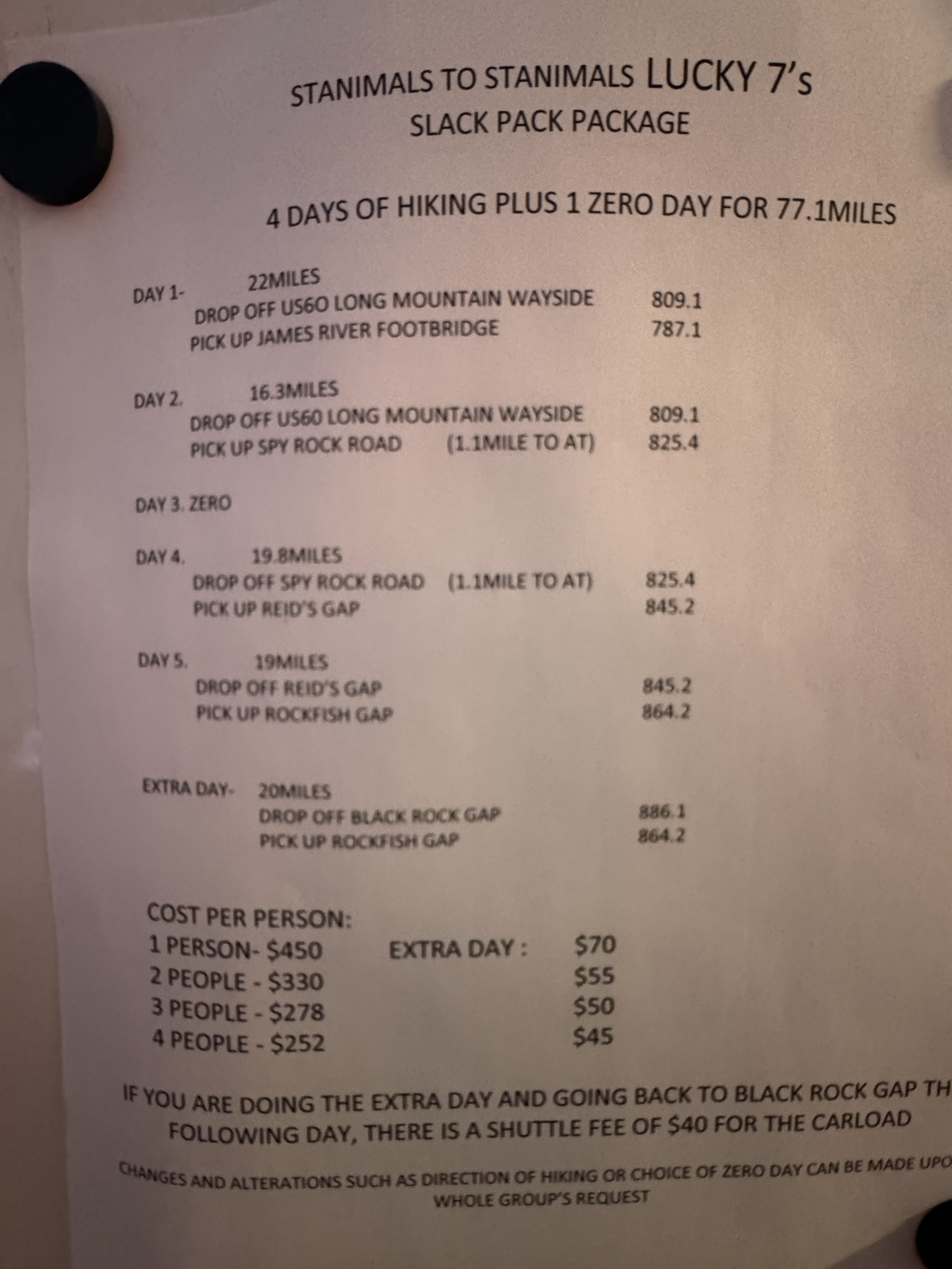
    We settled into the bunk rooms at Stanimals, showered, did laundry, went out for dinner, and bought basic supplies for tomorrow. The hostel offers a 5-day slackpack package from Glasgow to Waynesboro. First two nights at Glasgow, next 3 nights in Waynesboro including a zero day. $250 including a bunk, showers, and the driving. Not a bad deal since we were going to zero in Waynesboro anyway. The heat index is over 100 the next several days with some big climbs. Slackpacking those is going to help a lot PLUS these will be big 20-mile days which will SAVE us 1 day on our overall schedule. Anything that saves a day is a good thing.

    Got my big pack all set up for slackpacking tomorrow. We will be doing 22 very hot miles from US 60 back to Glasgow departing at 6:00 a.m.

    Day 73 Map – Thunder Hill shelter to Glasgow, VA

    Technical Notes:

    • Pop-Tarts 380
    • Pop-Tarts 380
    • Trail mix 200
    • Crackers 210
    • Snickers 220
    • Snickers 220
    • PayDay 240
    • Dr. Pepper 150
    • Dr. Pepper 150
    • Spaghetti 2800
    • Pringles 300
    • Gatorade 140
    • Water liters 5
    • Miles 14.7
    • Time 8:40
    • Elevation gain 1884
    • Elevation loss 5171
    • Calories consumed 5290
    • Calories burned 6500