
Tuesday, June 16. Clear and mid-40s going up to 65.
This is such a big and amazing day. I have to split it into two blog entries. I apologize in advance for all the scenery photos. This was the most amazing day on the PCT, and the only thing from the AT that is close is Mount Katahdin. The photos don’t do justice to the awe-inspiring scenery. In my opinion, this even puts the Tetons to shame.
Keep in mind that the only way to see any of this in person is to hike two days in and then two days out. No tourists, no helicopters, no other way to experience this.
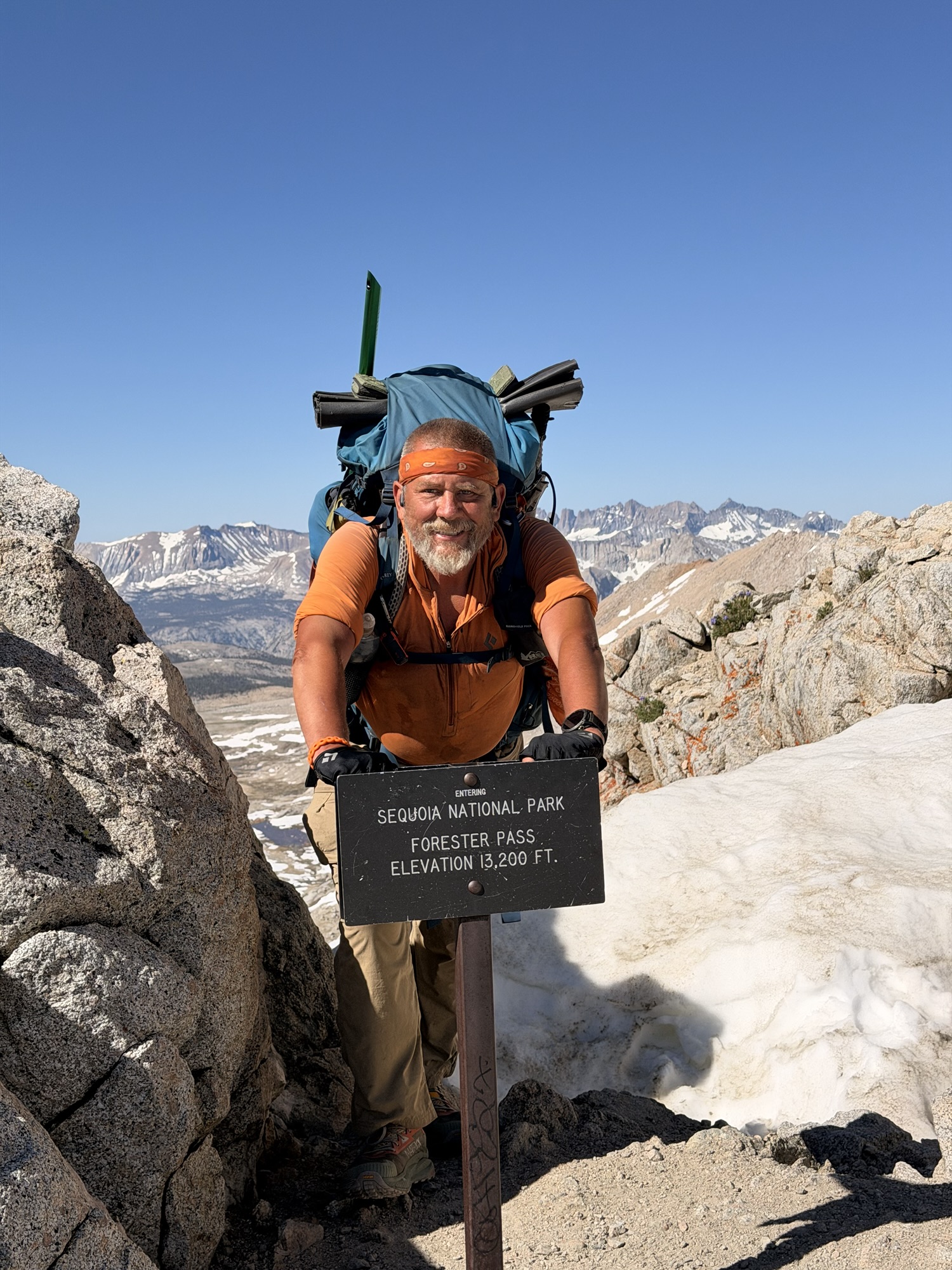
Up at 4:30. We have a big day. Up and over Forrester Pass. This is the highest point on the PCT at 13,200 feet. As previously discussed, we need to get up, over, and down before the sun warms up the snow. Margarita, Brad, and I hit the trail at 5:45.
I put together a largish video of the ascent, summit, and descent of Forrester. Thought I would try this as opposed to embedding lots of small video clips. Consider this video foreshadowing of the rest of this blog entry.
YouTube Video of Forrester Pass Adventure
We did the first water crossing of the day in our camp shoes .6 miles after starting the day.
YouTube Video of Day 54 First Water Crossing
We started the 5.5-mile ascent of Forrester about 6:30. We quickly climbed above the tree line into a land of boulders, snow fields, lakes, and little streams or small rivers of melting snow. The first few miles were a long, gentle grade.


We had to make our first snow traverse at 7:00 a.m. and 11,600 feet. The snow was still frozen and easy to cross without spikes.

There are several ponds and lakes on the ascent. A few are still sporting a layer of ice.

The view back to where we hiked this morning just kept getting better and better!

Around 8:15, we crossed a broad snow field and an ice bridge before starting the extremely steep switchback ascent up to the actual pass.


At 8:30, we finally got a good view of the actual pass. Thank god for switchbacks. The final ascent to the pass is almost vertical. And there is a snow traverse right near the top of the climb.


I reached the summit at 9:00. What a rush! The views are spectacular, and the thrill of climbing up here is indescribable. Who cares if there is no oxygen!


The view back south where we came from is great, but the view going north is spectacular.


Now that we are up here, we have to get down across a large, steep snowfield. Who knows the term “glissade”?
YouTube Video Glissading Down Forrester
We had a multi-mile hike through wet, slushy snow after the glissade. We wore our spikes. I potholed several times up to my knees and hips. Some slipping and falling as well. The goal is to stay in the old boot tracks and hope they are semi-frozen.


We got out of the big snow field around 10:00. We had more snow to descend through, but nothing like the last hour. Lots of rivers and ponds on this side of the pass from the snow melt too.


We took a long lunch break at noon. How about that view for lunch!


And this is a good place to break the blog into two parts!


Leave a Reply