Tag: North Carolina

  • Day 38 – Spivey Gap to Sam’s Gap

    Day 38 – Spivey Gap to Sam’s Gap

    Today’s Miles: 13.4

    Trip Miles: 341.4

    “And it’s a great day to be alive

    I know the sun’s still shining

    When I close my eyes

    There’s some hard times in the neighborhood

    But why can’t every day be just this good

    Ah, yeah” – Travis Tritt

    Patchy fog before 8 a.m., then a chance of showers and thunderstorms. Mostly sunny. High near 68, with temperatures falling to around 65 in the afternoon. West wind 0 to 5 mph. Chance of precipitation is 30%. New rainfall amounts less than a tenth of an inch possible.

    Up at 7:00. Used the bath house then packed my slackpacking pack and headed to the common room for a quick breakfast. Not a cloud in the sky. Going to be a great slackpacking day!! Owner drove me and Overkill to Spivey Gap at 8:05. Got on trail at 8:35.

    Spivey Gap is 13.4 miles back to Sam’s Gap. That 13.4 will be the first 1/2 up Big Bald then 1/2 back down the other side of Big Bald. 

    Stopped at High Rocks at 9:30 for water break and second breakfast. It’s just a great big rock in the shade. See fellow hiker lower right for perspective.

    High Rocks near Spivey Gap

    Stopped at Little Bald to enjoy the view. That’s Erwin, TN in the distance.

    View towards Erwin TN from Little Bald Mountain
    Chuck on Little Bald

    Had cell service up here and heard back from Uncle Johnny’s hostel in Erwin. I booked the last cabin for Wednesday and Thursday nights. Yes!

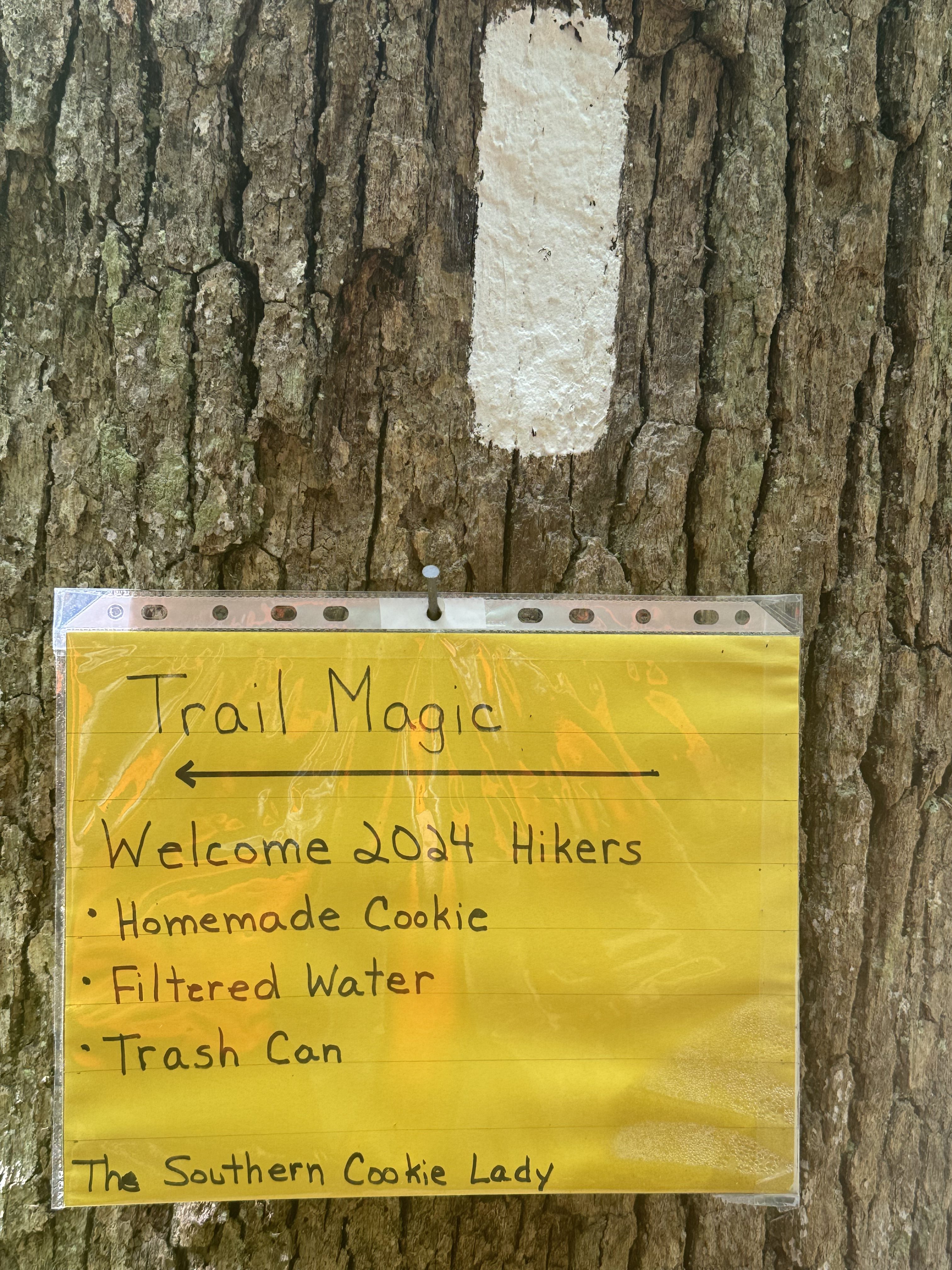
    Someone weed whacked the trail. This is awesome!

    They weed wacked the trail!

    Same someone maintains a nice shelter. Stopped at Big Bald Shelter at 12:15 for food and to resupply water.

    Big Bald Shelter
    Big Bald Shelter

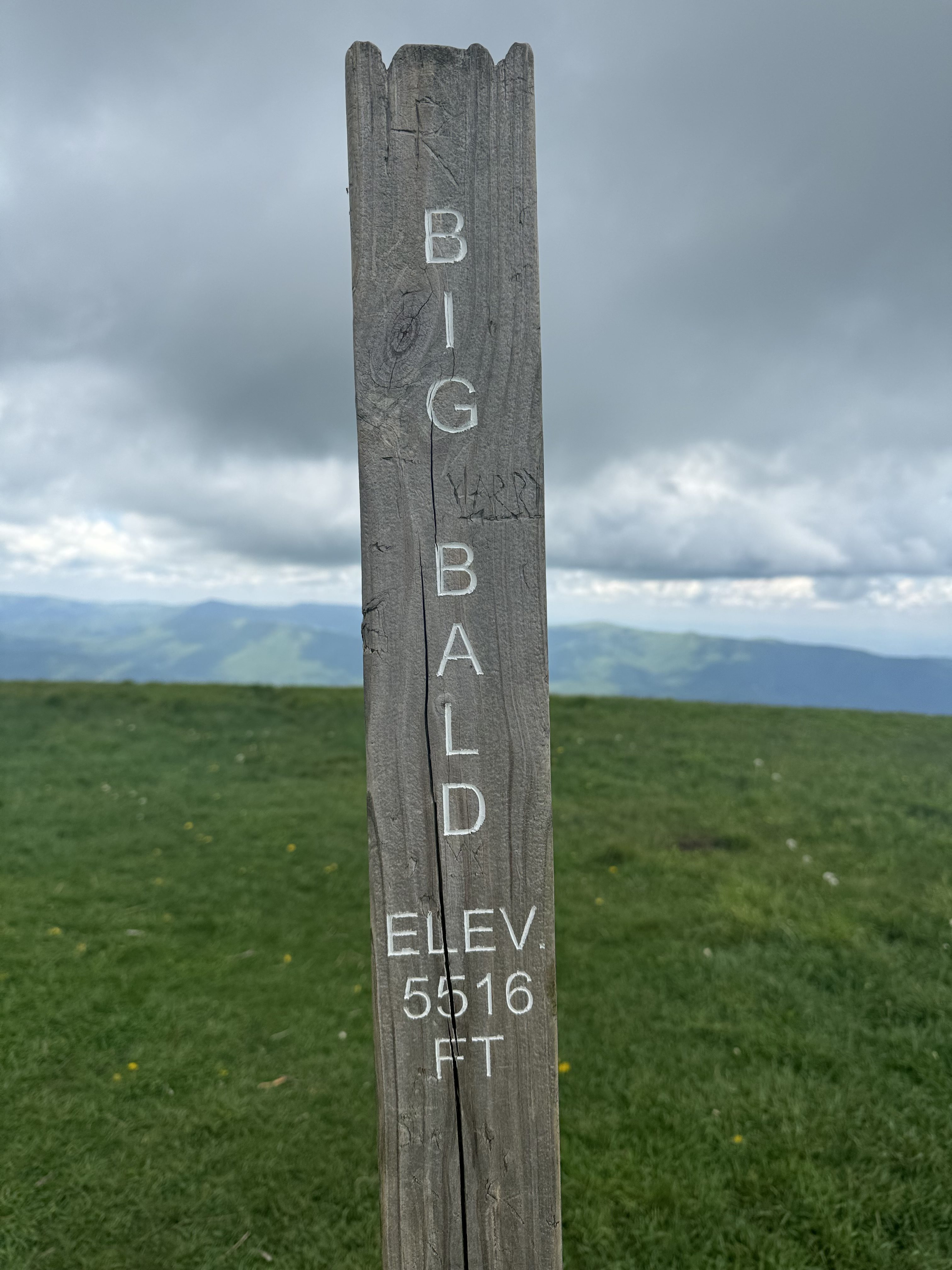
    Back on trail at 12:50. Got 1.2 miles UP to Big Bald itself. Glad I’m doing this with only a tiny backpack. After that, it’s all very much downhill back to Sam’s Gap.

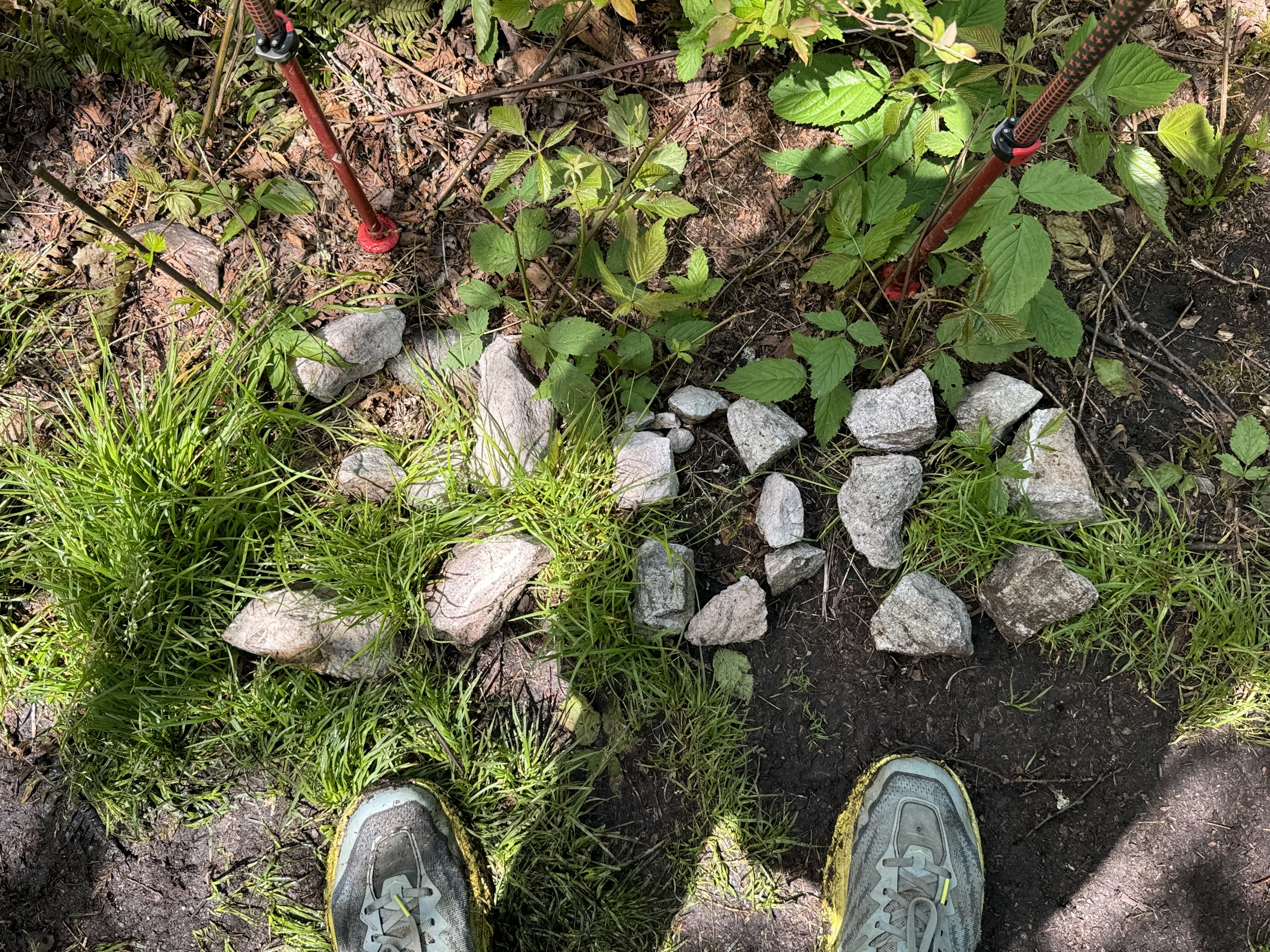
    I just scratch my head at some of the things we run across on the trail. This card table and chairs are set up by a stone fire ring partway up to Big Bald.

    Creepy random table and chairs ascending Big Bald

    Overkill took a picture of us walking across part of the bald towards Big Bald itself.

    Chuck ascending Big Bald

    Big Bald has an amazing view.

    Summit of Big Bald Mountain
    USGS marker on Big Bald
    View from Big Bald

    YouTube video of 360-degree view from Big Bald.

    Found a nice pair of benches to rest on with a view back towards Big Bald. Overkill and I took a break here before starting the long descent into Sam’s Gap.

    Nice place to sit, looking back at Big Bald

    And that descent is long and steep. These terraced steps are not doing my knees any good. That’s Overkill partway down for perspective.

    Overkill on the big terraced descent t to Sam’s Gap

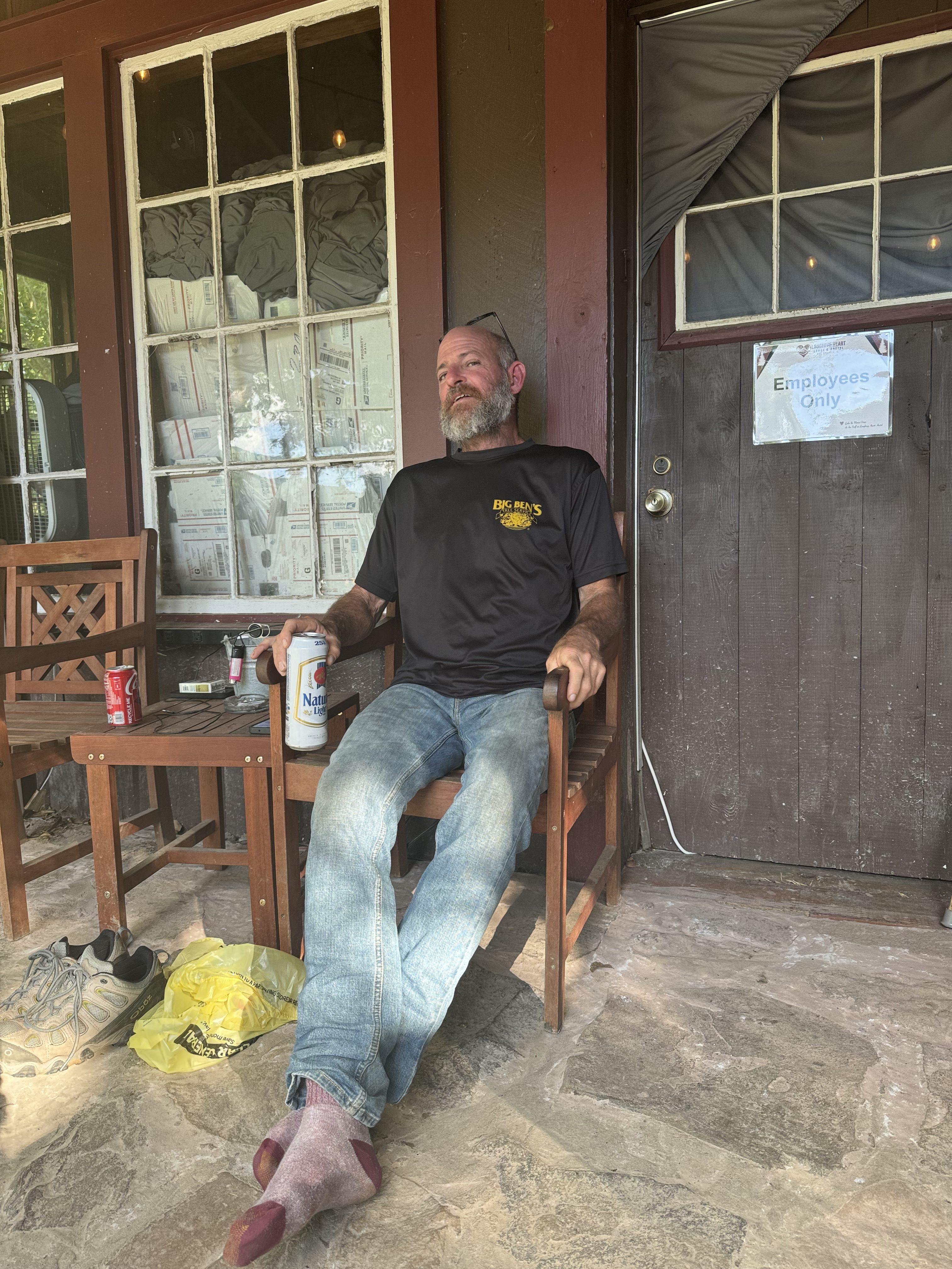
    Finished at Sam’s Gap at 5:00 exactly. Took 600mg of ibuprofen, and the owner  gave me an ice pack again!

    There are 6 new faces at the hostel this evening. I made ramen noodles for dinner and ate at 6:00. Chilled in the common room with my ice pack until 8:30, then went to my cabin.

    I got my big pack mostly ready for tomorrow. Good timing on staying at Nature’s Inn and hitting Erwin as I have one dinner and one crappy breakfast left in my food bag. Don’t even have enough snacks for tomorrow. Will buy some at Nature’s Inn. Called Dana at 9:30 and in bed at 10:30.

    Day 38 Map – Spivey Gap to Sam’s Gap

    Technical Notes:

    • Jimmy Dean breakfast bowl 330
    • Snickers 250
    • Trail mix 390
    • Snickers 250
    • Trail mix 390
    • Ramen x 2 720
    • Fritos 500
    • Muffin 400
    • Water liters 4
    • Miles 13.4
    • Time 8:25
    • Elevation gain 3947
    • Calories consumed 3300
    • Calories burned 5000
  • Day 37 – Flint Mountain Shelter to Sam’s Gap

    Day 37 – Flint Mountain Shelter to Sam’s Gap

    Today’s Miles: 11.2

    Trip Miles: 328

    “I blew out my flip-flop, 

    Stepped on a pop top,

    I broke my leg twice, had to limp on back home,

    God, I still feel pain,

    I wish I had some cocaine,

    But that’s been gone since early this morn’ (long gone)” – Jimmy Buffett

    A slight chance of showers and thunderstorms after 3 p.m. Mostly sunny. High near 75, with temperatures falling to around 69 in the afternoon. North wind 0 to 5 mph. Chance of precipitation is 20%. New rainfall amounts less than a tenth of an inch possible.

    Up at 7:00. Ate, packed, chatted with folks a bit, and out at 8:45. Cool, not humid, mostly sunny. Day looks great.

    Easy 3-mile warmup downhill then climb number one for the day. It is 2.6 miles and 1600 feet up. 

    Made it to Devil’s Fork Gap at 9:55. First of these steps over a fence. Lots more in the future. This is typically where the trail crosses private land such as a pasture or farmland. Also a water cache here.

    Gate crossing at Devil’s Fork Gap

    As I was climbing up out of Devils Fork Gap I kept hearing a bell, and it was getting louder. Turns out that fence with the steps leads into a wooded cow pasture area. Here comes a big old milk cow with her bell ringing followed by about 4 calves and two more cows. Moooo!

    Cows at Devil’s Fork Gap

    The next 2 hours was a nasty climb up a beautiful gorge with a stream running the entire length. Lots of small waterfalls along the way. 

    Waterfalls climbing out of Devil’s Fork Gap

    Near the top of the gorge I ran into this little lady. She was not shy at all, just stood in the middle of the trail staring at me. We had a nice one-sided conversation. 

    Doe at the top of the groge

    Finally finished that big nasty climb at 12:46. That was a tough one! 

    Tough climb out of Devil’s Fork Gap

    Finally got a view and cell service at the end of the climb. 

    View at top of Devil’s Fork Gap

    Took a break for food and water. Texted the hostel and they have lots of rooms. Will meet me at Sam’s Gap. Back at it at 1:15.

    Sam’s Gap at I-26

    Made Sam’s gap at Interstate 26 at 4:05. Shuttle will be here soon. Knee hurts and overcompensating is causing other walking issues. Glad I called it. Next stop would have been 7.7 miles UP to a shelter. I’ll do that tomorrow. I’m 24.4 miles from Erwin, TN. At this rate, I’ll get there in two more days. Probably Wednesday around 6:00 in the evening. 

    I’m staying at Nature’s Inn Hostel. Rustic but just my redneck style. Two other thru-hikers here: Overkill and one other. Awesome owners. Got settled in, unpacked, clothes hung up to dry, showered, and hung out in the common room/barn. 

    Nature’s Inn Hostel common room
    Nature’s Inn Hostel common room

    Had a pair of nice homemade pulled pork sandwiches for dinner part 1.

    Dinner part one at Nature’s Inn Hostel

    Dinner part two was a 1/4 lb hotdog and I have not ruled out dinner part three.

    And dinner part three is an entire frozen pizza at 9:00 p.m.

    The owner dug up an awesome old-school ice pack. That and 600mg of ibuprofen should help. 

    They had an ice pack – YEY!

    This hostel offers slackpacking. I had not considered that option before, but carrying 30 less pounds will be a huge deal. Therefore, I’m slackpacking from Spivey Gap 13.4 miles back to Sam’s Gap and spending another night (Tuesday night) here at Nature’s Inn Hostel. That 13.4 will be the first 1/2 up Big Bald then 1/2 back down the other side of Big Bald. That will leave 11 miles downhill on Wednesday into Erwin. I have the option of slackpacking that part into Erwin as well. Game time call on that depending on my knee.

    Planning my first slack packing at Nature’s Inn Hostel

    Picked out a small school kid-style backpack to use for slackpacking (a Jansport, of course) and made a list of things to bring. With 1.7 liters of water, snacks, and rain gear, I’m guessing 8 lbs  fully loaded. 

    Headed to my room around 9:30. Called Dana and chatted for a while, set an alarm for 7:00 a.m. Shuttle leaves at 8:15.

    I have mixed feelings about today. Started off good with great weather, but started to become just work by the final third of the day due to my knee. Also need to figure out why my pack is hurting my back. Ended quite well thanks to a shower, real food, an ice pack, and a bed.

    Day 37 Map – Flint Mountain Shelter to Sam’s Gap

    Technical Notes:

    • Pop-Tarts 370
    • Snickers 250
    • Trail mix 270
    • Trail mix 270
    • Snickers 250
    • 1/4 lb hotdog 390
    • Pulled pork on a roll x2 700
    • Frozen pizza 1080
    • Dr Pepper x 5 750
    • Water liters 5
    • Miles 11.3
    • Time 7:15
    • Elevation gain 2900
    • Calories consumed 4700
    • Calories burned 5500
  • Day 36 – Little Laurel Shelter to Flint Mountain Shelter

    Day 36 – Little Laurel Shelter to Flint Mountain Shelter

    Today’s Miles: 14

    Trip Miles: 316.8

    “I like big butts and I can not lie…” Sir Mix-A-Lot

    Patchy fog before 8 a.m., then a slight chance of rain showers between 8 a.m. and 11 a.m., then a slight chance of showers and thunderstorms. Mostly sunny, with a high near 68. Northeast wind around 5 mph. Chance of precipitation is 20%.

    Up at 7:15. Damp and overcast, but it looks like it will clear off soon. Lone wolf headed out at 7:30. Ate, packed, refilled water, and headed out at 8:50. Sun is mostly out, and day looks promising. Knee still swollen. Took 600mg of ibuprofen. First big stop is a shelter at 7.3 miles.

    Made it to Camp Creek Bald at 9:52. One hour flat. Not bad considering.

    Made it to the top of Big Firescald Knob at 11:30. Really great view. 

    Chuck on Big Firescald Knob
    View from Big Firescald Knob

    YouTube video from Big Firescald Knob.

    That was a fun rock scramble. First on the trip so far, but not the last !

    First rock scramble of the trip

    Woohoo! Crossed the 300-mile mark about 12:00!

    300 mile marker

    Reached Jerry’s Cabin Shelter at 1:00. Got my tent rain fly and footprint out to dry. Partly sunny and breezy. Perfect for drying out. Filtered water and had a snack. 

    Been a good day so far. Making a little under 2 miles per hour and completed 7.3 miles. Nice scenery and plenty of level walking. I’m being VERY careful with my left leg. Passed about 8 SOBO hikers…mix of section hikers and day hikers. 

    Drying my gear at Jerry’s Cabin Shelter

    Back on trail at 2:00. Got about 2 miles and 800-foot climb up to Big Butt Mountain (I’m not making that up). Doesn’t look too bad. After that, about 4.7 miles downhill to camp for the night. Should get on about 6:00.

    Trail passes through a large meadow at mile 302.8.

    Meadow hike near Big Butt Mountain

    And there is a great big rock.

    Great big rocks

    Why would I want to bypass big butts?

    Really? Why bypass Big Butts?

    Summitted Big Butt at 3:00….and had this very nice view 

    View from summit of Big Butt Mountain

    Made Flint Mountain Shelter at 5:20. Very nice shelter. No cell service. Weather has been perfect this afternoon. Clear, windy, mid-70s, lower humidity. Evening looks similar. Camp all set up by 6:00. 

    Flint Mountain Shelter

    Hung a clothesline and put up my sweaty clothes to dry. Breezy and low humidity, so they should actually dry for a change.

    Got water and made dinner at 6:30. Had great conversations with an older section hiking couple, two 30-year-olds sectioning, and Puzzler who is a NOBO completing his triple crown, and a young woman thru-hiking a NOBO.

    In my tent at 8:15. Tomorrow I’m either doing 11.3 to a hostel or 18.9 to a shelter with a big climb the last 4 miles. Will see how I feel at the time. Knee is not as bad tonight as last, but still swollen and sore. Got a good 2.6-mile 1600-foot climb early in the day. 

    Day 36 Map – Little Laurel Shelter to Flint Mountain Shelter

    Technical Notes:

    • Pop-Tarts 370
    • Snickers 250
    • Trail mix 270
    • Trail mix 390
    • Peak Refuel chicken rice 740
    • Fritos 400
    • Water liters 5
    • Miles 14 
    • Time 8:30
    • Elevation gain 3100
    • Calories consumed 2500
    • Calories burned 5500
  • Day 35 – Spring Mountain Shelter to Little Laurel Shelter 

    Day 35 – Spring Mountain Shelter to Little Laurel Shelter 

    Today’s Miles: 8.6

    Trip Miles: 302.8

    “Oh, what starts with a letter C?

    Cookie starts with C.

    Let’s think of other things that start with C.

    Ah, ah, who cares about other things?

    C is for cookie, that’s good enough for me.

    C is for cookie, that’s good enough for me.

    C is for cookie, that’s good enough for me.

    Oh, cookie, cookie, cookie starts with C” – Cookie Monster

    A chance of rain showers before 8 a.m., then showers and thunderstorms likely. Cloudy, with a high near 65. West wind around 5 mph. Chance of precipitation is 60%. New rainfall amounts between a tenth and a quarter of an inch possible.

    Up at 8:00. Wet and drizzling. Not terrible.  Lone Wolf was moving slow and we chatted some more. He forgot his trekking poles and someone is meeting him up trail at noon to drop them off.

    Ate, cleaned up, packed up, and got on trail at 9:50. First 1/3 of day is downhill, second third is up, and last third is so-so with lots of small puds for a total of 15.9 miles. Hoping for some sun or wind mix afternoon to dry out my tent.

    Passed about 20 Boy Scouts on their way to Hot Springs. Stopped and chatted with one of their scout masters.

    Took a break at Allen Gap and had a snack. I’m a little worried about water for the next 5 miles uphill in this humidity, but not a lot of choice. I’ll need to conserve a bit. I’ll stop again in 4.9 miles at Little Laurel Shelter. That would be a short day but less annoying people than will be at camp at Jerry’s Cabin Shelter later this evening.

    Very humid today with some drizzle. My knee hurts and I’m moving slowly. 

    Stopped and got water and cookies from the Southern Cookie lady around 1:30. She said the humidity is in the low 90s, which explains a lot! We chatted for about 15 minutes before I headed back out.

    Souther Cookie Lady

    Only made it 8.6 miles to Little Laurel Shelter. And that was a struggle. My left knee that I hurt when I fell on the  way into Hot Springs is quite swollen and sore. I’ll try some anti-inflammatories tonight. Worst case scenario, I make it to Erwin, TN, and take another break. Not happy about this.

    I pitched my tent at 4:00. There are 3 other people here at the shelter. I hung up my tent’s rain fly to dry from last night. It should dry before we get some thunderstorms early in the evening. 

    Lone Wolf was here when I got here. He was along with a father-daughter pair of SOBO LASHers. I talked a bit with Lone Wolf. He’s a nice guy. The father-daughter pair is finishing his aborted thru-hike from last year. He injured himself. He has to get from the VA/TN border to Springer to complete his journey. I hope to meet Lone Wolf at camp tomorrow night.

    Little Laurel Shelter

    Had dinner at 6:00, got water, and had a call with Dana. My knee hurts more now that I’m resting, and the swelling is up. I’m in my tent at 7:00. A group of NOBOs just arrived. The storm seems to be closing in based on thunder and rising winds. But with these mountains, you never know. I plan to take something to knock me out for the night in a while. Rain started at 8:00.

    I’ll borrow some ibuprofen from someone tomorrow morning. Worst case I hike 7.3 miles to Jerry’s Cabin Shelter. I want to try for 14 to Flint Mountain Shelter. Got a 1.8 mile hike up from where I am no matter what, but it looks mellow with a 1.9 mile 760 foot mountain around 7.5 miles in tomorrow. Will see how the knee is doing. If it stays bad or gets worse I’ll arrange a shuttle into Erwin and take 3-5 days off to let it heal. I can get ice and antiinflamatorios and’m okay with taking severokays off for an injury. Dana and I talked about this before I got on the trail. Was suppono hit mile 300 today, but that did not happen. I’m more annoyed than upset at the moment. Will try to keep my head in that space.

    Day 35 Map – Spring Mountain Shelter to Little Laurel Shelter

    Technical Notes:

    • Pop-Tarts 370
    • Twix 125
    • Pop tarts 270
    • Cookie 130
    • Trail mix 270
    • Peak Refuel rice and pork 450
    • Water liters 4
    • Miles 8.6
    • Time 5:32
    • Elevation gain 1900
    • Calories consumed 2500
    • Calories burned 3000
  • Day 34 – Hot Springs, NC to Spring Mountain Shelter 

    Day 34 – Hot Springs, NC to Spring Mountain Shelter 

    Today’s Miles: 11.3

    Trip Miles: 294.2

    “By the time we got into Tulsa Town,

    We had eighty-five trucks in all.

    But there’s a roadblock up on the clover leaf,

    And them bears were wall to wall.

    Yeah, them smokies were thick as bugs on a bumper.

    They even had a bear in the air.

    I says, callin’ all trucks,

    This here’s the Duck.

    We about to go a huntin’ bear” – C. W. McCall

    Scattered rain showers between 9 a.m. and 11 a.m., then a chance of showers and thunderstorms. Mostly cloudy, with a high near 66. South wind around 5 mph. Chance of precipitation is 70%. New rainfall amounts between a quarter and half of an inch possible.

    Woke at 7:00, but went back to sleep till 8:00. Finished yesterday’s blog including the retrospective. Studied the map for today. I have 11.3 miles, two big mountains, one medium mountain, and lots of rain in the forecast. Only doing short miles today because of the rain and a planned late start. Since trail runs through town, I plan to have a big breakfast on the walk out of town and immediately do the first nasty climb. Figure 10:30 ish. 

    Trail Days starts today in Damascus, and lots of people are leaving to shuttle up there. Big 3-day festivals with thousands of people just isn’t my thing. This is a HUGE event on the AT. A lot of people just hike to Trail Days and are done after that. Sort of a big section hike with a party at the end. The NOBO bubble will thin out a lot after Trail Days and Damascus. 

    https://www.visitdamascus.org/traildays.html

    I am switching to brand-new socks. Wonder how long these will look so nice 🙂

    New Socks

    Grabbed a last shower, packed , and walked to the diner at 9:00. Goodbye Laughing Heart!

    Had a good-sized breakfast at the Smoky Mountain diner. Nice mural in the entry.

    Mural at Smoky Mountain diner

    Done with breakfast and on trail at 10:15. No rain yet! Trail really started 1.3 miles from the hostels. Road walk to that point. Time to climb this.

    Crossing the French Broad
    Climb out of hot springs

    Trying a new pack load out. Food bag horizontal in the middle of the pack to place the weight lower.

    Good view of the actual hot springs resort. This was also used as a POW internment camp in WWI.

    Spot Springs Resort and the French Broad Rover

    YouTube video of the French Broad River.

    Had a nice chat with an older LASHer. Met her at the hostel a couple of times. She is slackpacking this week and making her way north. I may meet her again in Erwin. She plans to go as far as southern Virginia. Topped off water at 12:50. Had a pair of Twix bars before moving on.

    YouTube video of the dam and pond.

    Chatted with a trail maintenance crew who were just wrapping up for the day. They looked hot, sweaty, and tired. It hasn’t rained, but it’s quite humid.

    Took a break at 2:15 at Tanyard Gap where the trail crosses US Routes 25 and 70. Chatted with a nice lady out walking her dog on the trail. Had some cell service, so texted with Dana. Back on trail at 2:30.

    Surprise blank snake on the trail.

    Surprise Sneak

    I had my first bear encounter just before camp at 5:20. A very big mama and three cubs. She sent the cubs up a big tree when she saw me. I messed up the videos. Instead of 5 minutes of amazing video of her and the cubs, I ended up with about 30 seconds of video. Still a very cool experience!

    Mama Bear and Three Cubs

    YouTube video of mama bear and cubs.

    Made it to Spring Mountain Shelter at 6:15. I met Lone Wolf on the trail. He passed me just before I got to the bear. He’s a nice guy from California. Chatted a bit. 

    Camp at Spring Mountain Shelter
    Spring Mountain Shelter

    Finished eating, getting water, and settled into my tent at 7:20, and the rain started. Good timing for me!!

    Talked to Dana for a while. We settled on meeting on Thursday night, May 30, in Damascus, Virginia. I should get into town around 5:00, and Dana will leave home around 3:00 and drive down. We will drive to Abington, Virginia, for the weekend, and I’ll get back on the trail Sunday at noon.

    Today was a good day. The first 2/3 felt easy-ish. I am getting used to the mountains and more fit. The last 1/3 was more uphill, and I was ready to be done. The double zero helped my knee, but it always takes me a day to reacclimatize to hiking.  

    Day 34 Map – Hot Springs, NC to Spring Mountain Shelter

    Technical Notes:

    • Coffee: 75
    • Meat omelette: 900
    • English muffin: 150
    • Twix x 2: 250
    • Snickers: 250
    • Chicken curry: 850
    • Dehydrated chicken: 170
    • Water liters: 2.4
    • Miles: 11.3
    • Time: 8:44
    • Elevation gain: 3815 
    • Calories consumed: 3200
    • Calories burned: 5000
  • Day 33 – Zero Day 2 in Hot Springs, NC 

    Day 33 – Zero Day 2 in Hot Springs, NC 

    Today’s Miles: 0

    Trip Miles: 282.9

    “Sittin’ in the mornin’ sun

    I’ll be sittin’ when the evenin’ come

    Watching the ships roll in

    And I watch ’em roll away again, yeah

    I’m sittin’ on the dock of the bay

    Watching the tide roll away

    Ooh, I’m just sittin’ on the dock of the bay

    Wastin’ time” – Otis Redding

    Up at 7:00. Overcast and drizzling. Stayed in bed tweaking blog posts till 8:30. I feel fine today. Still want to give my knee a day off, so I’ll take it easy. Very tempted to slackpack today, but will be good.

    Walked into town for a nice breakfast at the diner. Picked up the few items I still need at the local Dollar General. Got back to hostel and moved back into my normal room about 10:00.

    I blogged and got all the new blogs uploaded by 2:15. Phew!

    Chilled and played some games until 5:30. Hung out on the deck and chatted with Sam. We have been hiking around each mother for 5 weeks. He was originally stopping in Fontana, but started doing tick-tock videos to fund his hike. He’s leaving today and hitching to Knoxville where he will get a job for a few months then get back on trail, he does tree work so this is s good time of year for employment.

    Heard from Mike. He is about 6 days ahead of me. He left Erwin TN today. He also recommended Uncle Johnny’s hostel. I’ve had mixed reviews on that place, but Mike’s is most current so I’ll plan to stay there in 5 days. My resupply boxes are going there as well.

    Walked into town at 6:00 and had a great burger and some ciders. Stopped at DG on way home for some snacks. Tried to enjoy the deck at the hostel but people were talking go politics so I went to my room. Chatted with Dana and went to bed about 11:00.

    Laughing Heart is my favorite hostel so far. It’s large, great vibe, not a basement dungeon, lots of people, 50 feet from the trail, and easy walking distance to town. Plus I really like Hot Springs. Small but has everything a hiker needs and is full of hikers. Roughly the size of Poolesville in terms of businesses. 

    Laughing Heart Hostel
    Laughing Heart Hostel

    Retrospective 

    I’m not looking forward to the rain for the next 7 days, but I’m ready to move on up the trail. I will see Dana in 2 weeks in Damascus. Also just ready to be done with NC and TN. Looking forward to Virginia. Looking forward to getting to the Blacksburg area and seeing college friends then doing the walk home to Maryland over the month of June.

    I’ll be even more alone on this next part of the trek. Eric, Mike, Lolly, Sam are all ahead of me or off trail. But at least the mountains are not as bad and the weather is warm. 

    My body is doing good. I’m making bigger and bigger miles and not hurting as much from those miles. I’m carrying 17 less pounds of me and I’ve lightened by pack a few pounds. I’m much more comfortable with the solitude on trail and my overall abilities.

    Overall I’m much more comfortable with life on trail and all that entails. It’s not just weather and trail and camp and water and food and privies. It’s also the towns and people and the iconic places that I have read about and seen in hundreds of hiking videos. 

    I would not mind running into some more trail magic. I have barely had any and hopeful for more as I get into summer in Virginia soon.

    Upcoming weather

    Technical Notes:

    • Three eggs 0
    • Pork chops0
    • Coffee0
    • Pop tarts0
    • Huge hamburger0
  • Day 32 – Zero Day in Hot Springs, NC

    Day 32 – Zero Day in Hot Springs, NC

    Today’s Miles: 0

    Trip Miles: 282.9

    “Got nothing against a big town,

    Still hayseed enough to say,

    Look who’s in the big town,

    But my bed is in a small town,

    Oh, and that’s good enough for me” – John Mellencamp

    Showers and thunderstorms. Mostly cloudy, with a high near 67. Chance of precipitation is 80%.

    Up at 7:00. Didn’t sleep well. Not sure why.  But it was a bed and a roof!

    Today will be rainy, tomorrow partly sunny, then bad thunderstorms and rain Friday through Sunday. Part of me wants to slackpack about 15 miles tomorrow to take advantage of the good weather and get the worst of the elevation out of the way in dry weather. But my knee is not happy with me after my fall yesterday afternoon. Also, I’m not sure there are any good last-minute slackpacking shuttle options in town. I’ll ask at the outfitters. Or I just hike out and try hitching back to town. Probably gonna be a game-time decision based on my body. 52 miles in the past 3 days is wearing on me a bit.

    Had coffee at the hostel then walked 10 minutes to the Smoky Mountain Diner for breakfast. Very nice country diner. Huge portions. I got scolded for not finishing all of my breakfast.

    Meandered through town to Artisun Gallery and Cafe for a latte while I wait for the local outfitter to open at 9:30. The AT goes directly through town. The sidewalk has AT logos to make sure you don’t get lost in this sprawling metropolis.

    The AT is the sidewalk in Hot Springs
    Walking the AT through Hot Springs, NC

    Artisun Cafe is very nice. Indoor and outdoor seating. Chilled out with free WiFi and Latte for a while.

    Artisun Cafe

    Got some cash out of the ATM at the outfitter and resupplied for 5 days and 4 nights on trail with 4 lbs of food. Also got a new dry bag to replace the one for my quilt that tore, fresh fuel can, and a new stick of Body Glide (it’s gonna rain a lot for the next week).

    On that note, saying goodbye to some loyal companions. The dry bag that was a bit too small for my 10-degree quilt tore, and my Injinji Toesocks have several holes torn in them and are threadbare. All that rain and mud in the Smoky Mountains didn’t do them much good. These are actually sock liners, so they are very thin to begin with. Replaced with the exact same socks. See old and new below.

    Saying goodbye to loyal friends

    Yes, those are my dirty, torn socks next to my brand-new ones. You try walking 75 miles in the dirt, mud, and rain without changing your clothes, washing, and see what your socks and feet look like!

    Moved out of the bunk room and into my private room for the next two nights. Nice little room with AC. AC is important not for the heat but the humidity! The owner of the outfitter described Hot Springs as a rainforest, and it feels like it.

    My room at Laughing Heart Hostel

    Did laundry, prepped my food for the next 5 days, charged electronics, back-flushed my water filter several times, cleaned the outside of my pack somewhat, and worked on blogs all afternoon. All written, just need to do the tedious uploading 🙁

    I signed the 2024 thru-hiker banner in the hostel. Every hostel has one.

    2024 banner at Laughing Heart

    I have a Poolesville Planning Commission meeting at 7:00 tonight. I read all the material for the meeting and made notes. Unfortunately, the Wi-Fi here is not stable, so I’m going to have to do audio-only for tonight’s meeting. That is frustrating, but I don’t want my technical issues to interfere with the meeting.

    About 5:00, I started feeling very nauseous. I never get nauseous! Eventually, I talked to hostel staff to give them a heads up since everyone is very worried about Norovirus on the trail. They decided to move me to an isolated room in their old staff quarters just to be safe. Got moved into semi-quarantine about 6:45.

    Attended the Poolesville planning commission meeting virtually. The meeting ran until 8:30. Then I FaceTimed with Dana until 11:00. By that time, I was no longer nauseous and never did throw up, so I had a pair of Pop-Tarts for dinner. 

    I expect to be fine tomorrow and move back into the hostel. I have no idea what made me sick. 

     Went to sleep about midnight.

    Technical Notes:

    • Skillet breakfast: 1200
    • Large Latte: 220
    • Pop-Tarts: 370
    • Fritos: 500
    • Water liters: 0
    • Miles: 0
    • Time: 0
    • Elevation gain: 0
    • Elevation descent: 0
    • Calories consumed: 2110
    • Calories burned: 0

    Everest: 29000

    Climbing from base camp: 11000

  • Day 31 – Roaring Fork shelter  to Hot Springs, NC

    Day 31 – Roaring Fork shelter  to Hot Springs, NC

    Today’s Miles: 17.6

    Trip Miles: 282.9

    “When you’re alone, and life is making you lonely, You can always go …Downtown” – Petula Clark

    Showers and thunderstorms. Mostly cloudy, with a high near 67. Chance of precipitation is 80%.

    Up at 7:00. No rain!!! Shocked we got no rain last night, but pleased. It is overcast and the Garmin weather forecast looks good until 5:00. But that forecast is not the most accurate. I’ll still wear my normal hiking shirt even though it’s damp. Want to save my spare long sleeve in case I don’t make it to town today. Almost 18 miles is a long day on top of the past two days. Got a fallback planned for tonight if I can’t physically make it to Hot Springs.

    Slept very well and feel decent. Need to stretch Achilles a lot before starting. All my hiking clothes are damp and not much chance of drying today. 

    I’ll check weather and see about a room for tonight when I get cell service in a couple of hours. At least I’m not packing up a soaking wet tent like I had expected to do. Yea!

    Ate, brushed teeth, packed, topped off water and headed out at 8:45. Trying a  new arrangement inside my pack to try to stop upper back pain I get later in the day.

    Made Lemon Gap at 10:10. Rearranged pack a bit. Cloudy and misty with very limited visibility. Nothing really photo worthy.

    Lemon Gap

    Made Walnut Mountain Shelter at 11:10. Partial water refill. Very cold and windy up here! Got out of here fast as I’m very wet from humidity.

    Summited Bluff Mountain at 4680 feet at 12:49. Last big climb today. Now it’s 10.3 miles down to Hot Springs.

    Took a bad fall around 1:00 in the rain. Damn tree roots. Tweaked my bad knee again and pulled something behind my knee. 

    Took a spill due to the roots

    Stopped for water at 2:00. It’s very humid and I’m going through a lot of water.

    Got cell service at 2:45 at Garenflo Gap. Texted with Dana and reached out to Laughing Heart Hostel and booked a bunk for tonight! YEA! Back on the trail…6.2 miles to go in the ongoing drizzle.

    Garenflo Gap

    Made it to the hostel right on 6:00, exactly as I predicted. Getting good at judging miles. Showered and unpacked just enough for the bunk room tonight. Picked out some loaner clothes and walked into town at 7:00.

    All I could find in the Laughing Heart Hostel’s loaner clothes for pants was a pair of size 32 skinny leg pants. Nothing else was even close to my size. OMG they fit! First time I’ve fit that size in about 15 years at least. Found a scale at the hostel and I’m down 17 lbs in 4.5 weeks. 

    Got dinner and drinks at Spring Creek Tavern. Great vibe, nice staff, good food, huge portions. I think I can afford the calories!

    Dinner and drinks at Spring Creek Tavern in Hot Springs, NC
    Spring Creek Tavern

    Back to the hostel at 9:00. Drank a few ciders and swapped stories with the older crowd sitting on the back porch. In bed at 10:00.

    Day 31 – Roaring Fork shelter to Hot Springs, NC

    Technical Notes:

    • Stinger waffle 150
    • Justin nut butter 210
    • Trail Mix 270
    • Trail mix 270
    • Trail mix 270
    • Snickers 250
    • Seltzer 150 x 6 = 900
    • Beer batteries mushrooms 640
    • 6’’ Philly cheese steak 600
    • Tots 500
    • Water liters 6
    • Miles 17.6
    • Time 9:15
    • Elevation gain 3029
    • Elevation descent 5600
    • Calories consumed 4200
    • Calories burned 6500
  • Day 30 – Cascades Tent Site to Roaring Fork Shelter 

    Day 30 – Cascades Tent Site to Roaring Fork Shelter 

    Today’s Miles: 17

    Trip Miles: 265.3

    “Climb every mountain,

    Ford every stream,

    Follow every rainbow,

    Till you find your dream” – Oscar Hammerstein 

    Scattered rain showers after 2 p.m. Cloudy. High near 65, with temperatures falling to around 59 in the afternoon. South wind 10 to 15 mph, with gusts as high as 25 mph. Chance of precipitation is 40%. New rainfall amounts less than a tenth of an inch possible.

    Up at 7:00. Slept great! Best sleep in many days. Sleeping next to Mother Nature’s white noise machine helped. 

    Cascades

    Snapped an arm off my glasses. I’ve done this once before and Dana figured out how to fix them. Will work on that once I dig out my emergency spare glasses! And fixed!!!!

    Out of camp at 8:15.

    I crossed Interstate 40. Five bars cell so called Dana and chatted while she was driving to work. 

    I-40 crossing
    Walking under I-40
    Big climb up from I-40

    Passed turnoff to Standing Bear Farm at 9:10. No plans to stop and hang out with the hippies. Not my scene and I have enough supplies to make it to Hot Springs.

    This is not a fun start to the day. Crap!

    Big climbs today

    Took a break, had a snack, and refilled water at 10:30. Hard climbing morning! 

    Summited Snowbird Peak at 4275 feet at 12:15. Thank god! Nice 360-degree views but cloudy.

    AT sign on Snowbird Peak
    FAA VOR facility on Snowbird Peak
    USGS marker on Snowbird Peak

    I took some really amazing video up here! But the Internet ate it 🙁

    That facility on top of Snowbird Mountain is an old but still functional FAA VOR. For those curious about what VOR (Very High Frequency Omni-Directional Range) is, here you go:

    https://www.faa.gov/about/office_org/headquarters_offices/ato/service_units/techops/navservices/gbng/vor

    Took a break for water and lunch at 1:20. 8.5 miles till camp. Weather is getting questionable. Wind kicking up and spitting rain. I have 2 nasty uphills and one medium one left. Wish there was a shelter in between the one right near me and the one 8.5 miles away. If I see a decent stealth spot, I may use it.

    That which does not kill us makes us stronger!

    Peak two down at 3:00. Been raining on and off. Put my rain kilt on about 2 miles ago. Hate wet pants, but don’t mind the cool rain on my upper body. Will take a break in .6 miles at Brown Gap Spring…all downhill to there. 

    Last big nasty climb for the day coming up after my break.  Not exactly a walk in the park after this, but not terrible either.

    Ascent to Max Patch

    Got to Max Patch gate at 5:05. That last climb was harder than I thought, especially in the cold rain. Here is some info on Max Patch. 

    https://www.maxpatch.org

    Max Patch Map
    Max Patch
    Max Patch

    It is cloudy and rainy and windy up here.  At least I am able to get a bit of the view, but I want to come back on a clear day.

    YouTube Video of Pax Patch.

    Made it to Roaring Fork shelter at 6:45. Wet, cold, sore. Last mile was a struggle. No cell service. Set up camp, got water, got into dry clothes, made dinner. Last hot meal I have. Checked in with Dana via Garmin. 

    Ate at 8:20 in my tent. Cold and damp outside. Walked smellables to bear box at 9:00. There are about a dozen people here, but they’re all asleep. I’m the only night owl as usual.

    Camp at Roaring Fork Shelter

    Battery bank one dead. Used bank two to charge phone. Glad I conserved battery usage. If I was out here two more nights as originally planned, it would be tight.

    That was my longest and hardest day yet. On top of the 16.6 miles yesterday. I feel good. Achilles and calves are sore but not terrible. Gonna try almost 18 miles tomorrow to get into Hot Springs, NC an entire day early. Two big hills to climb, but they’re both in the first 7.2 miles. Lots on down after that. The rain for the next 4 days is incentivizing me to get to town.

    Day 30 Map – Cascades Tent Site to Roaring Fork Shelter

    Technical Notes:

    • Cliff bar 250
    • Trail mix 270
    • Snickers 250
    • Trail mix 270
    • Trail mix 270
    • Trail mix 270
    • Fritos 300
    • Mountainhouse teriyaki 440
    • Dehydrated chicken 170
    • Water liters 4
    • Miles 17
    • Time 9.5
    • Elevation gain 6000
    • Elevation descent 3000
    • Calories consumed 2600
    • Calories burned 6500
  • Day 29 – Tri-Corner Knob Shelter to Cascades Tent Site 

    Day 29 – Tri-Corner Knob Shelter to Cascades Tent Site 

    Today’s Miles: 16.6

    Trip Miles: 248.3

    “Goin’ down hill, you got me goin’ down hill. And still I can’t get my fill of you.” – John Anderson 

    Sunny, with a high near 67. West wind 5 to 15 mph, with gusts as high as 20 mph.

    Up at 6:50. Dozed back off till 8:00. Out of camp at 9:40. Looks like a real nice day. No clouds and warming up to 65 and dropping 3300 feet in elevation. Mostly downhill today. Should be to camp by 4:30.

    Stopped at an overlook for some pictures of Pigeon Forge and on to Knoxville in the distance. Had cell service so I ordered red pepper flake packets from Amazon. Will arrive at home tomorrow. I’ll have Dana send me those and a new pair of shoes to Erwin, TN. Will be there in about 6 or 7 days.

    Pigeon Forge and on to Knoxville in the distance
    Pigeon Forge and on to Knoxville in the distance
    Pigeon Forge and on to Knoxville in the distance

    It never ceases to amaze me how much temperature can change with a little elevation difference. Back home I get roughly 500 to 700 feet of elevation difference between my house and my normal day hiking spots on the AT in Maryland and Pennsylvania. Just that small elevation change can have a 5-10 degree temperature difference and cross the rain/snow boundary. Out here I’m dealing with elevation changes in the 3000 to 4000 foot range and temperature swings of almost 40 degrees. 

    Stopped at the abandoned helipad at 11:00 for a snack and a video. Now I start the BIG descent out of the Smokies. Interesting that I’m feeling a little regret about that given how crappy the last week in the Smokies has been. Guess it goes to show what two good days in a row can do !

    YouTube video of abandoned helipad.

    Stopped at Crosby Knob Shelter at 1:30. Did some maintenance on my feet and socks, had lunch, topped off water, and rested up. Have not finalized my destination for today. If I feel good, I may go past Davenport Gap Shelter and tent outside the park tonight. Will see how I feel in 4 more hours.

    I got my last good view of the Smoky Mountains at 4:30.

    YouTube Video of last view of Smokies.

    Deposited my backcountry permit and exited the Smokies at 6:20. Made a really good time today. Bittersweet feelings about leaving the Smokies.

    Exiting GSMNP
    Next stops after the Smokies

    Made camp at 7:00 about 2 miles outside the park. Very cool unofficial campsite with a fast-moving stream splitting the site in half. I’m camped on one bank of the stream, and a young man that I have met several times since Fontana is on the other bank. Good cell service.

    Ate dinner at 8:00. Got a hot dog from my neighbor camper to go along with my chicken and rice. Called Dana after dinner and chatted for a while.

    Rain starts tomorrow afternoon and goes till Saturday. I want to get into Hot Springs early on Wednesday. To make that happen, I need to make big miles. I’m going to try for Roaring Fork Shelter 17.5 miles away tomorrow. Decent amount of uphill tomorrow as well.

    Day 29 Map – Tri-Corner Knob Shelter to Cascades Tent Site

    Technical Notes:

    • Tea 0
    • Justin’s nut butter 210
    • Honey Stinger waffle 150
    • Snickers 250
    • Trail mix 270
    • Fritos 320
    • Dehydrated pork 240
    • Knorr Mexican rice 585
    • Water liters 3.4
    • Miles 16.6
    • Time 8:40
    • Elevation gain 2115
    • Elevation descent 6471
    • Calories consumed 2200
    • Calories burned 6500