Tag: North Carolina

  • Day 28 – Icewater Spring Shelter to Tri-Corner Knob Shelter 

    Day 28 – Icewater Spring Shelter to Tri-Corner Knob Shelter 

    Today’s Miles: 12.6

    Trip Miles: 231.7

     “I’m on the top of the world looking down on creation. And the only explanation I can find. Is the love that I’ve found, ever since you’ve been around…” – Carpenters

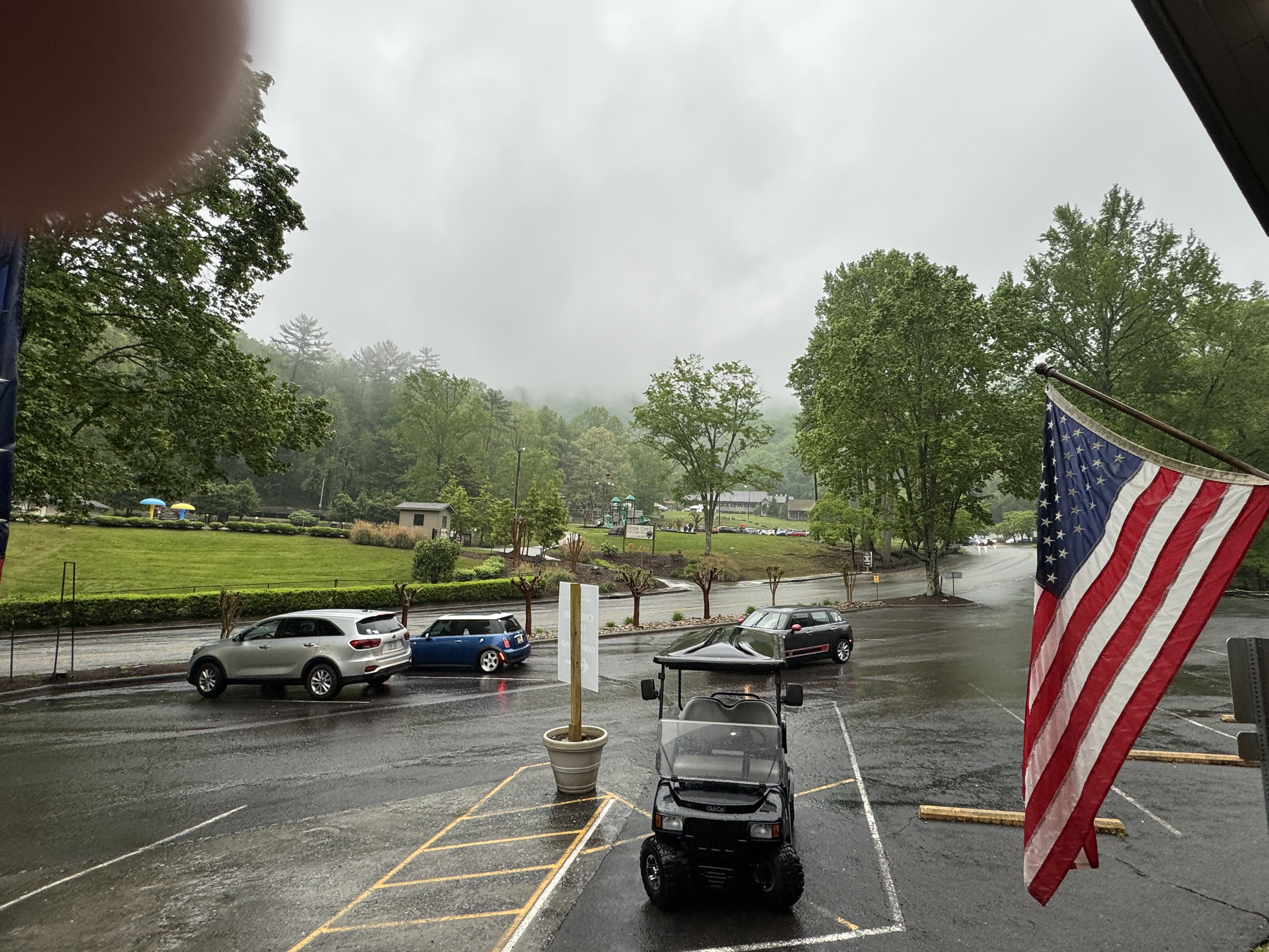
    Mostly sunny, with a high near 54. Northwest wind 15 to 25 mph. New rainfall amounts less than a tenth of an inch possible.

    Last night sucked. Very cold and damp. I don’t think anybody got much sleep. Up at 7:00. Laid in bed till 7:30 so the sun would burn through the fog. Made tea and had pop-tarts and Fritos. I’m dry and a little chilly. Today should be easy. Gonna wait till it warms up a bit to head out. May leave thermals on until I hit a shelter with a privy. Peck’s Corner is at 7.4 miles….approximately 1:00.

    Heard from Mike. He marathoned into Hot Springs last night and is taking a  zero at Laughing Heart Hostel. 

    Gotta conserve battery to make it 6 days to Hot Springs. Not using my Apple Watch anymore. Got out of camp at 9:00. Still cold but the sun is finally out. 

    Icewater Spring Shelter
    Hiking in the sun in GSMNP…finally

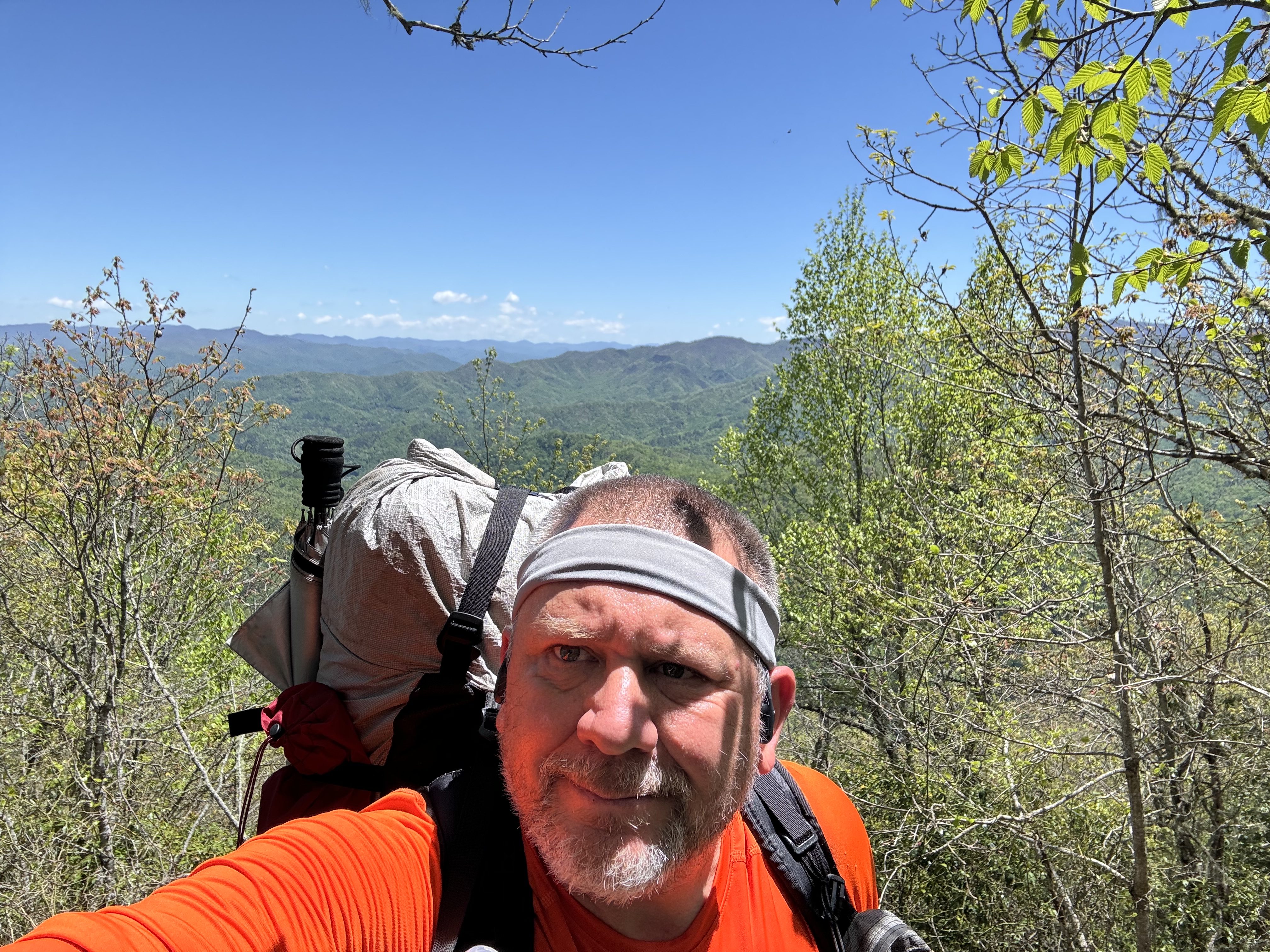
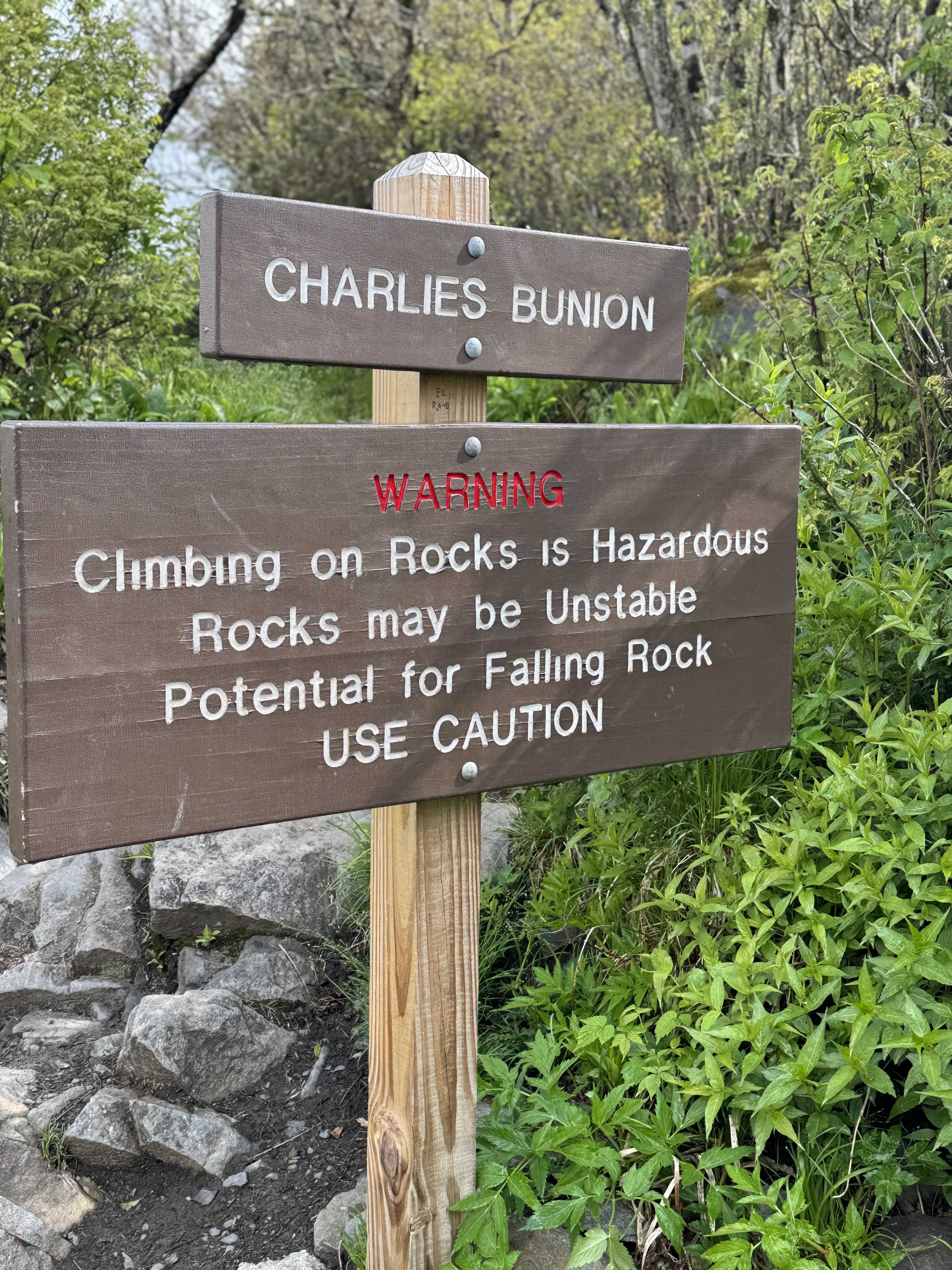
    I reached Charlie’s Bunion about 9:45. Pictures just don’t do justice to the view and the STEEP drop-off from this massive rock formation.

    Charlie’s Bunion
    Chuck on Charlie’s Bunion

    YouTube video at Charlie’s Bunion.

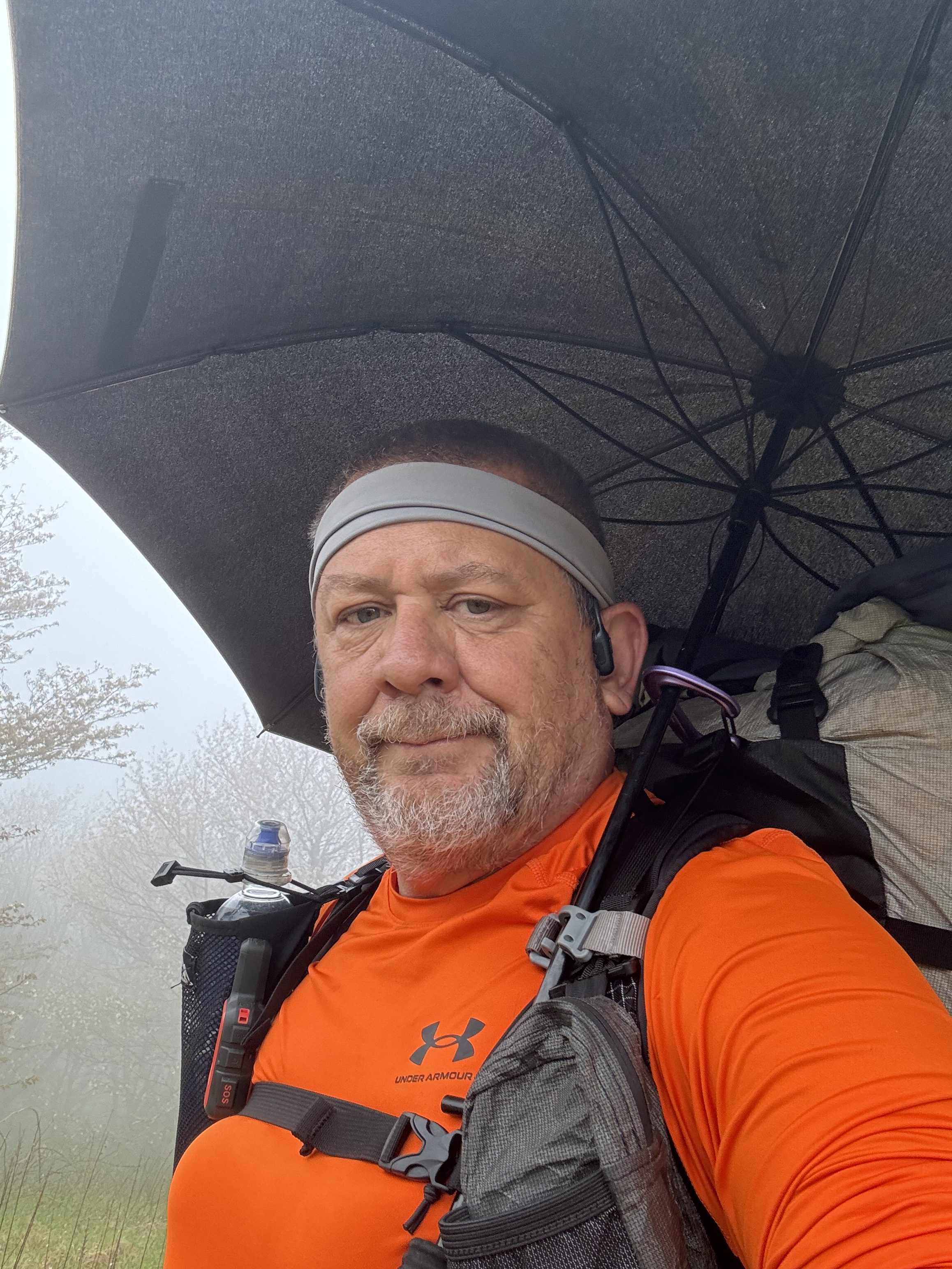
    I thought I would try the camera mount on my trekking pole and show people what actually hiking the trail looks like.

    YouTube video of Chuck hiking.

    And I thought a sample of the knife ridge would give some idea of just what kind of verticals and trail width look like!

    YouTube video walking on knife ridge.

    And a video looking back at Charlie’s Bunion and down into the valley towards Pigeon Forge.

    YouTube video looking back at Charlie’s Bunion.

    Around noon, I realized that I’m looking down on the lakes just east of Knoxville. Talk about a long-distance view.

    Knoxville from Charlies Bunion
    Map of GSMNP area

    Stopped for a snack at about a mile past Laurel Top at 12:30. Called Dana while I had good cell service. The views are amazing. 

    Day 28 views
    Day 28 views looking south
    Chuck with a southern view into North Carolina

    Took a small video looking south into the NC wilderness.

    YouTube video of North Carolina wilderness view.

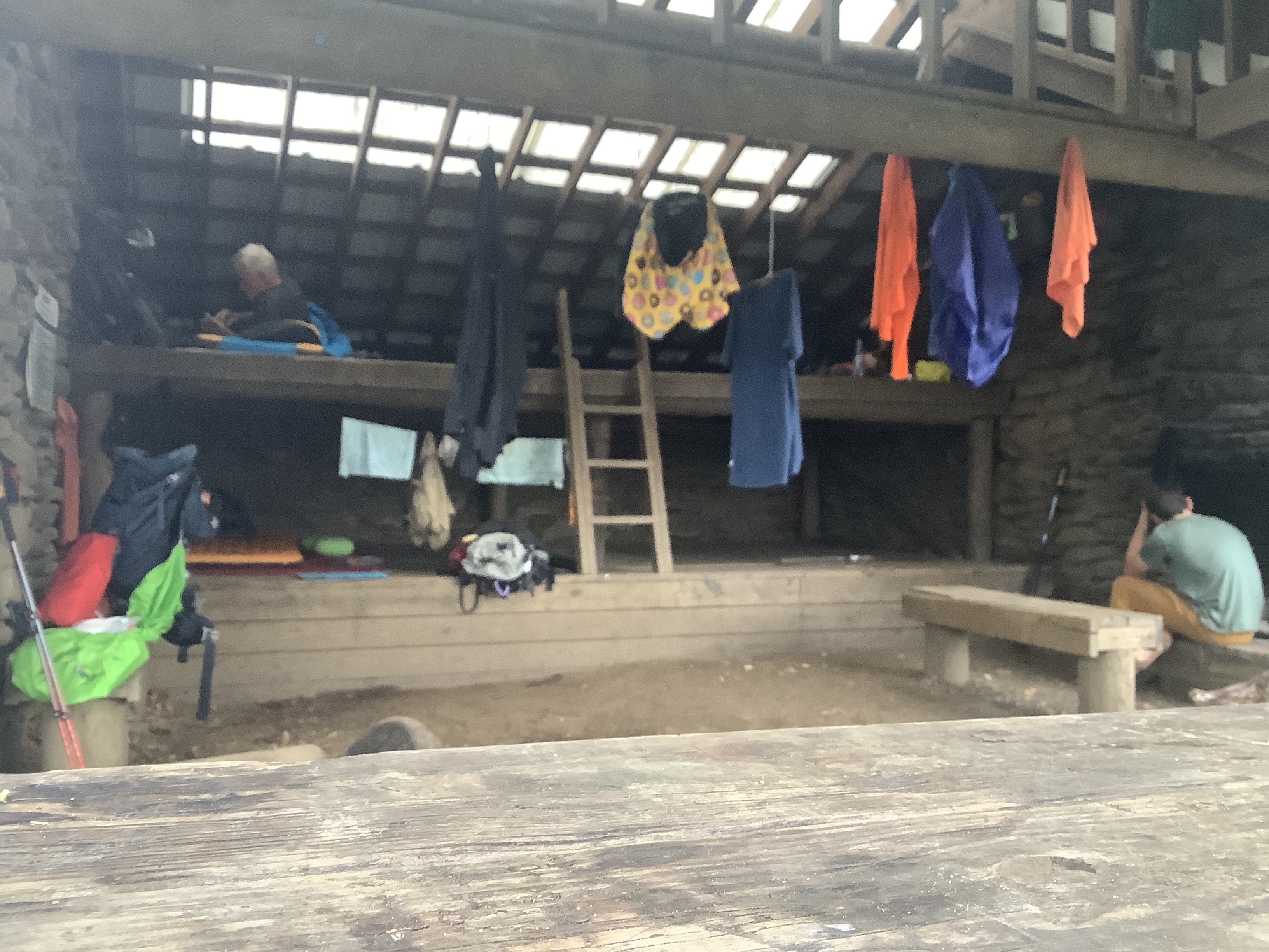
    Made camp at 4:40 at Tri-Corner shelter. It’s a large shelter with a heavy tarp over the front to keep wind out and heat in. One older gentleman with a tent setup and 2 others in the shelter. I got one bar of cell service. 

    Tri-Corner shelter
    Tri-Corner shelter

    Got my sleep space set up, hung a clothesline to dry sweaty clothes, and ate a bag of Fritos. It’s getting cloudy and there is a chance of showers this evening. Nothing terrible, but it’s also getting cold again. It’s dropping into the low 40s and breezy. The elevation here is 5887 feet. My hands are cold, but I have light gloves and heavy gloves. 

    Ate dinner at 5:50. I want to get into the shelter and my quilt as soon as it’s getting cold fast. I’m in bed at 7:00.

    Earlier today, I got a text from Lolly. She was still not feeling well and decided to halt her hike. She was section hiking to Erwin, TN, but Newfound Gap was as far as she felt she could go.

    This was a really good day. Maybe the best hiking and views so far on the trail. It was the first time I really got to enjoy the amazing views in the Smoky Mountains. And no ridiculous verticals.

    Day 28 Map – Icewater Spring Shelter to Tri-Corner Knob Shelter

    Technical Notes:

    • Pop-Tarts 370
    • Tea 0
    • Fritos 320
    • Snickers 250
    • Trail mix 270
    • Fritos 320
    • Fritos 320
    • Mount House rice and chicken 540
    • Dehydrated chicken 170
    • Fritos 320
    • Water liters 1.7
    • Miles 12.6
    • Time 7:30
    • Elevation gain 3175
    • Calories consumed 3000
    • Calories burned 4500
  • Day 27 – Clingman’s Dome to Icewater Spring Shelter

    Day 27 – Clingman’s Dome to Icewater Spring Shelter

    Today’s Miles: 10.8

    Trip Miles: 219.1

    “On the road again. Goin’ places that I’ve never been. Seein’ things that I may never see again. And I can’t wait to get on the road again” – Willie Nelson 

    A chance of rain showers between 8 a.m. and 2 p.m., then a chance of showers and thunderstorms. Partly sunny. High near 57, with temperatures falling to around 52 in the afternoon. Northwest wind 15 to 30 mph. Chance of precipitation is 50%. New rainfall DP pop amounts between a tenth and quarter of an inch possible.

    Up at 8:46. Showered and packed, then went to Flapjacks for a quick breakfast. Shuttle picked me up at 10:00. Lolly got picked up before me. We got dropped off at Clingman’s Dome visitor parking lot. Great view down to Fontana Dam. We hiked to Clingman’s Dome tower and got there at 11:00. 

    Looking back at Fontana from Clingman’s

    Lolly was not feeling well and moving slowly. We parted ways after about 1 mile. She was still not feeling well and did not want me to wait for her. She has plenty of bailout points if needed. I pushed on, making good time towards Newfound Gap. I summited Mount Collins at 12:45.

    Crossed through a gate designed to keep wild hogs out at 2:40. And it started sleeting…or is it hail when the pellets are the size of small peas?

    Wild hogs keep out

    Reached Newfound Gap at 3:15. Talked to a couple of backcountry patrol folks who just wanted to make sure everything was okay. Had a snack, took a picture, at the TN / NC border sign, and headed up the trail. Got 3 more miles to Icewater Shelter.

    Crossing the NC/TN border at Newfound Gap
    Welcome to Newfound Gap

    Sleeted and rained on and off on the way to the shelter. 

    Got to Icewater Spring shelter at 5:00. There are 9 others here, including a ridge runner. We are in a cloud with drizzle. No working privy up here. Cold, windy, and damp. 5900 feet elevation here. Going down to 30. Got my filter in my sleeping bag to keep from freezing. It’s uncomfortably cold and damp!

    Icewater Spring Shelter

    Ate at 6:00, then got into my quilt and put on all my layers, my buff, and gloves. Mornings are going to suck.

    Cold night at Icewater Spring

    Texted with Dana. Just trying to stay warm! May put on my rain jacket to sleep and stay warm. Gonna wear the heavy sealskin gloves to sleep. 7:30 in bed.

    Tomorrow looks easy. Good weather and 12.6 miles without a lot of big hills.

    Day 27 Map – Clingman’s Dome to Icewater Spring Shelter

    Technical Notes:

    • Apple juice: 226
    • Two eggs: 160
    • Corned beef hash: 500
    • Hash browns: 150
    • Snickers: 250
    • Trail mix: 270
    • Dehydrated pork: 170
    • Ramen: 740
    • Water liters: 1.7
    • Miles: 11.1
    • Time: 6:00
    • Elevation gain: 2606
    • Calories consumed: 2400
    • Calories burned: 3500
  • Day 24  – Siler’s Bald Shelter to Clingman’s Dome

    Day 24  – Siler’s Bald Shelter to Clingman’s Dome

    Today’s Miles: 4.5

    Trip Miles: 208.3

    “Rain, rain, go away, Come again another day” – English Nursery Rhyme 

    Up at 6:30. Cold and wet. Packed up and got out of camp at 7:30. It rained again at 7:35…..of course.

    This will be a short 4.5-mile hike to Clingman’s Dome, the highest point on the Appalachian Trail at 6612 feet. It is my first 6000-footer and it also marks the 200-mile mark (actually 200.3). So it’s a trifecta!

    On the ascent, things change to dense spruce-fir forest. Between that and the rain and fog, it feels like Narnia.

    View on ascent of Clingman’s Dome
    Fir trees on Clingman’s Dome

    Made Clingman’s Dome observation tower at 10:15. See stock photo below because I’m in a cloud and can barely see the tower today!

    Clingman’s Dome Observation Tower

    I’m sitting here watching the tourists and waiting for Lolly before I go up the tower. Lolly got here about 10:45. Faster than I had expected. She is just as done with this weather as I am. We climbed the ramp to the tower and took some quick photos. It’s windy and we are wet and cold. I’m wearing my rain jacket for warmth and to block the wind.

    Cold and foggy on Clingman’s Dome

    YouTube video at top of Clingman’s Dome Tower

    We hiked the 1/2 mile down to the visitor center and parking lot to wait for our shuttle. Picked up a snack at the visitor center just to break the monotony of my snack food. Ran into Moses and another young guy whose name I can’t remember at the parking lot. Zero cell service. They have been trying to hitch a ride to Gatlinburg. I hit up my shuttle driver on my Garmin to see if we could fit all four of us, and he responded that he could. Traveling Lite Shuttle service picked us up at 12:15, and we headed to Gatlinburg! I called shotgun. Shuttle also brought me my resupply box, which is how this adventure originally started.

    Got down to Gatlinburg about 1:00. Checked into the Reagan Inn….bless them for having  room available! Unpacked sloppily and walked a block to Walgreens to look for some cheap flip-flops. Ended up with my lovely new camp shoes, Pringles, chili Fritos, and a 12-pack! Talk about one-stop shopping.

    I washed my Hokas out in the bathtub and rigged them on the room heater to dry with my tent poles holding them in place. Cranked it up to 77 degrees and fan on high.

    improvised shoe dryer in Gatlinburg

    I got EVERYTHING unpacked and set out to dry. Sorted my remaining food as well as my resupply box contents. I’m good on food to get me out of the Smokies and to Hot Springs.

    Drying out in Gatlinburg
    Drying tent on the patio in Gatlinburg
    Resupply in Gatlinburg

    Took a loooooong hot shower and a short nap. Eventually made my way a block to one of our favorite Gatlinburg restaurants….Howards. I had a large appetizer, nice T-bone steak, mushrooms, broccoli, chocolate cake, two Fireball shots, and several seltzers. And I’m still hungry.

    Dinner and Dessert at Howard’s Restaurant

    Walked back to the hotel and had a call with Dana, then fell asleep watching TV.

    Day 24 Map – Siler’s Bald Shelter to Clingman’s Dome

    Technical Notes:

    • Mini donuts 400
    • Snickers 250
    • Trail mix 270
    • And stopped counting once in Gatlinburg 
    • Water liters 1.7
    • Miles 4.5
    • Time 2:45
    • Elevation gain 1659
    • Calories consumed – lots
    • Calories burned – not many 
  • Day 23 – Spence Field Shelter to Siler’s Bald Shelter

    Day 23 – Spence Field Shelter to Siler’s Bald Shelter

    Today’s Miles: 11.8

    Trip Miles: 203.8

    “I’d keep playing. I don’t think the heavy stuff is going to come down for quite a while.” – Carl Spackler

    Rained hard in the night. Foggy, chilly, and drizzly this morning. Up at 7:00. Got moving slowly with this weather. Made hot tea and ate breakfast. Packed up, topped off water, and headed out with my umbrella at 9:30. Not quite the last out of camp, but close!

    Started raining hard about 10:30. I submitted Rocky Top Mountain and Thunderhead Mountain at 5500 feet right at the worst of the storm. Thunder, lightning, driving rain, and I’m standing in ankle-deep mud and water with minimal cover. 

    Rainy day on Thunderhead mountain
    Thunderstorm on Thunderhead mountain

    Hustled down off the mountain, but had to be very careful with the river of water and all the slippery mud on the trail. Rain stopped about noon, and the sun came out, and a breeze kicked up. Starting to dry out.

    Made it to Derrick Knob Shelter at 1:30. Stripped down and hung out clothes to dry in the sun and breeze while I ate lunch. Good timing as I’m developing a blister on my right foot from being wet for 3 days. Will wrap that before I head back out.

    Drying out at Derrick Knob shelter

    Dana got me a two-night hotel reservation in Gatlinburg for $59 per night at a good central location. Looking forward to drying things out and getting clean! I’ll take a zero and be back on the trail Thursday morning.

    Back on trail at 2:00. Got dumped on by a bad thunderstorm. Wet and cold. Lightning was close again. Miserable late afternoon. Made Siler’s Bald shelter at 6:00. Cold and wet and not going any farther tonight. Lolly came into camp about 6:30. Very wet and cold. We have 4.5 miles to Clingman’s Dome tomorrow morning. Easy morning. Just hope it’s dry. We get our shuttle at noon. 

    Lolly at Siler’s Bald shelter

    Got into dry clothes fast and set up camp. Tried to dry some clothes but not much success. I’ll wear my camp clothes tomorrow as they are dry and I’m headed into Gatlinburg.

    Ate at 7:30, got water, and climbed into my quilt at 8:00. Another group of 5 came in about 7:45 . One guy was borderline hypothermic. We made him ziplocks of hot water to put in his pits and crotch. It got right chilly and windy when that last storm came through.

    Overall, a miserable day. Two bad lightning storms with negligible cover, dumped on twice and drizzled on most of the rest of the time, wet, cold, and ready to be done with the Smoky Mountains.

    Day 23 Map – Spence Field Shelter to Siler’s Bald Shelter

    Technical Notes:

    • Tea 0
    • Pop-Tarts 340
    • Snickers 250
    • Trail mix 270
    • Pepperoni 560
    • Ramen x 2   740
    • Dehydrated chicken 170
    • Water liters 5
    • Miles 11.8 
    • Time 9:10
    • Elevation gain 4046
    • Calories consumed 2200
    • Calories burned 6500
  • Day 22 – Birch Spring Campground to Spence Field Shelter 

    Day 22 – Birch Spring Campground to Spence Field Shelter 

    Today’s Miles: 11.4

    Trip Miles: 192

    “A foggy day, in London town, it had me low, and it had me down” – Frank Sinatra 

    Patchy fog and a slight chance of rain showers before 7 a.m., then areas of fog and a slight chance of showers and thunderstorms between 7 a.m. and 9 a.m., then patchy fog and a chance of showers and thunderstorms between 9 a.m. and 11 a.m., then a chance of showers and thunderstorms between 11 a.m. and 2 p.m., then showers and thunderstorms likely. Partly sunny, with a high near 65. Southwest wind 5 to 10 mph. Chance of precipitation is 60%. New rainfall amounts between a quarter and half of an inch possible.

    Woke just before 7:00…looked outside at the heavy fog, but no rain, and went back to sleep until 7:30. Slept well. Decided to get moving slowly as I want the fog to burn off before I get moving. No point in getting everything wet from the fog. My rain fly is wet as well as everything I wore yesterday, but hopefully I can dry the clothes this morning by tying them to the outside of my pack. Assuming the fog lifts at a reasonable time.

    I will start the day with a 2.4-mile 800-foot climb up Doe Knob, then a 2-mile 950-foot climb up Devils Tater Patch, then a 4-mile 1100-foot climb up to Spence Field Shelter for tonight. I’m not even going to try making it to Derrick Knob Shelter tonight.

    All this means I’m not making it to Newfound Gap by noon Tuesday to meet my resupply drop. I’ll text the driver later today and ask if he can switch to Clingman’s Dome parking lot instead and MAYBE take me into Gatlinburg. I need to think about all that a bit more, but leaning towards a night in town after all. Gotta see how many miles I do and how I feel. Got moving at about 9:00.

    YouTube video of foggy morning 

    Sun came out at 10:00. Still humid, but at least all the wet clothes hanging on the back of my pack now have a chance to dry. 

    Summited Doe Knob at 10:45. Sun is in and out of the clouds. 2.5 miles down, 9 more to go. Stopped for water at 11:30. Now it’s time for my 2-mile 950-foot climb up Devils Tater Patch. Yea!

    Stopped for lunch at Mollies Ridge shelter at 12:45. Lolly was here and we had lunch. If I go into Gatlinburg on Tuesday, we may split a shuttle. Rained briefly while I was under cover eating lunch. It’s overcast, not sure what weather the afternoon will bring. Got 6 more miles to camp. Back on trail at 1:15. 

    Spit rain on and off all afternoon. Trail is muddy and slippery.

    Stopped at Russell Field Shelter at 2:50 for a break and to refill water. Got 2 bars of cell service, so I called Dana to check in. Got back on trail at 3:30.

    Russel Field Shelter

    I have 2.9 more miles to Spence Field Shelter. Should make it by 5:30 at the latest.

    Made camp at 5:05. There are 3 others here, and Lolly will be here shortly. An older couple doing a SOBO section rolled in at 6:15. Total of 7 of us here tonight. 

    Got unpacked and set up in the shelter on the bottom level. Hung up clothes to dry as best as they can. Made dinner at 6:30.

    Spence Field Shelter

    First half of today was nice. Second half sucked as it was wet and I had to slug through mud and muck. Soaked feet and very muddy. It’s going to rain tonight and in the morning. Not sure what my plan will be for tomorrow yet. 

    Texted shuttle driver who is bringing me resupply on Tuesday. Asked him to meet at Clingman’s Dome instead and if he can take me and Lolly into Gatlinburg. He said yes. I asked Dana to find me a hotel with laundry and a 1:00 check-in with an option to extend to Wednesday night. That will depend on the weather. 

    I am currently 16.4 miles from Clingman’s Dome and it’s going to rain a lot tomorrow morning. I gotta make at least 8 miles tomorrow. I’ve got Derrick Knob shelter at 6.3 miles or Siler’s Bald shelter at 12 miles or Double Spring Gap shelter at 13.7 miles. Game time decision based on weather.

    Day 22 Map – Birch Spring Campground to Spence Field Shelter

    Technical Notes:

    • Pop-Tarts 340
    • Snickers 250
    • Salami 400
    • Fritos S 370
    • Chicken Gumbo 540
    • Dehydrated pork 240
    • Water liters 5
    • Miles 12
    • Time 7:54
    • Elevation gain 3320
    • Calories consumed 2500
    • Calories burned 4500
  • Day 21 – Fontana to Birch Spring Campground

    Day 21 – Fontana to Birch Spring Campground

    Today’s Miles: 8

    Trip Miles: 180.6

    “Smoky Mountain rain keeps on falling …” – Ronnie Milsap

    A chance of rain before 8 a.m., then patchy fog and showers and thunderstorms. Cloudy, with a high near 61. South wind 10 to 15 mph. Chance of precipitation is 90%. New rainfall amounts between a half and three-quarters of an inch possible.

    Up at 7:20. Walked to the restaurant and ordered breakfast at 8:00. Walked down to the store/office and checked out. Waiting on the shuttle to take me back to the bathroom by the marina where I stopped yesterday. No cheating on miles!

    I’m starting in shorts today. Super humid with all the rain and it’s warm. 

    I’m not feeling good about hiking:( Rainy, 7 days in the Smokies, alone, and generally blah. I need to find some people over the next several days and try to be more social. Gotta get my head straightened out. Texted with Vicki and Matt Canada. That helped.

    And the heavy rain just started at 8:50. Looks like it’s going to be heavy rain till around noon. Lovely.

    Got the shuttle to the bathroom near the Fontana marina and it was pouring. Waited under cover 15 minutes and changed my plans based on a comment the shuttle driver made. Is it really worth it hiking in pouring rain for the next 3 hours versus sitting tight under cover? Decided he was right and walked down to the marina, got a cup of coffee, plugged in to power up, used their WiFi, and waited for the worst of the storm to pass. 

    Weather radar of rain at Fontana

    YouTube video of the rain at Fontana Marina

    Looking at the radar map, the last of the worst weather will move by around noon. I’ll head out after that. Just means I get in later tonight. I’ll still be wet, but there is a huge difference in walking in a shower vs walking in pouring rain. 

    Hanging out at Fontana Marina

    YouTube video waiting out the rain at Fontana Marina

    Was feeling pretty sorry for myself at first. Sitting here at the marina listening to Kenny Chesney radio on their outdoor speakers plus talking to Dana got my head in a better place. I need to learn to slow down, enjoy the moment, and stop worrying about schedule/pace. 

    Since I had good WiFi at the marina I could watch the weather radar and see when the worst of the rain would be done. There were a few 15 minute breaks with sun that fooled a few people, but I waited until everything went by at 12:30.

    No way I can make Mollies Ridge Shelter as originally planned with this late start. I’ll just do 8 miles to Birch Spring Campsite. Stopped at the Fontana Hilton and took some pictures. Damn nice shelter and there are showers about 50 yards up the road.

    Fontana Hilton
    Fontana Hilton

    Hiked across the Fontana Dam about 1:30 and took several pictures. Also, my new umbrella rigging is working great! I would be dry other than the fact that it’s 90% humidity and I’m sweating to death.

    Approaching Fontana Dam
    On Fontana Dam
    Fontana Dam power station
    Chuck on Fontana Dam

    Just on the other side of the dam, I met a husband and wife pair of section hikers. They are finishing their hike, but they want to walk about another mile or so to see the drop box where we put our backcountry hiking permits. We hiked together for about 40 minutes and had a nice conversation. They took pictures of me at the entry to the national park and of me putting my permit in the box. Very cool!

    Entering GSMNP
    Depositing backcountry permit at GSMNP

    The next 3 hours were a half-day climb up into GSMNP. Very steep, long climb from the dam up to Shuckstack Firetower. 

    Big climb up Shuckstack

    Made it to the tower at 5:00. Passed a father-son pair headed to the dam and chatted briefly. The tower is sketchy. The metal structure is okay, but the wood floors at the top are scary. I kept my feet on the metal braces and not the wood floor. Took two videos. A cloud was rolling in on me, so not the best views, but cool all the same.

    Salamander on Shuckstack
    View from Shuckstack
    Shuckstack Mountain fire tower
    Chuck on top of Shuckstack Fire Tower

    YouTube video at top of Shuckstack

    YouTube video at top of Shuckstack NOT inside the tower

    Rained on me while descending the tower. Then stopped when I got to my umbrella. Go figure. Hiked about another 2 miles to camp by 6:30. Nice camp site. Sun came out just as I started to set up my tent. Yea…no wet tent!!

    First camp in GSMNP – Birch Spring
    Birch Spring Campground

    Two people here with me: Lolly, who I have met several times in the past 4 days, and a ridge runner. Made dinner at 7:30 … very nice chicken curry I picked up in Fontana. Lolly and I chatted with the ridge runner over dinner. Lots of warnings about bears. Also picked her brain about some upcoming shelters. 

    Hung all my smellables on the bear cables at 8:30 and crawled into my tent. It’s getting chilly, but it’s very damp/humid. Bad combo. Caught up on the blog for today, then called Dana a bit after 9:30.

    I should go 17.5 miles tomorrow to reach Dereck Knob Shelter, but that’s a long way with Rocky Top Mountain in the way. Odds are I have to bail and only make it 11.7 miles to Spence Filed Shelter. There are no other options, and in GSMNP, you MUST sleep in or right beside a shelter. You will be fined if caught breaking that rule. Lots of bear activity up here.

    Overall, what started out as a bad day ended up being fairly decent 🙂

    Day 21 Map – Fontana to Birch Spring Campground

    Technical Notes:

    • Milk 250
    • Coffee 0
    • Breakfast skillet 500
    • Snickers 250
    • Trail mix 270
    • Spicy chicken curry 630
    • Dehydrated chicken 270
    • Water liters 3.7
    • Miles 8.5
    • Time 5:53
    • Elevation gain 3038
    • Calories consumed 2170
    • Calories burned 3500
  • Day 20 – Cable Gap Shelter to Fontana

    Day 20 – Cable Gap Shelter to Fontana

    Today’s Miles: 5.2

    Trip Miles: 172.6

    A chance of rain showers between 10 a.m. and 2 p.m., then a chance of showers and thunderstorms. Partly sunny, with a high near 67. Chance of precipitation is 50%.

    Up at 7:00. Drizzle. Packed up camp, then went to shelter to eat and finalize organizing my backpack by just after 8:00. 

    I carry an ultralight umbrella and have had good luck with it for the past few years. Ever since I got my backpack properly fitted back at Mountain Crossings, my old setup is not working. The umbrella is attached to my left pack strap at two points so that it is hands-free AND rides at an angle that keeps it well above my line of sight when climbing a mountain. Unfortunately, my old setup no longer works. I saw a ridge runner with an umbrella earlier this week, and they had a carabiner attached to their left load lifter as their second point of attachment, and that seemed to work well. Since I have a week of rain in my future and I hate traditional rain gear in warm weather , I took the time to re-rig my umbrella. Used the traditional umbrella attachment strap high on my left pack strap, then added a carabiner on my left load lifter. I can thread the umbrella shaft through those two and then use a small shock cord to fix the umbrella handle to my sternum strap on the far left side. Works perfectly. I’ll try to get a picture.

    Left camp at 8:30. No rain gear as trees are blocking drizzle. Put up umbrella after an hour when rain got heavier. New setup worked extremely well!

    Made a call to the Fontana resort once I got some cell service. They just had a cancellation for tonight, so I grabbed it. Otherwise, they were all booked. Yes!

    Got to Fontana marina and bathroom at 11:45. Shuttle took me to the store and checking at 12:30.

    Turns out the Minis are here this weekend. I thought that was last weekend. Need to text Laura some pictures.

    Minis at Fontana

    Grabbed some snacks and a six-pack from the store and lugged all my gear up to my room…about 1/3 of a mile and it was UP. Unpacked, put out the tent to dry, sorted the remaining food, called Dana, and took a nap for 2 hours. 

    Woke up at 4:00. Showered, worked on blogs, and got my laundry sorted. Walked back down to the store at 5:00 and got change for the laundry. $3.00 for wash and another $3.00 to dry! Got laundry going then bought my resupplies for the next 3 nights on the trail. 

    Worked on blogs some more then joined Jon Lunning’s virtual Friday happy hour Zoom at 6:00. Ed Byrd was on the call. That was an awesome surprise. Great to talk to everybody for an hour.

    Walked up to the restaurant and had a burger for dinner, then trekked back to my room. Finished the blogs…Will post them later tonight.

    I have a call with Dana at 9:00 to plan out some resupply that she will ship to Hot Springs, NC for me this weekend.  I have the basic supply box ready at home, but need to tweak it a bit.

    I need to get all my gear packed before I go to sleep later. Need to be able to move quickly in the morning so I can get breakfast and catch the 9:00 shuttle back to the trail. Got about 14 miles to hike in the rain tomorrow as my introduction to the Smoky Mountains. Fun, right?

    Almost forgot, I’ve been hiking alone for the past 3 days. Mike is moving on and making big miles. I may see him partway through the Smoky Mountains, but not counting on it. I’m solo now. That is making some things more mentally challenging. I’m honestly not looking forward to the Smokies in the rain. Need to dig deep and muscle through to Hot Springs, NC which is 7 or 8 days away.

    No pain, no rain, no Maine.

    Day 20 Map – Day 20 – Cable Gap Shelter to Fontana

    Technical Notes:

    • Waffle 150
    • Nut butter 220
    • Snickers 250
    • Other food at Fontana Lodge
    • Water 1.7 liters
    • Miles 5.2
    • Time 3:24
    • Elevation gain 1185
    • Calories consumed … a lot
    • Calories burned 1500
  • Day 19 – Sassafras Gap Shelter to Cable Gap Shelter

    Day 19 – Sassafras Gap Shelter to Cable Gap Shelter

    Today’s Miles: 15.4

    Trip Miles: 167.4

    Sunny, with a high near 82. Southeast wind 1 to 6 mph.

    Up at 6:50. Nice morning, but it’s going to be hot today. One nasty climb right out of camp, then another in 8 miles…call it noon. Overall, I’d like to do 15.4 miles today in order to be close enough to Fontana tonight to get in by noon tomorrow. And tomorrow starts 5/6 days of rain. Lovely.

    A note on heat. Being from the mid-Atlantic, I don’t mind the heat very much. It’s the humidity that I hate. But I’m used to working and hiking in the low 90s with 75-85% humidity. It’s amazing how many people that I have met who are complaining about the heat when it’s only 82 and low humidity. And a lot of them are from the south. I’m confused.

    Finally killed off my first fuel can, making tea this morning. I need to calculate how many boils I got out of it. Ate breakfast, topped off the charge on my watch, packed up, used the privy, and headed out at 8:15.

    As I was leaving camp, I noticed my left knee was swollen. As my soccer friends know, my knees are not in the best shape. It doesn’t hurt right now, but it has a habit of popping out of joint. If that happens enough times, it will hurt and keep popping out more frequently. I need to be very careful with my foot placement for the next few days.

    I summited Cheoah Bald at 9:10. Got a great picture. Insects are really bad, but I’m holding off on applying Deet for now. 

    View from Cheoah Bald

    I’ll stop at Stecoah Gap in 5.7 miles. There are picnic tables, a parking lot, and water there. Good lunch spot.

    Stopped at Stecoah Gap at 12:30. About 12 hikers were here in the shade using the picnic tables. Including the loud group from last night. Walked about .1 miles to get water, then had lunch, threw away trash, and rested until 1:30. Let the other folks get well ahead of me before I left. The only downside was that there is road construction going on right next to us.

    Stecoah Gap construction sign
    Stecoah Gap construction

    Immediately after lunch, I had to climb this nasty thing. It took almost 2 hours to go 2.3 miles and 1100 feet up. I felt like an old man on those near-vertical parts. I stopped every 100 yards or so. That may have been the worst climb so far. At least the next 6 miles are mostly downhill to camp for tonight. MOSTLY!

    Very hard climb out of Stecoah Gap

    I nursed my water on the way up that thing. Fortunately, there was a spring just after the summit. I hiked down to the spring and filtered water, then hiked back up to the trail. It was warm and sunny but breezy.

    Speaking of warm and sunny, this guy was sunning himself on the trail just past the summit and scared the crap out of me. I hate rattlesnakes!

    My first rattlesnake – Stecoah Gap

    I have had a few questions about what the actual trail looks like in terms of width and drop-off and such. It varies a lot, but lately it has been narrow (2 feet or less) with steep drops. A few examples.

    Steep drop off

    I made it to Cable Gap Shelter at 7:05. No cell. And the loud youngsters were here again. I got camp set up quickly and walked to the shelter to make dinner at 7:50. I tried stovetop stuffing with dehydrated chicken. It was good, but a LOT of food. I only ate about half of it. Lesson learned.

    All in all, it was a hard 16-mile day. I’m beat and have rain to look forward to for at least the next week. I crawled into bed and fell asleep by 9:00.

    Day 19 Map – Sassafras Gap Shelter to Cable Gap Shelter

    Technical Notes:

    • Tea: 0 
    • Poptarts: 370
    • Summer sausage: 450
    • Snickers: 250
    • Trail mix: 270
    • Stovetop stuffing: 500
      • Too much food: 
    • Dehydrated chicken: 170
      • New fuel can
    • Water: 6 liters
    • Miles: 16
    • Time: 11:16
    • Elevation gain: 3634
    • Calories consumed: 2200
    • Calories burned: 4322
  • Day 18 – NOC  to Sassafras Gap Shelter

    Day 18 – NOC  to Sassafras Gap Shelter

    Today’s Miles: 7.10

    Trip Miles: 152

    Patchy fog before 9 a.m. Mostly sunny, with a high near 68. North wind 2 to 7 mph.

    Played with YouTube since my videos are too big for Trailjournals. Added YouTube videos to the last three days’ blogs. 

    Showered, ate, packed, and headed out  a bit before 10:00. Mike left early, and we will meet up at camp. Got 7.1 nasty uphill miles to climb out of the NOC to Sassafras Gap. Hope to be there by 5:00.

    11:00 granola break. Beautiful day. Mid-60s and breezy. Not another person out here.

    View from the NOC climbout

    Stopped at 1:00 to refill water. This is the only water between here and camp. Had a Snickers bar and rested in the cool of the spring for 15 minutes. 

    YouTube video of waterfall on NOC climb out.

    The final 2 miles to camp are going to suck….very steep.

    Nasty climb out of the NOC

    Made Sassafras Gap Shelter at 3:30. One flat tent spot 100 yards below the shelter. Got camp and bear hang setup by 4:45. Taking my time today and not rushing to get set up as I rarely get to camp this early.

    Texted with Mike. He will camp about 9 miles ahead of me at Brown Fork Gap. We should hook back up at Fontana before the Smoky Mountains. 

    Which reminds me, we start into the Smoky Mountains on Saturday, and it looks like lots of rain from Saturday through at least Monday. That’s going to suck big time. 

    No pain, no rain, no Maine.

    I am happy with the short day today. My body still isn’t ready for longer days. It hasn’t even been 3 weeks on the trail yet. I’ll try bigger miles after Great Smoky Mountain National Park (GSMNP). It’s nice to NOT be in pain at camp, and I am in camp early enough to relax and enjoy myself before sunset. 

    Had dinner at 6:00. Early for me. Nice to not feel exhausted in camp for a change. Settled into my tent and played some games till late (10:00…woohoo) in the evening. 

    I don’t normally speak ill of my fellow hikers, but I’m glad I picked the tent spot way away from the shelter. There is a very annoying group of 4 young guys hanging out at the shelter. I ran into them earlier today at a water refill. Loud, slightly obnoxious, crude, and not doing a great job of respecting other hikers’ sense of space and noise. Very unusual for thru-hikers, and they are thru-hiking.

    Day 18 Map – NOC to Sassafras Gap Shelter

    Technical Notes:

    • Donuts 450
    • Coffee 0
    • Granola 200
    • Snickers 250
    • Knorr chicken rice 620
      • 2 cups full boil, simmer 12 minutes 
      • Use less water…try 1.5
    • Dehydrated chicken 170
    • Fritos 320
    • Water 4 liters
    • Miles 8.44
    • Time 6:17
    • Elevation gain 3385
    • Calories consumed 2100
    • Calories burned 4000
  • Day 17 – Wesser Bald Shelter to NOC

    Day 17 – Wesser Bald Shelter to NOC

    Today’s Miles: 5.7

    Trip Miles: 144.9

    Rain showers likely before 11 a.m., then showers and thunderstorms likely between 11 a.m. and 2 p.m., then a chance of showers and thunderstorms. Partly sunny, with a high near 74. Chance of precipitation is 60%.

    Woke to rain at 7:00. Rain just started as I woke up, then picked up. At least it’s warm 🙂 Got packed quickly and moved to shelter to eat and finalize backpack setup and get into full rain gear. Mike and I headed out about 8:45. I’m probably carrying at least one, if not two, pounds of extra water due to my waterlogged tent and other gear. 

    No pain, no rain, no Maine.

    We have 5.7 wet miles to go to reach the  NOC. The Nantahala Outdoor Center (NOC) is a major eco-tourism destination with the AT literally running right through the place. Restaurants, outfitter, general store, and all kinds of outdoor activity centers. It was only 5.7 miles, almost all VERY downhill, but it was a hard hike. Big steps/terraces, slippery rocks and mud, and awesome views. Due to the steep downhill terrain and mud, we spent a lot of time doing this almost shuffle with our feet to keep from slipping. Sounds easy, but it was very tiring on the calves. Rain stopped about 10:00, and we got rid of our rain gear.

    View descending into the NOC

    I ran into a group of 4-day hikers about 1 mile from the bottom. I could tell that they were day hikers because they were clean, and I could smell the soap and deodorant on them as they went past. About that time, I realized that the rain had washed some of the stink off of me and my clothes. I could really smell myself this morning. TMI?

    Got into the NOC at 11:45. Mike got here about 30 minutes before. He had French fries waiting for me at the restaurant. Checking in isn’t until 3:00, so we hung out at the restaurant and had lunch and beverages until about 2:00. We walked over to the outfitter so Mike could replace his torn rain pants with a rain kilt. We got online and purchased our hiking permits for the Great Smoky Mountain National Park (GSMNP). The outfitter printed them for us. We will need those in 3 days…..foreshadowing!

    NOC general store

    Walked to the store, picked up our Resupply boxes, and checked into our rooms at 3:00. And of course, the rooms were about 3/4 of a mile away and uphill. Nice little rooms with a shared common area and laundry. I got all my gear unpacked so it could dry out. 

    Gear explosion at the NOC
    Gear explosion at the NOC

    YouTube video of pack explosion and resupply at the NOC.

    Called Dana and hung out in the room. I unpacked my Resupply box and realized I have WAY too much food. I’ll deal with that in the morning…too tired now. I ate some of my trail food for dinner since I have so much. Mike and I did laundry and I started packing up for tomorrow. I will finish that chore in the morning. I got 3 days of blogs written.  It’s 9:30 now.  I will crash once I get these blog entries uploaded. 

    And now for some hiking hygiene information that you probably don’t want to know about, but is very important. Let’s talk about chaffing!

    Seriously, chaffing is a major issue with hiking in general and even more so with long-distance hiking. There are all kinds of videos and websites  devoted to this topic. I learned about it the hard way 2 years ago when I started hiking long distances in the lovely mid-Atlantic heat and humidity.

    For men and women, the chaffing issues occur in the privates and especially in the butt cheeks. For endowed women, they also have issues with the boobs. Sorry, but those are the facts. 

    Chaffing is not just uncomfortable, it is debilitating. It is not uncommon for chaffing to cause a person to have to get off trail for several days. I know of men and women who have been in so much pain they had to quit their thru-hike. 

    Why do I bring this up now? Because I was in a rush today and forgot to preemptively deal with this. I learned the hard way two years ago to apply preventive lotion “down there”. I have been good about that so far, but with scrambling out of camp today with the rain, I forgot. Factor in the rain, humidity, etc., and I was starting to chaff big time in the cheeks today. Keep in mind it was less than 6 miles and it still messed me up. 

    Fortunately, I carry Body Glide as a preventative as well as good old-fashioned medicated diaper rash cream in case of problems! 

    In all seriousness, this could have cost me a day or two off trail to heal up.   I WILL NOT screw up like this again.

    Day 17 Map – Wesser Bald Shelter to NOC

    Technical Notes:

    • Cliff bar 250
    • Ruben sandwich 820
    • Fries 350
    • Sweet tea x 2 200
    • Chocolate cake 550
    • Fritos 270
    • Seltzer 210
    • Seltzer 210
    • Summer Sausage 450
    • Seltzer 210
    • Seltzer 210
    • Water 3 liters
    • Miles 6
    • Time 3.5
    • Elevation gain 600 (3100 feet descent)
    • Calories consumed 
    • Calories burned 2700