“There’s no place that I’d rather be than right here
With my red necks, white socks, and blue ribbon beer
The barmaid is mad ’cause some guy made a pass
The jukebox is playin’ there stands the glass
And the cigarette smoke kind of hangs in the air
Rednecks, white socks, and blue ribbon beer” – Johnny Russell
Rained on us last night, so I’m carrying a wet tent. Got out at 8:20 this morning. The weather is good but humid.
Headed for lunch and resupply at a local store about 7.5 miles into our day. Nice view on the last .5-mile road walk down to the store.
nice view
Stopped at Brushy Mountain Outpost at 11:35 at mile 7 for today. Got hotdogs and fries for lunch at a few small resupply items to get me to Pearisburg. The place is decent if a little rednecky and intimidating.
Brushy Mountain Outpost
Dried out our tents while eating lunch. Great view.
drying our gear at Brushy Mountain Outpost
Back on trail at 1:00. Long but good break. We crossed I-77.
Looking down on I-77Crossing I-77Chuck crossing I-77
Stopped for water at a shelter. .2 miles to shelter and .2 miles to water. Ugh. But it’s the last water for 9.6 miles. Getting dry out here.
We struggled in the afternoon. Both of us are tired, my back hurts, and my feet are killing me. We decided to call it at 14.2 miles instead of 21. Found an okay campsite on top of a ridge. Made camp at 6:00.
campsite on a ridge
Dried clothes out on the clothesline, made dinner, and planned out the next 2 days into Pearisburg. The new plan is to hike 15 miles tomorrow and tent by a creek. There are lots of hills tomorrow. The next day we go 8 miles to a road and shuttle into Pearisburg at 2:00. That way we can max out our time in town. We then shuttle back to the trail and we will figure out that plan later.
It’s now 8:00. I took a muscle relaxer and hope to be asleep by 9:00. I am going to check on the shuttles for the day after tomorrow. There is a cool view from my tent on the ridge at 8:05.
Nice view from inside tentDay 59 map – Suiter Road to tent site at mile 599.3
Made it here in good time. I’m shooting for Suiter Road, Laurel Creek, which will make 21 miles today. There is Jenkins shelter at 16.6 miles, but that’s a short day. Right now I feel good, it’s partly sunny, breezy, low humidity, and low 60s. Chilly when the sun is not out. Back on the trail at 12:30.
Reached VA Route 623 at 3:25. Water cache here, but not much left. Maybe 1 gallon left. No more water until Jenkins Shelter in 4.6 miles.
Made Jenkins shelter just before 6:00. Not sure why it took me so long to get here. Sat at a picnic table to study the map and had just decided to give up for today instead of pushing another 4.5 miles and 2 hours……when I heard “Chuuuuuuck”.
I turn around and there is Overkill walking out from behind the shelter. I knew I was within 10 miles max of her, but did not expect you to catch up today! She only did 11 miles yesterday and stayed at Chestnut Knob Shelter. That let me catch up 8 miles. She was having a bad day today and not moving very fast, which let me catch her. She wants to do the extra 4.5 miles , so we pushed on at 6:00.
Made it to Suiter Road at 8:00. We hiked REALLY hard to make that time. Thank god we found a tent site right next to a flowing creek. It’s getting hard to find water. Made camp and ate dinner in the dark at 9:30. We are going 18.8 miles tomorrow. Got a long dry stretch in the morning and another in the afternoon. I need to start carrying an extra liter despite the weight. We pass a camp store at mile 7 tomorrow. Plan to eat lunch and get water there. I’ll pick up an extra water bottle there. Yey…another 2 lbs.
I am very happy to have caught up with Overkill so quickly. We make a very complimentary hiking pair, plus it feels good to be with someone consistently. We should be together through to Mount Kathadin.
“I’m a lad from old Virginia Bravely knocking my way back home To that cabin home in the mountain Never more let me roam
I’m a lad from old Virginia And I’m coming, coming home There I’ll settle down forever In my old Virginia home” – The Carter Family
Now that I am moving north into Virginia, I feel like I am walking home in a few different ways. I am getting close to the Tazewell, Dublin, Pulaski areas where my people on my father’s side are from. I am also getting close to Blacksburg and Virginia Tech which have tons of memories for me. And I will be walking north along the I81 and Shenandoah corridors to Harper’s Ferry where I do a lot of my day hiking. I will meet up with Dana twice in this section. This entire big section just feels like home and brings up lots of memories and emotions.
Up at 7:00. Overcast, breezy, upper 50s, scattered thunderstorms this afternoon. It’s very humid today. Ick.
I’m aiming for a tenting site about 16 miles north . My feet are sore this morning. Need to stretch well and I’m going to try a second pair of socks for padding today. Wondering if my insoles are too narrow?
I hope to gain a few miles on Overkill today. I have 3 or 4 PUDs depending on if I go 15 or 20 miles today. Hopefully not as many rocks as yesterday!
I will pass the quarter way mark around noon. That’s a major milestone! Plan to celebrate at the Quarter Way Inn for lunch.
On trail at 8:15. Goodbye to all the critters.
Hens at the Alpaca FarmNoisy roosterGoodbye to the Alpacas
Cross under I81. I wanted to get cash but the Exxon wasn’t open yet. Oh well.
Crossing I-81 for the first time
Supply cache at the trail head sign just past I81 this morning.
supply cache near I-81
Very well maintained trail. Recently mowed and weed whacked last several miles like this.
That’s what I call trail maintenance
Walking through pastures today
Pasture walkGate crossing
Random privy.
Random privy
I reached the quarter way mark at 10:10. Huge milestone
reached the 1/4 way mark
Ran into Tortilla again a couple of miles before the Quarter Way Inn. We hiked to the Inn together. Stopped at the Quarter Way Inn at 1:15. Really nice place. Had a frozen Birds Eye meal for lunch. Eating healthy! Called Dana and chatted for a while using the Wi-Fi at the Inn. Back on the trail at 2:40.
Long story short, this was my afternoon of pastures, cows, cattle gates, rinse, repeat.
more cow pasturesmore cowsmore cow gatesjust passing throughbeware high waterChuck crossing a gatecows literally on the ATlast gate of the day
I basically created a mini cattle stampede when I forced that last set of cattle off the trail so I could get by.
Once I was done with all the cows and gates, I had two nasty PUDS and 7 more miles to finish. I wanted to push far so I had all these behind me before tomorrow.
tough climb to end the day
Scared a young bear at 6:20 at mile 562.8. It ran off downhill in the woods. It was not a cub.
Got to a washed-out bridge over Lick Creek at 7:10 at mile 564.1. It was a nice spot and the river could be carefully crossed on stones. I wanted to go 2 more miles, but the water source there is dry and the camp spots here are superb. I guess I’m staying here.
washed-out bridge over Lick Creek
Great campsite by a washed-out bridge. No cell service. It has a nice, shallow river, two 20×24 blocks of wood that used to be part of the bridge but are now seats, a dead-level spot, a great bear hang tree, and nobody else is here, even though there are at least 4 other tent sites.
nice campsite at Lick Creek
Made dinner at 8:40. It was late, but it’s quiet and light, and there are no bugs. There is a chance of rain till midnight, but it’s just overcast now. The breeze is picking up and helping to dry sweaty clothes.
Note: The new sleep pad is good, but the pump sack sucks. I need to order a better one ASAP.
Day 57 map – Long Neck Lair Alpaca Farm to Lick Creek
Up at 7:20. Slept well. Beautiful day again. No clouds, low 60s, low humidity. All the breakfast places are closed this morning.:( Found a latte and donut nearby.
This is going to be a tough day. It’s the third anniversary of Andrea’s death. Tough day to be completely alone. This all hit me very hard this morning.
AndreaAndrea & Chuck 1987
Phil picked me up at the Merry Inn and we stopped at the post office so I could ship my torn sleep pad home.
I want to make it to civilization tonight. I don’t want to be alone in my tent in a field tonight. Feel like I need people today. Shooting for the Alpaca Farm tonight around 6:00.
Phil dropped me off just before 10:00 and I’m on trail at 10:00. Really in the green tunnel today!
Green Tunnel
Reached Partnership shelter at 11:45. Very nice two-story shelter.
Partnership ShelterPartnership Shelter
Visitor center closed on weekends, but I was able to get water.
Mount Rogers Visitor Center
Exciting to see signage for I-81.
Getting close to I-81
Stopped for a break at 1:45 on a convenient log. Two more PUDs to go then all downhill to the alpaca farm.
Stupid snake flitted across the trail almost under my feet.
Snake
Met a pretty girl on the way down the last mountain today.
Hello girl
Got to Chatfield Shelter at 3:55. Gave my feet a break till 4:15. Still have almost 5 miles or 2.5 hours to go to reach the Alpaca farm. Ugh.
Chatfield Shelter
Moving slower than I expected today. Feet still hurt. I hope the new insoles help in a few days. Trail is VERY rocky today so that does not help.
Rocky but not PA
Stopped at the schoolhouse museum and settlers museum about 4:45. Nice trail magic supplied by the local church.
Ran into Tortilla again at the schoolhouse. He and I have been meeting on and off for about 3 weeks. He’s pushing on much further today.
Shared the trail with a very large rabbit near the end of my journey today.
Big Bunny
Got to Long Neck Lair Alpaca Farm at 6:15. Interesting place. It’s a .4-mile road walk down US 11. Just north of Atkins, VA, on I81 near the Sunoco I Yelped the other night.
Atkins, VARoad walk to the Alpaca farmLong Neck Lair Alpaca FarmLots of Alpacas
It’s not bad. Interesting but not bad.
rustic shower
There are 5 of us in the bunkhouse tonight. It can sleep 10.
Showered, did laundry, and did lots of texting with friends and family. Bought a root beer and a frozen pizza and a candy bar for dessert. And I’m still losing weight.
I’m doing better mentally this evening. Had way too much time on my hands/mind this morning waiting for the post office to open. My head was in a bad place, not too surprisingly
Day 56 Map – State Route 670 to Long Neck Lair Alpaca Farm
“So I’ll just keep touching up my gray hair. Live and hope someday she’ll understand. It’s no matter if I live to be a hundred. There’ll always be a place in my heart for Mary Ann” – unknown bluegrass artist
Up at 7:00. Cool, clear day with no rain in the forecast until Monday. Successfully dried all my gear with the space heater last night. Got packed up so I can get shuttled to the trail when the hostel owners are ready. The hostel provided a nice hot breakfast.
I need to contact the hostel associated with the outfitter in Marion later today and see about getting from the trail to town and back. Their website says they will help me work that out. The outfitter does not open until 10:00. When and where I can get picked up this evening will dictate my miles today, unfortunately. I hate being constrained like that.
Just before I got a ride to the trail, I called Coach at The Merry Inn and confirmed a bunk for tonight and a pickup at 5:15. That time and location are flexible. I’ll text them an hour before I get to my stopping point. I’ll probably just do about 14.5 miles today, but the next stop is possible at 18.3. That later one is later than I like due to the time the outfitter in Marion closes. Will see how fast I’m moving today.
On the trail at 9:00. Boring hike today. Nothing special to see with all the foliage filled in. Stopped for a snack at 11:15 at 5 miles in. Stopped again at 11:50 to take my pack off for a few minutes and rest my back.
Stopped at Comers Creek Falls. Very nice waterfalls. Not a good picture.
Comers Creek Falls
Took a break to rest my feet and back for 20 minutes at Dickey Gap.
Say hello to my little friend.
Little friend
Got cell service around 3:00. Texted with Merry Inn and confirmed pickup at 5:00 at VA Route 670.
Also heard from Overkill. She zeroed at the same hostel last night and gave it a big thumbs up.
Passed through a very large cow pasture. Nice odor.:(
Large cow pastureLarge cow pasture
Topped off water and reached my destination at 4:20. Nice, quiet spot by the road. The driver should be here about 5:00 to drive into Marion.
VA SR 670
Phil, an older gentleman, picked me up at 5:00. We had a nice chat on the drive into town.
Got checked into the Merry Inn and picked up my new sleeping pad and a pair of new insoles downstairs at the outfitter. Yey! It’s a really nice hostel. The staff is very friendly. Just me, an older couple, and one other older guy. We sat in the foyer and chatted for over an hour. We had a nice dinner just down the block at the Wooden Pickle.
The same 3 people were still chatting when I got back from dinner. We all talked until 11:00! It’s nice to have the entire place to ourselves. I got things mostly packed up so I can get moving quickly in the morning.
Had a fun late Friday night FaceTime with Dana, Christina, and Laura. But it’s midnight and I need to try to sleep.
Note to self – consider more slackpacking!
My shuttle will be ready as soon as I get back from the post office at 9:40. I need to get my old sleep pad packed up and ready to ship tonight. The weather looks great tomorrow. I have 4 miles uphill to start, then mostly downhill or flat for the rest of the day. I would like to do 19 miles tomorrow. I will see how my feet feel.
Overkill will be at the Quarter Way Inn tomorrow night. That’s a 24-mile hike for me, so it’s closer than I thought. I should catch up with her in 2-3 days max.
It’s the end of the world as we know it and I feel fine” – REM
Up at 7:00. Very windy and cool today with a 60% chance of rain all day. Fell back asleep till 8:00. Literally woke up in a cloud! On the trail at 9:10.
My sleeping pad deflated every hour last night. I obviously put a small hole in it. I have a patch kit assuming I can find the leak. This sucks.
Made it to 2.5 miles to Elk Garden at 10:20. There is a pit-toilet and trash cans here, availed myself of both:)
Sign at Elk Garden
Had a snack before going out at 10:40. Entering Lewis Fork Wilderness area.
Entering Lewis Fork Wilderness area
Up there is where I spent the night.
Into the clouds
And now I have to climb this to reach Mount Rogers.
Onward to Mount Rogers
Walking out of the woods into a meadow in the clouds today. Feels like walking off the edge of the world.
Walking in the clouds
This pony did not want to yield the trail to me. We are in a very large area of wild pony herds today including the Greyson Highlands.
First pony in Grayson Highlands
Got to Thomas Knob shelter at 12:45. 4 thru hikers, 2 scout masters, and 8 scouts sheltering from the rain and cold wind. I’ll get some food and water and head out. It’s too cold and crowded. I want to get to lower altitude. It’s going to rain all day so I’ll just deal with it. I slipped and poked a few small holes in my CNOC bag while getting water. Will see if duct tape can fix it. Headed back out at 1:20.
Called a hostel and they have a room. Getting picked up at 5:00. Shorter day than wanted by 6 miles, but I’m not making good time in this rain and mud.
I passed the 500-mile mark!
Left the AT for Pine Mountain Trail at mile 500.4. Pretty hike to cut off the Greyson Highlands section of AT. Hiked through miles of these in heavy rain.
Pine Mountain Trail
Rejoined the AT at mile 508.9. Now it really started pouring! Took a good fall on slippery rocks, but I’m good. Stopped at Old Orchard Shelter for a break. Ran into Puzzler and 3 friends. They are doing a 23-mile slackpack today. Staying at the same hostel as me so I’ll see them later this evening.
Headed out at 4:00 to meet my driver 1.6 miles away at 5:00. It’s pouring and ankle-deep mud. I have not been this wet and muddy since before the Smokies. At least it’s warm at the lower altitudes.
Made it to the parking lot near Fox Creek and State Route 603 at 4:45. Driver should be here at 5:00. Got to the hostel about 5:40. Interesting place and interesting owner. I’m good with it but a lot of people would not be.
Did laundry, showered, went to DG for frozen pizzas and hard seltzer, attempted to dry shoes and jacket on a clothesline. Will try to dry shoes with a small space heater in the room tonight.
No way I’m finding the leak in my sleeping pad. I’m ordering a new one. Not sure where I’ll ship it yet.
Heard from Overkill. She was smart and took today off in Marion. Will be at Quarter Way Inn tomorrow night. I’m probably 30 miles behind her roughly. Caught up a day and a half. Next two days have great weather and I’ll try for big miles.
Ran into another hiker named Tortilla that I have leapfrogged with since Erwin. We chatted for quite a while.
Ordered a new sleep pad at the outfitter in Marion. Now I have to get there to pick it up.
“Well, I never thought I’d find a place where I could be
Just happy as a jaybird in a cherry tree,
So I stayed down in Virginia, ’cause that’s the very best,
So bless the day that brought me here,
And bless the folks I love so dear.” – Frank Sinatra
Up at 7:15. Clear and 68 degrees. Forecast calls for rain this afternoon and tonight. Got moving slowly, did not sleep well. Had two nice cups of coffee at the dining room tabu with my pop-tarts. Chatted with Larry again for a bit. Got out of the Inn at 8:45.
VERY humid out here this morning. My pack is HEAVY with all this food! Bothering my mid-back a bit. Trying an experiment. Feet hurt the last three days. I think it’s the new orthotics. Hiking today with them out. No insoles.
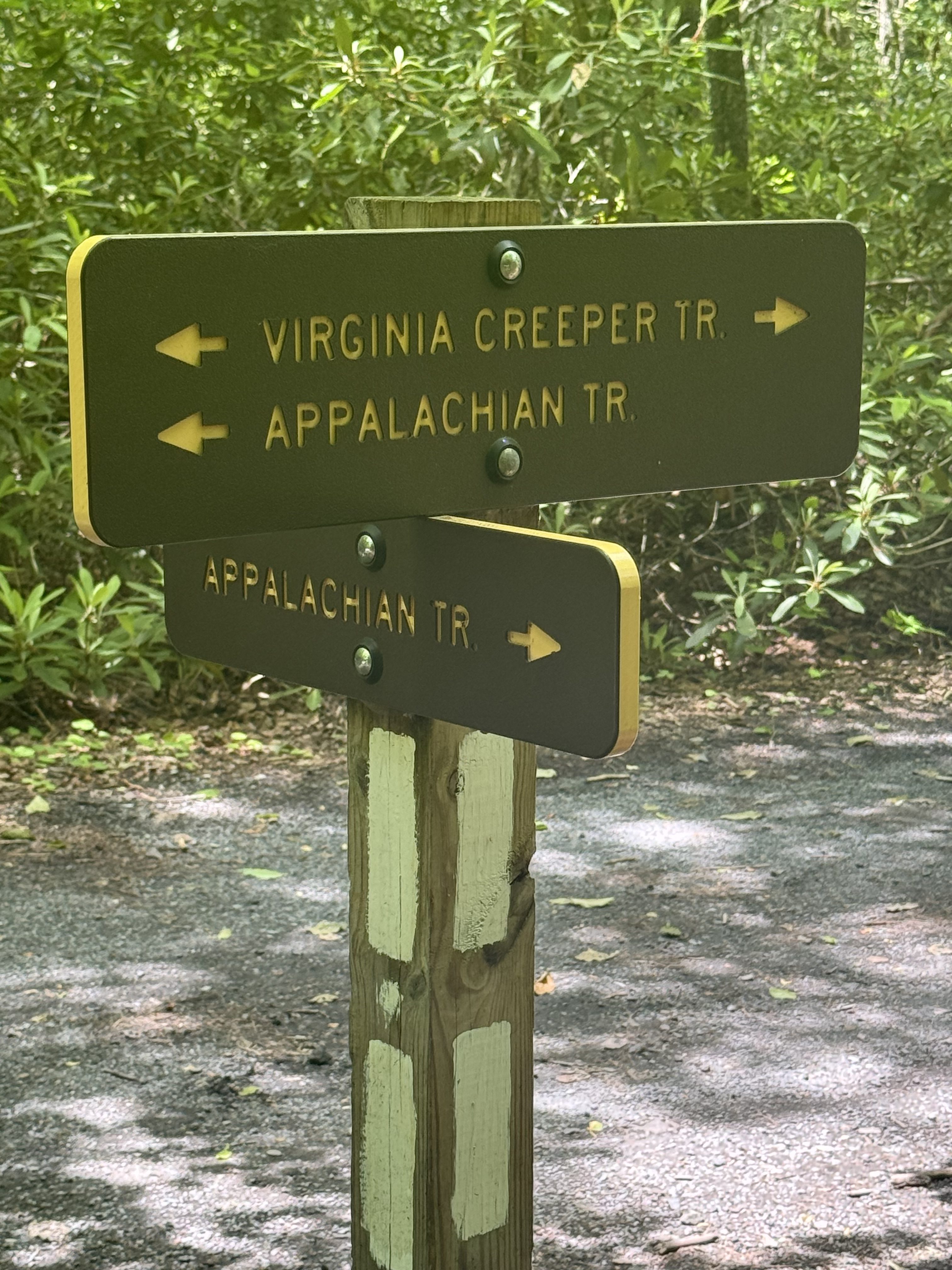
I am doing the first 9.14 miles today on the Virginia Creeper Trail (VCT). The VCT and AT overlap through and a bit past Damascus, diverge for 9 miles or so, then join back up at AT mile 484.5. See VCT map if my actual hike today below.
VCT Map
It’s pretty out here on the VCT along the river.
Stream on the VCTStream on the VCT
Took a break at 4.7 miles to rest my pack. Moving again at 10:25.
Ran across this little guy on the trail. 99%sure this is a juvenile copperhead.
Baby copperhead on the VCT
Stopped for lunch at Hellbender’s Cafe at 11:25. Yum…chili dogs! I’m 7.6 miles into the day and it’s really starting to look like thunderstorms as forecasted.
Hellbender’s Cafe
Back on trail at noon. Nice waterfall.
Waterfall on VCT
Rejoined the Appalachian Trail at mile 484.5 at 1:00. Right on schedule. There is a bench here, so I took my shoes and pack off for 30 minutes.
VCT and AT Intersection
I have 2.5 miles on the AT yet to Lost Mountain Shelter at mile 487. Then 5.8 miles on the AT to Whitetop Road at mile 492.8 for a total of 8.3 more miles today. I’m guessing 5-6 more hours given the upcoming elevation and the way I feel at present. That’s not going to be easy, but it puts me in really good shape for my plan for tomorrow!
Difficult ascent to Whitetop Road
Met up with a doe and her very small fawn while getting water at 2:15.
Doe and her FawnDoe and her Fawn
Stopped at 3:00 for a 15-minute break at Lost Mountain Shelter. All three of us here commented on the nasty humidity today!
Crossed through a cattle gate and skirted a cow herd.
Cows near Lost Mountain
What a nasty climb the last 2.5 miles! Took me over 2 hours.
Ugly ascent to buzzard Rocks
Made it to Buzzard Rock at 6:30. Awesome view, but storms are moving in.
Stopped for water and made it to the Whitetop Parking lot and then found a tent site .2 miles past there in the woods at 7:00. Got camp set up. One bar cell service. Whitetop is the second tallest mountain in Virginia. I’ll be climbing Mount Rogers, the highest, tomorrow.
Storms are moving about, but there’s no rain, just nice wind, and the humidity is down. I may actually be able to dry my super sweaty clothes before dark.
Finished dinner at 8:45. Late day. Not enough time to dry clothes. Oh well. Will see what I can do tomorrow.
I was getting tornado alerts from home this evening. Turns out a tornado touched down IN Poolesville. Once I get better cell service tomorrow, I’ll find some photos or video.
Tornado struck back home
Asleep about 10:30.
Day 53 Map – Damascus, VA to Whitetop Road parking
That’s where the birds yeah warble sweet in the spring-time
That’s where this heart of mine, yeah longs to go” – Ray Charles
Up at 7:00. Sunny, breezy, mid-60s. Out of camp at 8:00. It’s getting very humid and the green tunnel isn’t helping.
10:55 crossed the Virginia / Tennessee state line.
Orange Man crossing into VirginiaVirginia / Tennessee Line
Today should be easier than this. Left Achilles is hurting as well as both feet. I got past this a few weeks ago and it’s all back now. The last two days doing 16 miles was harder than the 18s last week. I guess it’s the 3 days off? Hopefully I get past this crap quick.
I don’t plan on a full zero day for 2 to 4 weeks depending on a bunch of factors. I need to make miles!
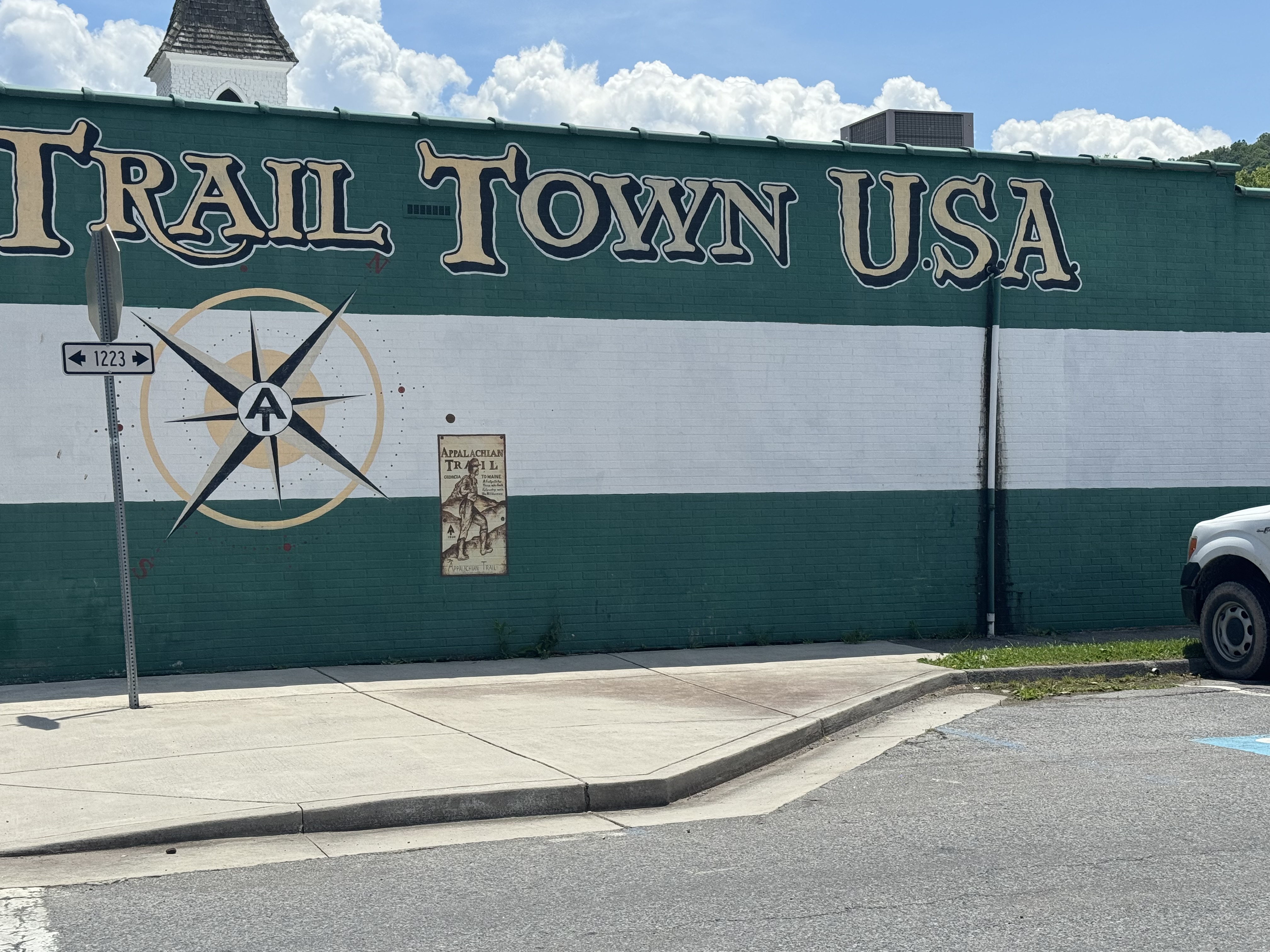
Got to Damascus at 12:30. Made good time. Nice quiet little town. The trail runs right through town and down the sidewalk of Main Street.
Welcome to Damascus, VADamascus, VA sidewalk is the AT
Got an early check-in at Dancing Bear Inn. It’s someplace between a hostel and B&B. Quite nice and quiet . Very nice owner.
Dancing Bear Inn, Damascus VAPrivate room at Dancing Bear InnThe parlor at Dancing Bear Inn
I’m in the Duck bedroom. And it has a duck!
The Duck in The Duck Room
Showered, got laundry done, charged electronics, did resupply shopping at the outfitter in town then walked a mile to the local grocery store and back. I had to say goodbye to an old pair of friends that I have been hiking with for over a year.:(
Goodbye to my original water bottles
They were both leaking. They have done me well. Replaced with a new 1-liter and a new .7-liter Smart Water bottle. Also picked up a pair of Injinji socks and a SUPER lightweight Outdoor Research shirt (orange) that has amazing wicking and quick drying material. The new short sleeve that Dana brought me in Johnson City was an utter failure in terms of material, wicking, and drying. I’ll keep it for now as a camp shirt, but probably ditch it due to weight soon.
Had a nice dinner with an older section hiker named Larry at the local diner. Talked for close to 2 hours. Very cool dude. Had a good local bourbon at the local distillery.
I got all my food sorted and packed. Got a 5-day food carry coming up. Ugh. That’s heavy, and my next resupply is at a Sunoco station at I-81 & US 11 near Atkinson, VA on Sunday or Monday.
Videoed with Dana to finalize the resupply box headed to Eric Hanson later next week. Lots of lessons learned going into this resupply box 🙂
I have about 16 miles tomorrow with 2 good climbs. And the forecast is sketchy…mixed thunderstorms and very humid the next 2 days.
Chilled in my room, updated blogs, and read till close to midnight.