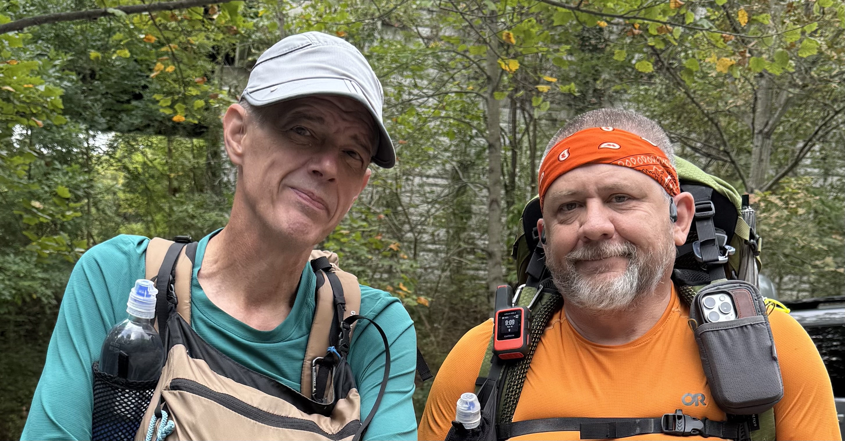
Tag: Trail-Journal

  • Day 3 – Kitchen Creek to Mount Laguna

    Day 3 – Kitchen Creek to Mount Laguna

    April 26, 2026. Rainy, windy with gusts to 35 mph, 34 going up to 38, feels like 24 degrees.

    Up at 6:30. It’s cold, wet, very windy, and miserable. It won’t warm up much if any today. We have 12 miles to town with the first 9 uphill. I figure this will take at least 7 hours.

    Last night was miserable. Rain on and off, freezing temperatures, and crazy wind. The wind buffeting the tent made it almost impossible to sleep. The rock trick worked to keep the tent up until about 5:00 a.m. when my tent collapsed again. Crawled out and got things fixed and slept for another hour.  If you call that sleep.

    Brad and I got moving at 7:30.

    I don’t have much to say about today other than YUCK. It was very cold, extremely windy, overcast with rain on and off until about 1:00. Long steady uphill ending at 5900 feet. We have gained over 3000 feet in elevation in 3 days. Hence the cold and chance of snow tonight.

    Boom!

    Brad and I arrived at the Pine House Cafe in Mount Laguna at 2:15. Brian, Hell Yeah, Titus were here. We had an early dinner together before Brian and Hell Yeah headed out to do 8 more miles. Crazy youngsters. Awesome to have real food.

    Lodge at Mount Laguna

    Checked into the mediocre Tiny House Block hostel at 3:30. Titus is also staying here. I’ve been in worse, but not for $50. They are the only game in town. Got settled in, dried tent as best I could, walked 1/2 mile to get resupply before they close at 5:00, showered, started laundry, and started relaxing.

    Hostel at Mount Laguna
    Hostel at Mount Laguna

    Got blogs updated and posted. Packed food bag. Generally got ready for hiking tomorrow. Once my electronics finish recharging I plan on a good night’s sleep out of the elements. The wind is still howling outside our room and it is 35 degrees with a real feel of 24 at 6:45 p.m.

    My cold weather gloves tore in two places today. Not sure how that happened. I will replace them later this week in the next big town. The heel started to tear off my NEW hiking shoes. These things are 5 days old and only 2.25 days in the trail. I’ll be sending a nasty-gram and a photo to the manufacturer. Duct tape to the rescue until I can find a replacement layer in the week. Frustrating!

    Overall, the trip has been good so far. I’m a little disappointed in how slow I’m hiking and that I can’t do more than 15 miles yet. But that is to be expected. I planned for the bad weather, but I was hoping to not have it for longer. Oh well.

    One potential issue, however. Full disclosure time. That hike in the rain today on top of the heat the past 2 days has left me with a bad chafing issue. I should have gotten ahead of it more than I did. There is a chance that I will not be able to hike tomorrow. Will see in the morning. Fingers crossed.

    Day 3 Map – Kitchen Creek to Mount Laguna

    Technical Notes:

    • Pop Tarts 340
    • Peanut M&M 250
    • Cheeseburger with bacon 680
    • Fries 383
    • Large coffee
    • Seltzer x 3 300
    • Propel x 2
    • Water liters: 2.3
    • Miles: 13.4
    • Time: 6:45
    • Up: 3314
    • Down: 1293
    • Calories consumed: 1953
    • Calories burned: 2889
    • iPhone battery used: 40%
  • Day 2 – Hauser Creek to Kitchen Creek

    Day 2 – Hauser Creek to Kitchen Creek

    April 25, 2026. Sunny and mid-40s going up to mid-50s.

    Up at 6:00. Slept really well. Surprisingly so for the first night on the trail. 

    On the trail at 7:00. We had a tough climb out of Hauser Creek first thing. I struggled and had to make frequent stops. Still feeling that 11lb water carry in my hips. 

    What trail looks like

    We reached Lake Maurena campground at 9:25. Brad beat me here by 15 minutes. I wasn’t as slow as I thought!

    There was a big trail magic event at the campground! We stayed for an hour. I had coffee and bagels and chatted with folks. Everyone from camp last night plus many others were here. 

    Trail magic at Lake Maurena

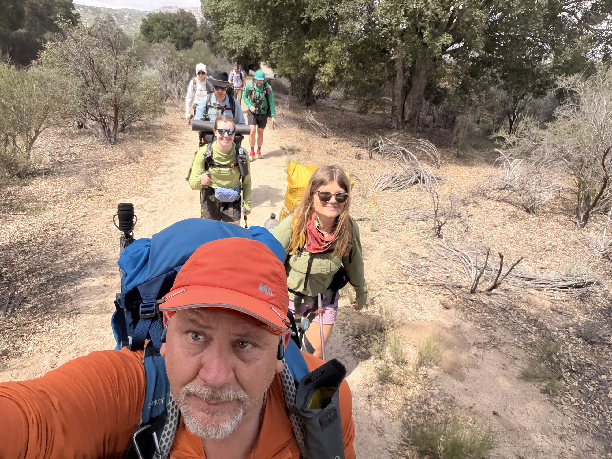
    Hiked out of Lake Maurena with a crew of six. We all met at CLEEF on Thursday evening. 

    Hiking with 6 from CLEEF

    Stopped at 12:00 and 8.7 miles for a break. Found a nice shade tree. First shade in 3.5 miles. We are making good time as a group. Next stop is a campground in 2.3 miles for water and a decision as to how far to go today.

    Brad and I took a break at 1:00 in the shade. We let the younger folks plow ahead. We are not in a hurry and they are on a mission.

    We reached Boulder Oaks Campground at 1:15 and 11.1 miles. Lots of hikers here including the folks we were hiking with earlier. Toilets and water too.

    Blooming Cactus on Trail

    I reached our planned campsite at 13.8 miles at 3:15. Brad missed it and kept going. Took a break and pressed on trail to follow. Ugh.

    Met up with Brad 1 mile down the trail. I was struggling badly at this point. We pressed onward hoping to find a pair of tenting spots not on the map. I found two spots while Brad took a side trail DOWN into Kitchen Creek for water. No way I could handle the climb back out of there. I’ll survive with the 2 liters I have with me tonight. Set up camp at 4:40.

    The forecast for the night is bad. Rain, very cold, high winds. Worried about keeping my tent from collapsing in this high wind and sandy soil. 

    Got camp set up slowly. Almost fell asleep getting my air mattress and other gear settled into the tent. Dozed for 90 minutes and then forced myself to eat dinner. Rain and wind started around 6:00.

    Wind pulled out 2 tent stakes and the tent collapsed at 6:30. Big winds have not even arrived yet. Trying the little rock, big rock trick instead of using tent stakes. Hopefully, that will hold through the night.

    Ugh. I am almost broken. 15.6 miles today. The plan was 12, but we ran into issues and had to go further. 31.7 miles in 2 days. That was not the plan. I need to slow up. Water is proving very problematic and dictating where we need to stop. I’m okay, just need to slow up before I injure myself.

    Trying to go to sleep at 8:30.

    Day 2 Map – Hauser Creek to Kitchen Creek

    Technical Notes:

    • Pop Tarts 340
    • Bagel 300
    • Coffee x 2
    • Fatty Beef Stick 300
    • Propel x 2
    • Potato chips 350
    • Curry Noodles 450
    • Dehydrated Chicken 170
    • Water liters: 3
    • Miles: 15.55
    • Time: 9:50
    • Up: 3166
    • Down: 1621
    • Calories consumed: 1910
    • Calories burned: 4199
    • iPhone battery used: 50%
  • Day 1 – Mexico Border to Hauser Creek 

    Day 1 – Mexico Border to Hauser Creek 

    Friday, April 24, 2026. Mostly sunny and 36 going up to 67.

    Up at 5:30. A bit chilly this morning, but the sun isn’t fully up yet. Slept fairly well last night. Coyotes woke me up at least once. 

    Had a nice breakfast provided by the staff, packed up, got my PCT hang tag, and headed to the Mexican border. The staff at CLEEF are really amazing. And it’s all volunteer.

    Mile sign at CLEEF

    It was an easy half-mile walk south to the border. I walked there with Aubrey, who is a fellow AT thru-hiker. That wall is much larger in person than it looks on TV. 

    Border Wall
    Border Wall

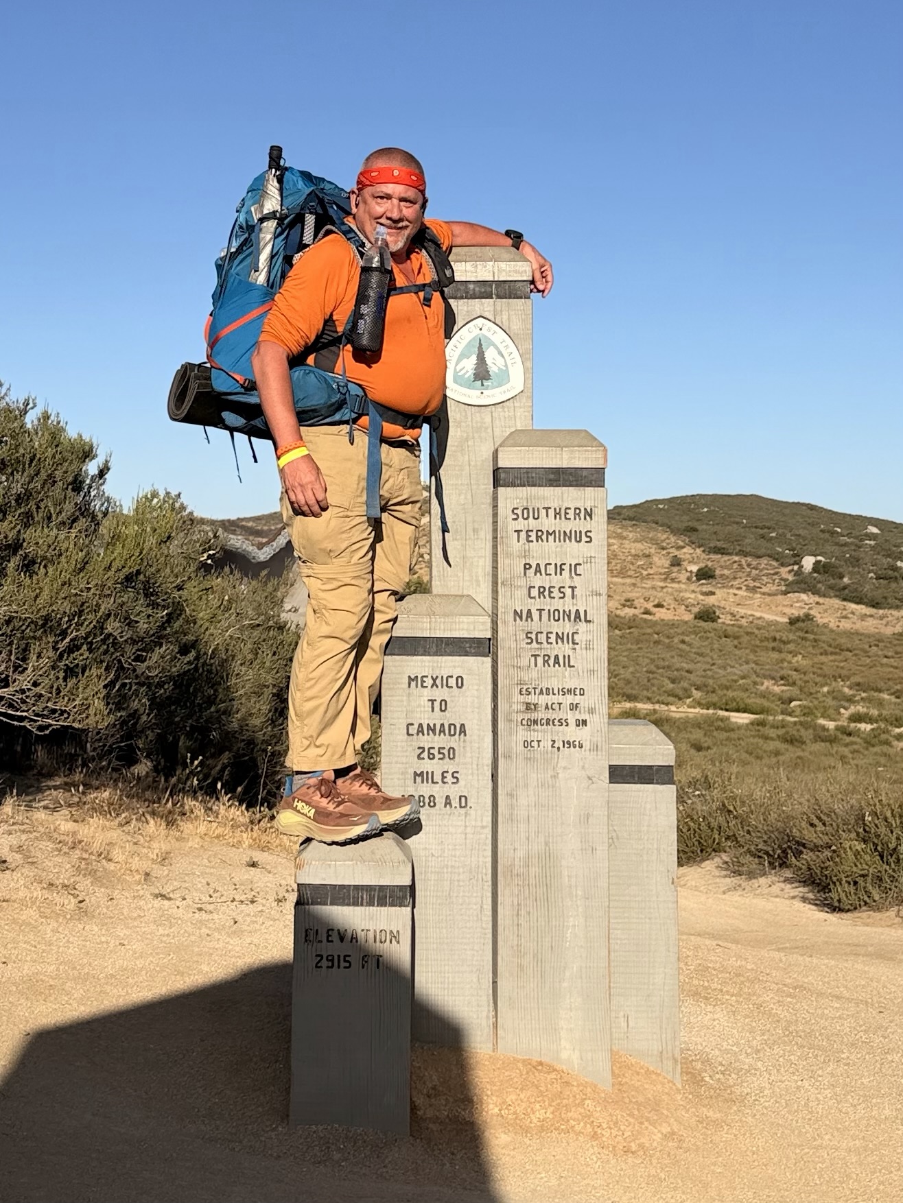
    Brad was already at the PCT Southern Terminus Monument when we arrived. Me, Brad, and Aubrey took each other’s pictures on the monument.

    Orange Man at PCT Southern Marker
    Orange Man at PCT Southern Marker

    We then walked to the actual border wall and touched Mexico before heading north to Canada. This is the official start of our 2,655-mile adventure!

    Touching Mexico

    Brad and I left together at 7:35. We took each other’s picture at the famous 3-mile marker. 

    Orange Man at the Famous PCT 3-Mile Sign

    We planned to go 16 miles to camp. Both of us would have preferred a 13-mile day, but water will be dictating a lot of our plans. I started the day with 4 liters of water, which means a 32.5-lb pack. Ugh.

    We stopped for water and a snack at 9:30 and 4.4 miles.  Natalie was already there taking a break. We both refilled 1 liter of water and moved on after a 15-minute break. The next water is in 10 miles. As we were leaving, Aubrey, Brian, Hell Yeah, Britta, Nile, and John arrived, followed by Pebbles. 

    We started a long ascent into the desert. There were no clouds in the sky, and the sun was hot. I was not covering my face or arms with my sun hoodie. More on that later.

    We stopped for a break and a snack in the only shade we had seen all day at 11:10 and 7.75 miles. We have been climbing since we hit water at mile 4.4 and have 1.6 more miles of climbing. Then it’s flat and downhill to camp.

    Day 1 View

    The temperature was only about 70, but the constant sun and long, steady climb made it quite warm. We stopped for a break at 1:30 and 11.5 miles in the shade. We started the day at 3 miles per hour but slowed to about 2 miles per hour.  I was really feeling those 32 lbs on my hips.

    We took another break at mile 13 in the shade. My feet and hips were really feeling the weight plus the first day blues.

    We reached the water cache at 3:00 and 14.6 miles. This cache is maintained by the staff at CLEEF. This day would be brutal without the cache. 

    Day 1 Mile 14 Water Cache

    The sun finally started to get to me. My arms were okay, but I think I burned my lips and my face a bit. Not terrible, but still. I started hiking with the hood of the sun hoodie up from here on.

    Hot and Sun Burned on Day 1

    There is no water at camp, and we have 5 miles uphill in the morning before we reach water. I carried 5 liters or 11 lbs of water the next 1.2 miles to camp. That made for a 37 lb pack on day 1. Let me tell you how much that sucked!

    The last mile was steep downhill with slippery, loose sand and a huge weight on my back and hips. Just a bit sketchy.

    We got to Hauser Creek at 3:50 and set up camp.  We beat all but 2 hikers here and basically got the best camp spots in the shade of a grove of trees. Awesome! 

    As expected, I needed that 5 liters of water. Between rehydrating and making dinner I went through almost 3 liters leaving me with 2 liters for the first 5 miles tomorrow.

    My hips were SCREAMING by the time I dropped my pack. I had to rest for a bit before setting up camp. That is very unusual for me. Walking was very challenging at this point.

    Brad and I set up camp by 4:30. Really nice camp spot! Just after we set up, Aubrey, Niall, Natalie, and Jacob arrived. Natalie took a spot in our area, and the rest camped another 50 yards onward. Another much longer, Wyoming pitched her tent with us. She is celebrating her 50th birth year by hiking 5000 miles, including the PCT.

    Brad and I made dinner about 6:30. I was pleasantly surprised to have a good appetite. I usually don’t the first week on the trail.

    Hips were still pretty bad. I decided that sitting was not helping, so I walked around camp for the next hour, which helped a lot. 

    Britta, from Germany, arrived around 7:00 and made camp with us. She was not feeling well and had all the signs of altitude sickness.  We were worried about her, but she started feeling better and managed to eat eventually.

    Brian and Hell Yeah showed up at some point and took the lady 2 spots in our camp area. Brian is a ski instructor from Salt Lake City, and Hell Yeah is an Aussie miner. 

    Day 1 Camp

    We all hung out and chatted until 8:30. It turns out Hell Yeah is carrying a 50-lb pack. He is a big young guy, but still, that’s insane. We had a lot of fun poking fun at his gear, including the largest cooking pot I have ever seen on the trail. All in good fun.

    Crawled into my tent at 8:30 and worked on blogs until 9:15. Read for a bit and tried to get to sleep at 10:00.

    Overall, it was a good first day. I’m not sure if Brad and I will hike together long-term, but we should be good for at least the next week. The mileage was difficult due to the heavy water carry. I should not have to do that again for at least 2 weeks! I plan to send my camp shoes home in a couple of days. I’ll probably just stick with my trail shoes for now and think about camp shoes much later on. That will save me about 12 ounces and some bulk in my pack. 

    Day 1 Map – Mexico Border to Hauser Creek

    Technical Notes:

    • Bagel 270
    • Peanut Butter 307 
    • Peanut M&Ms 250
    • Jalapeño chips 300
    • Peak Refuel Beef Stroganoff 810
    • Propel x 3
    • Water liters: 3
    • Miles: 16.1
    • Time: 8:35
    • Up: 2005
    • Down: 2395
    • Calories consumed: 1937
    • Calories burned: 4294
    • iPhone battery used: 30%
  • Day 0 – San Diego to  CLEEF

    Day 0 – San Diego to  CLEEF

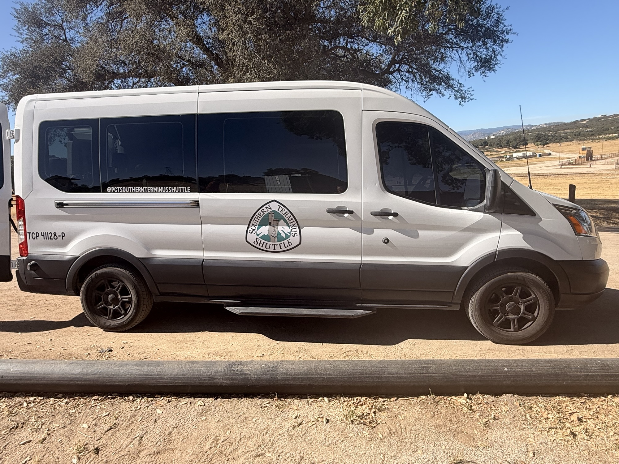
    Good nights’ sleep at the Best Western. And a very nice breakfast buffet. I chilled in the room until I checked out at noon. Put on my pack and walked about 1.4 miles to a UPS store to ship my duffle bag and travel clothes home. Got to the Old Town Transfer Station about 12:45 to wait for my 2:00 shuttle to  Camp Lockett Event & Equestrian and Facility (CLEEF) campground.

    Southern Terminus Shuttle

    There were two other hikers there waiting. Both from Canada. Brad from British Columbia and roughly my age. Titus from Montreal. We chatted until the shuttle arrived.   Four other hikers joined us and we left right at 2:00. We stopped at REI and I bought my fuel canister. From there we drove about 45 minutes to the general store near camp and picked up sandwiches for dinner. Checked into camp about 3:30 and pitched my tent.

    Tents at CLEEF

    The group of 7 from that shuttle hung out and socialized most of the evening. Hoping to build a trail family out of this group, but time will tell. 

    Shuttle crew at CLEEF

    The camp volunteers gave a 60-minute lecture on things like safety, water, hitchhiking, etc. Good info. Of the 25 of us here, only 5 have prior long-distance hiking experience.

    CLEEF pavilion

    Everyone signed the 2026 hiker banner.

    My name on CLEEF banner
    2026 CLEEF Banner

    Hiker midnight is 9:00 and everyone is in their tents and lights out by 9:15. I worked on today’s blog and read until midnight.

    Tomorrow is the big day. First day on the PCT!

  • Day 3 – Four Pines Hostel to Campsite (mile 691 NOBO)

    Day 3 – Four Pines Hostel to Campsite (mile 691 NOBO)

    Today’s Miles: 8.73

    Trip Miles: 36.52

    Day 3 – Four Pines Hostel to Pickle Branch Shelter

    Tuesday March 31, 2026. Up at 7:30. Sunny going up to mid-70s.

    I slept very well. My heels are hurting this morning but the rest of me feels decent. Thought I would feel worse. Should be a good day!

    The hostel crew made us a nice breakfast. I decided that my pack was way too heavy due to excess food. I sorted my food bag and left a lot of food at the hostel. I left 2.5 lbs of food! That leaves me 3.5 in food bag plus 10oz Fritos, 1 M&M, 2 trail mix in hip pockets for 3 full days. The hostel’s scale says my pack is down to 30lbs, which sounds correct. 

    We got packed up and walked the .5 miles back to the trail by 9:30. We are headed 2.7 miles up to Dragon’s Tooth. My recollection is that this is going to be a rough climb up steep rocky slabs. No water until about mile 9 today. 

    The ascent is about as I thought. Steep and rocky. We paused for a view back do to the hostel from last night at 10:05 and 1.44 miles.

    Chuck and Ed on ascent ot Dragon’s Tooth
    Looking down on Four Pines Hostel

    We had to walk around a 6 foot black snake who was winning himself on the trail. He refused to get out of our way.

    6 foot black snake on trail

    There is a spot on the ascent that we had to butt slide down last time I was here. It isn’t quite vertical, but darn close.

    Looking down a near vertical cimb on Drangon’s Tooth

    The last .2 3 miles are steep nearly vertical faces. You have to switch back up the rock face and be careful of your footing. Would not want to do this in the rain or ice.

    Ed standing on the side of the mountain near Dragon’s Tooth

    We arrived at the summit of Dragon’s Tooth at 11:25 and 2.95 miles. It is getting very hot and humid out here. I think I am going to have a bit of sun burn when this day is over. 

    Top of the ascent to Dragon’s Tooth

    The high school  group from the past two days got here before us. They camped at the end of the pastures yesterday instead at the base of Dragon’s Tooth as planned. They are finishing their hike in a few miles at the parking lot on the south side base of the Tooth.

    High school group at Dragon’s Tooth

    We took a 25 minute break on the top of the mountain before pressing on to Pickle Branch in 4.3 miles for water.

    Between the ascent up Dragon’s Tooth and the ups and downs over the next 5 miles, Ed was not doing too well. His legs just did not recover last night from our nearly 19 miles yesterday. Since we have to cross a gravel road near Pickle Branch, Ed decided to call the hike early. His brother Stuart will pick us up at the road around 3:00 this afternoon. 

    We met Stuart on trail about .5 miles before the road. He hiked towards us and brought us beer and soda. Thanks amigo! We hiked back to the car and Stuart drove me back to Blacksburg where I got my truck and drove back home to Maryland. I got home about 10:20 p.m. Nice evening for a drive. I also got to experience my first Buc-ee’s on the drive home up I-81.

    My first Buc-ee’S

    Overall this was a good hike for me. I got my new pack adjusted and felt very good the last 1.5 days on trail. No more back issues. I also realized that I just don’t eat much food on trail for the first few weeks. I had packed my food as if I had been on trail for several weeks, leading to a very heavy pack. That is probably the best lesson learned from this shakedown hike. I will plan much less food to start the PCT in a few weeks. I need to replace my hiking gloves. The right palm is tearing out. I also figured out a better way to arrange my gear in my pack. This new pack has two huge side pockets that are very deep. I found I can put my cooking pot and rain pants in one of the side pockets along with a 1 liter water bottle. That frees up some internal space. Nice!

    The biggest lesson learned, sorry Ed, is that we are not ready to do big miles yet. I remember that I intentionally did smaller 11-12 mile days for the first two weeks on the AT in 2024. And I took breaks every 2 hours and stretched my feet. Both of us need to keep that in mind. Me for my upcoming PCT hike and Ed’s AT LASH from Springer to Fontanna.

    Day 3 Map – Four Pines Hostel to Pickle Branch Shelter

    Technical Notes:

    • 2 eggs 160
    • 6 sausage patties 400
    • Biscuit 212
    • Coffee
    • Fatty Beef Stick 300
    • Water liter 3
    • Miles 8.73
    • Time 5:55
    • Up 2126
    • Down 2490
    • Calories consumed 1100
    • Calories burned 2711
    • Phone battery used 35%
  • Day 2 – Lambert’s Meadow to Four Pines Hostel

    Day 2 – Lambert’s Meadow to Four Pines Hostel

    Today’s Miles: 18.19

    Trip Miles: 27.79

    Day 2 – Lambert’s Meadow to Four Pines Hostel

    Monday, March 30, 2026. Up at  7:00. Cloudy and 45 degrees. Showers in the next few hours going up to 70.

    Slept decently for the first night on the trail. My back is very stiff but not nearly as bad as it could be. 

    Had breakfast, checked the weather, and got packed up fairly quickly this morning. We wanted to beat the rain that could start by 8:00. We started the 940-foot ascent to Tinker Cliffs at 8:00.

    The ascent up to Tinker’s Cliff was longer and harder than I remembered. The last time I was hiking, I was going down towards Daleville and not up this thing. We arrived at Tinker Cliffs at 9:10. It was breezy and looked like rain was moving in across the valley to the west. 

    Chuck at Tinker Cliffs

    It started to rain as we left Tinker Cliffs. Ed and I both used our umbrellas for most of the trek from Tinker to Campbell Shelter. The trail is not marked as well as it could be headed in this direction. We lost the trail several times. It was no big deal, but it was annoying. This rain makes all the leaves and rock climbs very slippery.

    Ed and his umbrella

    Finished the final steep climb to Campbell Shelter at 11:40 and had 6.1 miles. We got water, had lunch, put away our umbrellas, used the privy, and took a 30-minute break. There were several groups of people at the shelter getting water and avoiding the rain. They were all headed back the way we had come towards Daleville.

    Campbell Shelter

    We arrived at McAfee Knob at 1:15. That last .8 miles is very up. We have about 10 more miles to go today. This is going to be a long, hard day. Really feeling it in the hips and feet. Back is doing good though!

    View at McAfee Knob
    Chuck at McAfee Knob

    The rain stopped a while ago, and the sun is trying to come out. Warming up very fast, and it is very humid. We go to Rt 311 at 2:45. This is the new pedestrian bridge and parking lot for McAfee Knob. Took a 15-minute break, swapped water bottles, and rested my feet. We have 6.3 more miles to go. Lovely 🙁

    We crossed paths with the high school hiking group several times this afternoon. We took a break at 5:00 before crossing several miles of pastures. We have 2.7 more miles to go.

    Rest before crossing the pastures

    The last 3 miles were a death march. With a good-sized up and down in the last .7 miles. I struggled like I haven’t struggled in a very, very long time. My feet hurt like crazy. Hips are sore. Legs are dead. Absolutely exhausted!

    We got to the road for the hostel and did a .5 mile road walk to the hostel. Last thing my feet needed was the feel of hard asphalt under foot. 

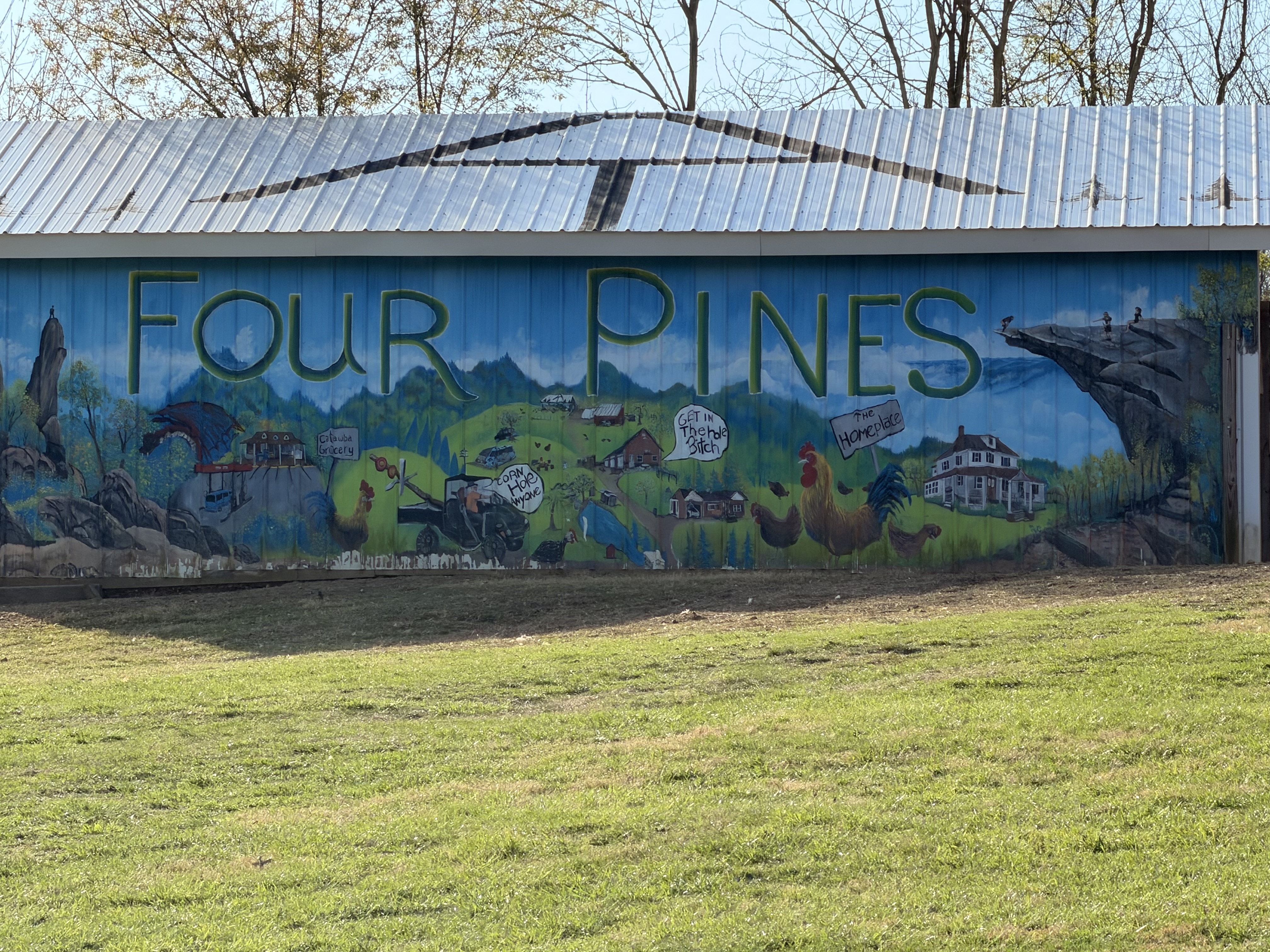
    Four Pines Hostel

    Got to Four Pines Hostel at 6:45. We are the only 2 guests tonight. There are two guys here who basically are doing work-for-stay this year. Both past thru hikers. We got a basic dinner with our stay. Tasty and filling. Hot shower was nice. Basic AT bunk room hostel. Nothing fancy but does the job. Plus they had a soda machine!

    Four Pines Hostel

    In bed at 9:00. Today was a very hard day. It ended up being over 18 miles mostly uphill with a stupidly heavy pack. We should not have tried this many miles this early in the season. I don’t know about Ed, but my legs and feet are very angry with me. Curious to see how I feel in the morning. We decided to sleep in a bit tomorrow. 

    Day 2 Map – Lambert’s Meadow to Four Pines Hostel

    Technical Notes:

    • Pop tarts 360
    • Fatty beef stick 300
    • Double Stuff Oreos x 4 300
    • Peanut M&M 250
    • Biscuit 212
    • Rice and beans 500
    • Kielbasa 125
    • Soda 160
    • Soda 160
    • Water liters 4
    • Miles 18.19
    • Time 10:45
    • Up 4091
    • Down 4242
    • Calories consumed 2400
    • Calories burned 4712
    • Phone battery used 55%
  • Day 1 – Daleville, VA to Lambert’s Meadow 

    Day 1 – Daleville, VA to Lambert’s Meadow 

    Today’s Miles: 9.6

    Trip Miles: 9.6

    Sunday, March 29, 2026. Up at 8:00. Sunny and 34 going up to mid-50s. Sunrise: 7:08 a.m. Sunset: 7:41 p.m.

    Had a big breakfast in Blacksburg, VA with Ed and our friend Jon. Dropped my truck off at our friend Don’s house for the week and drove to Ed’s brother Stuart’s house to drop off Ed’s car. Stuart drove us to the trailhead. Thanks a lot, Don and Stuart. We really appreciate the support.

    We got on the trail where the AT crosses US 220 near Daleville, VA at 12:30. We are headed SOBO. I hiked this section in 2024 on the thru-hike NOBO.

    I’m carrying my full load for the PCT including 5.5 days of food and 1.75 liters of water. Call it 33 lbs. I won’t have to carry more than 3 days of food on the PCT until mile 300 or further. This is a good test / prep. There won’t be water until we reach camp in 9.6 miles today. If it were summer, like last time I did this, I would carry a third liter today. 

    Power line warning

    The first 2 miles were our worst climb of the day. Hiked up to a massive set of high-tension lines. You can hear them humming and crackling.

    We made it to an overlook of the Roanoke Reservoir at 1:45. That steep climb is as bad as I remembered it, plus I don’t have trail legs yet. 

    Ed at Roanoke reservoir overlook
    Chuck at Roanoke reservoir overlook

    I’m also still getting used to this new pack. I need to fine-tune it a lot over the next few days. Passed about a dozen day hikers in this area.

    We took a break to swap water bottles at 3:49 and 5.77 miles in. We have 3.8 miles to go until we reach camp. The pack is doing okay after some adjustment.

    We reached an overlook and cliffs at 4:30 and 7.1 miles in. My hips and calves are not happy. I have not carried more than 28 pounds yet this year and on less steep terrain. 

    View from ledges looking over Daleville
    Chuck at ledges looking over Daleville

    We got to the ledges at 5:00 with 1.4 miles to go. Took a short break. My back is not happy. More on that later.

    We arrived at Lambert’s Meadow campsite at 5:45. There is 1 bar of cell service. Great water right by my tent spot.

    Lambert’s meadow camp site

    We both set up our tents. I set up about 5 feet from a babbling stream just past that picnic table. While we were setting up, a group of 6 high school kids stopped for water. They are camping 2 miles further ahead. I guess they are out for the week based on their loads.

    We filtered water and made dinner fairly quickly as it’s getting cold fast. We had to put on my fleece while making dinner. We both finished dinner and got in our tents by 7:15. It’s going to be COLD tonight. 

    Decent day overall. My hips hurt a fair amount, but that’s expected with this much weight. My calves were a slight issue, which did surprise me. The real bummer is my back…again. The last 2.5 miles were very annoying. I will try shortening the torso length on the pack (thank god it’s adjustable) so that I can crank down my load lifters to raise the weight off my shoulders. The net effect SHOULD be to get more weight off my back and instead transfer it to my hips. I also need to rearrange the gear in my pack and try to get my camp shoes inside my pack so that they are not pulling down and back on the rear of my pack. I will work on all that in the morning.

    Tomorrow we have 17 miles and 2 big climbs in the first half of the day. There are only 2 options for water, and both are in the first 9 miles. This time of year, that should be fine in terms of water. Given my pace, which is very slow at present, and my back issue today, I guess we will need about 9-10 hours tomorrow.

    Curious to see how bad my back feels in the morning. It could be annoying, could be very painful. It also depends on how well my back feels after sleeping on an air mattress on the ground:)

    Talked to Dana for a few minutes and played some games on my phone until 10:30 before trying to get to sleep.

    Technical Notes:

    • 2 eggs: 140
    • 4 pieces of bacon: 210
    • 4 sausage patties: 250
    • Coffee: 90
    • Peanut M&Ms: 250
    • Dehydrated chicken: 170
    • Curry noodles: 450
    • Water liters: 1.5
    • Miles: 9.6
    • Time: 5:25
    • Up: 2352
    • Down: 1642
    • Calories consumed: 1600
    • Calories burned: 2969
    • iPhone battery used: 30%
  • Pre-Hike – Daleville, VA to Big Stoney Creek Rd, VA

    Pre-Hike – Daleville, VA to Big Stoney Creek Rd, VA

    Ed and I are slowly section hiking the entire AT. Since my AT thru-hike in 2024, I have a goal to section hike the entire trail again over the next few years between big thru-hikes.

    In addition, this hike will serve as a shakedown hike for my upcoming PCT thru-hike starting on April 24, 2026. The goals of a shakedown hike include:

    • test all my gear and clothes
    • make sure I did not forget to pack anything
    • double check how much for per day I need
    • fine-tune my new backpack
    • generally get my mind ready for another thru-hike

    I have been training for the PCT for the past several months. Day hiking with 20+ lbs and/or working out in the gym 4-5 days a week. We have had some wild winter weather for Maryland including the harshest winter in a long time. That has been great training for the PCT including the heavy snow with a thick layer of ice. The weather for this upcoming shakedown hike will be a good test with nights in the upper 30s and days in the mid-80s. Plus a little rain.

    I have my exact pack load that I will be carrying on the PCT including a 5.3 day food supply. That is the longest food carry that I will have on the PCT, so this is a great test.

  • Day 10 – Gravel Springs Hut to Front Royal

    Day 10 – Gravel Springs Hut to Front Royal

    Thursday, October 16, 2025. Up at 7:25.   Windy, cold, 38 degrees, going up to 60 with sunny skies.

    Annoying…I have ash stuck all over my tent from the very smoky fire last night. 

    Chatted with Javelin and wished him happy trails. Packed up and got on the trail at 8:40. 

    Last Skyline Drive crossing NOBO

    Very cold wind this morning. Nasty gusts. Summited Mount Marshall at 10:00. Cold and windy.

    Shenandoah View Day 10

    Stopped at 11:45 and 7.13 miles on Compton Peak for an early lunch. I chatted with a group of youngsters and their chaperones about the AT for a bit. It’s still quite chilly and windy. Not sure about that 60-degree forecast. 

    At 12:55, we left the park. 

    Exiting Shenandoah NOBO
    Exiting Shenandoah NOBO

    Reached the 4H facility at 2:00. Just 1.8 miles to go. Unfortunately, uphill the next mile.

    We reached US 522 and the end of our hike at 2:40.

    Ed and Chuck finishing Shenandoah 2025

    We road walked a short distance to Mountain Home B&B to pick up Ed’s car and drive home this afternoon. 

    Very good trip overall. Even with the bad weather on Sunday and Monday. This will likely be my last overnight backpacking trip for the year. Between the colder weather, the lack of water, and the very short days, I think it is time to hang up the gear until the spring. Or maybe until February if I head to the South West for a few weeks.

    Day 10 Map

    Technical Notes:

    • Pop-Tarts 360
    • Fig bar 200
    • Fatty sausage 300
    • Trail mix 210
    • Water liters 1
    • Miles 14
    • Time 6:00
    • Up 2379
    • Down 3829
    • Calories consumed 1100
    • Calories burned 1923
  • Day 9 – Pass Mountain Hut to Gravel Springs Hut

    Day 9 – Pass Mountain Hut to Gravel Springs Hut

    Wednesday, October 15, 2025. Up at 8:00. Sunny and warm going up to the low 60s.

    Today is our last full day on the trail and in the park. We have 7.6 miles to Elkwallow Wayside. Looking forward to hot food for lunch. Only 13.6 miles total today with nice weather. Should be a good day.

    I had visitors while packing up this morning. Mom was hanging out about 8 feet from me while I was breaking down camp. She had no fear. The little one was only slightly more nervous.

    Help taking down my tent day 9
    Curious fawn at Pass Mountain

    On the trail at 9:00. Nothing much to see in the first part of today. Reached the burn  area from 2 years ago. It has recovered dramatically since I hiked this site last year. 

    Forest Fire burn area

    Reached Elkwallow Wayside at 12:00. Talked to Jolly who just flipped down to this area from NH. He has 4 more weeks on the trail headed south. Should get near the end of Virginia before he runs out of time. I pointed him to the best Chinese buffet on the AT in Waynesboro.

    ElkWallow Wayside

    We had a nice lunch and got back on the trail about 1:00. We have 6 miles to camp with the next 2 being a bit of a steep uphill. Should be making camp about 4:00.

    View of Front Royal in the distance. About 25 miles away.

    Looking North at Front Royal
    Shenandoah view Day 9

    We arrived at Gravel Springs Hut at 4:10. Got camp set up fairly quickly. Two other guys showed up separately. 

    Talked to Javelin who is SOBO on a thru-hike but will have to call it quits in about 4 weeks due to an injury. He started at Katahdin in June. He will finish his thru in April next year. 

    Adam is out for 2 days from Arlington. He built a fire with some help from all of us. 

    Ed at Gravel Springs Hut

    Hung out and chatted with the group until 7:15. Getting cold so headed into my tent to blog and read for a while.

    Day 9 Map

    Technical Notes:

    • Pop tarts 360
    • Cheese burger 600
    • Blueberry milkshake 250
    • Dr pepper 140
    • Onion rings 150
    • Crackers 190
    • Ramen 370
    • Spam 250
    • Chex mix 350
    • Water liters 1.5
    • Miles 14.46
    • Time 7:10
    • Up 2841
    • Down 3064
    • Calories consumed 2660
    • Calories burned 2287