Tag: 2025

  • Day 4 – Crocker Cirque Campsite to ME Rt 27

    Day 4 – Crocker Cirque Campsite to ME Rt 27

    Friday, August 15, 2025. Up at 6:30. Chilly and clear. Probably in the low 50s. 

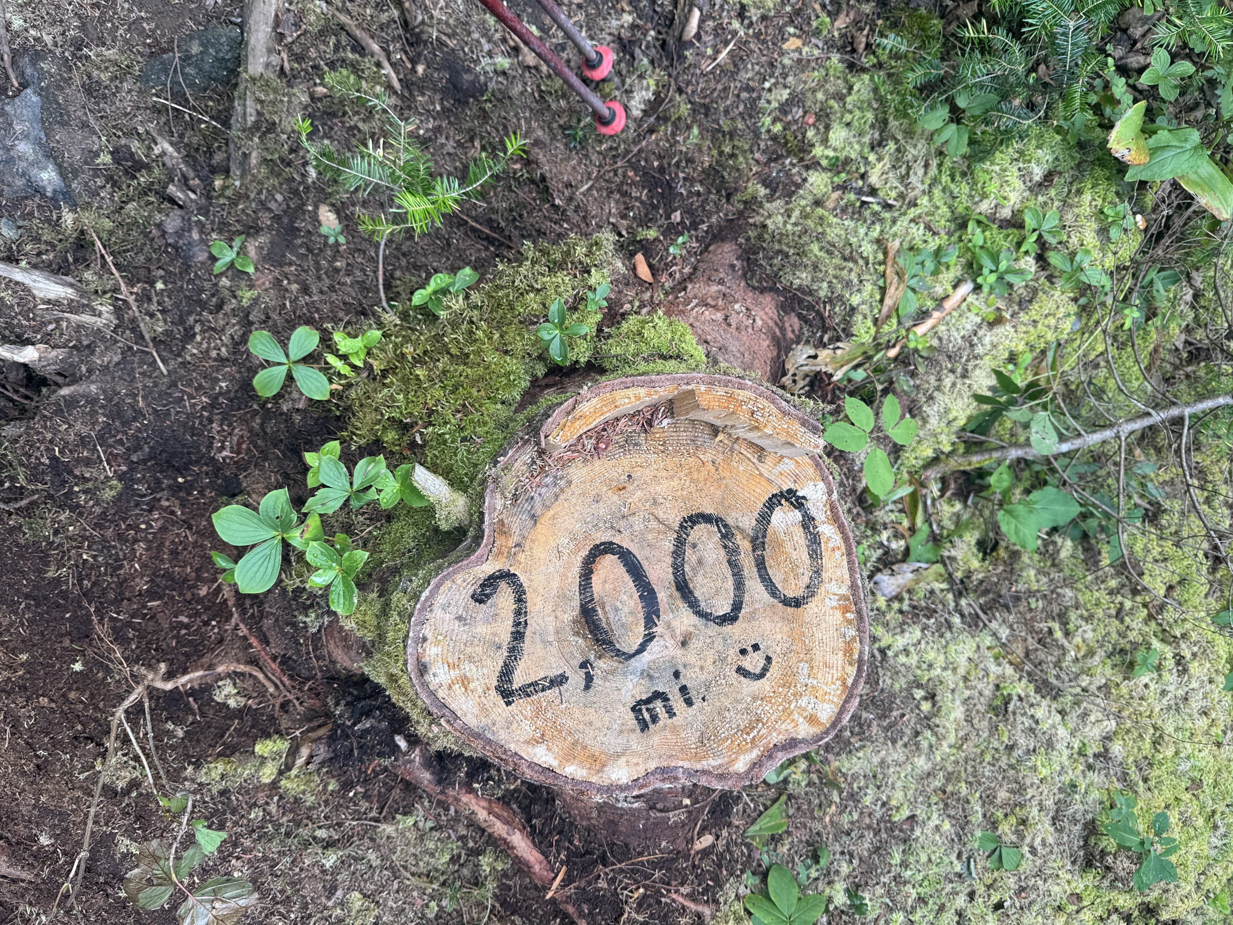
    On trail (mile 2002.8) at 7:45. Carrying an extra 2 liters of water as there may be no water for the next 8 miles. The youngsters are more concerned about weight, but Ed and I being the wise old men want to stay hydrated!

    Steep rocky climb, but not as hard as the last few days. Part of that is I’m starting to get my trail legs. 

    Ed and Mary-Beth ascending South Crocker Mountain in Maine
    Ed ascending through a rock field on South Crocker Mountain in Maine

    We met up with Mary-Beth from last night and hiked on and off today. We had some great conversations about hiking. She had lots of questions about long distance hiking.

    Stopped at South Crocker summit overlook for a water break and lunch. Very glad I carried the extra 2 liters of water. Great view of Sugarloaf mountain ski runs.

    Chuck and Mary-Beth on the summit of South Crocker Mountain in Maine
    Sugarloaf ski runs seen from South Crocker Mountain summit in Maine

    Summited North Crocker at 10:45 with Mary-Beth. Topped off my water bottles from the 2 liters I carried up here. We have 5 miles DOWN to meet our shuttle. About the same difficulty as South Crocker. 

    Summit of North Crocker Mountain with Mary-Beth and Ed in Maine

    Arrived at Rt 27 (mile 2010.1) at 2:25. The town chief of police, who is also an avid hiker, was doing trail magic. Ed and I helped ourselves to a nice cold PBR! We chatted with the chief for about 20 minutes while we waited for our shuttle. Ed got a great description of the next 16 miles through the Bigelows and talked about Maine in general. Really nice guy. 

    PBR trail magic courtesy of the Stratton Maine police chief

    Our shuttle driver from Hostel of Maine, Mike, took us to the hostel. Very nice upscale hostel. They are open year round and do a lot of ski businesses. Hence the upscale part. 

    Hostel of Maine
    Hostel of Maine Great Room

    Showered, got laundry done, and chilled out. Sat in the great room and talked to other folks for several hours. 

    Jumper is a 27 year old getting ready to head to Kings College in London to do her masters in theoretical physics. She is finishing up a 200 mile section hike SOBO from Katahdin.

    Toni is a trial lawyer from North Carolina platinum blaze section hiking with some friends. She retired last year. She did her graduate work at the London School of Economics. 

    Ladybug is a mother of 2 section hiking Maine, but has to make an emergency trip home but will be back on the 27th to submit Katahdin.

    Limo Bean is thru thinking NOBO. 

    It’s amazing the people you meet and sync with on the trail. Wide cross section of people. We all decided to go to the barbecue place just up the road for dinner. Excellent food and large quantities. I split a platter with Toni.

    Dinner with the gang from the Hostel of Maine

    Ed and I are slack packing 16 miles SOBO across the Bigelows tomorrow. Long dry day, but we are only carrying about 16 pounds including 4 liters of water (8.8 lbs), minimal food for the day, first aid, headlamp, and a few misc items. There are no exit points once we start until we get back to Rt 27 near the hostel. I’m guessing 10 hours. Any longer and we will be night hiking.

    Got our packs setup for tomorrow, finished charging electronics, and chatted with other hikers until 10:00.

    Very nice day with lots of great AT social interactions.

    After much thought, we decided to NOT do the 16.8 miles tomorrow slackpack. We are worried that we can’t make that distance with 5200 feet elevation gain in the amount of daylight we will have. So we are back to our original plan and doing 10.5 miles tomorrow. We resupplied for the next 4 days here at the hostel. We will repack our bags in the morning and catch the 7:30am shuttle to the trail.

    Day 4 Map – Crocker Cirque Campsite to ME Rt 27

    Technical Notes:

    • Pop tarts x 2 360
    • Fatty sausage 300
    • PBR 150
    • Coke Zero 0
    • Donut Cider 150
    • Etc….lots of calories in town 
    • Water liters 3.5
    • Miles 7.4
    • Time 6:30
    • Elevation gain 2024
    • Calories consumed lots
    • Calories burned 2500
  • Day 3 – Spaulding Mountain Lean-To to Crocker Cirque Campsite

    Day 3 – Spaulding Mountain Lean-To to Crocker Cirque Campsite

    Thursday, August 14, 2025. Up at 6:45. Cold and breezy after the rain last night. 

    Packed up and headed out (mile 199.6) at 7:55.

    Summited Spaulding mountain about 8:45. Tough climb but easier than the past few days. Ran into a few dozen blowdowns over the next 2 miles. Ranged from easy to difficult. Had to crawl under 2 of them.

    Ed navigating the blowdowns on Spaulding Mountain

    Some nice views up here. Nothing spectacular, but nice.

    Ed and Chuck at viewpoint on Spaulding Mountain

    We took a snack break at the side trail to Sugarloaf Ski Lodge at 10:10. If you need to bail out of this section, that is one of only two bailouts. It’s a .5 mile hike up to the top of the ski lift from here then 3 miles down the ski lift trails.

    Water is challenging. We refilled water at 10:50. Barely a trickle using the leaf trick, but it works.

    Getting water using a leaf

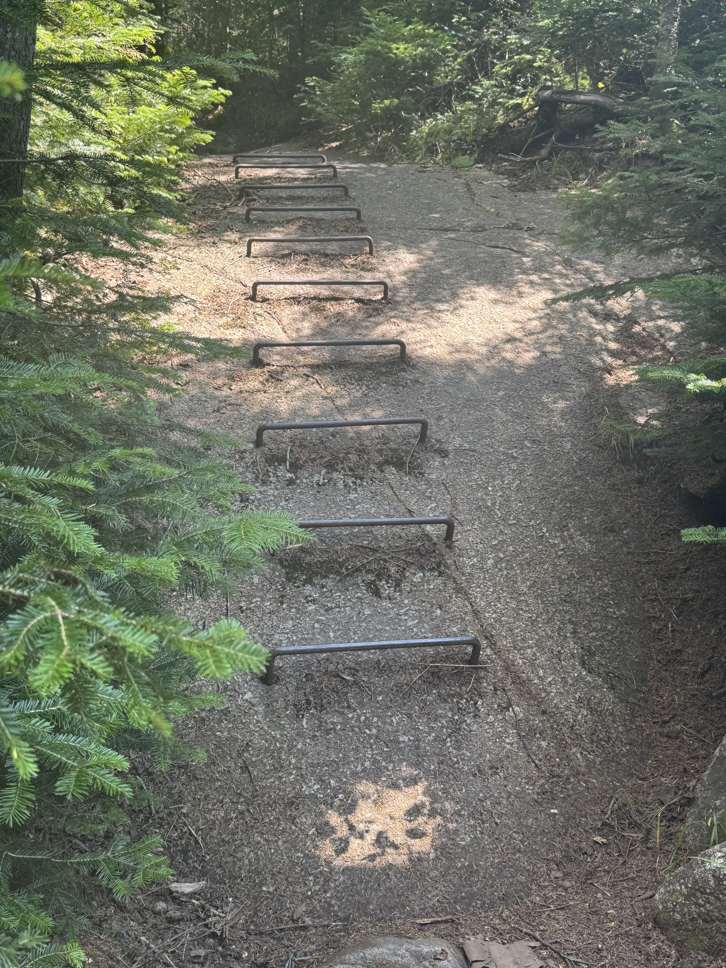
    Began the nasty descent for today. This is in the to 4 hardest descents on the trail in my opinion. Photos don’t do it justice.

    Map view of descent to Crocker Cirque
    Ed descending to Crocker Cirque
    Ed still descending to Crocker Cirque. Appalachian Trail Maine

    Completed the very challenging descent off of Sugarloaf down to the South Branch of the Carrabassett River at 12:30. Five miles down and 1.2 more miles to go on this short day. There is good water at camp so we do t have to carry a couple of liters uphill like the other night. Yey!

    Hung out, filled water, had lunch, and generally chilled for a while in the shade.

    Crossing the South Branch of the Carrabassett River

    Did the last 1.2 miles to Crocker Cirque Campsite (mile 2002.8) by 2:30. Nice place with privy, stream, tent pads, but terrible trees for making our bear hangs. Got setup and settled in for a long afternoon by 3:30. One or two bars ATT service depending on the wind.

    Chuck’s tent at Crocker Cirque Campsite

    It was a short day. We could have knocked out 4 or 6 more miles, but there are no more campsites for 8.5 miles and very questionable water. We are not on a hard schedule and our bodies are still getting used to these big verticals, so we are good with where we ended up. Tomorrow we get picked up at Rt 27 and get showers and beds and real food! And laundry…very important.

    Had a long conversation with Mary-Beth. Solo NOBO section hiker. She was at Virginia Tech from 1986 to 1991 and partied at Theat Xi her freshman and sophomore year. Small world.

    In bed at 7:30. Blogged and read for a few hours.

    Day 3 – Spaulding Mountain Lean-To to Crocker Cirque Campsite

    Technical Notes:

    • Pop tarts x 2 360
    • Fig bar 200
    • Fatty sausage 300
    • Payday 250
    • Peak Refuel chicken chili 760
    • Crackers 190
    • Fritos 300
    • Water liters 4
    • Miles 6.5
    • Time 6:30
    • Elevation gain 1890 feet 
    • Calories consumed 2360
    • Calories burned 2600

  • Day 2 – Poplar Ridge Lean-To to Spaulding Mountain Lean-To

    Day 2 – Poplar Ridge Lean-To to Spaulding Mountain Lean-To

    Wednesday, August 13, 2025. Up at 6:50. Clear and humid going up to upper 80s.

    Slept well once I got to sleep. Muscle cramps in my legs kept me up a bit. We got out of camp (mile 1988.6) at 8:00. 

    We stopped at Oberon Stream for a break and water at 9:45 and 2.5 miles. This is the first good water we have seen in a day.

    Oberon Stream

    Ed is struggling a bit. Yesterday wiped us both out. Going to be a short day today. Just 8 miles with 5.2 left. We might expand that by making a side trip to Mount Abraham, the second highest alpine zone in Maine. That will be a game time decision around late afternoon.

    Back on trail at 10:40 after a long break.

    Stopped for water and food at 4.7 by a fast moving stream at noon. We have a nasty 1.2 mile climb up Lone Mountain, then some decisions to make on a potential side trip.

    Day 2 water break and lunch.

    Back on trail at 12:30. This ascent may only be 1.2 miles, but it’s a killer. 1000 feet in that 1.2 miles. We are still feeling yesterday’s massive climbs. We are stopping for a short break every .075 miles. Needless to say, we are moving SLOWLY. 

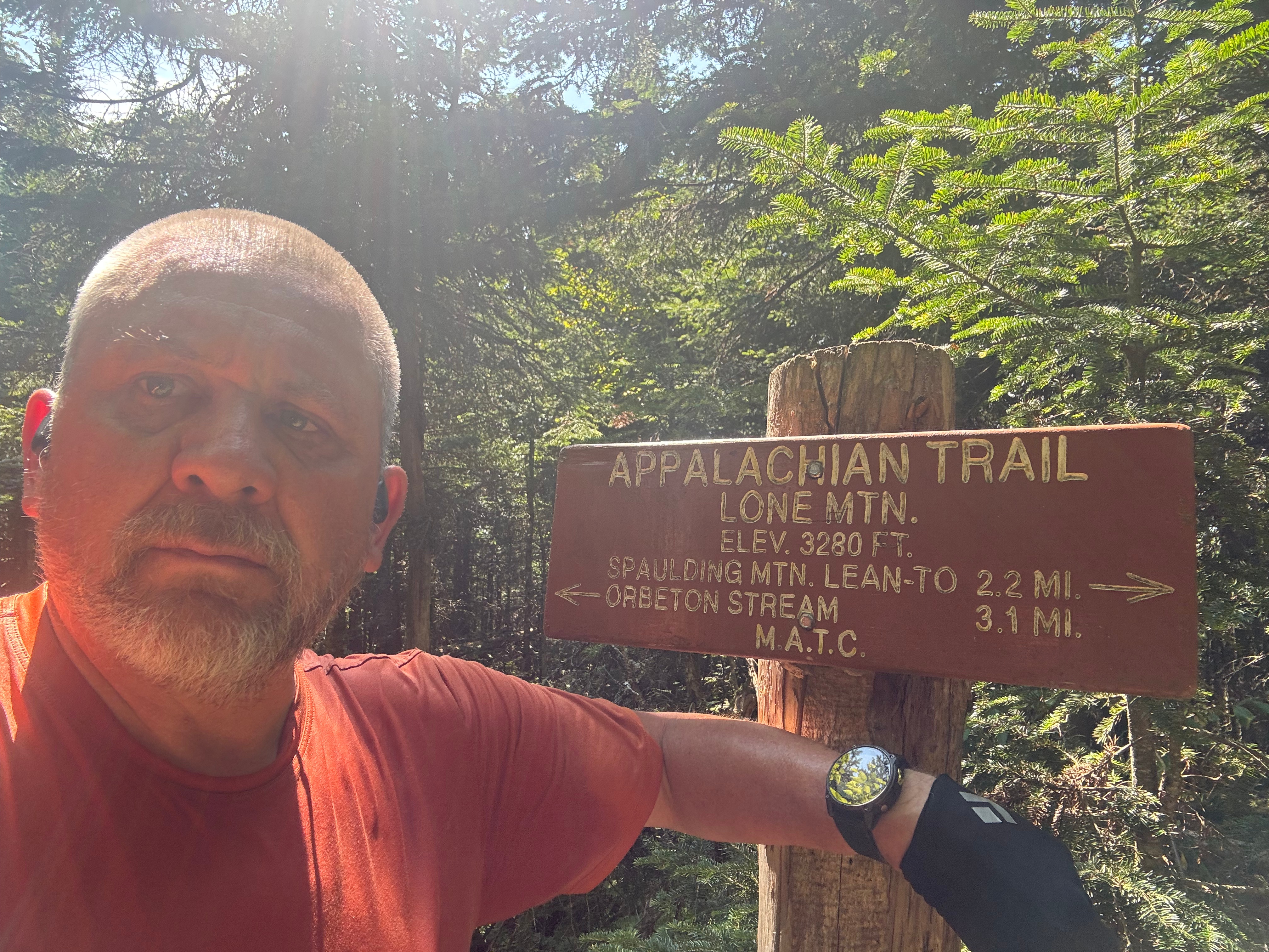
    Summited Lone Mountain at 1:45. We have 2.2 miles to camp. That was a hard climb. Last one for today unless we make a side trip to Mt Abraham. I’m not interested but Ed wants to. We will see in about a mile. I don’t think I have enough water for multi-mile side trip.

    Chuck at the summit of Lone Mountain
    Ed contemplating life on Lone Mountain

    Surprisingly had 2 bars cell on Lone Mountain so I had a nice call with Pitcrew. Also gave Hostel of Maine a heads up.

    Last 2 miles weren’t bad relatively. Arrived at Spaulding Mountain lean-to (mile 1996.6) at 3:30. There are a pair of retired brothers from west Tennessee here. They are slowly section hiking the entire AT. They are SOBO at present. Chatted with them quite a bit.

    There are 2 bars of cell service surprisingly. Texted with Hostel of Maine  and booked 2 bunks in bunk room. Since we are adding a day to this part of the hike, we arrive on a Friday and they are nearly full. Glad I reached out today!

    Rained at 5:20. Gonna rain on and off this evening. Five other hikers showed up over the course of the evening. All tenters. Had some good conversations.

    Overall about a dozen people here tonight. Far cry from the 1 or 2 that I would see last year. In bed at 7:30 and read for an hour.

    Day 2 Map – Poplar Ridge Lean-To to Spaulding Mountain Lean-To

    Technical Notes:

    • Mini chocolate donuts x 6 560
    • Fig bar 200
    • Zero sugar sausage 80
    • Fatty sausage 300
    • Peak Refuel Beef Stroganoff 810
    • Fritos 240
    • Geese crackers 190
    • Water liters 6
    • Miles 8
    • Time 7:40
    • Elevation gain 2329 feet
    • Calories consumed 3100
    • Calories burned 2380
  • Day 1 – ME Rt 4 to Poplar Ridge Lean-To

    Day 1 – ME Rt 4 to Poplar Ridge Lean-To

    Tuesday, August 12, 2025. Up at 5:30. Clear and getting up to the low 90s and dry.

    It was so hot on the top bunk that I gave up and slept on the cabin floor with the door partially open to allow cool air in. Got about 4 hours of sleep. Not great, not terrible.

    100 Mile Wilderness Adventures, Monson Maine

    It’s so warm already that I decided on light shorts. Not bothering with my convertible hiking pants for today. It is supposed to cool off in 2 days after a storm front moves through.

    Packed up. Topped off on water. Left my travel pack in Ed’s car. Generally got ready for our next 8 days on the trail.

    Barry picked us up at 6:30. We stopped in Monson for coffee and drove to the trailhead at Maine Rt 4 (mile 1977.9) near Rangeley, Maine.

    Started on the trail at 8:30. Hiking through pine forests and ferns most of the day with a lot of uphill the first 2/3 of the day.

    Appalachian Trail Sign Rangeley Maine

    The trail is not too rocky, but it is steep! Ascended 1260 feet in the first 3.7 miles. We have 3000 more feet to go today and the nasty incline is still a ways off.

    Ed climbing the trail NOBO near Rangeley Maine

    Passed by Ethel Pond at 10:00. Stepped aside to let a group of 4 thru-hikers pass by NOBO.

    Ethel Pond

    Stopped at Eddy Pond to fill up on water before we ascend into the alpine area for the next 6 miles. Had a snack while enjoying the view. Crystal clear alpine pond nestled up against some low mountains. There are 4 canoes here with paddles and life vests. According to comments, they have been here for years and people can use them on the pond.

    Eddy Pond with Canoes
    Eddy Pond clear view

    Back on the trail at 11:15. Time to start the big ascent to Saddleback Mountain.

    That last pond looks a lot smaller from above tree line.

    Looking down SOBO on Eddy Pond from the ascent up Saddleback Mountain

    Summited Saddleback Mountain (4126 feet) at 1:15. That was a bitch of a climb. Lots harder than last year. Guess I had been hiking for 5 months before I got here last year so I had my trail legs. 

    Ed and Chuck nearing the summit of Saddleback Mountain
    Ed on the summit of Saddleback Mountain

    Had a light lunch, talked to some day hikers and thru-hikers, then moved on at 2:00. We still have 7.8 miles to go to reach camp.

    Reached the summit of The Horn (4017 feet) at 3:20. Hard steep climb after a challenging decent from Saddleback. Basically we just walked down and back up both sides of a big saddle.

    Looking back SOBO at the trail between Saddleback Mountain and The Horn

    Getting low on water and no good water source for 2.5 miles. We have a nasty decent, then one more steep ascent up Saddleback Junior then down to a stream. Not sure we are going to make it 6.3 more miles to our primary campsite. Probably stay at our alternate site in 3.4 miles. 

    Map view of Saddleback, The Horn, and Saddleback Junior.

    That last 3.4 miles kicked our asses. Steep up and down with some treacherous and scary downhill parts. We gave up on the primary plan and settled for Poplar Ridge lean-to at mile 10.7. 

    We stopped 3.6 miles short of camp and hiked .2 miles to get sketchy water. Glad we did because we were almost out and the next water was not until 1 mile from camp and so sketchy. I have drank worse, but not in a long time.

    Shallow nasty water before ascending Saddleback Junior

    We summited Saddleback Junior at 6:15. We need water before camp and we will be pushing hard to make camp before dark! Not good.

    Got bad water (muddy and stagnant) 1 mile from camp and carried an extra 2 liters to camp, ouch. Glad we did because spring at camp is dry.

    Got to Poplar Ridge Lean-To (mile 1988.6) at 7:30. There are 4 tenters  here already in bed. We took the shelter as there are no more camp sites. Made dinner in the dark at 8:20. Surprisingly I had a good appetite. All settled into my bed at 9:00. Gonna read for a while.

    Overall a good day and a frustrating day. Good because that was a damn hard day and all the other thru-hikers agreed. We made it to our alternate site as planned. Not many idiots try a day like this as their first big day on the trail. I’m sore but don’t feel bad. Frustrated because I was so slow today. One mile per hour! Which got us to camp way too close to dark for my risk tolerance.

    We are changing our plans for tomorrow and going for an 8 mile day.

    Day 1 Map – ME Rt 4 to Poplar Ridge Lean-To

    Technical Notes:

    • chocolate donuts x 6 560
    • Mini chocolate donuts x 3 280
    • Zero sugar sausage x 3 120
    • Oreo cookie  70
    • Peak Refuel Curry Chicken 850
    • Water liters 6
    • Miles 11:03
    • Time 11:04
    • Elevation gain 4243 feet
    • Calories consumed 1880
    • Calories burned 4932
  • Day 0 – Drive to Monson Maine

    Day 0 – Drive to Monson Maine

    Monday August 11, 2025. 64 degrees and sunny.

    Up at 6:00. Ed and I had coffee and ordered breakfast to go from Wawa. Said goodbye to Lisa and got on the road at 7:15.

    Uneventful 11 hour drive. Went from this view of the New York skyline…

    New York City Skyline

    To this view of a camp in Monson, Maine…

    Monson Maine Campground

    Arrived at 100 Mile Wilderness Adventures in Monson at 6:30pm. Chatted with the owner and headed to the deli in town for takeout dinner before they closed at 7:30. Had a nice dinner while chatting with the hostel caretaker for a few hours.

    We split a nice little 2 bunk cabin. Unfortunately Maine is having a heat wave. It was 93 here today. Insane for this time of year up here. Very dry as well. Poor ventilation in the cabin and can’t leave the door open due to mosquitoes. 

    Cabin at 100 Mile Wilderness Adventures, Monson Maine

    Our ride picks us up at 6:30 tomorrow morning. Looking forward to 3 hard days starting tomorrow. In theory we will be back here in 8 days, but I won’t be surprised if it takes 10 days.

  • Pre-Hike – Maine 2025

    Pre-Hike – Maine 2025

    I did not enjoy the second half of Maine during my AT thru-hike last year. It was late in the season and I was getting burnt out. I would barely see a single person on trail during the later part of Maine. Plus I had to skip ahead in the Hundred Mile Wilderness to summit Katahdin before they closed the mountain for the year.

    In addition, my plans to thru-hike the Colorado Trail in 2025 fell apart after a health scare this spring. That freed up the month of August for me. Therefore I decided to push myself and go back to Maine and hike the second half of Maine from Rangeley to the base of Katahdin in Baxter Park. 

    August is the perfect month for Maine. The weather is cool. The bugs are almost non-existent. And the days are still long.

    My friend Ed agreed to join me on this adventure. We would spend a fair amount of the summer section hiking, exercising, and generally trying to get ready for Maine. This part of Maine is arguably the second hardest part of the AT. I was really looking forward to the physical and mental challenge.

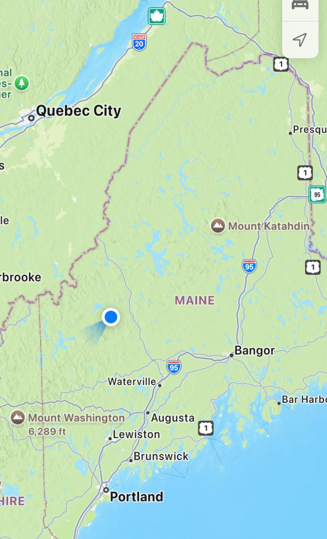
    Maine State Map

  • Day 5 – Alec Kennedy Shelter to Boiling Springs

    Day 5 – Alec Kennedy Shelter to Boiling Springs

    Thursday, July 4, 2025. Up at 6:30. Cool clear day.

    It got down to 61 degrees las night. The new blanket I am using worked perfect for this weather. I got packed up very quickly and walked over to the shelter to say goodbye to the crew from last night. On trail at 7:00. 

    Got to Cafe 101 in Boiling Springs at 8:30. Good 4 mile hike to wrap up the week. Juice and Die Hard joined us for breakfast and I treated them to a trail magic breakfast. Exchanged contact into with Juice. He and Die Hard are planning on the PCT next year and I need a partner. This could work great. Also saw Good News and Viking at the cafe and wished them Happy Trails.

    Janine arrived and joined us for breakfast before driving me and Ed home to Poolesville starting about 10:00. Janine is spending the holiday weekend with us. Yey!

    Overall, a great hike. I felt good-to-great including the 15 mile days and even did some 3 mile per hour sections.

    Technical Notes:

    • Pancakes x 1 – 110
    • Sausage – 200
    • Eggs x 2 – 140
    • Toast x 1 – 115
    • Coffee with creamer – 40
    • Coffee with creamer – 40
    • Water liters: 1
    • Miles: 4.06
    • Time: 1:28
    • Elevation gain: 441
    • Elevation descent: 928
    • Calories consumed: 
    • Calories burned: 581
  • Day 4 – Pine Grove Furnace to Alec Kennedy Shelter

    Day 4 – Pine Grove Furnace to Alec Kennedy Shelter

    Thursday, July 3, 2025. Up at 7:00. Weather looks great…76 degrees when we left the hostel. 

    Packed up, ate breakfast, and headed out at 7:45.

    Made great time getting to Green mountain store at 10:45 and 9 miles. Just under 3 miles per hour! Got drinks and breakfast sandwiches and hung out for an hour. Had nice chats with 3 locals about hiking and the weather and such. Always love stopping here. 

    Breakfast at Green Mountain Store, Pennsylvania

    Back on trail at 11:50.

    Fun rock scramble at Rocky Ridge. Ran into Good News, Juice, and Die Hard while taking a break on the summit. Love these rock mazes / scrambles.

    Ed on Rocky Ridge near Boiling Springs, Pennsylvania
    Chuck on Rocky Ridge near Boiling Springs, Pennsylvania

    Arrived at Alec Kennedy shelter and set up tents by 4:00. Still making great time on a 15 mile day! Tough tent pitch as all the spots are rocky, but the shelter is going to be crowded. Did get the tent pitched well and this is the first time I’ve pitched this new Durston x-mid for real. 

    We met a group of 6ish folks at Pine Grove last night and hiked around them all day today. We all stayed at Alec Kennedy shelter: Juice, Die Hard, Viking, Good News. Juice and his wife Juice are about my age. He is retired Navy and had some good stories. Good News and Viking are in their mid-twenties.

    Group photo at Alec Kennedy Shelter, Pennsylvania
    Group photo at Alec Kennedy Shelter, Pennsylvania

    We hung out, had dinner, and talked for several hours. Got some great input on hiking the AZT. Just really good conversation and camaraderie this evening. Makes me want to thru-hike again.

    Headed for the tent and some reading at 8:00. We need to be up and out at 7:00 tomorrow morning at the latest.

    Day 4 Map – Pine Grove Furnace to Alec Kennedy Shelter, Pennsylvania

    Technical Notes:

    • Pop tarts – 360
    • Body armor lyte – 20
    • Body armor lyte – 20
    • Sausage egg muffin – 450
    • Sausage egg muffin – 450
    • Oreo cookies – 330
    • Curry noodles – 450 
    • Dehydrated Chicken – 170 
    • Water liters: 4
    • Miles: 16:43
    • Time: 8:00
    • Elevation gain: 2756
    • Elevation descent: 2671
    • Calories consumed: 2250
    • Calories burned: 2972

  • Day 3 – Birch Run Shelter to Pine Grove Furnace

    Day 3 – Birch Run Shelter to Pine Grove Furnace

    Wednesday, July 2, 2025. Up at 7:45. Clear and warm. Nice looking day.

    Nothing dried let night. Hiking in my camp clothes today. Will find a sunny place to dry wet clothes at some point today. 

    We have an easy 10 miles today to Pine Grove Furnace where we can get real food. We plan to stay at the hostel which MAY have laundry. I stayed there before. 

    Filtered water after, packed up and on trail at 9:00.

    We and an annoying scary moment when tow big dogs came around a bend and ran at us barking. Their owner had them off leash on trail. Startled the hell out of Ed who was in the lead. One of the dogs did not listen to the owner. Annoying.

    Stopped at Tom’s Run shelter at 11:30 and 6 miles for water, lunch and to dry out clothes. Nice hike so far, humidity is way down and the temps are in low 80s with clear skies. Easy 4 miles downhill to our destination at Pine Grove Furnace.

    Drying gear at Tom’s Run Shelter, Pennsylvania
    Drying gear at Tom’s Run Shelter, Pennsylvania

    Mountain biker stopped by on a cross trail and we chatted for a bit. He thinks it’s hot and humid….wimp! 

    Clothes dry and back on trail at 12:20.

    We arrived at Pine Grove Furnace at 2:00. Got checked in and unpacked.

    Chuck on the porch at Pine Grove Furnace Hostel, Pennsylvania

    Met NOBO thru-hiker Good News. She is sharing the bunk room with us. Got showered and generally cleaned up. This place is as I remembered it…old, run down, dirty, but provides all the basics that is nasty hiker trash need. 

    Had early dinner at the Pine Grove Furnace store. Their Hiker Burger is monstrous and awesome!! Chilled after that, dried out clothes from today, planned route for tomorrow, semi packed for tomorrow. 

    We have 15 miles tomorrow and the last 4 are a bit tough. We have a great general store to stop at around mile 8.6 for cold beverages and lunch tomorrow as well.

    Lots of thru-hikers here tonight. Probably 12. They all came in after us.

    And back to the store for a buffalo chicken wrap for dinner. Yum.

    Ed and i hung out in the lounge and read till about 8:00. I went to the bunk room and read in bed till 10:00 or so.

    Day 3 Map – Birch Run to Pine Grove Furnace, Pennsylvania

    Technical Notes:

    • Pop tarts – 360
    • Fatty sausage – 300
    • Trail mix – 180
    • Root beer – 260
    • Hiker burger – 850
    • Fries – 200
    • Root beer – 260
    • Twix – 250
    • Buffalo chicken wrap – 500
    • Gatorade – 140
    • Water liters: 4
    • Miles: 10
    • Time: 5:00
    • Elevation gain: 810
    • Elevation descent: 1722
    • Calories consumed: 3240
    • Calories burned: 1700
  • Day 2 – Rocky Mountain Shelter to Birch Run Shelter

    Day 2 – Rocky Mountain Shelter to Birch Run Shelter

    Tuesday, July 1, 2025. Up at 7:015. Cloudy with high chance of rain.

    Had a hell of a thunderstorm about 9:45 pm last night. Thunder was shaking the shelter.

    On trail at 8:20. 

    Arrived at Caledonia state park for water, snack, and toilets at 10:00. Took a 30 minute break. Not as hot today but very humid.

    Ed at Caledonia State Park, Pennsylvania

    Received amazing trail magic from a couple who drove in from the Midwest solely for that purpose. We chatted with them for 45 minutes while enjoying bratwurst and sodas. People like this make the AT experience really special.

    Trail magic at Caledonia State Park, Pennsylvania

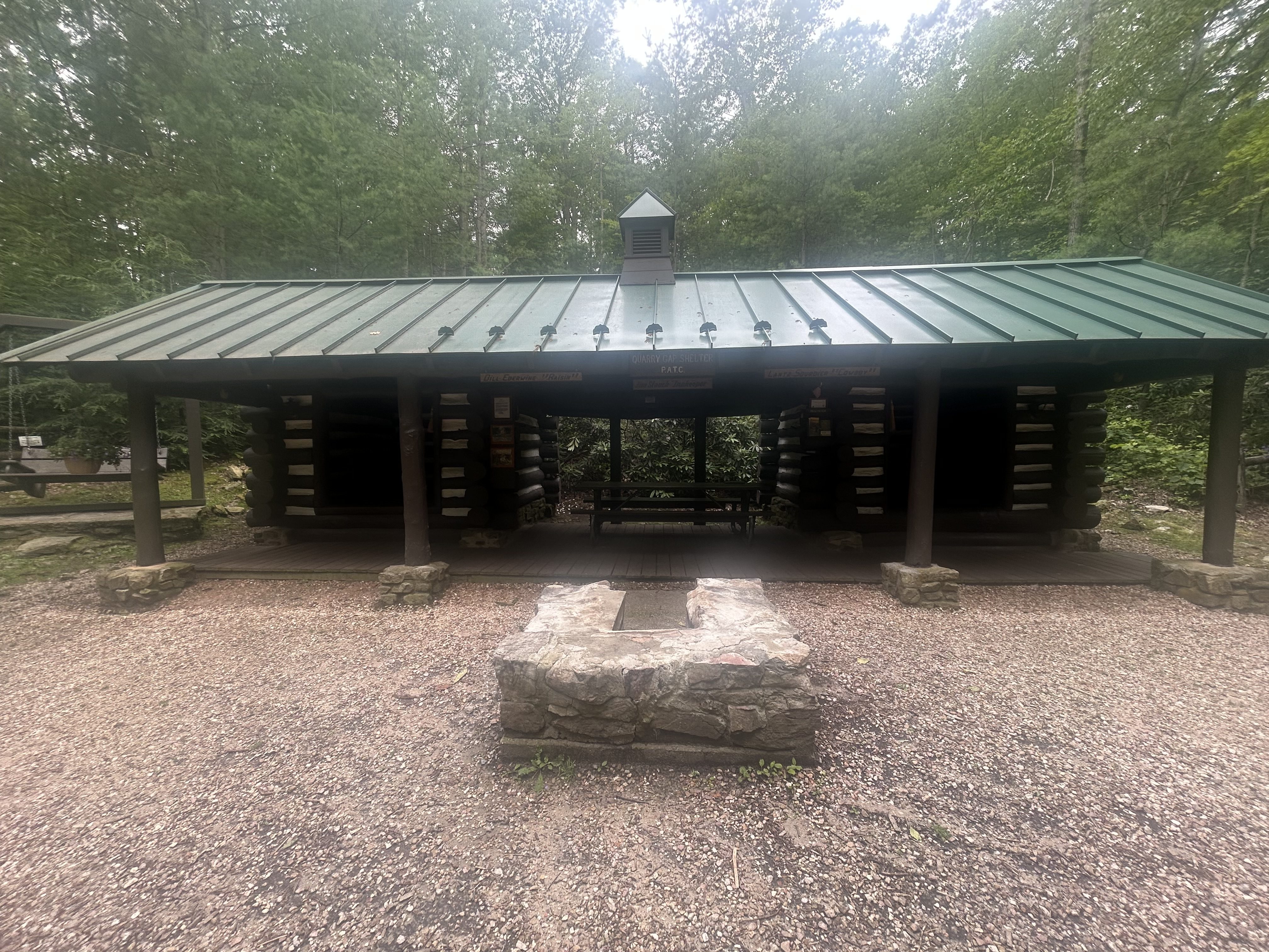
    Got to Quarry Gap at 12:20. Nicest shelter on the AT. Only rested for 15 minutes sine we spent so much time with the trail magic folks.

    Ed at Quarry Gap Shelter, Pennsylvania
    Chuck on the swing at Quarry Gap Shelter, Pennsylvania

    Stopped at Milesburn cabin at 3:30 and 10.8 miles to filter water and wait out a storm. Nice primitive cabin owned by PATC and rented to members and guests.

    Reached the Birch Run shelter at about 4:50. No cell service. Looks like we have it to ourselves. Rained hard the last 5 minutes to the shelter and continued to rain for quite some time. On the plus side, the rain cooled things off a lot and sucked the humidity out of the air. Almost chilly now.

    Birch Run Shelter, Pennsylvania

    Glad I decided to bring a pack towel. With the rain today we really needed to dry off once we got to camp. Also, the silk liner is working great. Put my sleeping pad inside of it, instead of me in it. Perfect in this humidity. Really helps with sleeping.

    In bed at 7:00.

    Day 2 Map – Rocky Run Shelter to Birch Run Shelter, Pennsylvania

    Technical Notes:

    • Pop tarts – 360
    • Zero sugar sausage – 120
    • Trail mix – 160
    • Bratwurst – 350
    • Grape soda – 160
    • Doritos – 150
    • Baby Ruth mini – 80
    • Baby Ruth mini – 80
    • Payday – 240
    • Fatty sausage – 300
    • Curry noodles – 450 
    • Dehydrated Chicken – 170 
    • Crackers – 190
    • Water liters: 4
    • Miles: 13.23
    • Time: 8:22
    • Elevation gain: 2083
    • Elevation descent: 1919
    • Calories consumed: 2810
    • Calories burned: 2813