Thursday, May 28, 2026. Cloudy, foggy, 35 going up to 55 and windy. Chance of rain.
Up at 6:40. It was COLD last night. And wet. Just above freezing.
Cold windy wet morning. Temps around 38 until we descend below cloud layer later in the morning.
We crossed the 500 mile mark!
500 Mile Marker500 Miles Baby
Descended below clouds and into sun at 10:40 and 9.5 miles. That sun feels soooooo good!
Took a break at 11:00 and 10.3 miles to dry our gear out and eat lunch.
Drying Gear on the way to Hiker Town
The last 5 miles into Hiker Town was frustrating. We could have gotten off trail and road walked and cut off 3 miles.
We arrived at Hiker Town 3:30. It was very cold, heavy overcast, and crazy windy. It’s going to rain in the next few hours. There is no shelter at Hiker Town. It’s like an old movie set with fake facades. Just tenting and a few exposed gazebos. I put on all my layers to stay warm. We had to wait about 90 minutes for a ride to the Neenach Cafe & Market about 8 miles away.
Hiker Town
The market has mediocre resupply options, but I got enough to make it to Tehachapi. The grill is great! I had an awesome double cheeseburger, a sandwich, and fries, and many beers.
Hiker Trash at Hiker Town
I was dreading pitching a tent at Hiker Town with this wind and cold and rain. Brad and I scored a “room” behind the market. It’s not much, but out of the elements and warm. It’s basically an upgraded garden shed.
Small Shed at Hiker TownSmall Shed at Hiker Town
Got my resupply all packed up. Confirmed my meds are getting refilled. Started working on resupply planning for the next 4 stops on trail.
In bed at 9:30. Very thankful to be indoors tonight!
Wednesday, May 27, 2026. Cloudy, foggy 43 going up to 55 and windy. Chance of rain.
Up at 6:40. Slowly got ready for the day. Wearing rain gear today as it’s drizzling on and off. At least I’m a bit below the cloud layer….call it 500 yards.
Brad headed out at 7:15. We plan to meet at a campground in 15 miles. I got packed, dried my tent as best I could, and got on trail at 8:00. I called Pit Crew and wished her happy birthday as I had 1 bar of cell service.
Hiked downhill 2.25 miles to a paved road and had second breakfast at a picnic table blocked from most of the wind. The sun is trying to peek through the clouds. Sticking with my rain gear as all the foliage is wet from the rain.
I have a steep 3.5 mile climb from the road followed by a steady uphill grade to Sawmill Camp. Should be there around 4:00 this afternoon.
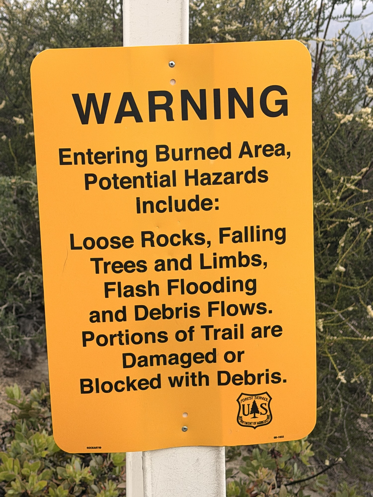
Walked through a major burn area in the late afternoon. There is a ridiculous amount of Poodle Dog Bush throughout this area. Some is taller than me.
They are not kiddingPoodle Dog Bush Every In The Burn Area
I stopped for a late lunch at 1:00 and 9.83 miles. Back on trail at 1:30.
I met Brad at the turnoff to Sawmill Camp at 4:00 and 15.4 miles. With this nasty weather, we decided to camp here instead of continuing on. We found tent sites on an old sunken road bed that got us mostly out of the wind.
The wind was very strong all night with rain on and off after 7:30 pm. The temperature dropped to about 33 degrees with a sub-freezing windchill. Coldest night on trail so far. Not pleasant at all! I got in my tent at 5:00 and did not come out until the next morning.
Surprisingly we had two bars of cell service. I have been wrestling with my Insurance in order to get my meds refilled in time to get them shipped to Kennedy Meadows by June 10. They won’t pay for the early refill, but I got a compromise of refill on June 5. If Pit Crew ships my Bear Can that day, it will get there just in time!
I also sent the trail angel in Tehachapi tracking info for my two packages.
Day 34 Map – Mile 483.6 to Mile 498.2
Technical Notes:
Protein Shake (10oz): 330 cal, 19g carb, 13.5g fat, 36g protein
Tuesday, May 26, 2026. Cloudy, foggy, 47 going up to 57, and windy.
Up at 5:30. Icky morning with clouds and wind. We got on the trail at 6:30.
Absolutely blah day. Walking in the clouds for hours, which makes everything wet. Eventually, we got below the clouds. Cold and very windy with damp clothes.
At 1:00, we reached the Green Valley Fire station. Had lunch and a break for an hour while huddling out of the wind behind a retaining wall.
Day 33 Embracing the Suck
Hiked 6.5 more miles to the only camp spot we could find that was semi-out of the wind. Next camp spots are 5 more miles. Made camp at 4:30.
Shittiest camp spot I have ever had to use. Literally and figuratively. Some jerk used it as a bathroom and did not bury their shit. It’s a weird size and shape surrounded by nasty scrub. But it’s all there is, and it’s starting to spit rain and getting COLD.
Made dinner in my tent and quilt at 6:00. Hot food, good! Bundled in my quilt and contemplating putting on gloves at 7:00. This is one of those “embrace the suck” days.
Chance of rain on and off tonight. Tomorrow’s forecast is the same, but a bit colder with a 25% chance of rain. I’m hoping to sleep in.
Asleep in the cold at 8:00. Warm in my quilt. It rained on and off from 3:30am until 7:00 in the morning.
Day 33 Map – Mile 464 to Mile 483.6
Technical Notes:
Protein Shake (10oz): 330 cal, 19g carb, 13.5g fat, 36g protein
Up at 6:45. We are doing a reverse Nero. We plan on 10 miles but not starting until 2:30 this afternoon. That gives time for a real breakfast, lots of planning and shopping while we have good internet service at the coffee shop in town, laundry, and other chores.
Day 32 Morning at Serenity Oasis
A lot of folks are headed to 6 Flags Magic Mountain for the day. After that, they will do triple 20-mile days to get into Hiker Town late Thursday or early Friday.
The plan is a big hiker party / night hike starting Friday about 7:00 p.m. People try to hike the LA aqueduct section of the trail at night because it is 17 miles of flat Mojave desert with no water and typically heat in the high 90s and zero shade. There should be about 25 or more of us in this group on Friday. Stay tuned!
It will only take Brad and me 3.5 days to reach Hiker Town. That puts us in sometime Thursday without pushing. Hence our late start today. There is nothing to do in Hiker Town as it’s just a collection of glorified sheds for rent and tenting space with crude showers in the desert. There is a small store with a grill and a hiker lounge about 8 miles down a side road that offers rides to and from Hiker Town. All that means we need to kill Thursday evening and all day Friday to hook up with the big LA aqueduct party. What the hell, it should be fun.
I did laundry, finalized my food for the next 3.5 days, shipped my extra food ahead 8 days to Tehachapi, and pretty much got ready to leave the oasis later in the day. We got a late breakfast at the Cowboy Tavern around 10:00.
After breakfast, I got a coffee and hung out at the coffee shop next door to use their WiFi for several hours. I ordered socks, electrolytes, milk powder, and a new sleeping pad from Amazon to a trail angel’s house in Tehachapi. They will deliver it to me when we hit town Monday.
I need new socks!
I also remembered to take care of all the monthly bills back home. I almost forgot about all the real world things that still need looked after.
I used my account to order shoes and a few things for Brad from REI to Tehachapi. For some reason, all his orders keep getting rejected. Must be a cross-border issue or something odd with his Canadian accounts.
I had a long video chat with Pit Crew and a nice call with my mom. Back to the oasis, finished packing, and we hit the trail at 2:30. Packing our 4 days of food and a big bag of Lay’s chips strapped to the back of my pack.
Packing out Lays Chips
We had a big 5-mile climb in the middle of our 10 miles today. We wanted to knock that out as part of our short day.
Day 32 View From Summit
We got a lot of water about mile 8.5 (after the climb) as we have 15 miles with no water tomorrow. I carried out 5 liters or 11 lbs of water for cooking and camping tonight, plus for all day tomorrow. Ouch!
We made camp at 6:45 and 9.5 miles. A bit exposed and windy, but not much else around. Fingers crossed my tent stays up tonight.
I want to give another shout-out to Pit Crew and her unwavering support and encouragement for this little adventure. I could not do this without her. This really hit home the past two days as I saw one person quit their hike today, several people are struggling with the mental side of things as well as family issues.
Side note…we know of at least three helicopter evacuations over the past 2 weeks. One of which we saw but didn’t realize what it was at the time.
Side note…we know of at least three helicopter evacuations over the past 2 weeks. One of which we saw but didn’t realize what it was at the time.
In bed at 7:45 and hoping the wind doesn’t get too bad tonight. My tent is not set up very well, and my fingers are crossed.
Up at 5:15. On trail at 6:15. Looking forward to brunch and beers at the Cowboy Tavern in 10.4 miles!
Margarita, Brad, Orange Man by LA RV
Started the day with a solid 2-mile ascent. We had another 1-mile ascent to bring us to our highest point of the day at 5 miles. That’s when the weather changed from sun and hot to descending through clouds and fine mist the rest of the way to town. It was pleasant and felt like walking in an air-conditioned shady room for 9 miles.
We walked through a tunnel under Hwy 14 and then walked through the Vasquez Rocks area.
Tunnel Under Hwy 14
Impressive rock formations. A lot of movies and TV shows have filmed here, including the original Star Trek series from the late 1960s. Specifically, this Famous Rock formation.
Day 31 Famous Rock – Star Trek
We reached Agua Dulce and the Cowboy Tavern at 10:15 and 10.15 miles. We got to town hours before the massive wave of hikers that would join us late in the afternoon. We had a great breakfast, chatted with other hikers, and headed to our hostel about 11:39.
Orange Man, Hot Mess, misc, Margarita, Karaoke at Cowboy Tavern
We arrived at Serenity’s Oasis at 11:45. Farmer John runs the hostel. It offers tent space, toilets, showers, laundry, kitchen, decent resupply, grills, hammocks, and places to relax. By the late evening, there were close to 50 hikers here. Very cool vibe.
Agua Dulce SignOur Tents at Serenity’s OasisSerenity’s Oasis
I picked up a resupply box that I shipped from Wrightwood and an Amazon package (LMNT, powered milk, protein powder). I sorted out all my supplies for the next 4 days to Hiker Town and figured out what I needed to purchase here in Agua Dulce. I only need to buy Skittles, dried bananas, jerky, dried mango, and 4 tuna packets.
No luck with the dried mangos at the small market in town. Also, I’m adding bigger dinners and more snacks to my diet as I just can’t get enough food. Hiker Hunger has kicked in.
I did score a 10k mAh power bank to replace my older one that is not holding a good charge. Nice!
At 6:30, six of us walked to the Mexican restaurant in town. This was the only restaurant open tonight. We were joined by many other hikers over the next 2 hours. I counted 34 of us in that restaurant.
Group Mexican Dinner in Agua Dulce
We meandered back to camp in the dark, and I got into my tent at 8:45. I worked on blogs and route planning for the next several days.
Really nice, relaxing day. Very social day with lots of old and new faces. I need to triple-check my resupply tomorrow and mail my extra items ahead to Tehachapi. We will be there in 8 days.
Day 31 Map – LA RV Resort to Agua Dulce
Technical Notes:
Protein Shake (10oz): 330 cal, 19g carb, 13.5g fat, 36g protein
Up at 5:20. On trail at 6:08. We have 17.4 miles in the desert to get to the RV Resort that offers tenting and showers and a pool for $30. Lots of people headed there. Then on Sunday morning we have 10 flat, nasty desert miles into the small town of Agua Dulce. We plan to get in there by 10:00 a.m., resupply, and chill all day.
Started the morning with a 2.7-mile steep ascent. Got a cool view down into the clouds. I’m calling this “Islands in the sky”.
Day 30 Islands in the Sky
Stopped for water at 8:20 and 5.0 miles. Just a boring day with lots of miles to knock out.
Filtered water and took a break in the shade at 12:09 and 13.4 miles. We have an ugly 4 more miles of hot desert to the RV Park.
Day 30 Lunch
Got to camp at 2:10 and 17.5 miles at LA RV Resort near Acton, CA. A bit dumpy, but I’ve stayed at worse campgrounds. Showers, expensive food, cold soda, ice cream, swimming pool!
Day 30 LA RV ResortDay 30 LA RV Resort
Just chilled all afternoon and evening. Had a double hamburger at the camp store for late lunch. Probably make a small dinner at some point. WiFi is only at the camp store area and no cell service.
Nice easy day with tons of hikers to socialize with. Got another even easier day tomorrow. Woo hoo!
Day 30 Map – Mile 427 to Mile 444.3 LA RV Resort
Technical Notes:
Protein Shake (10oz): 330 cal, 19g carb, 13.5g fat, 36g protein
Friday, May 22, 2026. Sunny, low 50s going up to 72.
Up at 5:30. Packed up and in the dining hall at 6:00. Chatted with the staff, had my breakfast, and had coffee. Got a ride to the trail at 7:00 from Bob.
We hiked fast today. Felt good and not too hot. Shooting for a 24-mile day.
Got trail magic from a dude who hiked 5 miles up the trail with fruit and water. I got an orange. He plans to hike the PCT next year.
Day 29 Trail Magic
Reached the Mill Creek Fire Station at 1:00 and 15 miles. There is water and a pit toilet. A bunch of us hung out in the shade of a tree for about an hour.
Lunch at Mill Creek Firestation
Took a break at 3:15 and 18.45 to take advantage of good cell service. I watched the Starship Flight 12 launch from the trail. Very cool!
Loaded up 3 liters of water 1.2 miles before camp. Got to camp about 5:50 and 24 miles. Two bars cell service. Margarita and one other are here too. I feel pretty good for a 24-mile day!
I need to reassess food in Agua Dulce. I ate 2 dinners tonight. And I’m still hungry.
Looking forward to the LA RV park tomorrow. Just 17 miles. Then just 10.4 miles on Sunday for a Nero into Agua Dulce and a restaurant and resupply.
Day 29 Map – Three Points (mile 403) to Mile 427
Technical Notes:
Protein Shake (10oz): 330 cal, 19g carb, 13.5g fat, 36g protein
Thursday, May 21, 2026. Sunny, mid-40s going up to 74.
Up at 5:30. Brad and I are going separate ways for a few hours this morning. I want to do the road walk through the Angeles Highway tunnel this morning, and he is going to hike the PCT over Mount Williamson. We will reconnect in about 3 miles at a road crossing.
On the road at 6:50. Cool walk through the tunnel without a sole or vehicle around. Nice echoes in the tunnel.
We have a mandatory road walk for about 4 miles due to a long-standing trail closure to protect an endangered tree frog. Overall planning on about 21 miles today.
Trail Closed for Tree Frogs
I waited for Brad at the Eagle’s Roost Picnic Area after 1 hour and 2 miles of walking down the centerline of the highway. Didn’t see a sole. I’m having thoughts of Randall Flagg (The Walking Man) up here in the high desert all alone just treading down the highway. And the crow that keeps squawking is getting creepy.
Brad arrived at 8:43, and we headed up the road at 8:50. We road walked for about 3 more miles. We reached the Buckhorn Campground at 9:50 and 5.11 miles. From here, we take a blue blaze trail about 1.5 miles north and rejoin the PCT. This place is closed due to the massive December 2025 rain storm damage.
Ruined Campground
Stopped for lunch at Cooper Canyon Camp at 11:45 and 8.33 miles. The last 1.5 miles up the canyon to here were steep and hard. The trail and canyon have been wiped out from the massive December 2025 rain storm. Reminds us of the disaster at Mission Creek.
Hiked through more burn areas and lots of flood and landslide areas all afternoon. The damage is massive.
Day 28 Landslide Area
We crossed the 400-mile mark in the afternoon. Awesome!
PCT 400 Mile Marker
Stopped at Camp Glenwood for water and a break at 3:20 and 13.9 miles. Private camp that offers water and picnic tables.
The trail crosses Angeles Highway for the last time at Three Points rest stop. We arrived at 4:30 and 16.5 miles. We ran into Chinchilla and her sister who was meeting her for personal trail magic.
There is a Christian camp 1.5 miles off the trail that offers hiker services. We had not planned on going there, but they were at the rest stop offering rides to the camp. Free bed, shower, dinner, power, and a ride back to the trail in the morning. A bunch of us decided to go instead of hiking 3 more miles to camp. Chinchilla, Hell Yeah, Margarita, Bedazzled, Natalie, Brad, and me. There may be some other hikers there already.
Angeles Christian CampAngeles Christian Camp Dinner Picture
The people here at Angeles Crest Christian Camp are wonderful. Currently being run by three generations of the same family. It’s like being a camp counselor again from the 1980s.
Day 28 Map – Jarvi Memorial Picnic Site (Mile 386.1) to Three Points (mile 403)
Technical Notes:
Protein Shake (10oz): 330 cal, 19g carb, 13.5g fat, 36g protein
Wednesday, May 20, 2026. Sunny, 45 going up to 67.
Up at 6:00. Had a light breakfast and coffee at the VRBO. We are getting a ride to the trail at 8:00 in front of the grocery store.
We walked to the store along with Mash and our trail angel picked us up at 8:00 sharp. We talked about the fire from 2 years ago that got very close to town and the storm this past December that dumped over 10 inches of rain in under 24 hours and wiped out Highway 2 north of town where we are headed. They think it will take another year to repair the road.
On the trail at 8:20. The only traffic on Hwy 2 are dump trucks trucking endless amounts of infill up to fix the washed-out sections of road. That and some people dropping off hikers. Very spooky up here as it’s also in the burn area.
Day 27 Inspiration Point Parking AreaInspiration Point on Hwy 2Day 27 Mile Signs
We had a very pleasant 4.5-mile hike in the trees to the base of Mount Baden Powell. Very much like an east coast hike up here out of the desert. I am only carrying 2 liters of water today.
We arrived at the Vincent Gap Trailhead at 10:00 and 4.5 miles for a brief break. Pleasant hike so far. Cool, lots of shade in the pines, relatively minor ups and downs.
Rest Area at Base of Baden Powell
Hwy 2 is closed from here for at least 20 miles due to washouts from December storms. This is where we start our 4.5-mile 2657-foot ascent of Mount Baden Powell. Switchbacks are plentiful the first 3 miles or so, then it’s an insane steep climb with some areas at a 30% grade. This should be “fun”.
Named for the founder of Scouting, Mount Baden-Powell is one of the more popular peaks on a side trail from the Pacific Crest Trail. At 9,406 feet (2,867 meters), it is the fourth highest peak in the San Gabriel Mountains. If you look carefully, and the smog is not too bad, you can see the downtown Los Angeles skyline.
We started our ascent of Baden Powell at 10:20. It’s steep even with switchbacks. We sat on a very well-placed wooden bench at 1 mile up and admired the view.
A Bench Ascending Baden Powell
Looking up into a monster tree around the 1-mile mark.
We stopped for water at Lamel Spring about 1.7 miles into the ascent. Last water until the late afternoon.
Big Tree Straight Up
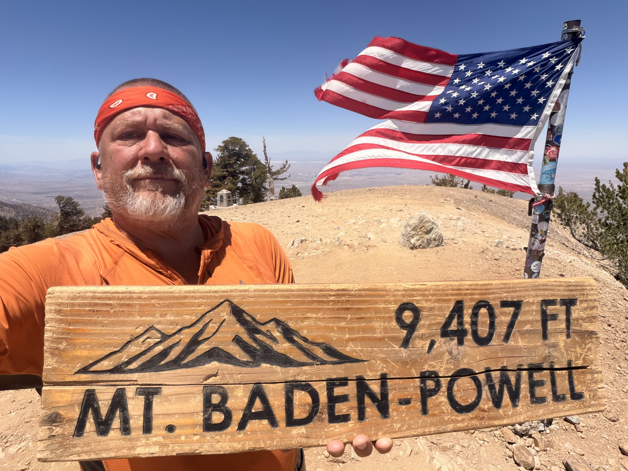
We summited at 12:50 and 8.79 miles. The summit is at 9,407 feet. We hiked uphill 3,414 feet so far today. It was hard, but much less so than we expected. We are getting our trail legs.
Amazing views. And fair cell service. Very cool experience and a bit emotional. We hung out for about 45 minutes soaking in the views and the experience.
Orange Man at Baden Powell SummitOld Glory on Mount Baden Powell
Shoutout to my Big Brother, Jon Luning, for getting a custom mini Theta Xi Fraternity flag made for me. This is the first major milestone on the PCT where I got to display the flag. Thanks, brother.
Chuck With Theta Xi Flag on Baden PowellChuck With Theta Xi Flag on Baden Powell
We had about 15 minutes with the summit to ourselves before a bunch of others arrived.
Orange Men on Mount Baden PowellHikers on Mount Baden Powell
We left the summit and started our 9-mile hike to water and our camp for the night. Fairly pleasant with a few big ups but mostly chill terrain and views west to LA and north to the Mojave Desert. Great view of Edwards AFB in the distance all afternoon.
We stopped for 5 liters of water at Little Jimmy Spring followed a 2.8-mile carry. No water at camp and none for 10.3 more miles. Surprisingly, my body easily carried that load this time!
Water From The Mountain Side
The last 2.5 miles was through a large burn area and landslide area. We finally encountered Poodle Dog Bush. This nasty plant is worse than poison oak and has a sticky resin all over that stings and burns badly for days. It thrives in old burn areas. It was everywhere this afternoon in the burn areas. Right up to the trail in places.
Poodle Dog Bush
We got to a rest stop on Hwy 2 about .5 miles before the road is closed. It’s like a different world up here as everything had been unused since last fall. Nobody comes up here now as this part of the road is very remote in normal times. Just construction traffic and none of that this late in the day.
Day 27 Angeles Crest Hwy Abandoned Rest Area
We walked up the abandoned highway .3 miles to a roadside picnic area at 6:45 and 18 miles. Clean pit toilet, trash can, picnic table, and an amazing view southwest towards LA.
Day 27 CampDay 27 Camp Picnic Area on Angeles Crest Hwy
Made camp and ate dinner watching an awesome sunset. It got cold the second after that sun dipped behind the mountains.
Day 27 Sunset Dinner View
As I expected, once it got dark, we had an outstanding view down onto the lights of LA. I stared at the lights for quite a while. Still photos don’t work, so I took a so-so video from inside my tent of the LA lights. We are camped at 6,800 feet and are about 40 miles from LA. The closest areas from us are Pasadena and Anaheim straight south.
Today was a great day. Big hard climb and a 5-liter water carry, and I felt great. Summiting Baden Powell in good weather is not all that common, and it has long been one of my key side quests on the PCT. It really makes me feel alive on days like this. And finish out the day with the cool view of the LA lights, wow!
Day 27 Map – Wrightwood to Jarvi Memorial Picnic Site (Mile 386.1)
Up at 6:15. Enjoyed morning coffee and worked on blogs while everyone else was still asleep.
Had breakfast at Grizzly Cafe. Very nice. Picked up a fuel can and two resupply boxes at the hardware store.
Grizzly Cafe in Wrightwood
Planned out food in detail for the next 5 days to Agua Dulce. Big, heavy food carry given how much I am eating.
Brad started looking for a trail angel to give us a ride to Hwy 2 and the PCT tomorrow morning. Starting with the Wrightwood Trail Angel Facebook group.
Ordered milk powder, protein powder, and electrolytes from Amazon for delivery in Agua Dulce at the end of the week. Went grocery shopping for dried fruit and a few lunch items. Brad and I also picked up stuff to make a spaghetti dinner for the house tonight.
Finished prepping and packing food for Agua Dulce. I am sticking solidly to the healthier diet.
Food Prep for Agua Dulce
Shipped extra dinners and dried fruit and a few other extras to the hostel where I will be staying in Agua Dulce. Also shipped my micro-spikes home as there isn’t enough snow on Mount Baden Powell to require them.
I ran into Hell Yeah on my way to the post office. He is staying in the house tonight as well.
And we ended up with Chinchilla, Natalie, and Bedazzled in the house. Full house.
Packs on Porch in Wrightwood
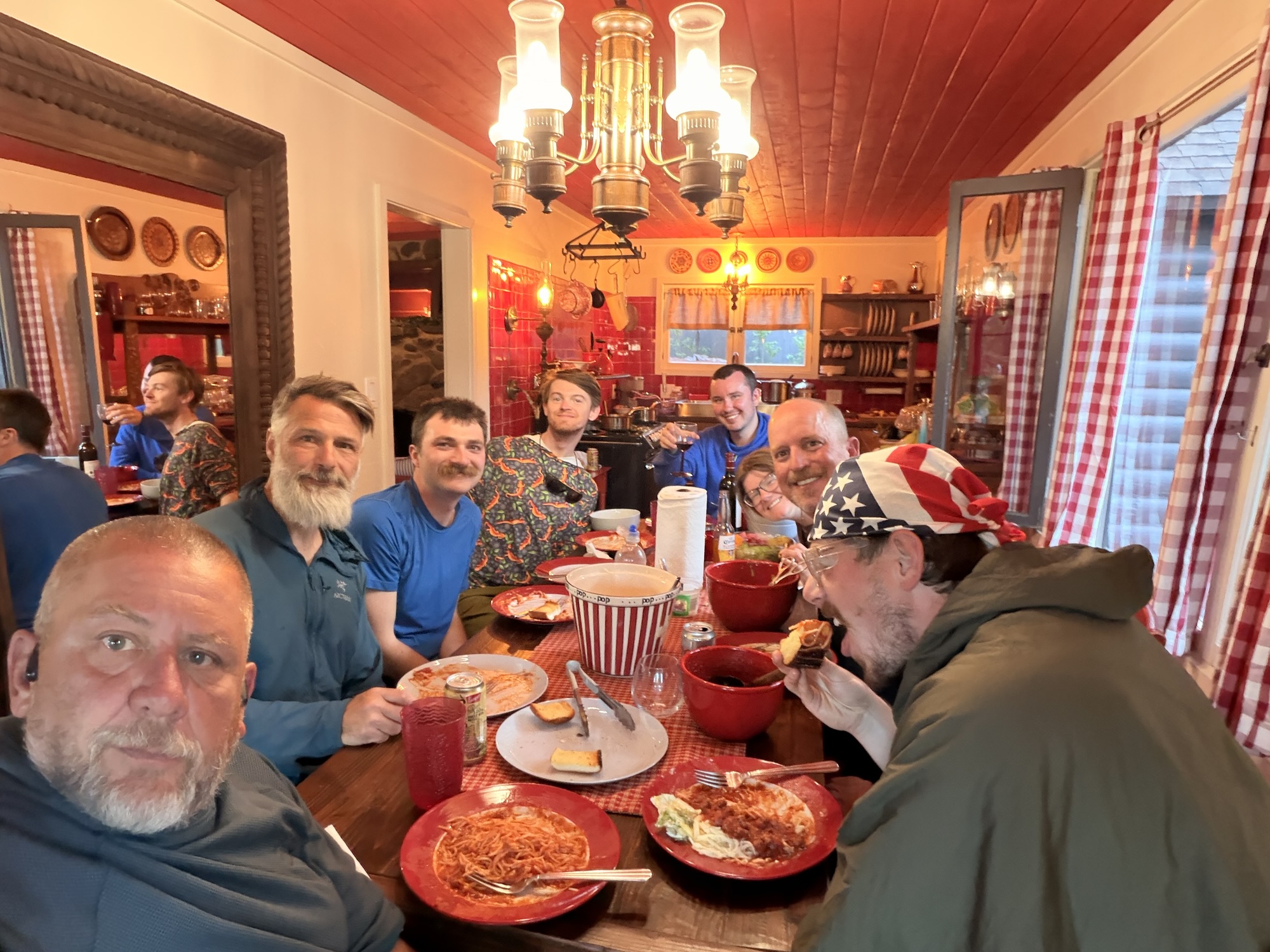
Brad and I made spaghetti, salad, garlic bread for everyone. It was a really nice evening.
Wrightwood Pasta Dinner
Brad arranged a ride with a trail angel to the PCT at 8:00. We meet them at the grocery store. I am basically packed. Just need to put the items I need in the morning into the pack and I will be all ready.
I am looking forward to this next 5-day stretch of trail. Mount Baden Powell will be steep and hard tomorrow we the a full 5-day food carry (heavy), but things are fairly chill after that. Plus my pack will weigh less each day. And I don’t foresee any water carries more of ham 2 liters between now and Agua Dulce.