Tag: Vermont

  • Day 141 – Norwich VT to Moose Mountain Shelter

    Day 141 – Norwich VT to Moose Mountain Shelter

    Today’s Miles: 12.3

    Trip Miles: 1774

    “Now I look in the mirror and what do I see?

    A lone wolf there staring back at me.

    Long in the tooth but harmless as can be.

    Lord, I guess he’s doing alright.

    And it’s a great day to be alive.

    I know the sun’s still shining.

    When I close my eyes,

    There’s some hard times in the neighborhood.

    But why can’t every day be just this good?” – Travis Tritt

    Up at 7:00. Uploaded blog from last night. Had breakfast at the hotel. Packed up and headed for the VT/NH border at 9:20. About 13 miles today with the first 2 or so a road walk through Norwich, VT and Hanover, NH.

    I made a tentative shuttle reservation for 5:00 Thursday evening from Hikers Welcome Hostel to the Notch Hostel. Need to firm that up Wednesday evening when I talk to the folks at the hostel about the hike details for Thursday.

    Partly cloudy, 68 degrees going up to 80. Very humid. Zero breeze.

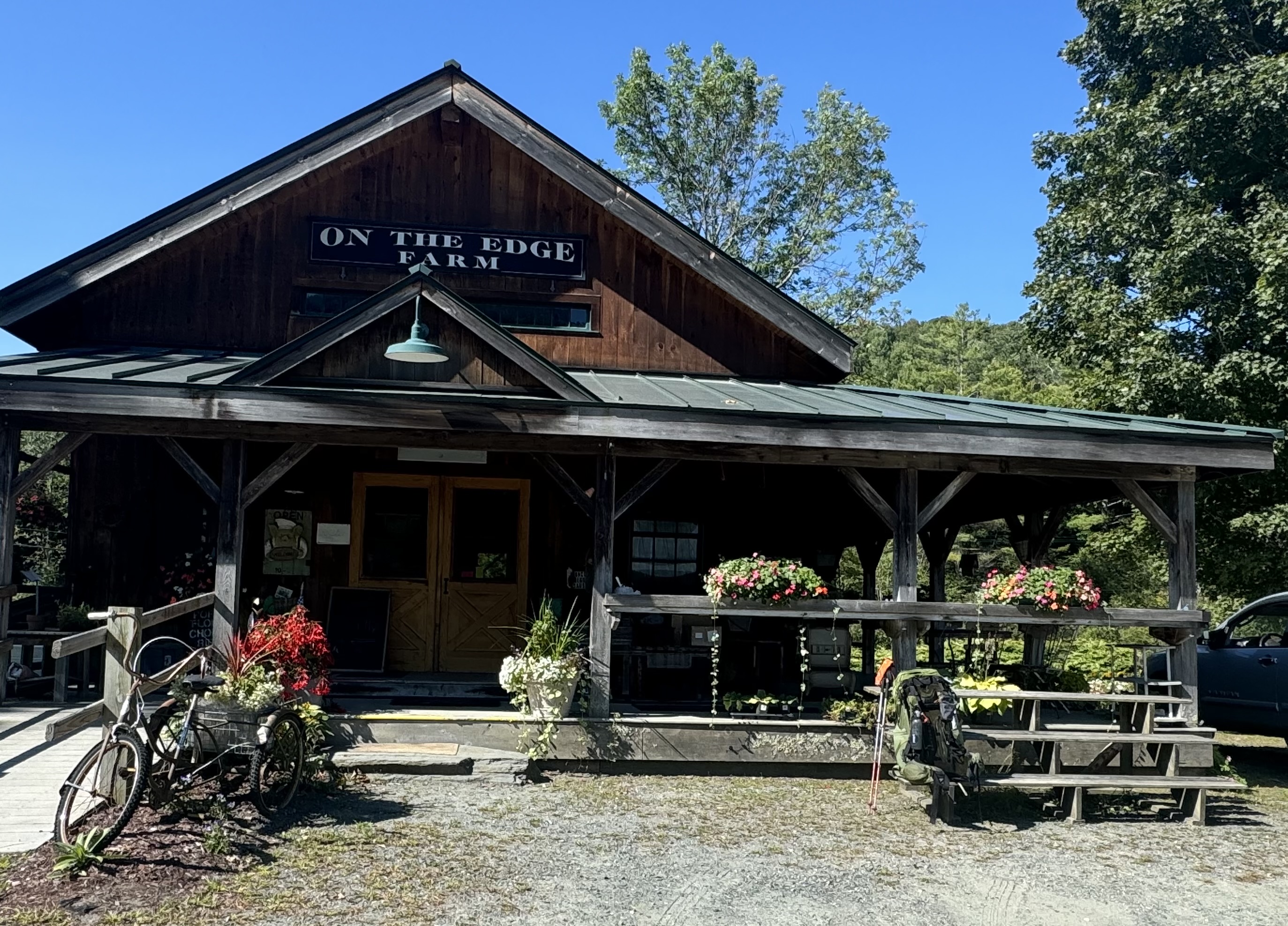
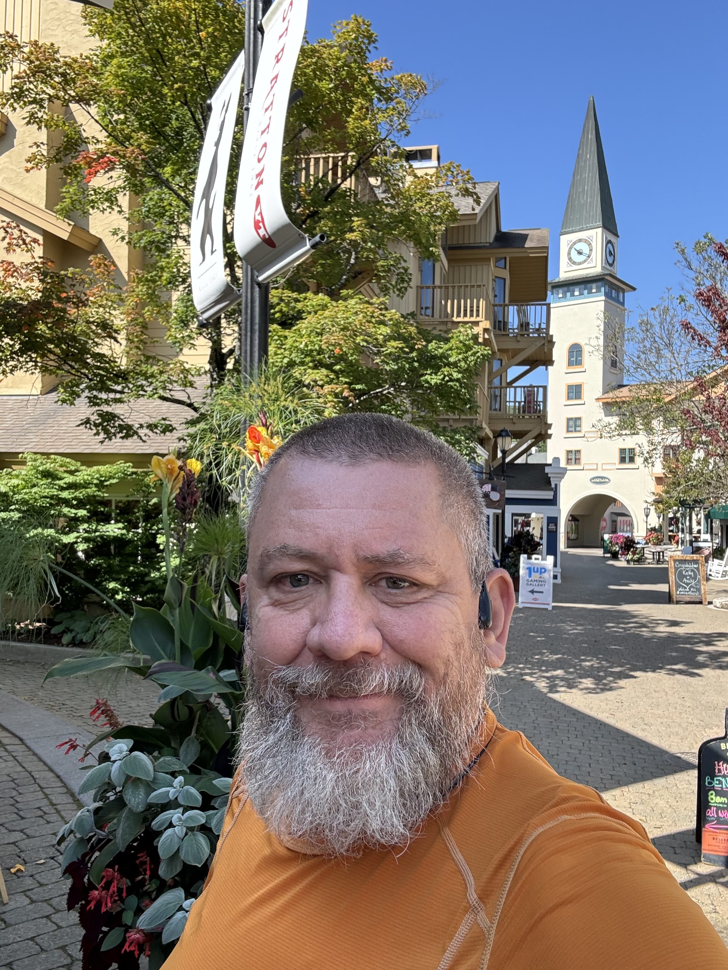
    A guy stopped his car a block from the Inn and asked if I wanted a ride to Hanover. Why not! Andy and his dog dropped me by the post office in Hanover. The trail runs right down Main Street then cuts through part of Dartmouth College before exiting town. I got some cash from an ATM and a large latte at a coffee shop and hung out for half an hour. Back on trail at 10:20.

    Nice signage painted on the sidewalk and some cool murals.

    AT mural in Hanover, NH
    AT mural in Hanover, NH

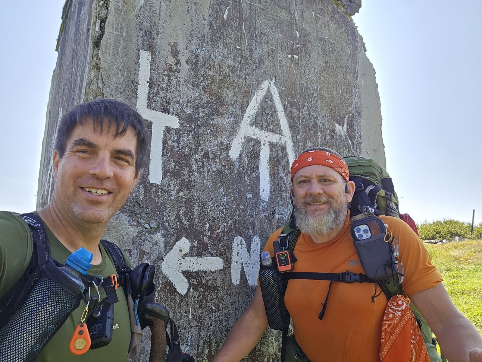
    Crossed the Vermont-New Hampshire border on the bridge over the Connecticut River. That’s 12 states down and 2 to go. I hit the Whites in 4 days. 

    I am GUESTIMATING that I will finish on October 14. That includes about 5 buffer days for bad weather in the Whites. That is 44 days away, so I’m starting my countdown to completion as of today. 

    Lots of roots and slabs of rock. It rained last night and things are very slippery. Plus lots of pine needles.

    Roots and slabs of rock in NH

    Crossed through a marsh on a boardwalk at 12:15.

    Marsh and boardwalk in NH

    Ran into a good-sized bear under an apple tree. I came around a bend in the trail and there he was lying under a big apple tree. Lots of apples lying on the ground. He lifted his head and stared at me until I reached for my camera . Then he scooted about 10 yards into the pine trees and continued to watch me. He obviously wanted me to leave so he could go back to eating apples. So I left.

    Talked to Dana as I soon had decent cell service after the best. She is shipping my shoes to me for delivery Friday at a hostel. Yay!

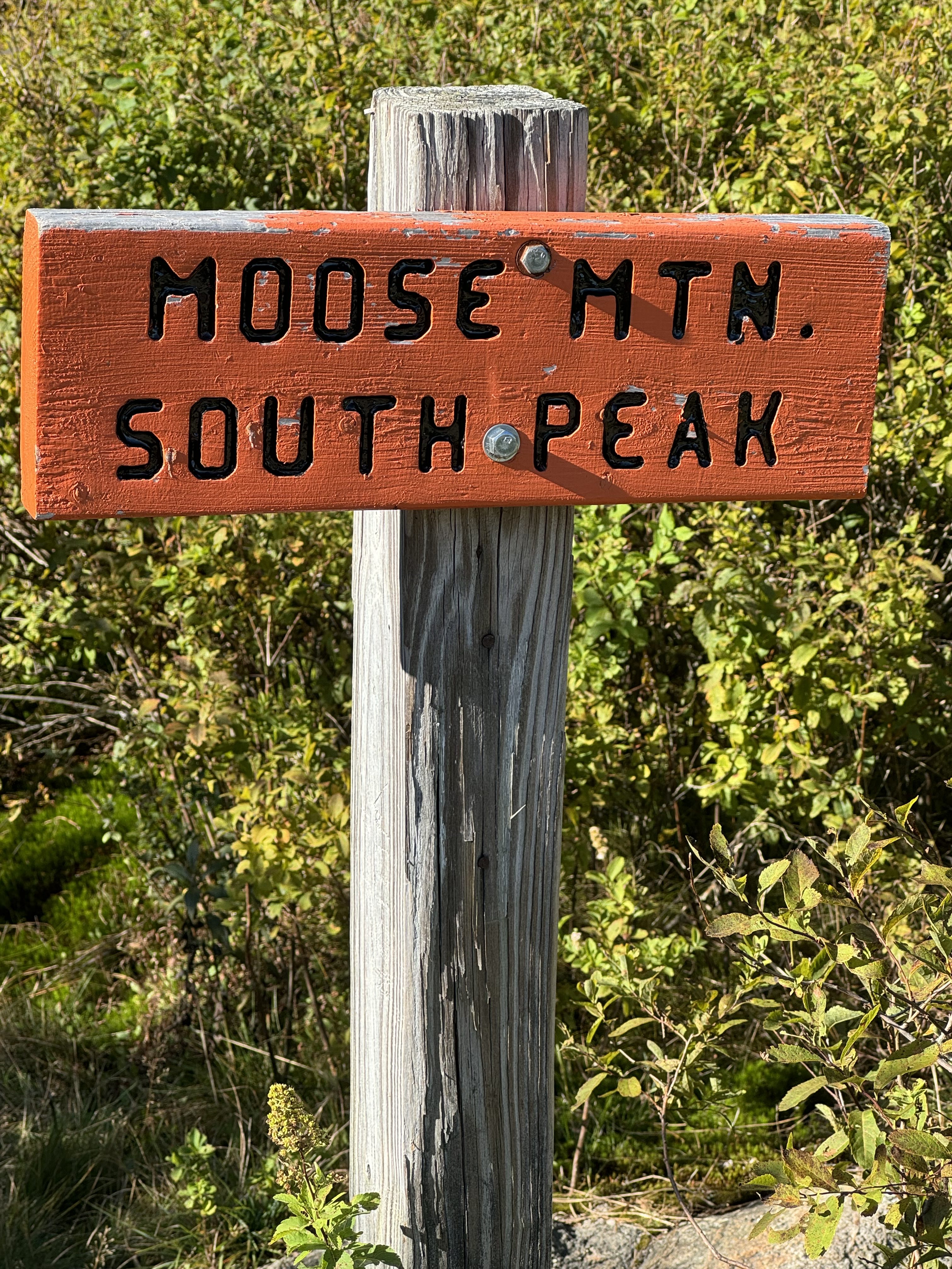
    Stopped for a snack at 1:00. Still humid but there is a sporadic breeze now. I have 6 miles to go. The next 3 miles are a slow ascent then the last 3 are a steep climb up to the top of Moose Mountain South. Should be in between 4:30 and 5:00.

    Stopped for a snack at 3:00 at Three Mile Road. I have 2.6 miles UP to camp. I am going to fill up two liters of water at a stream in .2 miles. The water for tonight is .2 BEYOND the shelter and is not the best. Ran into Uno and Google. They are likely pushing on to the next shelter another 6 miles further.

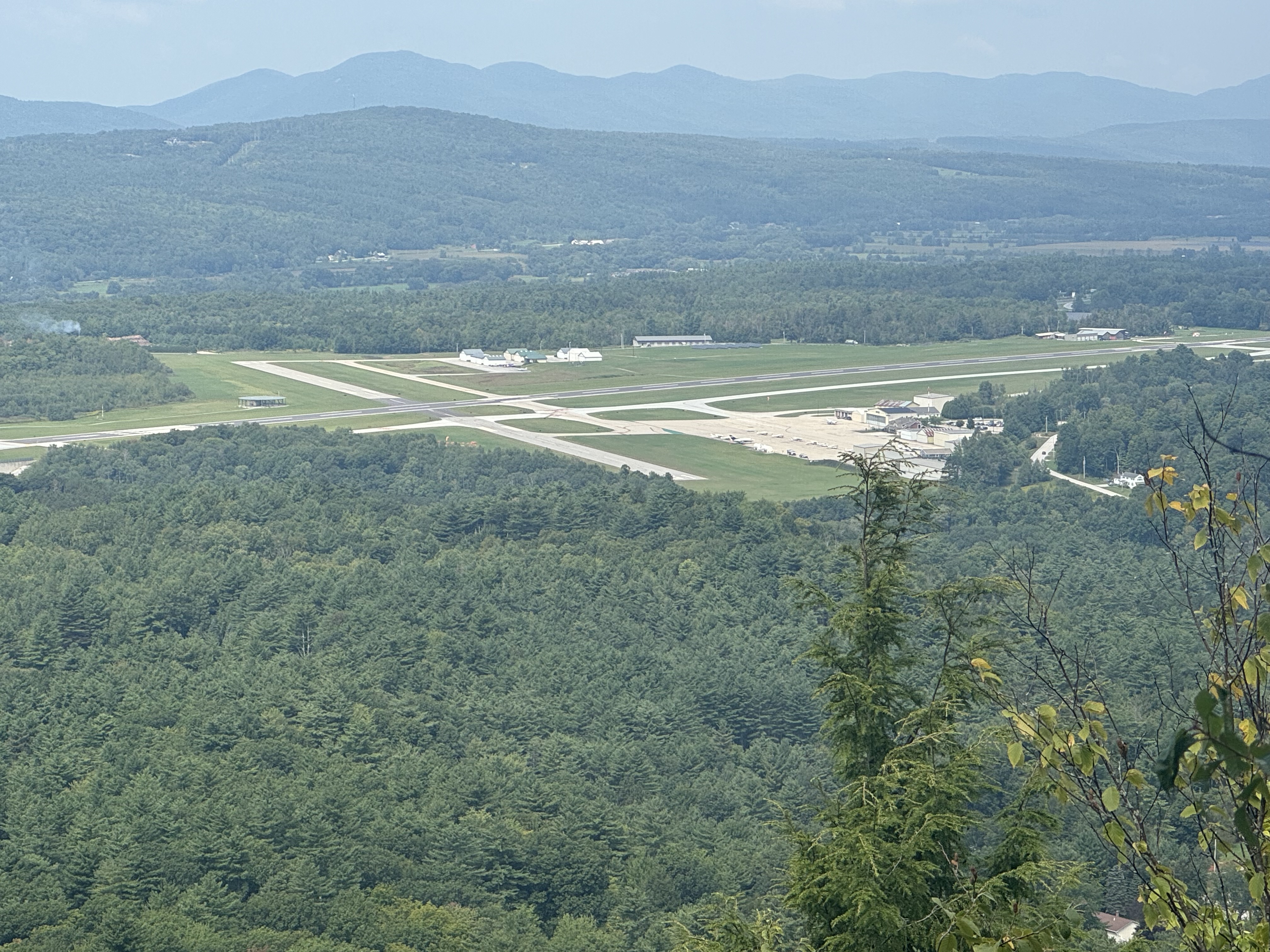
    Summited Moose Mountain South at 4:25. Nice view.

    Summit of Moose Mountain South
    Moose Mountain South

    Arrived at Moose Mountain Shelter at 4:45. Two bars of cell service!

    Moose Mountain Shelter
    Moose Mountain Shelter

    Very nice shelter setup. Airy with good views. Great tent spot just behind shelter with a stump for a seat. Nice bench that looks out over the valley below. 

    Hung a clothes line and put up wet clothes. It’s in the shade but there is a decent if sporadic breeze, so should get some drying accomplished before bedtime.

    Set up tent and otherwise made camp by 5:15. Made dinner and ate at 6:00. Weather is great this evening, but it will get chilly once I lose the sun.

    Spot, Xander (who hikes with Uno and Google), and two female NOBOS showed up about 5:50.  The Rascals (23, polar, newt, glass) are not far back and may be headed to this shelter for the night. And they arrived about 6:30. We talked about our plans for the first few days in the Whites. They have one day less than me to get to Hikers Welcome hostel. I have a reservation at Barn Door hostel in between here and where they are headed. I think we will all bunch up and catch up through the Whites. 

    Texted with Legend. He’s at Hikers Welcome hostel with Overkill and company 2 days ahead. They are hiking Mount Moosilauke tomorrow. Told him I want to hear feedback on that.

    Today was a good day and a big day mentally: New month (September 1), new state (NH), heading into the Whites, starting my 44-day countdown, caught up with the Rascals, got a good plan for the first several days in the Whites. 

    Day 141 Map – Norwich VT to Moose Mountain Shelter

    Technical Notes:

    • OJ 55
    • Scrambled eggs 180
    • Sausage 600
    • Bacon 130
    • Large latte 190
    • Sugar cookie 400
    • Cheese crackers 250
    • Skittles 100
    • Ramen 370
    • Dehydrated chicken 160
    • Fritos 200
    • Pepperoni 420
    • Fritos 400
    • Water 1.7
    • Miles 13
    • Time 6
    • Elevation gain 3204
    • Calories consumed 3800
    • Calories burned 5500
  • Day 140 – West Hartford VT to Norwich VT

    Day 140 – West Hartford VT to Norwich VT

    Today’s Miles: 8

    Trip Miles: 1761.7

    “Now he lives in the islands, fishes the pilin’s

    And drinks his green label each day

    Writing his memoirs, losing his hearing

    But he don’t care what most people say

    Through 86 years of perpetual motion

    If he likes you he’ll smile, then he’ll say

    “some of it’s magic, some of it’s tragic

    But I had a good life all the way” “ – Jimmy Buffett

    Up at 7:00. Got all my gear packed and headed to the common building for coffee and breakfast.

    Overcast, windy, 60 going up to 72 with rain this afternoon.  Humid though.

    Looks like it won’t rain till noon. I should get most of my short 8-mile day into Norwich done before the worst of the rain gets here. 

    Jon Luning is meeting me for dinner at the Norwich Inn at 5:30. Really looking forward to that. 

    Cooper Cab picked me up at 8:40 and shuttled me to West Hartford. On trail at   9:15.

    Crossed under I-89.

    Crossed under I-89

    I’ve been walking through pine trees and maples the past few days. Very up and down as we cross lots of little roads. Trail had been quite nice.

    pine trees and maples in VT

    Arrived in Norwich, VT at 1:00. Made good time. Chatted with Dana as I walked the last mile into town. Started to rain as I got to Main Street. Perfect timing. Walked 2 blocks to the hotel and I was able to get an early check-in at The Norwich Inn instead of 4:00 check-in. Got unpacked and made 5:30 dinner reservations for Jon and me at their pub.

    Norwich Inn in Norwich, VT

    Uploaded blogs and researched how to tackle The Whites. My goal is to slackpack Mount Moosilauke southbound from Hikers Welcome hostel, then slack the Kinsmans northbound from The Notch hostel. I texted Hikers Welcome hostel with a question about slacking and how to get to The Notch hostel in the evening. Hopefully, they get back to me. If not, I’ll call them in the morning.

    Got a text from Polar. The Rascals are hanging out in Hanover, NH, next door and asked if I wanted to join them. Told them I had plans but should see them in a few days. 

    Went next door to Dan & Whits store for snacks and a small resupply.

    My very good friend Jon Luning drove 3.5 hours each way from CT to have dinner with me. Awesome. Just fricking awesome. Thanks, brother!

    Chuck and Jon at the Norwich Inn

    We had a nice dinner at the pub in the hotel. Jon left for home after dinner, and I worked on route planning. I think my best bet is to slack Moosilauke southbound from Hikers Welcome hostel on Thursday, then get a private shuttle north to The Notch hostel that evening. I’ll make some calls tomorrow to shuttle drivers.

    Day 140 Map – West Hartford VT to Norwich VT

    Technical Notes:

    • Potatoes: 250
    • Zucchini bread: 175
    • Healthy burrito: 125
    • 600
    • Oreo: 160
    • Sugar cookie: 400
    • Tea: 90
    • Potato chips: 420
    • Lots more…town night
    • Water: .5
    • Miles: 8.2 
    • Time: 4
    • Elevation gain: 1791
    • Calories consumed: 5500
    • Calories burned: 3250
  • Day 139 – Winturri Shelter to West Hartford VT

    Day 139 – Winturri Shelter to West Hartford VT

    Today’s Miles: 17.4

    Trip Miles: 1753.7

    “I never said it’d be easy

    It’s just a part of life that I had to go through

    Oh yeah

    To make it to the top of the mountain

    It’s gonna be a steep climb

    It’s gonna be a steep climb” – Eric Gales

    Up at 6:45. Headed to the farm stand 4 miles away at VT 12. It’s a .2 mile road walk to the stand. Will pick up lunch and a beverage and possibly call Dana if there is service. Should be there by 10:15. On trail at 8:15.

    Sunny, 51 going up to 74. Looks like a very nice day.

    One of the tent campers had to scare off a bear in the middle of the night last night. 

    Stopped at On the Edge Farm Stand at 10:30 for lunch and WiFi. They have the cleanest porta potty I have ever seen. Had a nice chat with the owner. Back on trail at 11:10.

    On the Edge Farm Stand

    Ascended Dana Hill immediately after leaving the farm stand. OMG very very steep! Getting my climbing legs back.

    Cross a nice meadow at 12:30. This weather is spectacular! Topped off water at a stream not far past the meadow. Followed by another nasty steep climb at 2:00. Very steep!

    I’ve been seeing plastic tubing running through the trees on and off all day. Finally figured it out. Maple syrup harvesting in progress!

    Maple syrup harvesting

    Made yet another very steep uphill climb at 2:30. Good exercise I suppose, but slowing me down for the day. 

    Stopped at the top of the last hill at a nice wooden bench and took a water break. Met 3 NOBO hikers separately plus Uno while sitting here. The 3 I had not met before, including Full Moon and Mockingbird, all surprised me by saying “I’ve heard of you”. They had all hiked with either Legend or Uno and some of the other young group I had been hiking around for the past month and a half. Almost all of them are marathon hiking as close to Hanover, NH as possible today so they can get packages at the post office tomorrow before it closes at noon. 

    My new best friend, Cooper Cab, picked me up about 4:00. Stopped at a market in Woodstock for frozen dinner and snacks. Super expensive!! Got to Wise Pines hostel at 4:30. Nice place. Got showered and settled in. Will make dinner later. Started laundry and had a snack.

    Joined the weekly happy hour video chat at 6:00 then talked to Dana at 7:00 while I made dinner. Took care of some household administrative tasks. Headed to the bunk room to settle in at 9:00. Cooper is picking me up at 8:30 a.m.

    Day 139 Map – Winturri Shelter to West Hartford VT

    Technical Notes:

    • Pop Tarts 370
    • I’ve Cream Sandwich 250
    • Dr Pepper 150
    • Doritos 260
    • Roast Beef Sandwich 450
    • Dr Pepper 150
    • Oreos 160
    • Pepperoni 620
    • Doritos 800
    • Seltzer 600
    • Burritos 680
    • Hot Pockets 620
    • Water 4
    • Miles 17.4
    • Time 8
    • Elevation Gain 4011
    • Calories Consumed 5500
    • Calories Burned 5500
  • Day 138 – Inn at Long Trail to Winturri Shelter

    Day 138 – Inn at Long Trail to Winturri Shelter

    Today’s Miles: 14.4

    Trip Miles: 1736.3

    “Oh, give me land, lots of land under starry skies above

    Don’t fence me in

    Let me ride through the wide open country that I love

    Don’t fence me in

    Let me be by myself in the evening breeze

    And listen to the murmur of the cottonwood trees

    Send me off forever but I ask you please

    Don’t fence me in” – Bing Crosby

    Up at 6:45. Showered and had breakfast at the hotel. Finished some last-minute packing and played with some route planning tweaks. Might try to do some bigger miles the next two days so I can get into Norwich earlier on Saturday and minimize my time in the rain on Saturday. Cooper Cab picked me up at 8:45 and took me to the trail. We chatted for a bit about local hostels and trail pickup access. On trail at 9:15.

    Clear and low 50s going up to 70 degrees.

    Side note: I was talking to family back in Maryland last night and the temperature hit 99 with the heat index around 103.

    Very steep 1.5 miles to start the day! 946 feet per mile grade!

    Big climb out of Killington, VT

    Nice view of Killington ski resort and mountain from the opposite side of where I was two days ago. Taken from a power line crossing at 10:30 and 2 miles in for today.

    Killington ski resort and mountain from the opposite side

    Cool little waterfall.

    Cool little waterfall

    Going down! Ladder attached to the rock face. Foreshadowing for next week.

    Ladder attached to the rock face
    Ladder attached to the rock face

    The trail is very nice today, very little mud. Mostly packed dirt with a layer of old dried leaves. 

    I have been seeing a lot of grouse the last 4 days or so. At least a dozen a day. Damn things make a ruckus when they fly away.

    Reached Chateauguay Road at 2:00 and 9 miles in for the day. Heavily rutted dirt road, but it had seen use recently. Decent raised vehicle required. Stopped for a snack and to swap water. 

    Chateauguay Road

    I have 5.3 miles to the shelter for tonight. Should be there by 5:30. Back on trail at 2:30.

    Filled up on a liter of water at a stream at mile 9.4. No more water until camp.

    Made it to The Lookout at 4:00 and 11.9 miles. It isn’t an official AT shelter, but is a privately owned cabin that is open to hikers for camping. No water or electricity or privy, but it is a nice enough cabin. My original plan was to stay here, but I’m going another 2.7 miles to a shelter. It gets me closer to Norwich so I have less hiking in the rain Saturday morning.

    The Lookout

    YouTube video from the top of Lookout

    Got to Winturri Shelter at 5:30. There are 6 others here. There is a so-so bar of cell service. I set up my tent and generally got camp ready. I hung clothes to dry in a pine tree by my tent.  It was easier than setting up a clothesline!

    Winturri Shelter camp

    Ate dinner at 6:45 and worked on route planning for tomorrow.

    My feet hurt! Another reason to do these under 15-mile days! 

    Ugh. I heard from Dana. A tree is down in the backyard and it took out part of the fence that keeps the dogs from running off. It is lovely. I have to work with Dana to get the tree removed and the fence patched until I get home. I don’t have enough cell service to call now. It is frustrating. 

    Tree took out the fence at home

    In bed at 7:30. I am doing route planning and reading until 9:30. I want to be on the trail by 8:00 a.m. tomorrow. I am pushing some bigger miles to get to a road for a shuttle to a hostel around 5:00 p.m. I need to arrange the shuttle in the morning and then the hostel.

    Day 138 Map – Inn at Long Trail to Winturri Shelter

    Technical Notes:

    • Apple juice: 125
    • Omelette: 350
    • Sausage patty x2: 300
    • English muffin: 250
    • Coffee: 75
    • Cheese crackers: 250
    • Zero-sugar sausage: 120
    • Oreo: 160
    • Ramen: 370
    • Dehydrated chicken: 170
    • Oreo: 160
    • Fritos: 500
    • Water: 1.7
    • Miles: 14.4
    • Time: 8:15
    • Elevation gain: 4419
    • Calories consumed: 2830
    • Calories burned: 6500
  • Day 137 – Zero at Inn at Long Trail

    Day 137 – Zero at Inn at Long Trail

    Today’s Miles: 6.7

    Trip Miles: 1721.9

    “Lately I’ve been on the road more than I’ve been home.

    All this leaving her alone is killing me.

    And holding her, right now, has got me thinking more and more,

    This is right where I need to be.” – Gary Allan

    Up at 7:30. Rainy as predicted. Packed up gear to send home: summer quilt, fan, pack cover, shorts, short-sleeve shirt, underwear, sunglasses, carabiner, sandals, whistle. Had breakfast at the hotel then took a bus to the post office and shipped a package home. Got more cash as lots of services are cash-only lately. Walked .3 miles to the outfitter and bought a new fuel can. These new Merrell Hydro Moc water shoes are nice. Very solid on my feet and feel good. 

    Made reservations at the Notch Hostel in NH for 09/05 and 09/06. Packed up a few items I’m shipping ahead to the Notch hostel. Bought propel on Amazon for Dana to ship to the Notch hostel along with my last pair of shoes. Made a shuttle reservation for 9:30 tomorrow morning with Cooper Cab again.

    Uploaded 10 days’ worth of blogs including this one. Replanned the next 10 days in detail. 

    Now for some thoughts on this journey……

    As you may notice from my blog entries for the last few weeks, I have been struggling a bit. This journey is hard. Really hard. Both physically and mentally. Especially mentally/emotionally. 

    There are several things that are factoring into my mental struggles, I think. 

    The first and biggest is loneliness.  I did big parts of the trail solo earlier, but I guess I got used to not being alone. Who would have thought that introvert me, Chuck, was a social creature that craved company…at least from time to time? 

    The second is the difficulty of the trail. Most of this deals with what is looming on the horizon…New Hampshire and Maine. The White Mountains, the Presidentials, the Wildcats, the Bigelows, the Hundred-Mile Wilderness, etc. I half joke that the last 1700+ miles has all been training for the Whites. These mountains are tall, steep, very rocky in parts (think hand-over-hand climbing, not walking), and prone to major weather changes (wind, cold, clouds, rain) with little notice. This may make the Smokies look comfortable. 

    Dana knows that I have been nervous about the Whites since day one. And I really did not want to do them solo. Oh well!

    Third is the overall grind of doing this for the last four months. It wears on you physically (knees, feet, back, etc.). It also slowly wears at you emotionally…I’m ready to be done, I miss my friends/family/dogs, I miss my bed, I miss real food, etc.

    Also, it’s getting dark earlier. Much earlier. Depending on weather and which side of the mountain I’m on, it’s DARK at 7:30 instead of 9:00.

    Stir all the above together and what do you get? I’m not sure exactly, but it’s where my head has been lately. I have good days and bad days. Hell, more like good hours and bad hours. 

    I have made a few changes lately to help with all of this. The biggest change is shorter miles. I’m not doing 17 or 20+ mile days anymore. I’m staying in the 12-15 max range. Those last 2-3 hours each day were getting physically painful and I ended up with very little daylight at camp. Shortening the miles lets me get into camp with an hour or two to relax and enjoy life instead of rushing and eating in the dark. This has helped A LOT.

    The other change I have intentionally made is to do a lot more hostel/hotel destinations. That’s probably obvious from my blogs and goes hand in hand with the shorter miles. Part of me feels a little guilty about this, but the other part says “screw it, this is your retirement, have fun”. I’m mainly listening to that later part. 

    These changes have helped a lot, especially the shorter miles. This does push my finish date out to the second week in October, which increases the chances of bad weather (cold and possibly snow), but I’m dealing with that. 

    So, why am I still doing this, you may ask? Good question. I can’t really articulate the answer to that question. But that’s for a future blog 🙂 And yes, Paul Hooper, it may be PARTIALLY what you worried about, but only partially. 

    Final note on this topic. What I am going through isn’t unusual. I have read many blogs and watched lots of videos from people doing this trek. It is frustrating, but that comes with the territory.

    Enough for today. I had dinner at the pub in the hotel and joined the weekly Kile family video chat this evening. It’s been a long time since I attended one of those. 

    Technical Notes:

    • Apple juice 125
    • Omelette 400
    • Coffee x 3 100
    • Body armor 220
    • Seltzer 200
    • Oreos 160
    • Guinness 420
    • Bacon cheeseburger and chips 1400
    • Misc 600
    • Water 
    • Miles – 6.7 filler miles to even out my blue blaze yesterday and yellow blaze 3.5 miles tomorrow 
    • Time 
    • Elevation gain 
    • Calories consumed 4000
    • Calories burned 2300
  • Day 136 – Cold River Road to Inn at Long Trail

    Day 136 – Cold River Road to Inn at Long Trail

    Today’s Miles: 12.8

    Trip Miles: 1715.2

    “Life is like the snow: it will come and it will go.

    You gotta get out and get it while you can.

    I’ve got my skis and my six-string and I’ve got a song to sing.

    Ski and party, that’s my master plan” – Pixie and the Patrygrass Boys

    Up at 6:30. Packed all my gear to be slacked into a trash compactor bag for Flipakey to take to the Inn. I put labels on both sides of the bag with masking tape. I have 13 miles today with the first half uphill to Killington Peak. Headed out at 7:30. On trail at 8:00.

    Sunny, 60 going up to 81. Should be a nice day.

    Major milestone. Less than 500 miles to  Katahdin!

    500 miles to Katahdin

    Took a quick snack break at 9:45. The next 4 miles to the top of Killington are going to be steep and  challenging.

    Crossed the 1700-mile mark at 10:50.

    1700 Mile Marker

    Made it to the Cooper Lodge shelter at 11:50. Old shelter in very bad shape. Spur trail goes to the top of Killington Mountain from here. The climb up those last .2 miles was almost vertical at times. Very challenging! The view up here may be the best I have had since North Carolina. 

    Top of Killington Mountain
    Top of Killington Mountain

    YouTube video at the top of Killington.

    Took the easy blue by the top of the ski lifts back to the AT at Cooper Lodge. Started descending at 12:30. Got 5.5 miles to the Inn for tonight.

    Ski lifts on Killington Mountain
    Ski lifts on Killington Mountain
    Killington Base Area
    Descending off of Killington Mountain

    Arrived at Sherburne Pass Trail at 1:50. Taking this trail into the Inn at Long Trail. This is the old AT route. I have about 2.8 miles to my destination.

    View from Pico ski run.

    View from Pico ski run

    Arrived at the Inn at Long Trail at 3:30. Basic room, but very nice. Great room and game room on the first floor. Bus stop out front with hourly service to Killington and Rutland.

    Inn at Long Trail
    Inn at Long Trail
    Inn at Long Trail

    Unpacked, showered, and took the bus to the Killington Market for supplies and to generally scope it out. 

    My package from Dana arrived; winter quilt, water shoes, gloves, mittens, balaclava, buff, dehydrated chicken, red pepper flakes. I’ll mail my summer quilt and a few other items home tomorrow.

    Got a nice meal at the pub.

    Dinner and a rest at Inn at Long Trail

    Met a SOBO this evening who graduated from Poolesville in 2015. What a small world!

    Also had an hour-long chat with a Long Trail hiker that I met 3 nights ago at Lost Pond Shelter. She was a ridge runner in Shenandoah in 2011. Nice conversation.

    Day 136 Map – Cold River Road to Inn at Long Trail

    Technical Notes:

    • Cranberry Orange muffin 500
    • Body armor 220
    • Zero sugar Sausage 120
    • Zero sugar Sausage 120
    • Skittles 150
    • Oreos 160
    • Zero sugar Sausage 120
    • Skittles 100
    • Seltzer 100
    • Pringles 900
    • Reese’s 210
    • Guinness draft 210
    • Shepherd’s pie 1000
    • Guinness draft 210
    • Chips and salsa 500
    • Misc 1100
    • Water 1.7
    • Miles 12.8 + .7
    • Time 7
    • Elevation gain 3088
    • Calories consumed 6500
    • Calories burned 6000
  • Day 135 – VT 140 to Cold River Road

    Day 135 – VT 140 to Cold River Road

    Today’s Miles: 10.2

    Trip Miles: 1702.4

    “So I’m just sittin’ out here watching airplanes

    Take off and fly

    Tryin’ to figure out which one you might be on

    And why you don’t love me anymore” – Gary Allan

    Up at 7:15. No rush today, short miles. Chatted with Flipakey and reconfirmed shuttle for 9:00 with Cooper. Had breakfast and got my slack pack ready for today. Using my full-size pack, just without much in it! Left hostel at 9:00 and got on trail at 9:30. Flipakey is picking me up at a farm market at 3:30 and 10.3 miles. Short but vertical day.

    Low 70s going up to 81, overcast and 30% chance of rain all afternoon. Very humid!

    Took a break at the airport overlook at noon. Small regional airport. Sat and watched planes takeoff and land for a bit. Back on trail at 12:15.

    Rutland regional airport
    Rutland regional airport

    Crossed Clarendon Gorge at 12:45.

    Clarendon Gorge
    Clarendon Gorge

    That was some climb up out of the gorge! Can’t tell from photo, but this is VERY steep. There is a white blaze on a tree waaaaay up there.

    Climbing out of Clarendon Gorge

    Stopped at Stone’s Throw Farmstead at 3:15. Nice self-service farm store. Not a lot of selection today being a Monday, but nice. They provide power, water, seating, and a well-needed break for hikers. Flipakey is picking me up here at 3:45.

    Stone’s Throw Farmstead

    Stopped at market on way home to get stuff for breakfast, cash, and snacks for tonight. Will do laundry this evening then get things packed up in my pack liner so it can be dropped off at my hotel by Flipakey while I slackpack.

    I ordered my final pair of Hoka Speedgoats for this adventure. I will arrive at home on Tuesday, September 3.

    I did laundry, made dinner, packed for slack tomorrow, uploaded photos and videos, talked to my mom, and generally planned for tomorrow. I leave at 8:00 tomorrow morning.

    Day 135 Map – VT 140 to Cold River Road

    Technical Notes:

    • Banana nut muffin: 450
    • Pop-Tarts: 370
    • Skittles: 175
    • Beverage: 100
    • Ice cream sandwich: 350
    • Root beer: 270
    • Doritos: 1300
    • Root beer: 270
    • Seltzer: 700
    • Ramen: 370
    • Tuna: 360
    • Pizza: 350
    • Water: 1.7
    • Miles: 10.2
    • Time: 6
    • Elevation gain: 2915
    • Calories consumed: 5100
    • Calories burned: 5000
  • Day 134 – Lost Pond Shelter to VT 140

    Day 134 – Lost Pond Shelter to VT 140

    Today’s Miles: 11.3

    Trip Miles: 1692.2

    “Here on this mountain top, oh-oh-oh

    I got some wild, wild life

    I got some news to tell you, oh-oh

    About some wild, wild life

    Here come the doctor in charge, oh-oh-oh

    She’s got some wild, wild life

    Ain’t that the way you like it, oh-oh?

    Living wild, wild life” – Talking Heads

    I am getting picked up this afternoon and staying at Flipakey’s hostel. She had a couple of private rooms at her house and only charges $40 per night. I need to confirm time with her in the morning.

    Up at 6:30. On trail at 8:00.

    Upper 70s, clear, low humidity.

    Crossed Bog Branch at 8:30.

    Crossing Bog Branch, VT
    Crossing Bog Branch, VT

    Good use for salvaged I beams.

    salvaged I beam bridge

    Hiked by Little Rock Pond at 10:30. Beautiful lake at the base of a mountain. Very clear water.

    Little Rock Pond

    Bridge out!

    Bridge out!

    Got to the rock garden at 12:10. 

    rock garden

    YouTube video of Rock Garden

    Stopped for water at 1:50. Beautiful spot. Photo does not do it justice.

    Nice little waterfall

    Got to the parking lot at 2:15. Nice little 11.5-mile day. My ride will be here at 3:00 to go to the hostel. It’s not within easy walking distance of services, but it’s near the major bus stop that goes all the way into Killington and downtown Rutland. And Uber Eats delivers to her place. Good enough for me.

    Got to Flipakey’s house about 3:40. Stopped at the local market for snacks on the way. Decent place. She has 2 hiker bedrooms in the basement along with a nice bathroom and a little kitchenette. A little under a mile to the market, but far from other services. Fits my needs quite well. She has a conflicting shuttle appointment in the morning, so I’m trying to arrange transport back to the trail in the morning. 

    Flipakey’s house

    Arranged a shuttle for the morning. Made ramen and tuna for dinner instead of ordering out. I need to lighten my food load. Chatted with Dana and went to bed at 9:00.

    Day 134 Map – Lost Pond Shelter to VT 140

    Technical Notes:

    • Mini donuts 500
    • Pop tarts 370
    • Oreo 200
    • Trail mix 600
    • 1670
    • Doritos 1300
    • Seltzer 700
    • Ramen 370
    • Tuna 360
    • Reese’s 180
    • Peanut butter cake 600
    • Water 1.7
    • Miles 11.3
    • Time 6:15
    • Elevation gain 1597
    • Calories consumed 5500
    • Calories burned 5500
  • Day 133 – Pinnacle Inn (VT Rt 30) to Lost Pond Shelter 

    Day 133 – Pinnacle Inn (VT Rt 30) to Lost Pond Shelter 

    Today’s Miles: 14.8

    Trip Miles: 1680.9

    “The mountain is high, the valley is low

    And you’re confused ’bout which to go

    So I flew in to give you a hand

    And lead you into the promised land

    Come on and take a free ride

    Free ride

    Come on and take it by my side

    Come on and take a free ride!” – Edgar Winter

    Up at 7:00. Ate and packed and ready to go at 8:00. Road walked .5 miles to the trail and on trail at 8:30.

    Sunny, light breeze, light humidity going up to upper 70s. Beautiful day.

    Met the couple who stayed at our hotel last night.

    Legend, Orange Man, and the couple from last night

    Hiked very uphill 3 miles to the summit of Bromley Mountain with 3 other hikers who are staying at the same shelter as me tonight.

    Hiking up a ski run on Bromley Mountain
    Hiking up a ski run on Bromley Mountain

    Great views of the surrounding area as well as the ski lifts.

    View from tower on Bromley Mountain

    YouTube video at top of Bromley.

    YouTube video at top of Bromley tower. 

    Bromley ski patrol hut that they allow hikers to use. Very nice!

    Bromley ski patrol hut

    Had second breakfast and chilled for a few minutes.

    Orange Man and Legend chilling on Bromley Mountain
    AT direction sign on Bromley Mountain

    Got to Mad Tom Notch Road at 11:30 and 5.5 miles. Took a break and had a snack.

    Mad Tom Notch Road

    Stopped on Styles Peak summit for a snack at 12:40 and mile 7.1. Legend and I said goodbye at 1:00. He has a lot more miles to go and needs to pick up the pace. 

    Stopped to fill up water and have a snack at 2:10. Got 1.4 miles to the campsite at Griffith Lake. I’ll take a break there before going the final 4.2 miles to Lost Pond Shelter.

    Passed Griffith Lake at 3:20 and entered the Big Branch Wilderness. Second Wilderness today.

    Not a fun climb this late in the day.

    Orange Man in Big Branch Wildernes

    Got to Lost Pond Shelter at 5:30. Got tent set up, fetched water, changed clothes, and started dinner by 6:30. No cell. Two other hikers are here. Nice but smallish shelter. The other group of 3  hikers from this morning came in around 7:00.

    Lost Pond Shelter

    I had to redo my bear hang. Damn branch broke. I know I’m carrying a lot of food, but really? Checked in with Dana via Garmin and crawled into my tent to warm up at 7:30. It’s gonna be chilly but dry tonight.

    Day 133 Map – Pinnacle Inn (VT Rt 30) to Lost Pond Shelter

    Technical Notes:

    • Mini donuts 580
    • Chicken tenders 220
    • Chicken tenders 220
    • Chicken tenders 220
    • Skittles 100
    • Zero sugar sausage 120
    • Zero sugar sausage 120
    • Skittles 200
    • Oreo 160
    • Oreo 160
    • Skittles 100
    • Kielbasa 1000
    • Ramen 370
    • Fritos 400
    • Water 3
    • Miles 14.8 + .5
    • Time 9
    • Elevation gain 3291
    • Calories consumed 4000
    • Calories burned 6250
  • Day 132 – Stratton VT to Pinnacle Inn (VT Rt 30)

    Day 132 – Stratton VT to Pinnacle Inn (VT Rt 30)

    Today’s Miles: 17.5

    Trip Miles: 1666.1

    “I’d lay my head on the railroad tracks

    And wait for the Double “E”

    The railroad don’t want no more

    Poor, poor pitiful me” – Warren Zevon

    Up at 7:00. Had coffee and a little to eat. Shuttling to Stratton Ski Resort at 8:40 for breakfast and to catch the Gondola at 10:00.

    Sunny, low 70s, low humidity. First time I’ve seen a sunny day in at least 6 days. Great day for the Gondola and the Fire Tower. 

    Legend has decided to join me today. Good to have company.  We have 14.4 miles plus a .5 mile road walk to the lodge at the end of the day. Gondola opens at 10:00, so it’s gonna be a later day than I like. Probably 6:30pm at earliest.

    Great breakfast at the base of Stratton Mountain followed by a beautiful gondola ride up.

    Riding the gondolla up Stratton Mountain

    YouTube video on Stratton Gondola.

    Hiked to and climbed the Stratton Mountain Fire Tower. Amazing views on a clear day!

    YouTube video on Stratton Fire Tower.

    The extended tramily caught up at the Fire Tower and we chatted for a while. Great to see everyone again!

    Glass, 23, Newt, Legend, Orangew Man, Polar, ?? on Mount Stratton

    Got on the AT trail at 11:30. We have 14.4 miles to go. Late start and late arrival at camp tonight.

    Stopped near Stratton Pond at 1:00 for a snack break. Roughly 10 more miles to go to the road then .5 to the lodge. Still looking like 6:30-7:00.

    Crossed the 3/4 way point this afternoon. As of the end of day today I have 1658 miles done and 539 miles to go. 

    Got to Pinnacle Lodge at 6:20. Self-service check-in is interesting, but it works. Legend and I ordered a large pizza for dinner.

    Pinnacle Lodge

    This place is a bit of a dump. We should have shuttled into Manchester Center instead. Live and learn.

    Had a good morning but a bad/annoying afternoon and evening. I don’t know why, but hiking through these large wilderness areas that are very remote has been spiking my anxiety issues the past few days. And I have a very large one (multiple days to cross through) starting tomorrow. I have not had this problem since back in April. Spent ALL evening working on plans B, C, and D for how to deal with this. Stupid-ass anxiety crap. I had a long call with Dana about this. Thanks, sweetheart!

    It’s midnight, and I have a game plan. I will see how good the plan looks in the light of day tomorrow morning. 

    Technical Notes:

    • Mini donuts: 250
    • Breakfast skillet: 900
    • Oreos: 160
    • Oreos: 160
    • Gatorade: 140
    • Pizza: 700
    • Gatorade: 140
    • Water: .7
    • Miles: 14.4 + 1.25
    • Time: 7
    • Elevation gain: 1389
    • Calories consumed: 3000
    • Calories burned: 6000